Category:Nederlands Hervormde Kerk, Vreeland
Jump to navigation
Jump to search
| Object location | | View all coordinates using: OpenStreetMap |
|---|
 | |||||
| Upload media | |||||
| Instance of |
| ||||
|---|---|---|---|---|---|
| Location | Vreeland, Utrecht, Netherlands | ||||
| Street address |
| ||||
| Located on street |
| ||||
| Heritage designation |
| ||||
 | |||||
|
This is a category about rijksmonument number 26131
|
| Address |
|
Media in category "Nederlands Hervormde Kerk, Vreeland"
The following 62 files are in this category, out of 62 total.
-
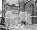
 Bestrating tegen zuid-west zijde van de kerk - Vreeland - 20247163 - RCE.jpg 1,200 × 958; 359 KB
-
 Bestrating voor entree van de kerk (westzijde) - Vreeland - 20247164 - RCE.jpg 1,200 × 949; 351 KB
-
 Dorp, reproductie door Jan de Beijer 1748 - Vreeland - 20247113 - RCE.jpg 1,200 × 942; 276 KB
-
 Dorpsgezicht - Vreeland - 20247129 - RCE.jpg 1,200 × 804; 214 KB
-
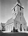
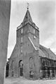 Exterieur met toren - Vreeland - 20247157 - RCE.jpg 803 × 1,200; 209 KB
-
 Exterieur met toren - Vreeland - 20247158 - RCE.jpg 806 × 1,200; 274 KB
-
 Exterieur met toren - Vreeland - 20247159 - RCE.jpg 810 × 1,200; 330 KB
-
 Exterieur naar het zuid-westen - Vreeland - 20247140 - RCE.jpg 1,200 × 958; 289 KB
-
 Exterieur OVERZICHT NAAR HET OOSTEN (KOOR) - Vreeland - 20292416 - RCE.jpg 1,195 × 1,200; 333 KB
-
 Exterieur OVERZICHT OOSTGEVEL, ZUIDGEVEL - Vreeland - 20292412 - RCE.jpg 955 × 1,200; 291 KB
-
 Exterieur WESTGEVEL, ZUIDGEVEL - Vreeland - 20292411 - RCE.jpg 1,191 × 1,200; 296 KB
-
 Exterieur ZUIDGEVEL - Vreeland - 20292413 - RCE.jpg 1,200 × 1,192; 497 KB
-
 Gezicht op het dorp vanuit het noorden - Vreeland - 20247117 - RCE.jpg 1,200 × 963; 275 KB
-
 Gezicht op Vreeland met kerktoren - Vreeland - 20247114 - RCE.jpg 1,200 × 891; 237 KB
-
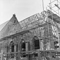
 Interieur koor tijdens restauratie - Vreeland - 20247148 - RCE.jpg 953 × 1,200; 225 KB
-
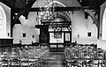
 Interieur naar het westen - Vreeland - 20247151 - RCE.jpg 1,200 × 962; 285 KB
-
 Interieur St Nicolaaskerk Vreeland.jpg 3,929 × 2,488; 3.01 MB
-
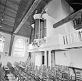
 Interieur, aanzicht orgel, orgelnummer 1584 - Vreeland - 20370590 - RCE.jpg 870 × 1,200; 181 KB
-
 INTERIEUR, DOOPBEKKEN MET HOUDER - Vreeland - 20292422 - RCE.jpg 1,195 × 1,200; 252 KB
-
 INTERIEUR, LEZENAAR VAN DE PREEKSTOEL - Vreeland - 20292423 - RCE.jpg 1,197 × 1,200; 328 KB
-
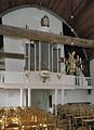
 INTERIEUR, ORGEL - Vreeland - 20292421 - RCE.jpg 1,200 × 1,183; 274 KB
-
 INTERIEUR, OVERZICHT KOOR - Vreeland - 20292417 - RCE.jpg 1,200 × 1,178; 295 KB
-
 INTERIEUR, OVERZICHT NAAR HET WESTEN - Vreeland - 20292415 - RCE.jpg 1,200 × 1,190; 318 KB
-
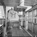
 INTERIEUR, OVERZICHT PREEKSTOEL MET DOOPHEK - Vreeland - 20292418 - RCE.jpg 1,195 × 1,200; 328 KB
-

-
 INTERIEUR, OVERZICHT VANAF HET KOOR NAAR HET WESTEN - Vreeland - 20292414 - RCE.jpg 1,198 × 1,200; 297 KB
-
 INTERIEUR, PREEKSTOEL, ZIJAANZICHT - Vreeland - 20292419 - RCE.jpg 1,200 × 1,197; 328 KB
-
 Inwendig naar het noord-oosten - Vreeland - 20247136 - RCE.jpg 1,200 × 882; 183 KB
-
 Inwendig naar het noord-oosten, bank - Vreeland - 20247138 - RCE.jpg 885 × 1,200; 146 KB
-
 Inwendig naar het zuid-oosten - Vreeland - 20247137 - RCE.jpg 1,200 × 887; 195 KB
-
 Inwendig, preekstoel - Vreeland - 20247139 - RCE.jpg 889 × 1,200; 188 KB
-
 Kap koor - Vreeland - 20247141 - RCE.jpg 1,197 × 1,200; 336 KB
-
 Kap koor - Vreeland - 20247142 - RCE.jpg 1,197 × 1,200; 289 KB
-
 Kap koor - Vreeland - 20247143 - RCE.jpg 1,190 × 1,200; 309 KB
-
 Kap koor - Vreeland - 20247144 - RCE.jpg 1,200 × 1,200; 204 KB
-
 Kap koor - Vreeland - 20247145 - RCE.jpg 1,186 × 1,200; 232 KB
-
 Kap koor - Vreeland - 20247146 - RCE.jpg 1,192 × 1,200; 241 KB
-
 Kerk vanuit het noord-oosten - Vreeland - 20247132 - RCE.jpg 1,200 × 894; 291 KB
-
 Kerk vanuit het noord-oosten - Vreeland - 20247135 - RCE.jpg 882 × 1,200; 245 KB
-
 Kerk vanuit het westen - Vreeland - 20247134 - RCE.jpg 894 × 1,200; 212 KB
-
 Kerk vanuit het zuid-westen - Vreeland - 20247133 - RCE.jpg 886 × 1,200; 206 KB
-
 Koor tijdens restauratie - Vreeland - 20247150 - RCE.jpg 1,200 × 958; 223 KB
-
 Noord-oost gevel - Vreeland - 20247160 - RCE.jpg 954 × 1,200; 319 KB
-
 Noordelijke torenmuur, vanuit de toren - Vreeland - 20247154 - RCE.jpg 948 × 1,200; 320 KB
-
 Noordgevel - Vreeland - 20247161 - RCE.jpg 1,200 × 955; 368 KB
-
 Oude doorgang zuid transept oost-gevel - Vreeland - 20247147 - RCE.jpg 958 × 1,200; 378 KB
-
 Oude gewelfaanzet zuidmuur toren - Vreeland - 20247153 - RCE.jpg 941 × 1,200; 342 KB
-
 Oude kapmoet, oost-gevel toren - Vreeland - 20247152 - RCE.jpg 1,200 × 970; 405 KB
-
 Oude toegang zuidmuur koor - Vreeland - 20247155 - RCE.jpg 947 × 1,200; 364 KB
-
 Oude toegang zuidmuur koor - Vreeland - 20247156 - RCE.jpg 953 × 1,200; 238 KB
-
 Overzicht vanuit het noordoosten - Vreeland - 20411306 - RCE.jpg 1,200 × 890; 273 KB
-
 Vreeland - Kerk RM26131.JPG 3,456 × 4,608; 1.42 MB
-
 Vreeland kerk detail westgevel.jpg 3,456 × 4,008; 9.03 MB
-
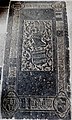 Vreeland kerk grafsteen in koor.jpg 2,244 × 3,732; 5.04 MB
-
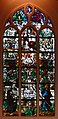 Vreeland kerk raam noordgevel.jpg 1,946 × 4,000; 4.57 MB
-
 Vreeland kerk raam oostgevel in het koor.jpg 1,800 × 4,000; 4.9 MB
-
 Vreeland kerk raam zuidgevel.jpg 2,084 × 4,000; 5.44 MB
-
 Vreeland kerk zuidoost.jpg 4,000 × 3,348; 7.19 MB
-
 Vreeland kerk zuidwest.jpg 3,000 × 4,000; 7.08 MB
-
 Vreeland.HervormdeKerk.JPG 3,072 × 2,304; 2.28 MB
-
 Zuid-transept oost-gevel na sloping van aanbouw - Vreeland - 20247149 - RCE.jpg 1,200 × 958; 366 KB
-
 Zuid-west gevel - Vreeland - 20247162 - RCE.jpg 946 × 1,200; 238 KB

_-_Vreeland_-_20247164_-_RCE.jpg)


_-_Vreeland_-_20292416_-_RCE.jpg)


