Category:Nederlands Hervormde Kerk, Nieuwer-Ter-Aa
Jump to navigation
Jump to search
| Object location | | View all coordinates using: OpenStreetMap |
|---|
church building in Stichtse Vecht, Netherlands  | |||||
| Upload media | |||||
| Instance of | |||||
|---|---|---|---|---|---|
| Location | Nieuwer-Ter-Aa, Stichtse Vecht, Utrecht, Netherlands | ||||
| Street address |
| ||||
| Heritage designation |
| ||||
 | |||||
|
This is a category about rijksmonument number 10640
|
| Address |
|
Media in category "Nederlands Hervormde Kerk, Nieuwer-Ter-Aa"
The following 34 files are in this category, out of 34 total.
-
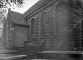 Buitenzijde, deel van de noordgevel - Ter Aa - 20211241 - RCE.jpg 1,200 × 883; 194 KB
-
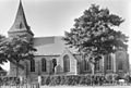
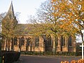
 De Dorpskerk van Nieuwer Ter Aa , niet ver van Breukelen.jpg 4,770 × 3,177; 3.63 MB
-

-
 Exterieur aanzicht - Nieuwer-Ter-Aa - 20164789 - RCE.jpg 1,200 × 812; 275 KB
-
 Exterieur OVERZICHT ZUIDGEVEL - Nieuwer-Ter-Aa - 20314246 - RCE.jpg 1,188 × 1,200; 357 KB
-
 Gedeelte noord-gevel - Ter Aa - 20003032 - RCE.jpg 893 × 1,200; 261 KB
-
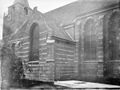
 Gedeelte zuid-gevel - Ter Aa - 20003034 - RCE.jpg 1,200 × 889; 250 KB
-
 Gedeelte zuid-gevel - Ter Aa - 20003035 - RCE.jpg 1,200 × 882; 297 KB
-
 Gedeelte zuid-gevel - Ter Aa - 20003036 - RCE.jpg 886 × 1,200; 197 KB
-
 Gedeelte zuid-gevel - Ter Aa - 20003037 - RCE.jpg 1,200 × 900; 282 KB
-
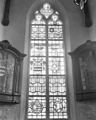
 Interieur met gebrandschilderde glazen - Ter Aa - 20003046 - RCE.jpg 893 × 1,200; 113 KB
-
 Interieur naar het oosten - Ter Aa - 20003045 - RCE.jpg 1,200 × 900; 170 KB
-
 Interieur vanuit het westen - Ter Aa - 20003038 - RCE.jpg 1,200 × 870; 134 KB
-

-

-

-
 Kerk naar het noord-oosten - Ter Aa - 20003040 - RCE.jpg 1,200 × 900; 233 KB
-
 Overzicht kerk naar het noorden gezien - Ter Aa - 20404352 - RCE.jpg 1,200 × 951; 323 KB
-
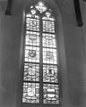
 Raam - Nieuwer-Ter-Aa - 20164780 - RCE.jpg 972 × 1,200; 223 KB
-
 Raam - Nieuwer-Ter-Aa - 20164781 - RCE.jpg 951 × 1,200; 172 KB
-
 Raam - Nieuwer-Ter-Aa - 20164782 - RCE.jpg 957 × 1,200; 192 KB
-
 Raam - Nieuwer-Ter-Aa - 20164783 - RCE.jpg 958 × 1,200; 165 KB
-
 Raam - Nieuwer-Ter-Aa - 20164784 - RCE.jpg 959 × 1,200; 175 KB
-
 Raam - Nieuwer-Ter-Aa - 20164785 - RCE.jpg 961 × 1,200; 214 KB
-
 Raam - Nieuwer-Ter-Aa - 20164786 - RCE.jpg 953 × 1,200; 210 KB
-
 Raam - Nieuwer-Ter-Aa - 20164787 - RCE.jpg 947 × 1,200; 168 KB
-
 Raam - Nieuwer-Ter-Aa - 20164788 - RCE.jpg 958 × 1,200; 298 KB
-

-
 Toren - Ter Aa - 20003028 - RCE.jpg 919 × 1,200; 290 KB
-
 Toren - Ter Aa - 20003029 - RCE.jpg 907 × 1,200; 273 KB
-
 TraoKerrek.jpg 1,600 × 1,200; 976 KB
-
 TraoKerrekDetail.jpg 1,600 × 1,200; 938 KB
-
 TraoTore.jpg 1,200 × 1,600; 782 KB
-
 Vooraanzicht - Nieuwer-Ter-Aa - 20164779 - RCE.jpg 981 × 1,200; 257 KB


