Category:Nederlands Hervormde Kerk, Maasland
Jump to navigation
Jump to search
| Object location | | View all coordinates using: OpenStreetMap |
|---|
church building in Midden-Delfland, Netherlands  | |||||
| Upload media | |||||
| Instance of | |||||
|---|---|---|---|---|---|
| Location | Maasland, Midden-Delfland, South Holland, Netherlands | ||||
| Street address |
| ||||
| Located on street |
| ||||
| Heritage designation |
| ||||
 | |||||
Nederlands: Oude Kerk - anno 15e eeuw
|
This is a category about rijksmonument number 26585
|
| Address |
|
Media in category "Nederlands Hervormde Kerk, Maasland"
The following 70 files are in this category, out of 70 total.
-
 Bank van eiken - Maasland - 20144470 - RCE.jpg 896 × 1,200; 239 KB
-

-
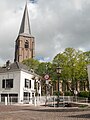
 Church Maasland.jpg 3,648 × 5,472; 9.08 MB
-
-
 Exterieur met toren naar het noord-westen - Maasland - 20144473 - RCE.jpg 959 × 1,200; 253 KB
-

-

-

-

-

-

-

-
 Heilige- rechts Kerkplein achter- links - Maasland - 20144566 - RCE.jpg 1,200 × 953; 200 KB
-
 Hek van kerkhof aan Doelenstraat - Maasland - 20144861 - RCE.jpg 1,200 × 803; 240 KB
-
 Interieur naar het oosten - Maasland - 20144458 - RCE.jpg 887 × 1,200; 154 KB
-
 Interieur naar het oosten - Maasland - 20144475 - RCE.jpg 1,200 × 958; 190 KB
-
 Interieur naar het oosten - Maasland - 20144479 - RCE.jpg 1,200 × 968; 209 KB
-
 Interieur naar het westen - Maasland - 20144476 - RCE.jpg 974 × 1,200; 207 KB
-
 Interieur noord zijbeuk naar het oosten - Maasland - 20144474 - RCE.jpg 1,200 × 970; 202 KB
-
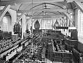
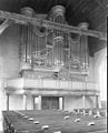
 Interieur van het schip met orgel - Maasland - 20144477 - RCE.jpg 1,200 × 965; 229 KB
-
 Interieur, deur in de oostelijke zijbeuk - Maasland - 20328236 - RCE.jpg 896 × 1,200; 316 KB
-
-
 Interieur, grafzerk - Maasland - 20144463 - RCE.jpg 937 × 1,200; 339 KB
-
 Interieur, noordelijke zijbeuk - Maasland - 20144461 - RCE.jpg 896 × 1,200; 202 KB
-

-
 Interieur, schip naar het oosten - Maasland - 20144462 - RCE.jpg 1,200 × 905; 271 KB
-
 Inwendig grafzerken - Maasland - 20144464 - RCE.jpg 944 × 1,200; 315 KB
-
 Inwendig grafzerken - Maasland - 20144465 - RCE.jpg 938 × 1,200; 345 KB
-
 Inwendig muur - Maasland - 20144460 - RCE.jpg 946 × 1,200; 280 KB
-

-

-

-
 Kerk vanuit het zuidoosten - Maasland - 20144452 - RCE.jpg 896 × 1,200; 275 KB
-
 Kerk vanuit het zuidoosten - Maasland - 20144453 - RCE.jpg 1,200 × 888; 288 KB
-
 Kerk, exterieur naar het noord-westen - Maasland - 20144480 - RCE.jpg 1,200 × 962; 246 KB
-
 Kerkplein 2-3 - Maasland - 20144671 - RCE.jpg 1,200 × 802; 193 KB
-
 Kruis noord zijbeuk - Maasland - 20144481 - RCE.jpg 940 × 1,200; 256 KB
-
 Lezenaar van koper - Maasland - 20144469 - RCE.jpg 1,200 × 896; 182 KB
-
-
 Luchtfoto's - Maasland - 20144447 - RCE.jpg 1,197 × 1,200; 465 KB
-
 Luchtfoto's - Maasland - 20144448 - RCE.jpg 1,185 × 1,200; 447 KB
-
 Luchtfoto's - Maasland - 20144449 - RCE.jpg 1,190 × 1,200; 464 KB
-
 Luchtfoto's - Maasland - 20144450 - RCE.jpg 1,197 × 1,200; 460 KB
-
 Luchtfoto's - Maasland - 20144451 - RCE.jpg 1,195 × 1,200; 478 KB
-
 Maasland - Grote kerk.jpg 1,944 × 2,592; 1.27 MB
-
 Maasland - Kerkplein 1.jpg 1,944 × 2,592; 1.64 MB
-
 Maasland - Kerkplein met hek.jpg 2,592 × 1,944; 2.47 MB
-
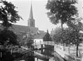
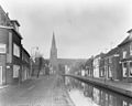
 Maasland 1905.jpg 585 × 392; 38 KB
-
 Maasland Oude Kerk and canal.jpg 3,648 × 5,674; 15.26 MB
-
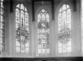
 Maasland Oude Kerk north window.jpg 4,008 × 6,008; 19.66 MB
-
 Maasland, de toren van de Oude Kerk RM26585 foto4 2014-04-14 11.56.jpg 3,312 × 4,416; 9.38 MB
-
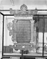
 Naamlijst der predikanten 1775 - Maasland - 20144488 - RCE.jpg 950 × 1,200; 234 KB
-
 Naamlijst der predikanten 1776 - Maasland - 20144491 - RCE.jpg 1,200 × 953; 247 KB
-
 Naamlijst der predikanten 1861 achterzijde - Maasland - 20144490 - RCE.jpg 953 × 1,200; 221 KB
-
 Naamlijst der predikanten voorzijde 1861 - Maasland - 20144489 - RCE.jpg 958 × 1,200; 225 KB
-
 Orgel - Maasland - 20144478 - RCE.jpg 967 × 1,200; 221 KB
-
 Overzicht toren van de hervormde kerk - Maasland - 20382026 - RCE.jpg 1,200 × 922; 189 KB
-
 Overzicht toren van de hervormde kerk - Maasland - 20382027 - RCE.jpg 930 × 1,200; 199 KB
-

-
 Tekstbord 1 thess. 5 vers 13, achterzijde - Maasland - 20144483 - RCE.jpg 961 × 1,200; 182 KB
-
 Tekstbord 1e thess. 5 vers 13, voorzijde - Maasland - 20144482 - RCE.jpg 960 × 1,200; 204 KB
-

-

-
 Tekstbord Leviticus 19 en Romeinen 13 voorzijde - Maasland - 20144485 - RCE.jpg 948 × 1,200; 201 KB
-
 Tekstbord Psalm 139 vers 1-5, voorzijde - Maasland - 20144484 - RCE.jpg 943 × 1,200; 198 KB
-
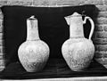 Twee kannen met zilveren deksel - Maasland - 20144472 - RCE.jpg 1,200 × 905; 207 KB
-
 Twee wapenbordjes detail tekstbord? - Maasland - 20144492 - RCE.jpg 962 × 1,200; 284 KB
-
-

-
 Zilveren schotel - Maasland - 20144471 - RCE.jpg 1,159 × 1,200; 220 KB


_-_Maasland_-_20144496_-_RCE.jpg)


_-_Maasland_-_20144577_-_RCE.jpg)


