Category:Nederlands Hervormde Kerk, Herveld
Jump to navigation
Jump to search
| Object location | | View all coordinates using: OpenStreetMap |
|---|
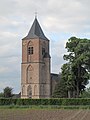
church building in Overbetuwe, Netherlands  | |||||
| Upload media | |||||
| Instance of | |||||
|---|---|---|---|---|---|
| Location | Herveld, Gelderland, Netherlands | ||||
| Street address |
| ||||
| Heritage designation |
| ||||
 | |||||
Kerk:
|
This is a category about rijksmonument number 36750
|
Toren:
|
This is a category about rijksmonument number 36751
|
| Address |
|
Subcategories
This category has the following 2 subcategories, out of 2 total.
Media in category "Nederlands Hervormde Kerk, Herveld"
The following 25 files are in this category, out of 25 total.
-
 Exterieur naar het noord-oosten - Herveld - 20111121 - RCE.jpg 889 × 1,200; 259 KB
-
 Exterieur naar het noord-westen - Herveld - 20111120 - RCE.jpg 892 × 1,200; 236 KB
-
 Exterieur naar het zuid-oosten - Herveld - 20111123 - RCE.jpg 1,200 × 888; 267 KB
-
 Exterieur naar het zuid-westen - Herveld - 20111129 - RCE.jpg 953 × 1,200; 270 KB
-
 Exterieur naar het zuid-westen - Herveld - 20111131 - RCE.jpg 1,200 × 957; 257 KB
-
 Exterieur, toren - Herveld - 20363296 - RCE.jpg 792 × 1,200; 191 KB
-
 Exterieur, zicht op koor - Herveld - 20363297 - RCE.jpg 783 × 1,200; 178 KB
-
 Gewelf koor - Herveld - 20111140 - RCE.jpg 1,200 × 881; 231 KB
-
 Gewelfschilder, koor - Herveld - 20111141 - RCE.jpg 1,200 × 887; 221 KB
-
 Gewelfschilder, koor - Herveld - 20111142 - RCE.jpg 881 × 1,200; 227 KB
-
 Herveld, kerk RM36751 foto6 2011-05-14 19.21.jpg 3,312 × 4,416; 8.26 MB
-
 Herveld-Z kerk achterkant.JPG 2,736 × 3,648; 3.6 MB
-
 Herveld-Z Rijksmonument 36751 toren NH kerk.JPG 2,736 × 3,648; 3.64 MB
-
 Interieur naar het noord-oosten - Herveld - 20111138 - RCE.jpg 1,200 × 891; 133 KB
-
 Interieur naar het noord-oosten - Herveld - 20111139 - RCE.jpg 1,200 × 885; 131 KB
-
 Interieur naar het oosten - Herveld - 20111132 - RCE.jpg 1,200 × 947; 175 KB
-
 Interieur naar het westen - Herveld - 20111133 - RCE.jpg 1,200 × 948; 194 KB
-
 Kerk, boerderij en schuur vanuit het oosten - Herveld - 20111112 - RCE.jpg 1,200 × 820; 264 KB
-
 Kerk, boerderij en schuur vanuit het oosten - Herveld - 20378786 - RCE.jpg 1,200 × 817; 266 KB
-
 Met schuur aan de Schoolstraat - Herveld - 20111154 - RCE.jpg 1,200 × 809; 193 KB
-
 Overzicht van de noordwestgevel met kerktoren - Herveld-Zuid - 20381451 - RCE.jpg 1,200 × 1,200; 304 KB
-
 Toren - Herveld - 20111124 - RCE.jpg 914 × 1,200; 271 KB
-
 Toren kerk en omgeving, vanuit het zuid-westen - Herveld - 20111153 - RCE.jpg 1,199 × 1,200; 312 KB
-
 Toren naar het noord-oosten - Herveld - 20111125 - RCE.jpg 956 × 1,200; 270 KB
-
 Toren naar het zuid-oosten - Herveld - 20111127 - RCE.jpg 951 × 1,200; 262 KB


