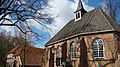
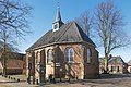
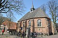
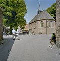
Category:Nederlands Hervormde Kerk, Bronkhorst
Jump to navigation
Jump to search
| Object location | | View all coordinates using: OpenStreetMap |
|---|
church building in Bronckhorst, Netherlands  | |||||
| Upload media | |||||
| Instance of | |||||
|---|---|---|---|---|---|
| Location | Bronkhorst, Bronckhorst, Gelderland, Netherlands | ||||
| Street address |
| ||||
| Located on street |
| ||||
| Heritage designation |
| ||||
| Inception |
| ||||
| Significant event |
| ||||
 | |||||
|
This is a category about rijksmonument number 34548
|
| Address |
|
Subcategories
This category has only the following subcategory.
Media in category "Nederlands Hervormde Kerk, Bronkhorst"
The following 33 files are in this category, out of 33 total.
-
 7226 Bronkhorst, Netherlands - panoramio (14).jpg 2,048 × 1,148; 791 KB
-
 7226 Bronkhorst, Netherlands - panoramio (37).jpg 4,896 × 3,264; 3.25 MB
-
 7226 Bronkhorst, Netherlands - panoramio (48).jpg 4,896 × 3,264; 3.64 MB
-
 7226 Bronkhorst, Netherlands - panoramio (79).jpg 4,000 × 3,000; 3.03 MB
-
 7226 Bronkhorst, Netherlands - panoramio (82).jpg 4,000 × 3,000; 2.52 MB
-
 7226 Bronkhorst, Netherlands - panoramio (9).jpg 2,048 × 1,148; 626 KB
-
 BRONKHORST KAPEL OF HERVORMDE KERK 01.jpg 4,608 × 3,456; 1.64 MB
-
 BRONKHORST KAPEL OF HERVORMDE KERK 02.jpg 4,608 × 3,456; 4.08 MB
-
 BRONKHORST KAPEL OF HERVORMDE KERK 03.jpg 4,608 × 3,456; 1.28 MB
-
 BRONKHORST KAPEL OF HERVORMDE KERK 04.jpg 4,608 × 3,456; 1.44 MB
-
 BRONKHORST KAPEL OF HERVORMDE KERK 05.jpg 4,608 × 3,456; 4.16 MB
-
 BRONKHORST KAPEL OF HERVORMDE KERK 06.jpg 4,608 × 3,456; 3.86 MB
-
 BRONKHORST KAPEL OF HERVORMDE KERK 07.jpg 3,456 × 4,608; 3.68 MB
-
 BRONKHORST KAPEL OF HERVORMDE KERK 08.jpg 3,456 × 4,608; 2.94 MB
-
 Bronkhorst kerk.jpg 500 × 281; 173 KB
-
 Bronkhorst, kapel RM34548 IMG 3927 2020-03-31 15.59.jpg 4,835 × 3,223; 11.61 MB
-
 Bronkhorst, kerk foto2 2011-02-17 11.55.jpg 4,416 × 3,312; 13 MB
-
 Cafe bronkhorstre - kopie.jpg 2,579 × 4,106; 4.62 MB
-
-
 Exterieur - Bronkhorst - 20044013 - RCE.jpg 1,200 × 893; 299 KB
-
 Exterieur naar het noord-westen - Bronkhorst - 20044011 - RCE.jpg 905 × 1,200; 254 KB
-
 Exterieur naar het noord-westen - Bronkhorst - 20044012 - RCE.jpg 1,200 × 945; 323 KB
-
 Exterieur overzicht - Bronkhorst - 20044014 - RCE.jpg 956 × 1,200; 271 KB
-
 Exterieur overzicht - Bronkhorst - 20044015 - RCE.jpg 1,200 × 954; 306 KB
-
 Exterieur OVERZICHT BOVENSTRAAT - Bronkhorst - 20311467 - RCE.jpg 1,187 × 1,200; 335 KB
-

-
 Exterieur OVERZICHT OOSTGEVEL - Bronkhorst - 20311466 - RCE.jpg 1,193 × 1,200; 352 KB
-
 Interieur naar het oosten - Bronkhorst - 20044017 - RCE.jpg 1,200 × 919; 170 KB
-
 Interieur naar het westen - Bronkhorst - 20044016 - RCE.jpg 1,200 × 947; 169 KB
-
 Kapel, bestrating om de kapel - Bronkhorst - 20044020 - RCE.jpg 1,200 × 954; 348 KB
-
 Kapel, exterieur - Bronkhorst - 20044019 - RCE.jpg 806 × 1,200; 177 KB
-
 Kerk - Bronkhorst - 20525818 - RCE.jpg 1,200 × 900; 250 KB
-

.jpg)
.jpg)
.jpg)
.jpg)
.jpg)
.jpg)


.jpg)


_op_%C3%A9%C3%A9n_negatief;_boven_de_dorpskerk_te_Steenderen_en_onder_de_N.H._kerk_te_Bronkhorst_-_Steenderen_-_20044018_-_RCE.jpg)