Category:Native American history of the 1830s
Jump to navigation
Jump to search
Subcategories
This category has the following 18 subcategories, out of 18 total.
1
B
C
F
- Fort King (17 F)
I
K
O
T
- Tahlonteeskee Cherokee Museum (17 F)
- Treaty of New Echota (8 F)
- Treaty of St. Peters (1837) (3 F)
- Tsali Historic Marker Q-3 (1 F)
Media in category "Native American history of the 1830s"
The following 61 files are in this category, out of 61 total.
-

-
-

-
 Alabama tribal land map 1830.png 572 × 555; 78 KB
-
 An Indian Town, Residence of a Chief.jpg 328 × 231; 26 KB
-
-
 Ball play dance.jpg 1,400 × 913; 120 KB
-
 Black Lake Indian Village.jpg 810 × 1,200; 1.15 MB
-
 BuffaloHunters.jpg 528 × 437; 39 KB
-
 Catlin Hidatsa village.jpg 548 × 358; 194 KB
-
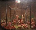
 Catlin Okipa.jpg 640 × 458; 358 KB
-
 CatlinDragoons.png 1,322 × 944; 2.07 MB
-
 Cessions Southeastern Tribes- Andrew Jackson.jpg 2,030 × 1,512; 1.91 MB
-
 Cherokee Hills Byway - Tahlonteeskee Cherokee Museum - NARA - 7717615.jpg 1,174 × 787; 511 KB
-

-
 CherokeeLotteryLandDeed.jpg 2,000 × 2,432; 1.6 MB
-
 Cherokeenation1830map.jpg 576 × 426; 74 KB
-
 Chickasaw and Choctaw land cessions in Mississippi.jpg 2,000 × 3,183; 927 KB
-
 Crow Tipi or Lodge- George Catlin.jpg 640 × 523; 186 KB
-
 Florida massacre 1836.jpeg 1,865 × 1,143; 784 KB
-
 Frances Slocum and daughters.jpg 567 × 484; 82 KB
-

-

-

-

-
-

-
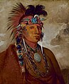
 George Catlin - Wah-ro-née-sah, The Surrounder, Chief of the Tribe - Google Art Project.jpg 3,284 × 4,001; 3.07 MB
-

-

-
-
 George Catlin, Ojibwa Portaging Around the Falls of St. Anthony, 1835-1836.jpg 3,000 × 1,973; 2.08 MB
-
 Georgia, from the latest authorities. LOC 2010587363.jpg 4,536 × 5,105; 3.57 MB
-
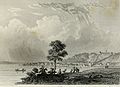
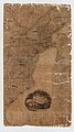
 Grand Rapids 1831.jpg 2,132 × 1,556; 751 KB
-

-
 Indian Village Chippewa-nung 1836 2017-05-17 135.jpg 2,176 × 3,264; 2.74 MB
-
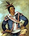
 Henry Inman - Sequoyah - Google Art Project.jpg 3,869 × 4,644; 2.75 MB
-
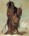
 Kee-món-saw, Little Chief, a Chief (George Catlin).jpg 490 × 600; 130 KB
-
-

-

-
 Map of Indian territory 1836.png 7,477 × 9,136; 92.32 MB
-
-
-
 Mexico 1832, Region Comanche.PNG 885 × 885; 57 KB
-
 Minnesota Land Cession Map 1 – Close up of 242 & 243.png 1,160 × 1,160; 2.87 MB
-
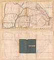
 Moseley map.jpg 500 × 296; 27 KB
-
-
 Papakeechie's Reserve 1979.jpg 4,608 × 3,072; 3.91 MB
-
 Pawnee Indian cessions (2). (Pawnee country after 1833).png 2,256 × 1,462; 5.83 MB
-
 Peter perkins pitchlynn.jpg 1,149 × 1,400; 206 KB
-
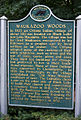
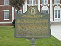 Seminole County Historical Marker.JPG 4,320 × 3,240; 4.33 MB
-
 Seminolesmassacreingwhites.jpg 600 × 353; 108 KB
-
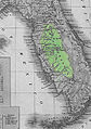 Semreservation.jpg 229 × 325; 20 KB
-

-
 Tomakawk.jpg 504 × 332; 15 KB
-

-
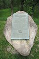
 Treaty marker near the Forks of the Wabash.jpg 2,816 × 2,112; 3.69 MB
-
 Tullockchishko.jpg 1,077 × 1,310; 864 KB
-
 Wahpeton Haus.jpg 800 × 486; 302 KB
-
 Winter village of the Manitaries (Hidatsa) in Dakota Territory, 1833 - NARA - 530977.jpg 3,000 × 2,418; 2.01 MB


.jpg)


.jpg)


_Going_To_and_Returning_From_Washington_-_Google_Art_Project.jpg)


.jpg)
_-_NARA_-_102278691_(page_3).jpg)


,_Nebraska._Pawnee_reservation_and_relevant_Indian_territories.png)


._(Pawnee_country_after_1833).png)


.jpg)


_in_Dakota_Territory,_1833_-_NARA_-_530977.jpg)