Category:National Nature Reserves in England
Jump to navigation
Jump to search
Main Wikipedia article: National nature reserves in England.
designated by Natural England as key places for wildlife and natural features in England | |||||
| Upload media | |||||
| Instance of |
| ||||
|---|---|---|---|---|---|
| Subclass of | |||||
| Location |
| ||||
| official website | |||||
| |||||
Subcategories
This category has the following 69 subcategories, out of 69 total.
A
- Ashtead Common (35 F)
B
- Barnack Hills and Holes (8 F)
- Bedford Purlieus (11 F)
- Bradfield Woods (3 F)
- Brettenham Heath (27 F)
C
- Castle Bottom NNR (5 F)
- Castor Hanglands (8 F)
- Cavenham Heath (12 F)
- Chimney Meadows (4 F)
- Chippenham Fen (792 F)
- Chobham Common (5 F)
- Cribb's Meadow (9 F)
D
E
- East Blean Woods (4 F)
- Ebbor Gorge (13 F)
- Ebernoe Common (5 F)
F
- Far Ings National Nature Reserve (29 F)
- Foxley Wood, Norfolk (21 F)
H
- Ham Street Woods (4 F)
- Hamford Water (46 F)
K
- King's Wood, Heath and Reach (14 F)
- Knocking Hoe (26 F)
L
- Leigh Woods (95 F)
- Lullington Heath (5 F)
M
- Martham Broad (24 F)
- Martin Down (68 F)
- Monk's Dale (36 F)
- Monks Wood (5 F)
- Muston Meadows (8 F)
N
- North Solent (3 F)
O
- Old Hall Marshes (17 F)
R
- Redgrave and Lopham Fens (7 F)
S
- Shapwick Heath (41 F)
- Studland and Godlingston Heath (153 F)
- Swanscombe Skull Site (12 F)
T
- Titchfield Haven (26 F)
U
- Upwood Meadows (8 F)
W
- Weeting Heath (5 F)
- Whitbarrow (41 F)
- Woodwalton Fen (38 F)
Media in category "National Nature Reserves in England"
The following 44 files are in this category, out of 44 total.
-
 7 sisters dudley castel tunnels.jpg 1,780 × 1,204; 1.63 MB
-
 Black-a-Tor Copse - Dartmoor - South Devon, England.jpg 1,920 × 1,280; 3 MB
-

-
 Cassop Vale National Nature Reserve.jpg 640 × 480; 103 KB
-
 Castlebottomnnr.jpg 5,312 × 2,988; 9.24 MB
-
 Clouds Brushing Dunkery.jpg 5,483 × 1,076; 609 KB
-
 Direction sign - geograph.org.uk - 737151.jpg 480 × 640; 118 KB
-
 Dunkery Hill.jpg 1,324 × 855; 237 KB
-
 Entrance to Finglandriggs Wood - geograph.org.uk - 118282.jpg 640 × 480; 164 KB
-

-

-
 Footpath through the Rhododendrons ^2 - geograph.org.uk - 737150.jpg 640 × 480; 135 KB
-
 Gait Barrows National Nature Reserve - geograph.org.uk - 139322.jpg 480 × 640; 111 KB
-

-
 Gibraltar Point.jpg 640 × 480; 143 KB
-

-
-
 Goss Moor - geograph.org.uk - 851816.jpg 640 × 474; 127 KB
-
 Hartland Moor National Nature Reserve - geograph.org.uk - 36702.jpg 640 × 480; 121 KB
-
 Hartland Moor NNR, Dorset - geograph.org.uk - 82501.jpg 640 × 425; 142 KB
-
 Hartland Moor NNR, Dorset - geograph.org.uk - 82518.jpg 640 × 425; 97 KB
-
 High Park Wood - geograph.org.uk - 364132.jpg 640 × 480; 152 KB
-
 Lathkill Dale looking downdale, about 1 km from Monyash, Derbyshire, UK.JPG 2,560 × 1,920; 1.01 MB
-
 Limestone Pavement on Hutton Roof Crags.jpg 2,832 × 2,128; 1.04 MB
-

-
 Malham tarn national nature reserve - geograph.org.uk - 178927.jpg 640 × 481; 138 KB
-
 Mottey Meadows National Nature Reserve - geograph.org.uk - 383988.jpg 600 × 450; 216 KB
-
 Path on How Hill Nature Reserve.jpg 3,600 × 2,400; 3.83 MB
-

-
-

-
 Ramsey Heights nature reserve.jpg 6,240 × 4,160; 12.24 MB
-
 Stoborough Heath NNR, Dorset - geograph.org.uk - 82492.jpg 425 × 640; 126 KB
-
 Swale Nature Reserve - geograph.org.uk - 1312065.jpg 640 × 480; 57 KB
-
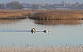 Swans at Shapwick Heath - geograph.org.uk - 664699.jpg 640 × 403; 51 KB
-

-
 View over Goss Moor - geograph.org.uk - 343607.jpg 640 × 426; 113 KB
-
 Whixall04LB.jpg 4,608 × 3,456; 5.51 MB
-
 Whixall05LB.jpg 4,608 × 3,456; 6.65 MB
-
 Wicken Fen NT map.svg 988 × 1,318; 1,009 KB
-
 Wicken Fen SSSI Map.svg 751 × 583; 403 KB
-
 Wybunbury banner Moss.jpg 2,800 × 400; 268 KB
-
 Wybunbury Moss.jpg 3,821 × 2,866; 1.29 MB
-
 Wye Downs DKT.jpg 2,130 × 1,577; 854 KB


_-_geograph.org.uk_-_153628.jpg)


