Category:National Cycle Network route signs
Jump to navigation
Jump to search

Subcategories
This category has the following 2 subcategories, out of 2 total.
5
N
- NCN 56 signs in Storeton (4 F)
Media in category "National Cycle Network route signs"
The following 80 files are in this category, out of 80 total.
-
 1st Heaton Norris Scout Group sign.jpg 2,048 × 1,536; 774 KB
-
 544 sign.jpg 4,320 × 3,240; 5.4 MB
-
 Entrance to Wirral Country Park at Heath Lane.jpg 5,184 × 3,456; 11.24 MB
-
 NCN 56 sign, Ackers Road.jpg 4,438 × 3,363; 9.39 MB
-
 A section of Cycle Route 1 - geograph.org.uk - 1388281.jpg 640 × 480; 135 KB
-
 Alnmouth, Northumberland ... on National Cycle Route 1. - Flickr - BazzaDaRambler.jpg 3,793 × 3,258; 2.43 MB
-
 Beechwood, Birkenhead - DSC03595.JPG 2,736 × 3,648; 3.63 MB
-
 Bidston, Birkenhead - DSC03565.JPG 2,736 × 3,648; 3.54 MB
-
 Bristol MMB W3 Cumberland Basin.jpg 2,304 × 1,728; 1.66 MB
-
 Cockup Bridge (footbridge), Wicken Fen - 8 December 2013 - 03.JPG 3,008 × 2,000; 2.44 MB
-
 Cycle route sign to St Annes at Blackpool - DSC07083.JPG 2,736 × 3,648; 3.52 MB
-
 Cycle route sign, George Square (geograph 3104586).jpg 640 × 480; 288 KB
-
 Cycle route signpost - geograph.org.uk - 1626496.jpg 640 × 480; 57 KB
-
 Cycle routes signs in Wirral - geograph.org.uk - 1005878.jpg 640 × 481; 113 KB
-
 Cycleway sign, Draycote - geograph.org.uk - 1295736.jpg 640 × 517; 190 KB
-
 Direction Sign - geograph.org.uk - 259548.jpg 640 × 424; 74 KB
-
 First Way of the Roses waymarker.jpg 4,608 × 3,456; 3.48 MB
-
 Green Chain Link and National Cycle Route - geograph.org.uk - 93394.jpg 640 × 480; 167 KB
-
 Harland Way route sign.jpg 2,169 × 3,056; 2.89 MB
-
 Landican Lane public footpath - DSC04085.JPG 3,648 × 2,736; 3.54 MB
-
 Little Sutton - Badgersrake Lane - geograph.org.uk - 253888.jpg 640 × 480; 429 KB
-
 Logo Hadrians Cycleway.jpg 655 × 222; 36 KB
-
 Logo NCN 1.jpg 254 × 252; 28 KB
-
 National Cycle Network 56 Merseyside.jpg 1,579 × 895; 749 KB
-
 National Cycle Network 56 Trans Pennine.jpg 1,536 × 756; 794 KB
-
 National Cycle Network 56 Wirral.jpg 1,089 × 1,547; 1.07 MB
-
 National Cycle Network 62 Liverpool Loop Line.jpg 840 × 1,515; 851 KB
-
 National Cycle Network route 1 - geograph.org.uk - 177829.jpg 640 × 480; 80 KB
-

-
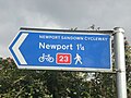 National Cycle Network route 23 sign to Newport.JPG 3,072 × 2,304; 2.26 MB
-
 National Cycle Network Route 56 Signpost-by-David-Quinn.jpg 640 × 480; 96 KB
-
 National Cycle Network routes sign near Heath Lane, Willaston.JPG 2,736 × 3,648; 3.54 MB
-
 National Cycle Network sign near Harlech.jpg 1,944 × 2,592; 1.07 MB
-
 National Cycle Network Sign Post - geograph.org.uk - 129287.jpg 640 × 426; 53 KB
-
 National Cycle Network Signpost. - geograph.org.uk - 681469.jpg 480 × 640; 76 KB
-
 National cycle network signs.jpg 2,816 × 2,112; 1.25 MB
-

-
 National Cycle route 23 sign.JPG 2,304 × 3,072; 2.33 MB
-
 NCN 1 and NCN 164 route sign.jpg 4,032 × 3,024; 2.66 MB
-
 NCN 56 sign on Kings Parade, Liverpool.jpg 3,456 × 5,184; 5.33 MB
-
 NCN 68 sign at Derby Station.jpg 640 × 615; 103 KB
-
 NCN Ranger-Markierung.jpg 586 × 815; 166 KB
-
 NCN route 647 meets 64.jpg 4,032 × 3,024; 6.49 MB
-
 NCN route 647 Western Trailhead.jpg 960 × 1,280; 557 KB
-
 NCN Routes 70 and 71.jpg 3,445 × 2,736; 2.81 MB
-
 NCN sign on Mellock Lane.jpg 3,456 × 5,184; 13 MB
-
 NCN Signs in Berwick on Tweed.jpg 600 × 531; 58 KB
-
 NCN signs in Derby.jpg 702 × 514; 94 KB
-
 NCN signs, Bridge Street, Neston.jpg 3,456 × 5,184; 11.14 MB
-
 NCN-65 NCN-656 signs.jpg 2,846 × 1,897; 1.63 MB
-
 NCN-route-688-western-start-sign.jpg 2,793 × 2,793; 2.53 MB
-
 NCN-route65-route-656-signs.jpg 2,738 × 2,738; 1.72 MB
-
 NCN-route65-route-675-signs.jpg 2,988 × 2,988; 1.74 MB
-
 NCN-route65-route-688-signs.jpg 1,645 × 2,057; 481 KB
-
 NCN-route71-route-65-signs.jpg 2,057 × 2,057; 1.05 MB
-
 NCN-route71-route-657-signs.jpg 2,871 × 2,157; 1.75 MB
-
 NCN1 signpost - geograph.org.uk - 1747180.jpg 640 × 480; 103 KB
-
 NCR 20 - Tilgate Forest.JPG 2,816 × 2,112; 2.66 MB
-
 NCR 21 sign.jpg 1,000 × 762; 322 KB
-
 New Town Trail Kilwinning.JPG 2,288 × 1,712; 1.29 MB
-
 Nidderdale Greenway signs.jpg 1,800 × 1,200; 1.51 MB
-
 Rea Valley cycling route sign, Kings Norton.JPG 2,736 × 3,648; 3.52 MB
-
 Road junction near Alnham - geograph.org.uk - 1332031.jpg 640 × 480; 123 KB
-
 Road Junction outside Lesbury - geograph.org.uk - 565116.jpg 640 × 480; 60 KB
-
 Route 1 - geograph.org.uk - 1421332.jpg 426 × 640; 63 KB
-
 Shropshire Union Canal - geograph.org.uk - 48235.jpg 640 × 420; 98 KB
-
 Sign by the Wirral Way - geograph.org.uk - 1137950.jpg 480 × 640; 158 KB
-
 Sign for cycle route 23 on a lampost in Newport.JPG 2,304 × 3,072; 2.18 MB
-
 SignpostAtCopysGreenWighton(RonStrutt)Jun1999.jpg 352 × 447; 93 KB
-
 Signs for the National Cycle Route 23 in Newport.JPG 2,304 × 3,072; 2.49 MB
-
 Storeton, Wirral - DSC04111.JPG 2,736 × 3,648; 3.64 MB
-
 Sustrans National Route 8.jpg 2,592 × 1,944; 2.18 MB
-

-
 Taff Trail sign, Grangetown.jpg 2,112 × 2,816; 2.38 MB
-
 Way-of-the-roses-sign-route-688.jpg 4,320 × 3,240; 3 MB
-
 Wegweiser National Route 1.jpg 235 × 174; 22 KB
-
 Wicken Fen - 8 December 2013 - Wicken Fen - 01.JPG 3,008 × 2,000; 2.23 MB
-
 Wicken Fen - 8 December 2013 - Wicken Fen - 22.JPG 2,000 × 3,008; 1.84 MB
-
 Wicken Fen - 8 December 2013 - Wicken Fen - 25.JPG 3,008 × 2,000; 1.79 MB
-
 Wicken Fen - 8 December 2013 - Wicken Fen - 31.JPG 2,000 × 3,008; 2.64 MB


,_Wicken_Fen_-_8_December_2013_-_03.JPG)

.jpg)


Jun1999.jpg)


