Category:National Cycle Network route 62
Jump to navigation
Jump to search
Long distance cycle route from Fleetwood to Selby. Between Southport and Selby it forms a large section fo the Trans Pennine Trail.  | |||||
| Upload media | |||||
| Instance of | |||||
|---|---|---|---|---|---|
| Part of | |||||
| Location |
| ||||
| Connects with | |||||
| Has part(s) | |||||
| Partially coincident with | |||||
| official website | |||||
| |||||

Subcategories
This category has the following 6 subcategories, out of 6 total.
C
- Conisbrough Viaduct (20 F)
L
- Longdendale Trail (97 F)
N
O
- Old Penwortham Bridge (10 F)
S
- Sykehouse Lock (4 F)
Media in category "National Cycle Network route 62"
The following 47 files are in this category, out of 47 total.
-
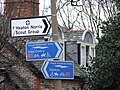 1st Heaton Norris Scout Group sign.jpg 2,048 × 1,536; 774 KB
-
 Above Woodhead Tunnel - geograph.org.uk - 130240.jpg 640 × 480; 84 KB
-
 Bull Lane Bridge - geograph.org.uk - 1293101.jpg 640 × 480; 77 KB
-
 Bull Lane Bridge crosses NLER.jpg 1,984 × 1,488; 634 KB
-
 Central signpost, Rimrose Valley.jpg 3,431 × 5,152; 25.9 MB
-
 Crossing of the A628, at Long Side - geograph.org.uk - 130251.jpg 640 × 480; 78 KB
-
 Crossroads at Charlesworth - geograph.org.uk - 1011709.jpg 640 × 470; 69 KB
-
 Cycle Path 62 - geograph.org.uk - 4377857.jpg 6,000 × 4,000; 4.84 MB
-
 Cycle route sign to St Annes at Blackpool - DSC07083.JPG 2,736 × 3,648; 3.52 MB
-
 Cycle track at Larkholme - geograph.org.uk - 1593224.jpg 640 × 459; 47 KB
-
 Downholland Brook - geograph.org.uk - 828845.jpg 640 × 480; 39 KB
-
 Entering Sykehouse lock - geograph.org.uk - 1184208.jpg 640 × 463; 73 KB
-
 Fingerpost on Greenwich Road bridge.jpg 3,320 × 4,988; 21.72 MB
-
 Footbridge and Campervan - geograph.org.uk - 197468.jpg 640 × 480; 99 KB
-
 Former crossing on the Sankey Canal - geograph.org.uk - 141979.jpg 640 × 426; 67 KB
-
 Former North Liverpool Extension Line at East Prescot Road, L14 (1).JPG 4,320 × 3,240; 5.08 MB
-
 Me and my shadow. - geograph.org.uk - 548829.jpg 640 × 478; 140 KB
-
 Merseyrail Northern line crosses NLER.jpg 1,984 × 1,488; 657 KB
-
 National Cycle Network 62 Liverpool Loop Line 2.jpg 1,147 × 1,475; 1.32 MB
-
 National Cycle Network 62 Liverpool Loop Line 3.jpg 1,352 × 1,060; 1.1 MB
-
 National Cycle Network 62 Liverpool Loop Line 4.jpg 899 × 1,039; 734 KB
-
 National Cycle Network 62 Liverpool Loop Line.jpg 840 × 1,515; 851 KB
-
 National Cycle Network Route 62 - geograph.org.uk - 3031985.jpg 640 × 480; 201 KB
-
 National Cycle Network route 62 2.jpg 3,872 × 2,592; 4.61 MB
-
 National Cycle Network route 62 Bridge.jpg 3,872 × 2,592; 3.33 MB
-
 National Cycle Network route 62 Graffiti.jpg 3,872 × 2,592; 4.13 MB
-
 National Cycle Network route 62 sign 001.jpg 1,488 × 1,984; 624 KB
-
 National Cycle Network route 62.jpg 3,872 × 2,592; 4.61 MB
-
 National Cyclist Network Route ^62 - geograph.org.uk - 3323348.jpg 640 × 480; 210 KB
-
 NCN Millennium Milepost MP1159 Gee Cross Tameside.jpeg 1,000 × 1,333; 1.02 MB
-
 Northern signpost, Rimrose Valley.jpg 3,453 × 5,185; 21.05 MB
-
 Old Penwortham Bridge - geograph.org.uk - 1005262.jpg 640 × 480; 108 KB
-
 Old Rail Bridge - geograph.org.uk - 300296.jpg 640 × 480; 94 KB
-
 River Mersey and Cheadle Bridge - geograph.org.uk - 51166.jpg 640 × 480; 129 KB
-
-
 Sign post on National Cycle Network route 62 near Aintree.jpg 1,488 × 1,984; 410 KB
-
 Signs at Greenwich Road bridge.jpg 3,302 × 4,827; 24.41 MB
-
 Simon Bridge - geograph.org.uk - 8292.jpg 640 × 261; 119 KB
-
 Southern signpost, Rimrose Valley.jpg 3,359 × 5,044; 24.95 MB
-
 Sykehouse Lock - geograph.org.uk - 5166.jpg 640 × 480; 66 KB
-
 The Selby Canal - geograph.org.uk - 199461.jpg 640 × 480; 96 KB
-
 The view west from Carterhouse Bridge - geograph.org.uk - 141985.jpg 640 × 426; 63 KB
-
 Topham Ferry Bridge - geograph.org.uk - 1332878.jpg 640 × 480; 83 KB
-
 TPT sign, Okell Drive.jpg 3,456 × 5,184; 11.98 MB
-
 Trans Pennine Trail sign.svg 512 × 269; 17 KB
-
 Trans-Pennine Trail signpost, Ormskirk Road, Aintree.jpg 2,955 × 4,596; 7.8 MB
-


.JPG)


