Category:Narsarsuaq Airport
Jump to navigation
Jump to search
| Object location | | View all coordinates using: OpenStreetMap |
|---|
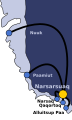
airport located in Narsarsuaq, Kujalleq, Greenland  | |||||
| Upload media | |||||
| Instance of | |||||
|---|---|---|---|---|---|
| Named after | |||||
| Location | Kujalleq, Greenland, Denmark | ||||
| Operator | |||||
| Date of official opening |
| ||||
| Elevation above sea level |
| ||||
| Follows |
| ||||
| Replaces |
| ||||
| IATA airport code |
| ||||
| ICAO airport code |
| ||||
| official website | |||||
 | |||||
Media in category "Narsarsuaq Airport"
The following 30 files are in this category, out of 30 total.
-
 51st Rescue Squadron SB-17s Narsarsuaq Air Base Greenland.jpg 1,623 × 854; 299 KB
-
 80-G-61960 (21831427098).jpg 2,736 × 2,196; 1.4 MB
-
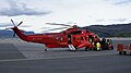
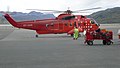 Air greenland helicopter (6161955627).jpg 3,968 × 2,232; 1.76 MB
-
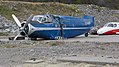 Antonov has seen better days (6162489760).jpg 3,839 × 2,159; 2.55 MB
-
 C-123s 1956.jpg 895 × 601; 92 KB
-
 Canadian F-86s at Narsarssuak 1956.jpg 1,717 × 1,553; 557 KB
-
 F340 Inspektionsskibet Beskytteren.jpg 1,173 × 1,176; 239 KB
-
 Greenland snow machine tracks OLLI.jpg 720 × 600; 578 KB
-
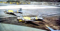
 Greenlandair Airbus.jpg 597 × 400; 52 KB
-
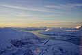
 Kangerlussuaq (6137157335).jpg 3,968 × 2,232; 1.91 MB
-
-
 NarsarssuakAB-Greenland-1942.jpg 640 × 734; 165 KB
-
 NarsarssuakAB1956.jpg 1,937 × 1,089; 376 KB
-
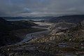
 Narsarsuaq (6140766733).jpg 3,968 × 2,232; 2.71 MB
-
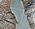
 Narsarsuaq 2008-10-29 filtered.jpg 6,436 × 1,690; 6.52 MB
-
 Narsarsuaq airport from signal hill - aircraft on approach.jpg 640 × 429; 60 KB
-
 Narsarsuaq Airport Overview looking SW.jpg 5,803 × 3,868; 3.35 MB
-
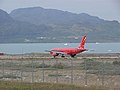
 Narsarsuaq-airport-atlantic-airways-avro-rj85-oyrce.jpg 3,872 × 2,176; 2.26 MB
-
 Narsarsuaq-airport-atlantic-airways-avro-rj85.jpg 3,528 × 1,376; 1.17 MB
-
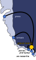 Narsarsuaq-airport-destinations-HE.svg 240 × 400; 29 KB
-
 Narsarsuaq-airport-destinations.svg 240 × 400; 26 KB
-
 Narsarsuaq-airport-runway-from-air.jpg 3,872 × 2,176; 2.18 MB
-
 Narsarsuaq-airport-runway.jpg 941 × 1,675; 222 KB
-
 Narsarsuaq-airport-sikorsky-s61n.jpg 3,872 × 2,176; 2.43 MB
-
 Narsarsuaq-airport-terminal-dutyfree.jpg 3,872 × 2,176; 2.96 MB
-
 Narsarsuaq-airport-terminal-from-tarmac.jpg 3,872 × 2,176; 3.67 MB
-
 Narsarsuaq-airport-terminal.jpg 3,872 × 2,176; 2.89 MB
-
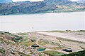
 Narsarsuaq.jpg 500 × 375; 100 KB
-
 PBY-5A Catalina of VP-6 (CG) at Narsarsuaq c1943.jpg 1,880 × 1,200; 1.07 MB
-
 Qaqortoq-heliport-destinations.svg 240 × 192; 26 KB

.jpg)
.jpg)
.jpg)


.jpg)


.jpg)


_at_Narsarsuaq_c1943.jpg)
