Category:Narrowboats in Shropshire
Jump to navigation
Jump to search
Ceremonial counties of England: Bedfordshire · Berkshire · Buckinghamshire · Cambridgeshire · Cheshire · Derbyshire · Devon · East Riding of Yorkshire · Essex · Gloucestershire · Greater London · Greater Manchester · Hampshire · Hertfordshire · Kent · Lancashire · Leicestershire · Lincolnshire · Merseyside · Norfolk · North Yorkshire · Northamptonshire · Nottinghamshire · Oxfordshire · Shropshire · Somerset · South Yorkshire · Staffordshire · Suffolk · Surrey · Warwickshire · West Midlands · West Sussex · West Yorkshire · Wiltshire · Worcestershire
City-counties: Bristol ·
Former historic counties:
Other former counties:
City-counties: Bristol ·
Former historic counties:
Other former counties:
Media in category "Narrowboats in Shropshire"
The following 172 files are in this category, out of 172 total.
-
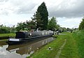
 'like sardines' at Betton Mill Wharf - geograph.org.uk - 887659.jpg 640 × 480; 114 KB
-
 'Maiden' at Market Drayton - geograph.org.uk - 516815.jpg 640 × 428; 91 KB
-
 'Saturn' at Ellesmere - geograph.org.uk - 1003056.jpg 640 × 428; 70 KB
-
-

-

-

-
 Aston Bottom Lock - geograph.org.uk - 1002147.jpg 640 × 428; 126 KB
-
 Aston Top Lock - geograph.org.uk - 1002093.jpg 640 × 428; 101 KB
-
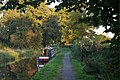
 Autumn on the Shropshire Union Canal - geograph.org.uk - 256088.jpg 640 × 496; 104 KB
-
 Battersea at Little Soudley.jpg 4,032 × 3,024; 2.99 MB
-
 Benefits of re-opening a canal - geograph.org.uk - 585237.jpg 640 × 480; 98 KB
-
 Bethsaida at Shebdon Wharf on the Shropshire Union Canal.jpg 4,032 × 3,024; 4.96 MB
-
 Betton Mill and bridge no. 63 - geograph.org.uk - 257350.jpg 640 × 469; 119 KB
-

-

-

-

-
 Boats at Victoria Bridge - geograph.org.uk - 257631.jpg 640 × 496; 150 KB
-

-
 Bridge 17 on Llangollen Canal - geograph.org.uk - 1067115.jpg 640 × 480; 77 KB
-
 Bridge No 34 Shropshire Union Canal - geograph.org.uk - 52865.jpg 640 × 480; 134 KB
-

-

-
 British Waterways Ellesmere Yard - geograph.org.uk - 130737.jpg 640 × 429; 103 KB
-

-
 Bucyrus No 3 at Wheaton Aston.jpg 4,032 × 3,024; 4.63 MB
-
 Canal boat at Hindford - geograph.org.uk - 193973.jpg 640 × 480; 111 KB
-
 Canal boat entering the lock - geograph.org.uk - 252709.jpg 493 × 640; 136 KB
-
 Canal Boat on the Llangollen Canal - geograph.org.uk - 1451582.jpg 640 × 480; 160 KB
-

-

-
 Canal narrow boat - geograph.org.uk - 795283.jpg 640 × 480; 116 KB
-
 Canal stub near Lockgate Bridge - geograph.org.uk - 551991.jpg 640 × 480; 85 KB
-

-
 Charmaine near Brewood.jpg 4,032 × 3,024; 5.65 MB
-
 Cheswardine Road Bridge - geograph.org.uk - 516613.jpg 640 × 428; 125 KB
-
 Corolla at Audlem 01.jpg 4,032 × 3,024; 5.48 MB
-
 Corolla at Audlem 02.jpg 4,032 × 3,024; 5.46 MB
-
 Django at Hampton Bank - geograph.org.uk - 567752.jpg 640 × 480; 133 KB
-
 Dragonfly at Goldstone Wharf.jpg 4,032 × 3,024; 5.26 MB
-
 Electra on the Shropshire Union Canal 01.jpg 4,032 × 3,024; 3.82 MB
-
 Electra on the Shropshire Union Canal 02.jpg 4,032 × 3,024; 3.05 MB
-
 Ellesmere Basin - geograph.org.uk - 1003079.jpg 640 × 428; 83 KB
-
 Ellesmere Basin - geograph.org.uk - 130734.jpg 640 × 429; 99 KB
-
 Ellesmere Basin - geograph.org.uk - 130735.jpg 640 × 429; 89 KB
-
 Ellesmere Tunnel, Llangollen Canal - geograph.org.uk - 520397.jpg 640 × 542; 142 KB
-
 Foxglove on the Shropshire Union Canal.jpg 4,032 × 3,024; 4.89 MB
-

-
 Goldstone Wharf, Market Drayton - geograph.org.uk - 280073.jpg 640 × 424; 85 KB
-

-
-
 Grindley Brook Locks, bottom pond - geograph.org.uk - 52848.jpg 640 × 480; 150 KB
-

-

-
 Hope on the Shropshire Union Canal.jpg 4,032 × 3,024; 5.9 MB
-

-

-
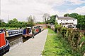
 Hotel boats at Maesbury - geograph.org.uk - 1002335.jpg 640 × 428; 116 KB
-
 Iona near Market Drayton.jpg 4,032 × 3,024; 3.65 MB
-
-
 Juno on the Shropshire Union Canal.jpg 4,032 × 3,024; 4.09 MB
-
 Life in Slow Motion on the Shropshire Union Canal.jpg 4,032 × 3,024; 6 MB
-
 Lift Bridge - geograph.org.uk - 293032.jpg 640 × 480; 55 KB
-
 Lion Quays - geograph.org.uk - 188909.jpg 640 × 480; 124 KB
-
 Lion Quays Hotel and Leisure complex - geograph.org.uk - 1758168.jpg 640 × 319; 48 KB
-

-

-
 Llangollen Canal - New Marton Bridge - geograph.org.uk - 130756.jpg 640 × 429; 106 KB
-
 Llangollen Canal - New Mills Lift Bridge - geograph.org.uk - 129675.jpg 640 × 429; 102 KB
-

-

-
 Llangollen Canal at Lower Frankton - geograph.org.uk - 1331440.jpg 640 × 425; 137 KB
-
 Llangollen Canal at Maestermyn - geograph.org.uk - 51981.jpg 640 × 480; 103 KB
-
 Llangollen Canal near Colemere - geograph.org.uk - 1005347.jpg 640 × 428; 93 KB
-
 Llangollen Canal near Hindford - geograph.org.uk - 1006549.jpg 640 × 428; 126 KB
-
 Llangollen Canal near St Martin's - geograph.org.uk - 1006569.jpg 640 × 428; 82 KB
-
 Llangollen Canal south of Grindley Brook - geograph.org.uk - 834395.jpg 640 × 480; 280 KB
-
 Llangollen Canal, Ellesmere - geograph.org.uk - 1005362.jpg 640 × 428; 99 KB
-
 Llangollen Canal, from Maestermyn Bridge - geograph.org.uk - 1006474.jpg 640 × 428; 109 KB
-
 Llangollen Canal, Hampton Bank - geograph.org.uk - 1005305.jpg 640 × 428; 124 KB
-
 Llangollen Canal, Hindford - geograph.org.uk - 1001676.jpg 640 × 428; 99 KB
-
 Llangollen Canal, Lower Frankton - geograph.org.uk - 1001922.jpg 640 × 428; 115 KB
-
 Llangollen Canal, near Balmer Heath - geograph.org.uk - 1005316.jpg 640 × 428; 109 KB
-
 Llangollen Canal, Platt Lane - geograph.org.uk - 1005142.jpg 640 × 428; 114 KB
-
 Llangollen Canal, Rhoswiel - geograph.org.uk - 1006634.jpg 640 × 428; 100 KB
-
 Llangollen Canal, Whitchurch - geograph.org.uk - 1003552.jpg 640 × 428; 125 KB
-
 Lynch Brothers Ltd.jpg 4,032 × 3,024; 5.97 MB
-
 Maestermyn Marine - geograph.org.uk - 1006537.jpg 640 × 428; 101 KB
-
 Maestermyn Marine - geograph.org.uk - 1006542.jpg 640 × 428; 95 KB
-
 Montgomery Canal at Frankton Junction - geograph.org.uk - 551956.jpg 640 × 480; 68 KB
-
 Montgomery canal at Queen's Head - geograph.org.uk - 52452.jpg 640 × 480; 123 KB
-

-

-

-
 Montgomery Canal, Frankton Locks - geograph.org.uk - 130746.jpg 640 × 429; 83 KB
-
 Montgomery Canal, Maesbury - geograph.org.uk - 1002347.jpg 429 × 640; 84 KB
-
 Montgomery Canal, Maesbury - geograph.org.uk - 1002561.jpg 640 × 428; 122 KB
-
 Montgomery Canal, Maesbury - geograph.org.uk - 1002643.jpg 640 × 428; 75 KB
-
 Montgomery Canal, Maesbury - geograph.org.uk - 1002648.jpg 640 × 428; 74 KB
-
 Montgomery Canal, Maesbury - geograph.org.uk - 1002655.jpg 640 × 428; 43 KB
-
 Montgomery Canal, Maesbury - geograph.org.uk - 1002680.jpg 640 × 428; 117 KB
-
 Montgomery Canal, Maesbury Marsh - geograph.org.uk - 1002264.jpg 640 × 428; 94 KB
-
 Montgomery Canal, Maesbury Marsh - geograph.org.uk - 1002297.jpg 640 × 428; 116 KB
-
 Montgomery Canal, Maesbury Marsh - geograph.org.uk - 1002683.jpg 640 × 428; 125 KB
-
 Montgomery Canal, Maesbury Marsh - geograph.org.uk - 1002695.jpg 640 × 428; 116 KB
-
 Mooring on Llangollen Canal - geograph.org.uk - 376466.jpg 640 × 480; 142 KB
-
 Narrow boats on the Llangollen Canal - geograph.org.uk - 1235716.jpg 600 × 450; 355 KB
-

-
-
 Narrowboat on Llangollen Canal - geograph.org.uk - 1067110.jpg 640 × 480; 124 KB
-

-

-

-
-
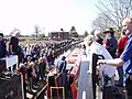
 Opening ceremony at Aston Top Lock - geograph.org.uk - 260310.jpg 640 × 480; 89 KB
-
 Poacher's Pocket, Gledrid Bridge - geograph.org.uk - 130760.jpg 640 × 429; 101 KB
-
-
 Poppy on the Shropshire Union Canal.jpg 4,032 × 3,024; 2.93 MB
-
 Queen's Head Wharf - geograph.org.uk - 1066734.jpg 640 × 443; 380 KB
-
 Raising the canal boat - geograph.org.uk - 252711.jpg 514 × 640; 166 KB
-
 Resolute No. 20 at Wheaton Aston.jpg 4,032 × 3,024; 3.97 MB
-
 Saturn fly-boat - geograph.org.uk - 326337.jpg 640 × 480; 82 KB
-
 Shropshire Union Canal - geograph.org.uk - 795268.jpg 640 × 480; 117 KB
-

-

-
 Shropshire Union Canal at Adderley Locks - geograph.org.uk - 1596585.jpg 640 × 474; 141 KB
-
 Shropshire Union Canal at Market Drayton - geograph.org.uk - 256105.jpg 640 × 464; 131 KB
-

-

-

-

-

-

-
 Shropshire Union Canal at Tetchill - geograph.org.uk - 51925.jpg 640 × 480; 100 KB
-

-
-

-

-

-

-
 Shropshire Union Canal south of Hack Green, Cheshire (geograph 6569769).jpg 1,440 × 960; 1.29 MB
-

-

-
 Siena on the Shropshire Union Canal.jpg 4,032 × 3,024; 3.44 MB
-
 Sir James near Norbury Junction.jpg 4,032 × 3,024; 3.36 MB
-
 Squire near Brewood on the Shropshire Union Canal.jpg 4,032 × 3,024; 6.37 MB
-
 Starks Bridge - geograph.org.uk - 299140.jpg 640 × 480; 69 KB
-

-
 Taking it steady - geograph.org.uk - 1331479.jpg 640 × 425; 115 KB
-
 The Current Limit of Navigation - geograph.org.uk - 46397.jpg 640 × 480; 224 KB
-
 The Llangollen Canal at Grindley Brook - geograph.org.uk - 1537055.jpg 640 × 523; 148 KB
-
 The Llangollen Canal near Welsh Frankton - geograph.org.uk - 1331415.jpg 640 × 425; 108 KB
-
 The North on the Shropshire Union Canal.jpg 4,032 × 3,024; 4.41 MB
-

-

-

-
 Tight turn - geograph.org.uk - 1425238.jpg 640 × 502; 88 KB
-

-
 View south east from Victoria Bridge - geograph.org.uk - 257341.jpg 640 × 507; 100 KB
-

-
 Whincroft on the Shropshire Union Canal.jpg 4,032 × 3,024; 3.27 MB
-
 Whitchurch Arm - geograph.org.uk - 1003594.jpg 640 × 428; 99 KB
-
 Whitchurch Arm - geograph.org.uk - 1003603.jpg 640 × 428; 76 KB
-
 Whitchurch Arm - geograph.org.uk - 1003619.jpg 640 × 428; 100 KB
-
 Whitchurch Arm - geograph.org.uk - 1004893.jpg 640 × 428; 71 KB
-
 Whitchurch Arm - geograph.org.uk - 1004906.jpg 640 × 428; 117 KB
-
 Whitchurch Arm - geograph.org.uk - 1005061.jpg 640 × 428; 108 KB
-
 Whitchurch Arm - geograph.org.uk - 1004916.jpg 428 × 640; 79 KB
-
 WhixallMarinaEvening.jpg 1,600 × 1,200; 175 KB
-
 William No. 1 north of Wheaton Aston.jpg 4,032 × 3,024; 6.51 MB
-


Apr2005.jpg)


.jpg)


,_Shropshire_Union_Canal,_Cheswardine,_Shropshire_-_geograph.org.uk_-_547811.jpg)


