Category:Nagy-Hárs Hill
Jump to navigation
Jump to search
| Object location | | View all coordinates using: OpenStreetMap |
|---|
mountain  | |||||
| Upload media | |||||
| Instance of | |||||
|---|---|---|---|---|---|
| Location | Budapest, Hungary | ||||
| Mountain range | |||||
| Elevation above sea level |
| ||||
 | |||||
Subcategories
This category has the following 6 subcategories, out of 6 total.
B
- Bátori Cave (23 F)
H
- Hárs-hegyi Cavity (1 F)
- Hárs-hegyi Szent Miklós Cave (2 F)
- Hárs-hegyi tanösvény (2 F)
K
V
- Views from Nagy-Hárs Hill (3 F)
Media in category "Nagy-Hárs Hill"
The following 18 files are in this category, out of 18 total.
-
 Ausblick vom Aussichtsturm, Richtung Nagy-Hárs Berg, 2022 Budapest.jpg 2,272 × 1,704; 980 KB
-
 Boletus reticulatus at Nagy-Hárs Hill.jpg 2,560 × 1,920; 3.16 MB
-

-
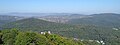
 Hűvösvölgy, Vadaskert, Nyék és a Hármashatár-hegy a Kaán Károly-kilátóból.jpg 3,264 × 1,315; 3.41 MB
-
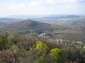 Janoshegyview2.JPG 2,272 × 1,704; 1.25 MB
-
 Kaán Károly-kilátó bejárat.jpg 3,264 × 2,448; 3.29 MB
-
 Kaán Károly-kilátó faszerkezete félig árnyékban.jpg 2,448 × 3,264; 2.94 MB
-
 Nagy- és a Kis-Hárs-hegy az Erzsébet-kilátóból.jpg 3,264 × 1,232; 3.53 MB
-
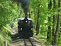 Nosztalgia vonat.JPG 2,048 × 1,536; 724 KB
-
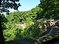 Old quarry at Nagy-Hárs Hill 01.jpg 2,560 × 1,920; 3.56 MB
-
 Old quarry at Nagy-Hárs Hill 02.jpg 2,560 × 1,920; 3.4 MB
-
 Resting place at Nagy-Hárs Hill.jpg 2,560 × 1,920; 3.52 MB
-
 Vadaskerti-hegy, Széchenyi-hegy, János-hegy és a Nagy-Hárs-hegy a Hármashatár-hegyről.jpg 3,264 × 1,516; 3.04 MB
-
 View of Nagy-Hárs Hill from János Hill.JPG 2,560 × 1,920; 3.22 MB
-
 View of Nagy-Hárs Hill from Kis-Hárs Hill 01.JPG 2,560 × 1,920; 3.32 MB
-
 View of Nagy-Hárs Hill from Kis-Hárs Hill 02.JPG 2,560 × 1,920; 3.08 MB
-
 View of Nagy-Hárs Hill from the Pál Csergezán view tower, Nagy-Kopasz.jpg 2,560 × 1,920; 3.03 MB
-
 Újlaki-hegy kilátás.jpg 4,608 × 2,592; 5.46 MB


