Category:NUTS maps of Ireland
Jump to navigation
Jump to search
Media in category "NUTS maps of Ireland"
The following 6 files are in this category, out of 6 total.
-
 Ireland stub, noflag.svg 563 × 800; 67 KB
-
 IRL Border, Midland and Western.png 400 × 499; 18 KB
-
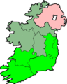 IRL Southern and Eastern.png 400 × 499; 19 KB
-
 Island of Ireland location RoI regions.svg 1,450 × 1,807; 771 KB
-
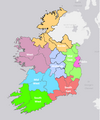 NUTS3 Boundaries Ireland.png 598 × 716; 174 KB
-
 SE Region Ireland 2018.png 800 × 998; 192 KB


