Category:NH Kerk Kootwijk
Jump to navigation
Jump to search
| Object location | | View all coordinates using: OpenStreetMap |
|---|
church building in Barneveld, Netherlands  | |||||
| Upload media | |||||
| Instance of | |||||
|---|---|---|---|---|---|
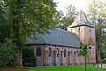
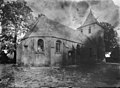
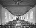
| Location | Kootwijk, Barneveld, Gelderland, Netherlands | ||||
| Street address |
| ||||
| Located on street |
| ||||
| Heritage designation |
| ||||
 | |||||
|
This is a category about rijksmonument number 8624
|
| Address |
|
Media in category "NH Kerk Kootwijk"
The following 24 files are in this category, out of 24 total.
-
 20161004 Kerk Kootwijk.jpg 5,184 × 3,456; 4.11 MB
-
 Aanzicht vanuit het zuidoosten - Kootwijk - 20126992 - RCE.jpg 1,200 × 881; 205 KB
-
 Exterieur - Kootwijk - 20126977 - RCE.jpg 898 × 1,200; 308 KB
-
 Exterieur - Kootwijk - 20126978 - RCE.jpg 1,200 × 860; 242 KB
-
 Interieur naar het koor - Kootwijk - 20126996 - RCE.jpg 1,200 × 964; 195 KB
-
 Interieur naar het noord-oosten - Kootwijk - 20126991 - RCE.jpg 895 × 1,200; 177 KB
-
 Interieur naar het noord-westen - Kootwijk - 20126987 - RCE.jpg 895 × 1,200; 175 KB
-
 Interieur naar het noord-westen - Kootwijk - 20126990 - RCE.jpg 889 × 1,200; 160 KB
-
 Interieur naar het oosten - Kootwijk - 20126986 - RCE.jpg 1,200 × 888; 139 KB
-
 Interieur naar het zuid-oosten - Kootwijk - 20126988 - RCE.jpg 896 × 1,200; 178 KB
-
 Interieur naar het zuid-oosten - Kootwijk - 20126989 - RCE.jpg 894 × 1,200; 156 KB
-
 Interieur toren naar het noord-oosten - Kootwijk - 20126985 - RCE.jpg 894 × 1,200; 244 KB
-
 Interieur toren naar het zuid-oosten - Kootwijk - 20126984 - RCE.jpg 881 × 1,200; 212 KB
-
 Kerk vanuit het noord-westen - Kootwijk - 20126979 - RCE.jpg 889 × 1,200; 257 KB
-
 Kerk vanuit het zuid-oosten - Kootwijk - 20126982 - RCE.jpg 881 × 1,200; 325 KB
-
 Kerk vanuit het zuid-oosten - Kootwijk - 20126983 - RCE.jpg 883 × 1,200; 332 KB
-
 Kerk vanuit het zuid-westen - Kootwijk - 20126980 - RCE.jpg 888 × 1,200; 318 KB
-
 Kerk vanuit het zuid-westen - Kootwijk - 20126981 - RCE.jpg 881 × 1,200; 282 KB
-
 Kerkje kootwijk (30961940236).jpg 3,872 × 2,592; 4.84 MB
-
 Kootwijk, de Nederlands Hervormde kerk RM8324 IMG 4341 2020-04-08 16.39.jpg 4,820 × 2,805; 10.78 MB
-
 Noord-oost gevel - Kootwijk - 20126994 - RCE.jpg 1,200 × 956; 393 KB
-
 RM8624 NH Kerk.JPG 4,320 × 3,240; 2.35 MB
-
 Westgevel - Kootwijk - 20126993 - RCE.jpg 954 × 1,200; 391 KB
-
 Zuidgevel - Kootwijk - 20126995 - RCE.jpg 1,200 × 953; 400 KB


.jpg)


