Category:Mytholm
Jump to navigation
Jump to search
Subcategories
This category has only the following subcategory.
Media in category "Mytholm"
The following 52 files are in this category, out of 52 total.
-
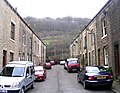
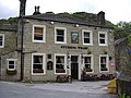
 Bank Terrace, Mytholm - geograph.org.uk - 1045226.jpg 640 × 463; 106 KB
-
 Bench at Horsehold Scout - geograph.org.uk - 1748744.jpg 640 × 427; 55 KB
-
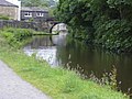
 Bridge over River Calder - geograph.org.uk - 1136435.jpg 640 × 480; 77 KB
-
 Calderside - geograph.org.uk - 4111.jpg 640 × 480; 90 KB
-
 Church Lane - King Street - geograph.org.uk - 1142017.jpg 640 × 480; 310 KB
-
 Colden Road, Mytholm - geograph.org.uk - 1045234.jpg 640 × 480; 126 KB
-

-
 Fields above Jack Bridge - geograph.org.uk - 430578.jpg 640 × 426; 107 KB
-
 Flooding on King Street, Mytholm - geograph.org.uk - 267977.jpg 640 × 480; 104 KB
-

-
 Hebden Royd Primary School - Eaves Road - geograph.org.uk - 1142022.jpg 640 × 483; 272 KB
-
 Marsh Lane, Pennine Bridleway - geograph.org.uk - 1045180.jpg 640 × 480; 75 KB
-
-
 Mill ponds below Eaves Wood - geograph.org.uk - 971574.jpg 640 × 427; 140 KB
-
 Mytholm and Calderside - geograph.org.uk - 723558.jpg 640 × 427; 216 KB
-
 Mytholm Close - Bankfoot - geograph.org.uk - 1142011.jpg 640 × 480; 281 KB
-

-
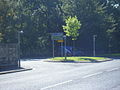
 Mytholm Turning Circle - geograph.org.uk - 1142021.jpg 640 × 411; 203 KB
-
 Mytholm, Hebden Bridge - geograph.org.uk - 1524932.jpg 640 × 480; 155 KB
-
 New House at Stubbing Drive - geograph.org.uk - 480659.jpg 640 × 480; 103 KB
-
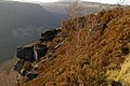 Outcrop at Top of Eaves - geograph.org.uk - 971129.jpg 640 × 426; 130 KB
-
 Oxford Street - Stubbing Holme Road - geograph.org.uk - 1141512.jpg 640 × 495; 267 KB
-
 Pennine Way, Pry Hill - geograph.org.uk - 40931.jpg 640 × 427; 114 KB
-
 Pry Farm - geograph.org.uk - 40936.jpg 640 × 427; 98 KB
-
 Rawtonstall Bank - geograph.org.uk - 1011909.jpg 620 × 464; 206 KB
-
 Rawtonstall Bank - geograph.org.uk - 1011911.jpg 640 × 480; 129 KB
-
 Remains of Mytholm Mill (geograph 98610, high-res).jpg 1,600 × 1,200; 501 KB
-
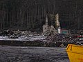
 Remains of Mytholm Mill - geograph.org.uk - 98610.jpg 640 × 480; 91 KB
-

-
 Rochdale Canal - geograph.org.uk - 1462644.jpg 640 × 480; 102 KB
-
 Rochdale Canal - geograph.org.uk - 480671.jpg 640 × 480; 95 KB
-

-
 Rochdale Canal milepost west of Stubbing Upper Lock (geograph 6545552).jpg 625 × 1,024; 248 KB
-
 Savile Bowling Club - geograph.org.uk - 1751601.jpg 640 × 480; 111 KB
-
 Sheep and Barley Croft - geograph.org.uk - 91271.jpg 640 × 480; 128 KB
-
 Steps (5486461555).jpg 2,667 × 4,000; 8.71 MB
-
 Stream - King Street - geograph.org.uk - 1142018.jpg 640 × 480; 343 KB
-
 Stream - King Street - geograph.org.uk - 1142019.jpg 640 × 480; 334 KB
-
 Stubbing Wharf off Halifax Road - geograph.org.uk - 480666.jpg 640 × 480; 101 KB
-
 Stubbings Wharf, King Street - geograph.org.uk - 1136433.jpg 640 × 480; 70 KB
-
 Trees and branches (3564026506).jpg 2,560 × 1,920; 5.41 MB
-
 Trinity Street - Stubbing Holme Road - geograph.org.uk - 1141524.jpg 640 × 480; 273 KB
-
 Turning Circle - geograph.org.uk - 1490451.jpg 640 × 480; 73 KB
-
 Under the Bridge (5487080602).jpg 2,600 × 3,342; 5.66 MB
-
 View across Mytholm - geograph.org.uk - 1385683.jpg 640 × 427; 77 KB
-

-
 View from Horsehold Road (4549045624).jpg 2,560 × 1,440; 2.56 MB
-

-
 View towards Bankfoot - geograph.org.uk - 1385686.jpg 640 × 480; 86 KB
-

-
 Where two valleys meet - geograph.org.uk - 1078786.jpg 640 × 480; 136 KB
-


.jpg)


.jpg)


.jpg)


.jpg)


.jpg)


.jpg)


