Category:Myojindaira
Jump to navigation
Jump to search
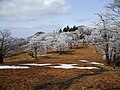
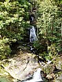
日本語: 台高山脈の明神平。奈良県東吉野村と三重県松阪市の境界に位置する
| Object location | | View all coordinates using: OpenStreetMap |
|---|
Media in category "Myojindaira"
The following 8 files are in this category, out of 8 total.
-
 Myojindaira00.JPG 2,472 × 3,296; 3.36 MB
-
 Myojindaira01.JPG 3,296 × 2,472; 3.51 MB
-
 Myojindaira02.JPG 3,296 × 2,472; 3.66 MB
-
 Myojindaira03.JPG 3,296 × 2,472; 3.54 MB
-
 Myojindaira04.JPG 3,296 × 2,472; 3.69 MB
-
 Myojindaira05.JPG 3,296 × 2,472; 3.33 MB
-
 Myojindaira06.JPG 2,472 × 3,296; 2.94 MB
-
 Myojindaira07.JPG 2,472 × 3,296; 2.97 MB


