Category:Myerscough and Bilsborrow
Jump to navigation
Jump to search
English: Myerscough and Bilsborrow is a civil parish in the Borough of Wyre in Lancashire, England. It was formed on 1 April 2003 as a merger of the former parishes of Bilsborrow and Myerscough, and lies on the eastern border of the Fylde plain. (→Myerscough and Bilsborrow)
civil parish in the Borough of Wyre in Lancashire, England  | |||||
| Upload media | |||||
| Instance of | |||||
|---|---|---|---|---|---|
| Location | Wyre, Lancashire, North West England, England | ||||
 | |||||
Subcategories
This category has the following 2 subcategories, out of 2 total.
B
M
- Myerscough (15 F)
Media in category "Myerscough and Bilsborrow"
The following 200 files are in this category, out of 324 total.
(previous page) (next page)-
 'Owd Nell's Tavern - geograph.org.uk - 4499295.jpg 6,841 × 2,045; 2.08 MB
-
 'Owd Nell's Tavern at Bilsborrow - geograph.org.uk - 4499301.jpg 5,876 × 2,151; 1.78 MB
-
 'Owd Nell's Tavern street - geograph.org.uk - 4499312.jpg 7,174 × 1,866; 3.29 MB
-
 A bevy of beauties..... - geograph.org.uk - 2370023.jpg 3,264 × 2,448; 5.21 MB
-
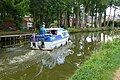
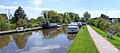
 A canal boat on the Lancaster Canal - geograph.org.uk - 4139071.jpg 4,592 × 3,056; 6.38 MB
-
 A not very challenging ford over Bacchus Brook - geograph.org.uk - 4155740.jpg 4,592 × 3,056; 6.98 MB
-
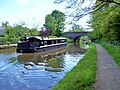
 A pleasure craft on the Lancaster Canal - geograph.org.uk - 3487393.jpg 4,090 × 2,699; 6.16 MB
-
 A6 at Brock - geograph.org.uk - 1180456.jpg 640 × 426; 103 KB
-
 A6 at The Roebuck - geograph.org.uk - 3293580.jpg 640 × 480; 43 KB
-
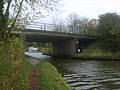
 A6 Crosses the Lancaster Canal - geograph.org.uk - 1180385.jpg 640 × 426; 110 KB
-
 A6 crosses the Lancaster Canal - geograph.org.uk - 3293578.jpg 640 × 481; 40 KB
-
 A6 crossing Lancaster Canal - geograph.org.uk - 2409266.jpg 800 × 524; 45 KB
-
 A6 Garstang Road at Bilsborrow - geograph.org.uk - 5913648.jpg 640 × 512; 106 KB
-
 A6 near Bilsborrow - geograph.org.uk - 2315615.jpg 800 × 546; 60 KB
-
 A6 roundabout giving access to new marina at Brock - geograph.org.uk - 2376641.jpg 1,600 × 1,137; 286 KB
-
 A6 southbound at Barton Grange Hotel - geograph.org.uk - 3293582.jpg 640 × 481; 56 KB
-
 A6 southbound at Brock - geograph.org.uk - 3293579.jpg 640 × 480; 66 KB
-
 Acorn Nurseries - geograph.org.uk - 5147382.jpg 4,608 × 2,567; 1.84 MB
-
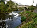
 Aqueduct over River Brock - geograph.org.uk - 2390492.jpg 3,456 × 2,592; 2.97 MB
-
 Autumn Bowls - geograph.org.uk - 1555579.jpg 640 × 480; 60 KB
-
 Barge Ahoy^ - geograph.org.uk - 1556238.jpg 640 × 480; 58 KB
-
 Barn, Midge Hall Farm - geograph.org.uk - 3808773.jpg 640 × 480; 54 KB
-
 Barton Grange Garden Centre - geograph.org.uk - 2171298.jpg 1,500 × 1,000; 348 KB
-
 Barton Grange Garden Centre - geograph.org.uk - 2370001.jpg 1,600 × 1,302; 377 KB
-
 Barton Grange Garden Centre - geograph.org.uk - 5551157.jpg 1,500 × 1,109; 217 KB
-

-
 Barton Grange Garden Centre near Brock - geograph.org.uk - 1578803.jpg 640 × 427; 148 KB
-
 Barton Grange Garden Centre, Brock - geograph.org.uk - 1259102.jpg 640 × 480; 55 KB
-
 Barton Grange Marina - geograph.org.uk - 1180397.jpg 640 × 426; 101 KB
-
 Barton Grange Marina - geograph.org.uk - 1587329.jpg 640 × 480; 241 KB
-
 Barton Grange Marina - geograph.org.uk - 4139155.jpg 4,356 × 2,899; 7.28 MB
-
 Barton Grange Marina - geograph.org.uk - 4499819.jpg 8,343 × 1,481; 2.49 MB
-
 Barton Grange Marina, Lancaster Canal - geograph.org.uk - 2526692.jpg 1,280 × 957; 591 KB
-
-
 Barton, Garstang Road - geograph.org.uk - 6152527.jpg 800 × 533; 570 KB
-
 Bend on the Lancaster Canal - geograph.org.uk - 3636316.jpg 1,024 × 768; 589 KB
-
 Bends ahead - geograph.org.uk - 4930293.jpg 4,592 × 3,056; 6.21 MB
-
 Benson's Lane - geograph.org.uk - 3808888.jpg 640 × 480; 57 KB
-
 Bilsbarrow lane Bridge, M6 - geograph.org.uk - 4510842.jpg 640 × 362; 26 KB
-
 Bilsborrow Church - geograph.org.uk - 3220985.jpg 1,200 × 803; 321 KB
-
 Bilsborrow Hall Farm - geograph.org.uk - 3925573.jpg 2,498 × 1,402; 2.54 MB
-
 Bilsborrow Lane - geograph.org.uk - 5284601.jpg 800 × 600; 129 KB
-
 Bilsborrow Lane by Bilsborrow Hall Farm - geograph.org.uk - 5078277.jpg 1,500 × 968; 138 KB
-
 Bilsborrow Lane crossing the M 6 - geograph.org.uk - 1824450.jpg 1,024 × 712; 107 KB
-
 Bilsborrow Lane heading to Bilsborrow - geograph.org.uk - 5077467.jpg 1,500 × 999; 140 KB
-
 Bilsborrow Lane in Bilsborrow - geograph.org.uk - 5078287.jpg 1,500 × 999; 151 KB
-
 Bilsborrow Lane in Bilsborrow - geograph.org.uk - 5078298.jpg 1,500 × 999; 234 KB
-
 Bilsborrow Lane into Bilsborrow - geograph.org.uk - 5078282.jpg 1,500 × 999; 129 KB
-
 Bilsborrow Lane over the M6 - geograph.org.uk - 3121065.jpg 4,596 × 2,654; 2.18 MB
-
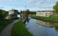
 Bilsborrow, canal - geograph.org.uk - 2956324.jpg 1,024 × 768; 167 KB
-
 Bilsborrow, Lancashire, St Hilda - geograph.org.uk - 5910247.jpg 4,608 × 3,456; 5.34 MB
-
 Bilsborrow, The White Bull - geograph.org.uk - 2956437.jpg 1,024 × 768; 155 KB
-
 Blackbird, St Hilda's Churchyard - geograph.org.uk - 2685697.jpg 640 × 481; 95 KB
-
 Boats on the Lancaster Canal - geograph.org.uk - 4327104.jpg 1,500 × 999; 228 KB
-
 Bowling Green and Pavilion at Guys Court - geograph.org.uk - 1775005.jpg 640 × 426; 234 KB
-
 Bridge 42 Lancaster Canal - geograph.org.uk - 1557765.jpg 640 × 480; 74 KB
-
 Bridge 44, Lancaster Canal - geograph.org.uk - 1556211.jpg 640 × 480; 88 KB
-
 Bridge 45 Lancaster Canal - geograph.org.uk - 1180416.jpg 640 × 426; 146 KB
-
 Bridge 45, Lancaster Canal - geograph.org.uk - 3485270.jpg 480 × 640; 97 KB
-
 Bridge 47 Lancaster Canal - geograph.org.uk - 1412047.jpg 640 × 480; 85 KB
-
 Bridge No 40 on Lancaster Canal - geograph.org.uk - 1245748.jpg 640 × 427; 69 KB
-
 Bridge No 41 on Lancaster Canal - geograph.org.uk - 1245747.jpg 640 × 427; 64 KB
-
 Bridge number 45, Lancaster Canal - geograph.org.uk - 6152347.jpg 800 × 590; 944 KB
-
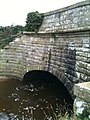
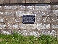
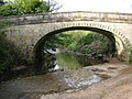
 Brock Aqueduct - geograph.org.uk - 1729051.jpg 3,888 × 2,592; 3.63 MB
-
 Brock Aqueduct - geograph.org.uk - 1775018.jpg 640 × 426; 247 KB
-
 Brock Aqueduct - geograph.org.uk - 2675225.jpg 1,536 × 2,048; 2.01 MB
-
 Brock Aqueduct - geograph.org.uk - 3901946.jpg 2,560 × 1,920; 2.87 MB
-
 Brock Aqueduct - geograph.org.uk - 4500001.jpg 2,848 × 2,134; 1.07 MB
-
 Brock Aqueduct - geograph.org.uk - 5845311.jpg 1,600 × 1,067; 377 KB
-
 Brock Aqueduct - geograph.org.uk - 6152340.jpg 800 × 600; 782 KB
-
 Brock Aqueduct No 46 - geograph.org.uk - 5920994.jpg 640 × 398; 62 KB
-
 Brock Aqueduct No 46 - geograph.org.uk - 5921002.jpg 640 × 521; 119 KB
-
 Brock Aqueduct view - geograph.org.uk - 4499990.jpg 2,848 × 2,134; 1.59 MB
-
 Brock Aqueduct, Lancaster Canal - geograph.org.uk - 3485259.jpg 480 × 640; 71 KB
-
 Brock Marina on the Lancaster Canal - geograph.org.uk - 2171292.jpg 1,500 × 991; 210 KB
-

-
 Cabin cruiser on Lancaster Canal - geograph.org.uk - 5845321.jpg 1,600 × 1,067; 405 KB
-
 Canal and Pylons - geograph.org.uk - 1557771.jpg 480 × 640; 45 KB
-
 Canal boat - geograph.org.uk - 5284591.jpg 600 × 800; 191 KB
-
 Canal boat on Brock Aqueduct - geograph.org.uk - 1775012.jpg 640 × 426; 254 KB
-
 Canal Maintenance - geograph.org.uk - 3901970.jpg 2,557 × 1,437; 1.71 MB
-
 Canal Signpost at Bilsborrow - geograph.org.uk - 4499940.jpg 2,048 × 2,786; 2.13 MB
-
 Caravan Park, Bilsborrow - geograph.org.uk - 3811171.jpg 640 × 480; 74 KB
-
 Claughton , Barton Grange - geograph.org.uk - 6300450.jpg 6,000 × 4,000; 5.49 MB
-
 Cottages by River Brock - geograph.org.uk - 1180535.jpg 640 × 426; 146 KB
-
 Crossing the Brock Aqueduct - geograph.org.uk - 6152338.jpg 800 × 600; 702 KB
-
 Display in Barton Grange Garden Centre - geograph.org.uk - 2370013.jpg 3,264 × 2,448; 4.59 MB
-
 Entrance to Lee farm - geograph.org.uk - 2183318.jpg 640 × 426; 217 KB
-
 Farm Building At Myerscough College - geograph.org.uk - 4093219.jpg 2,560 × 1,920; 2.17 MB
-
 Farm track and dyke on River Wyre - geograph.org.uk - 1041192.jpg 640 × 479; 101 KB
-
 Farmland and power lines - geograph.org.uk - 3808875.jpg 640 × 480; 40 KB
-
 Farmland off Benson's Lane - geograph.org.uk - 3808887.jpg 640 × 480; 65 KB
-
 Farmland off Moss Lane - geograph.org.uk - 3808889.jpg 640 × 480; 57 KB
-
 Farmstead As Seen From Hankinson Bridge - geograph.org.uk - 3256430.jpg 2,560 × 1,920; 2.67 MB
-
 Fishing lodge at Claughton - panoramio.jpg 600 × 450; 58 KB
-
 Floral urinals - geograph.org.uk - 3941002.jpg 2,048 × 1,536; 593 KB
-
 Flower urinals at Barton Grange Garden Centre - geograph.org.uk - 2116402.jpg 1,600 × 1,200; 308 KB
-
 Footbridge near Lower House - geograph.org.uk - 2718121.jpg 640 × 480; 157 KB
-
 Footbridge over River Brock - geograph.org.uk - 1180502.jpg 640 × 426; 155 KB
-
 Footpath and access to livery stables - geograph.org.uk - 4154478.jpg 4,338 × 2,730; 7.12 MB
-
 Footpath Near Brock Side - geograph.org.uk - 3925610.jpg 2,560 × 1,920; 3.63 MB
-
 Garstang Road at Bilsarrow - geograph.org.uk - 2376615.jpg 1,600 × 1,290; 365 KB
-
 Garstang Road crosses the West Coast Main Line - geograph.org.uk - 4327093.jpg 1,500 × 999; 168 KB
-
 Garstang Road near Bilsborrow - geograph.org.uk - 4327101.jpg 1,500 × 999; 254 KB
-
 Garstang Road through Barton - geograph.org.uk - 4327090.jpg 1,500 × 999; 204 KB
-
 Garstang Road, Barton Bangla Brasserie - geograph.org.uk - 6152505.jpg 800 × 533; 573 KB
-
 Gravel Pit near Lancaster Canal - geograph.org.uk - 1766063.jpg 3,072 × 2,304; 2.44 MB
-
 Grazing cattle - geograph.org.uk - 3636315.jpg 1,024 × 768; 529 KB
-
 Grazing east of Moss Lane - geograph.org.uk - 3811134.jpg 640 × 480; 55 KB
-
 Grazing east of the A6 - geograph.org.uk - 3811177.jpg 640 × 480; 61 KB
-
 Grazing south of Moss Lane - geograph.org.uk - 3811109.jpg 640 × 480; 58 KB
-
 Grazing, Midge Hall Farm - geograph.org.uk - 3808774.jpg 640 × 480; 53 KB
-
 Grazing, Threlfalls Farm - geograph.org.uk - 3811163.jpg 640 × 480; 85 KB
-
 Guy's - geograph.org.uk - 5147424.jpg 5,184 × 2,941; 1.97 MB
-
 Guy's Thatched Hamlet - geograph.org.uk - 4499320.jpg 4,127 × 1,501; 906 KB
-
 Guy's Thatched Village at Bilsborrow - geograph.org.uk - 3126014.jpg 1,500 × 1,000; 165 KB
-
 Hankinson Bridge - geograph.org.uk - 3636313.jpg 1,024 × 768; 521 KB
-
 Hankinson Bridge No 40 - geograph.org.uk - 5917870.jpg 640 × 565; 144 KB
-
 Hankinson House and the Lancaster Canal - geograph.org.uk - 5910846.jpg 800 × 766; 163 KB
-
 Head Nook Bridge - geograph.org.uk - 3811124.jpg 640 × 480; 75 KB
-
 Head Nook Bridge - geograph.org.uk - 3811132.jpg 640 × 480; 57 KB
-
 Head Nook Bridge No 43 - geograph.org.uk - 5919037.jpg 640 × 480; 85 KB
-
 Head Nook Bridge No 43 - geograph.org.uk - 5920211.jpg 640 × 455; 85 KB
-
 Heading towards Lower House - geograph.org.uk - 2718117.jpg 640 × 480; 66 KB
-

-
 Imposing barn at Lower House - geograph.org.uk - 2718126.jpg 640 × 480; 80 KB
-
 John Cross CE Primary School - geograph.org.uk - 5845339.jpg 1,600 × 768; 250 KB
-
 Junction of Bilsborrow Lane and Lydiate Lane - geograph.org.uk - 1824494.jpg 1,024 × 683; 234 KB
-
 Lancaster Canal - a storm - geograph.org.uk - 2575256.jpg 640 × 428; 111 KB
-
 Lancaster Canal - geograph.org.uk - 1555567.jpg 640 × 480; 106 KB
-
 Lancaster Canal - geograph.org.uk - 1556216.jpg 640 × 480; 84 KB
-
 Lancaster Canal - geograph.org.uk - 1556246.jpg 640 × 480; 42 KB
-
 Lancaster Canal - geograph.org.uk - 1774973.jpg 640 × 426; 243 KB
-
 Lancaster Canal - geograph.org.uk - 2526654.jpg 1,280 × 960; 533 KB
-
 Lancaster Canal - geograph.org.uk - 2526690.jpg 1,280 × 957; 500 KB
-
 Lancaster Canal - geograph.org.uk - 2575250.jpg 640 × 428; 122 KB
-
 Lancaster Canal - geograph.org.uk - 5147381.jpg 5,001 × 2,637; 1.97 MB
-
 Lancaster Canal - geograph.org.uk - 5284603.jpg 800 × 600; 163 KB
-
 Lancaster Canal - geograph.org.uk - 5845303.jpg 1,600 × 1,067; 267 KB
-
 Lancaster Canal - geograph.org.uk - 5845346.jpg 1,600 × 1,067; 374 KB
-
 Lancaster Canal - N of Hepgreave Bridge - geograph.org.uk - 6326298.jpg 5,184 × 2,920; 4.97 MB
-
 Lancaster Canal - towing - geograph.org.uk - 2575238.jpg 428 × 640; 114 KB
-

-
 Lancaster Canal at Barton Grange - geograph.org.uk - 4499823.jpg 2,796 × 2,062; 1.05 MB
-
 Lancaster Canal at Barton Grange - geograph.org.uk - 4499830.jpg 2,848 × 2,134; 1.18 MB
-
 Lancaster Canal at Bilsborrow - geograph.org.uk - 5845326.jpg 1,600 × 1,067; 298 KB
-
 Lancaster Canal at Bilsborrow - geograph.org.uk - 5910929.jpg 640 × 457; 71 KB
-
 Lancaster Canal at Bilsborrow - geograph.org.uk - 5920272.jpg 640 × 453; 122 KB
-
 Lancaster Canal at Bilsborrow - geograph.org.uk - 5920281.jpg 640 × 391; 78 KB
-
 Lancaster Canal at Bilsborrow - geograph.org.uk - 5920989.jpg 640 × 423; 114 KB
-
 Lancaster Canal at Bilsborrow - geograph.org.uk - 6152350.jpg 800 × 600; 920 KB
-
 Lancaster Canal crosses the Brock Aqueduct - geograph.org.uk - 5845315.jpg 1,600 × 1,067; 254 KB
-
 Lancaster Canal from bridge - geograph.org.uk - 1766028.jpg 1,600 × 1,200; 324 KB
-
 Lancaster Canal near Barton - geograph.org.uk - 5918987.jpg 640 × 594; 81 KB
-
 Lancaster Canal near Bilsborrow - geograph.org.uk - 5910909.jpg 640 × 480; 90 KB
-
 Lancaster Canal near Brock - geograph.org.uk - 5921269.jpg 640 × 452; 66 KB
-
 Lancaster Canal near Brock - geograph.org.uk - 5921284.jpg 640 × 428; 57 KB
-
 Lancaster Canal near Fence Foot - geograph.org.uk - 5919029.jpg 640 × 407; 62 KB
-
 Lancaster Canal near Hollowforth - geograph.org.uk - 5917818.jpg 640 × 541; 96 KB
-
 Lancaster Canal near Park Head - geograph.org.uk - 5917927.jpg 640 × 450; 107 KB
-
 Lancaster Canal near Yew Tree Farm - geograph.org.uk - 5910865.jpg 480 × 640; 71 KB
-
 Lancaster Canal walk - geograph.org.uk - 4499872.jpg 4,837 × 1,807; 1.82 MB
-
 Lancaster Canal Walk - geograph.org.uk - 4499886.jpg 3,828 × 1,690; 1.44 MB
-
 Lancaster Canal walk - geograph.org.uk - 4499898.jpg 2,848 × 2,134; 1.47 MB
-
 Lancaster Canal walk - geograph.org.uk - 4499907.jpg 2,804 × 2,074; 1.09 MB
-
 Lancaster Canal walk - geograph.org.uk - 4499950.jpg 2,848 × 2,134; 1.82 MB
-
 Lancaster Canal walk - geograph.org.uk - 4499961.jpg 2,848 × 2,134; 1.55 MB
-
 Lancaster Canal walk - geograph.org.uk - 4499982.jpg 2,848 × 2,134; 1.11 MB
-
 Lancaster Canal walk - geograph.org.uk - 4500016.jpg 4,532 × 1,651; 1.31 MB
-
 Lancaster Canal walk, Bilsborrow - geograph.org.uk - 4499915.jpg 2,848 × 2,134; 1.49 MB
-
 Lancaster Canal walk, Bilsborrow - geograph.org.uk - 4499924.jpg 2,848 × 2,134; 1.51 MB
-
 Lancaster Canal walk, Brock Aqueduct - geograph.org.uk - 4499977.jpg 2,848 × 2,134; 1.13 MB
-
 Lancaster Canal, Barton Grange Marina - geograph.org.uk - 2526688.jpg 1,280 × 961; 580 KB
-

-

-
 London to Glasgow - geograph.org.uk - 209805.jpg 640 × 480; 196 KB
-
 M6 northbound - geograph.org.uk - 4257561.jpg 640 × 474; 42 KB
-
 M6 Northbound near Brock - geograph.org.uk - 3134061.jpg 4,214 × 2,243; 1.82 MB
-
 Marina - geograph.org.uk - 1412054.jpg 640 × 480; 69 KB
-

-
 More Evidence Of Canal Maintenance - geograph.org.uk - 3901974.jpg 2,560 × 1,390; 1.75 MB
-
 Moss Lane - geograph.org.uk - 3811096.jpg 640 × 480; 65 KB
-
 Moss Lane - geograph.org.uk - 3811136.jpg 640 × 480; 62 KB
-
 Myerscough - geograph.org.uk - 5147385.jpg 4,920 × 1,859; 1.61 MB
-
 Myerscough - geograph.org.uk - 5147422.jpg 4,727 × 3,441; 1.88 MB
-
 Myerscough - geograph.org.uk - 5147423.jpg 5,184 × 3,456; 1.8 MB
-
 Myerscough and Bilsborrow , M6 Motorway - geograph.org.uk - 6300446.jpg 6,000 × 4,000; 4.81 MB
-
 Myerscough and Bilsborrow , M6 Motorway - geograph.org.uk - 6300448.jpg 6,000 × 4,000; 5.08 MB
-
 Myerscough College Lodge and Livery Stables - geograph.org.uk - 4930314.jpg 4,348 × 2,093; 5.71 MB
-

-
 Myerscough Hall Drive - geograph.org.uk - 3811175.jpg 640 × 480; 124 KB
-
 Myerscough, St Michael's Road - geograph.org.uk - 6152385.jpg 800 × 600; 937 KB
-
 Myrescough and Bilsborrow , M6 Motorway - geograph.org.uk - 6359864.jpg 6,000 × 4,000; 4.45 MB
-
 Myrescough and Bilsborrow , M6 Motorway - geograph.org.uk - 6359865.jpg 6,000 × 4,000; 4.87 MB
-
 Narrowboat on the Lancaster Canal - geograph.org.uk - 3126079.jpg 1,500 × 1,000; 135 KB
-
 New Bridge - geograph.org.uk - 4153091.jpg 4,592 × 3,056; 7.57 MB
-
 New Bridge And Weir - geograph.org.uk - 3925593.jpg 2,560 × 1,920; 3.57 MB
-
 New Bridge and Weir at Brockside - geograph.org.uk - 1180525.jpg 640 × 426; 154 KB
-
 New Bridge, Brockside - geograph.org.uk - 3049723.jpg 4,000 × 3,000; 4.92 MB
-
 New Bridge, River Brock - geograph.org.uk - 1283304.jpg 640 × 480; 106 KB


_-_geograph.org.uk_-_6152325.jpg)


