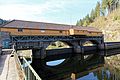
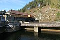
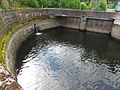
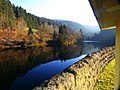
Category:Murgtalsperre Kirschbaumwasen
Jump to navigation
Jump to search
| Object location | | View all coordinates using: OpenStreetMap |
|---|
dam in Germany .jpg) | |||||
| Upload media | |||||
| Instance of | |||||
|---|---|---|---|---|---|
| Location | Forbach, Rastatt district, Region Mittlerer Oberrhein, Karlsruhe Government Region, Baden-Württemberg, Germany | ||||
| Located in or next to body of water | |||||
 | |||||
Media in category "Murgtalsperre Kirschbaumwasen"
The following 27 files are in this category, out of 27 total.
-
 Built In The Years 1914 To 1918 - panoramio.jpg 4,000 × 3,000; 4.8 MB
-
 Dam With Cormorant - panoramio.jpg 4,000 × 3,000; 2.42 MB
-
 Forbach Kirschbaumwasen - Murgtalstraße - Murgtalsperre Kirschbaumwasen 01 ies.jpg 5,616 × 3,744; 21.28 MB
-
 Forbach Kirschbaumwasen - Murgtalstraße - Murgtalsperre Kirschbaumwasen 02 ies.jpg 5,616 × 3,744; 15.54 MB
-
 Forbach Kirschbaumwasen - Murgtalstraße - Murgtalsperre Kirschbaumwasen 03 ies.jpg 5,616 × 3,743; 21.5 MB
-
 Forbach Kirschbaumwasen - Murgtalstraße - Murgtalsperre Kirschbaumwasen 04 ies.jpg 5,616 × 3,744; 21.46 MB
-
 Forbach Kirschbaumwasen - Murgtalstraße - Murgtalsperre Kirschbaumwasen 05 ies.jpg 5,616 × 3,744; 19.25 MB
-
 Forbach Kirschbaumwasen - Murgtalstraße - Murgtalsperre Kirschbaumwasen 06 ies.jpg 5,616 × 3,745; 21.62 MB
-
 Forbach Kirschbaumwasen - Murgtalstraße - Murgtalsperre Kirschbaumwasen 07 ies.jpg 5,616 × 3,743; 19.16 MB
-
 Forbach Kirschbaumwasen - Murgtalstraße - Murgtalsperre Kirschbaumwasen 08 ies.jpg 5,616 × 3,744; 23.11 MB
-
 Forbach Kirschbaumwasen - Murgtalstraße - Murgtalsperre Kirschbaumwasen 09 ies.jpg 5,616 × 3,744; 22.18 MB
-
 Forbach Kirschbaumwasen - Murgtalstraße - Murgtalsperre Kirschbaumwasen 10 ies.jpg 5,616 × 3,744; 23.7 MB
-
 Forbach Kirschbaumwasen - Murgtalstraße - Murgtalsperre Kirschbaumwasen 11 ies.jpg 3,744 × 5,616; 18.03 MB
-
 Forbach Kirschbaumwasen - Murgtalstraße - Murgtalsperre Kirschbaumwasen 12 ies.jpg 5,616 × 3,744; 21.18 MB
-
 Kirschbaumwasen Murgtalsperre 01 (fcm).jpg 4,320 × 3,240; 4.13 MB
-
 Kirschbaumwasen Murgtalsperre 02 (fcm).jpg 4,320 × 3,240; 4 MB
-
 Kirschbaumwasen Murgtalsperre 03 (fcm).jpg 4,320 × 3,240; 3.43 MB
-
 Murgtalsperre - panoramio.jpg 4,000 × 3,000; 6.47 MB
-
 Murgtalsperre Kirschbaumwasen Staumauer.jpg 2,000 × 1,500; 957 KB
-
 Murgtalsperre Kirschbaumwasen.jpg 2,000 × 1,500; 880 KB
-
 Reflection - panoramio (59).jpg 4,000 × 3,000; 6.39 MB
-
 The Dam - panoramio (4).jpg 4,000 × 3,000; 4.79 MB
-
 The Lake Nearly Kirschbaumwasen - panoramio.jpg 4,000 × 3,000; 3.37 MB
-
 The River Murg - panoramio (1).jpg 3,000 × 4,000; 3.62 MB
-
 Wasserkraftwerk Forbach pic2.JPG 4,608 × 3,456; 7.36 MB
-
 Wasserkraftwerk Forbach pic3.JPG 4,608 × 3,456; 7.42 MB
-
 Wasserkraftwerk Forbach pic4.JPG 4,608 × 3,456; 7.56 MB


.jpg)
.jpg)


.jpg)
.jpg)

.jpg)


