Category:Munster, Indiana
Jump to navigation
Jump to search
| Object location | | View all coordinates using: OpenStreetMap |
|---|
town in the U.S. state of Indiana  | |||||
| Upload media | |||||
| Instance of | |||||
|---|---|---|---|---|---|
| Location | Lake County, Indiana | ||||
| Inception |
| ||||
| Population |
| ||||
| Area |
| ||||
| Elevation above sea level |
| ||||
| official website | |||||
 | |||||
Subcategories
This category has the following 3 subcategories, out of 3 total.
Media in category "Munster, Indiana"
The following 32 files are in this category, out of 32 total.
-

-
 A street in Munster.jpg 2,592 × 1,944; 3.02 MB
-
 American Robin feeding chicks.jpg 842 × 516; 106 KB
-
 American Robin nest and eggs.JPG 2,048 × 1,536; 564 KB
-
 Ashwood Ln. in White Oak, Munster, Indiana.jpg 2,304 × 1,728; 661 KB
-
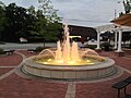
 Centennial Park (Munster, Indiana).JPG 3,264 × 2,448; 2.93 MB
-
 Centennial Park Golf Course, Munster.JPG 3,264 × 2,448; 2.43 MB
-
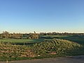
 Centennial Park lake in Munster.JPG 3,264 × 2,448; 2.23 MB
-
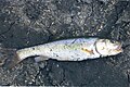 Chub from Munster Creek.jpg 1,192 × 795; 683 KB
-
 Five Guys (Munster, Indiana) 1.jpg 4,000 × 1,848; 7.16 MB
-
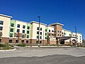 Homewood Suites in Munster, IN.jpg 3,138 × 2,354; 1.91 MB
-
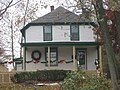
 Ibach House in Munster.jpg 2,816 × 2,112; 2.82 MB
-
 Kaske House in Munster.jpg 2,816 × 2,112; 1.96 MB
-

-
 McMansion, Munster, Indiana (levels adjusted).JPG 1,152 × 864; 366 KB
-
 McMansion, Munster, Indiana.JPG 1,152 × 864; 423 KB
-
 Monon Trail across Little Calumet River.jpg 3,264 × 2,448; 2.2 MB
-
 Monon Trail logo.jpg 910 × 1,346; 234 KB
-
 Monon Trailhead in Munster.jpg 2,048 × 1,536; 673 KB
-
 Munster - Camellia Drive.JPG 2,048 × 1,536; 755 KB
-
 Munster - FHH.JPG 2,592 × 1,944; 3.03 MB
-
 Munster - White Oak Estates.JPG 2,288 × 1,712; 1.58 MB
-
 Munster Town Hall.jpg 2,974 × 2,233; 1.25 MB
-
 Old Monon Railroad tracks.jpg 3,264 × 2,448; 2.81 MB
-
 Red Lobster (Munster, Indiana) 1.jpg 4,000 × 1,848; 6.15 MB
-
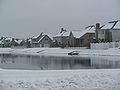
 Residents boat down a main street in Munster, IN.jpg 4,000 × 3,000; 3.28 MB
-
 Target (Munster, Indiana) 1.jpg 4,000 × 1,848; 5.75 MB
-
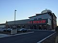 Three Floyds Distillery.JPG 3,264 × 2,448; 1.74 MB
-
 Three-Floyds-01.jpg 3,888 × 2,592; 4.74 MB
-
 US-IN-Munster.png 512 × 800; 33 KB
-
 West Lakes neighborhood.JPG 3,264 × 2,448; 1.66 MB
-
 White Oak Woods apartments.JPG 3,264 × 2,448; 2.39 MB


.JPG)


_1.jpg)


.JPG)


_1.jpg)

_1.jpg)


