Category:Mundford
Jump to navigation
Jump to search
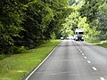
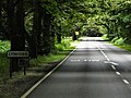
English: Mundford is a village and civil parish in the English county of Norfolk. It is situated at the intersection of two major routes, the A134 Colchester to King's Lynn road and the A1065 Mildenhall to Fakenham road, about from London.
village and civil parish in Norfolk, UK  | |||||
| Upload media | |||||
| Instance of | |||||
|---|---|---|---|---|---|
| Location | Breckland, Norfolk, East of England, England | ||||
| Area |
| ||||
| Said to be the same as | Mundford (Wikimedia duplicated page, civil parish) | ||||
 | |||||
Subcategories
This category has the following 4 subcategories, out of 4 total.
C
- The Crown, Mundford (3 F)
L
- Lynford Lakes (4 F)
Media in category "Mundford"
The following 200 files are in this category, out of 281 total.
(previous page) (next page)-
 A Pile Of Sugar Beet - geograph.org.uk - 297367.jpg 640 × 480; 111 KB
-
 A1065 approaching Mundford - geograph.org.uk - 3827040.jpg 640 × 430; 55 KB
-
 A1065 at Mundford - geograph.org.uk - 5543230.jpg 4,608 × 3,072; 2.04 MB
-
 A1065 towards Brandon - geograph.org.uk - 4576833.jpg 640 × 480; 95 KB
-
 A1065 towards Brandon - geograph.org.uk - 4576835.jpg 640 × 480; 105 KB
-
 A1065 towards Mundford - geograph.org.uk - 6051792.jpg 1,024 × 768; 237 KB
-
 A1065, Mundford - geograph.org.uk - 3827045.jpg 640 × 430; 60 KB
-
 A1065, Mundford - geograph.org.uk - 3827046.jpg 640 × 430; 70 KB
-
 A1065, northbound - geograph.org.uk - 3827038.jpg 640 × 430; 81 KB
-
 A1065, northbound - geograph.org.uk - 3827039.jpg 640 × 430; 61 KB
-
 A1065, Swaffham Road at Mundford - geograph.org.uk - 4351188.jpg 640 × 480; 78 KB
-
 A1065, Swaffham Road, South of Ickburgh - geograph.org.uk - 4689368.jpg 640 × 480; 371 KB
-
 A134 Cranwich Road, Mundford - geograph.org.uk - 5543209.jpg 4,608 × 3,072; 1.86 MB
-
 A134 Cranwich Road, Mundford - geograph.org.uk - 5543473.jpg 4,608 × 3,072; 1.87 MB
-
 A134 near Lynford Stag car park - geograph.org.uk - 5607558.jpg 1,600 × 1,200; 418 KB
-
 A134 Northbound, near to Mundford - geograph.org.uk - 4689639.jpg 640 × 480; 445 KB
-
 A134 South of Mundford - geograph.org.uk - 4689618.jpg 640 × 480; 379 KB
-
 A134 towards Thetford - geograph.org.uk - 4576822.jpg 640 × 480; 71 KB
-
 A134 towards Thetford - geograph.org.uk - 4576828.jpg 640 × 480; 99 KB
-
 A134, Lynford - geograph.org.uk - 4689651.jpg 640 × 480; 396 KB
-
 Access number 35 - geograph.org.uk - 5548345.jpg 4,608 × 3,072; 1.82 MB
-
 Access to forest track - geograph.org.uk - 6039745.jpg 1,024 × 768; 386 KB
-
 Amorous toads - geograph.org.uk - 6092653.jpg 1,024 × 769; 225 KB
-
 Area of mixed woodland - geograph.org.uk - 6085338.jpg 1,024 × 769; 377 KB
-
 Beech woodland with tracks either side - geograph.org.uk - 6112788.jpg 1,024 × 768; 359 KB
-
 Big Wood, Thetford Forest - geograph.org.uk - 222653.jpg 640 × 480; 121 KB
-
 Blackthorn in flower - geograph.org.uk - 6107995.jpg 1,024 × 768; 268 KB
-
 Breckland landscape - geograph.org.uk - 6107985.jpg 1,024 × 768; 304 KB
-
 Breckland landscape - geograph.org.uk - 6107993.jpg 1,024 × 768; 229 KB
-
 Bridge and Weir over stream leaving Lynford Lakes - geograph.org.uk - 6007804.jpg 4,608 × 3,456; 2.52 MB
-

-
 Broad ride in Thetford Forest - geograph.org.uk - 4251316.jpg 1,600 × 1,200; 911 KB
-
 Bungalows, Mundford - geograph.org.uk - 5930739.jpg 1,600 × 1,200; 451 KB
-
 Bungalows, Mundford - geograph.org.uk - 5930750.jpg 1,600 × 1,200; 294 KB
-
 Church lane, Mundford, Norfolk - geograph.org.uk - 822775.jpg 640 × 480; 84 KB
-
 Cleared area near Cranwich Heath - geograph.org.uk - 4250370.jpg 1,600 × 1,200; 790 KB
-
 Cleared area of Thetford Forest - geograph.org.uk - 4251321.jpg 1,600 × 1,200; 922 KB
-
 Cleared woodland - geograph.org.uk - 4251345.jpg 1,600 × 1,200; 779 KB
-
 Converging streams - geograph.org.uk - 6085400.jpg 1,024 × 769; 350 KB
-
 Cottages And Country Road - geograph.org.uk - 1456829.jpg 640 × 480; 115 KB
-
 Cranwich Heath - geograph.org.uk - 4251331.jpg 1,600 × 1,200; 736 KB
-
 Cranwich Road, Mundford - geograph.org.uk - 5246815.jpg 1,280 × 960; 446 KB
-
 Crop field towards pig farm - geograph.org.uk - 4576827.jpg 640 × 480; 67 KB
-
 Crop field, Mundford - geograph.org.uk - 4558541.jpg 640 × 480; 61 KB
-
 Damp ride - geograph.org.uk - 5600625.jpg 1,600 × 1,200; 547 KB
-
 Deer fence around new plantation - geograph.org.uk - 5600635.jpg 1,600 × 1,200; 353 KB
-
 Distant Marker - geograph.org.uk - 297363.jpg 640 × 480; 87 KB
-
 Disused old quarry road - geograph.org.uk - 6039739.jpg 1,024 × 768; 342 KB
-
 Ditch beside A1065 at Mundford - geograph.org.uk - 6051800.jpg 1,024 × 768; 346 KB
-
 Drain-stream from Lynford Lakes - geograph.org.uk - 6041158.jpg 1,024 × 768; 404 KB
-
 Duck rearing farm - geograph.org.uk - 6079263.jpg 1,024 × 769; 193 KB
-
 Duck rearing pens - geograph.org.uk - 6079226.jpg 1,024 × 769; 313 KB
-
 Entering Mundford - geograph.org.uk - 4558537.jpg 640 × 480; 76 KB
-
 Entrance to walk near Lynford Hall - geograph.org.uk - 5981387.jpg 4,608 × 2,510; 1.52 MB
-
 Eucalyptus in Thetford Forest - geograph.org.uk - 5600642.jpg 1,200 × 1,600; 518 KB
-
 Exit from forest path with barrier - geograph.org.uk - 6039766.jpg 1,024 × 769; 402 KB
-
 Fenced off recently replanted area - geograph.org.uk - 6108010.jpg 1,024 × 768; 284 KB
-
 Field from West Tofts Road - geograph.org.uk - 2031554.jpg 1,000 × 667; 166 KB
-
 Firebreak in Glebe Covert - geograph.org.uk - 4351201.jpg 640 × 480; 257 KB
-
 Foggy morning at Cranwich - geograph.org.uk - 6112776.jpg 1,024 × 768; 156 KB
-
 Footpath from Mundford - geograph.org.uk - 5930745.jpg 1,600 × 1,200; 621 KB
-
 Footpath from Mundford - geograph.org.uk - 5930748.jpg 1,600 × 1,200; 491 KB
-
 Footpath from The Lammas - geograph.org.uk - 5930740.jpg 1,600 × 1,131; 291 KB
-
 Footpath to Mundford - geograph.org.uk - 6079169.jpg 1,024 × 769; 453 KB
-
 Forest road Easterly view - geograph.org.uk - 6117883.jpg 1,024 × 768; 304 KB
-
 Forest road sign post - geograph.org.uk - 6117894.jpg 1,024 × 768; 434 KB
-
 Forest roads cross roads - geograph.org.uk - 6117874.jpg 1,024 × 768; 352 KB
-
 Forest track - geograph.org.uk - 3406792.jpg 1,600 × 1,200; 939 KB
-
 Forest track - geograph.org.uk - 3406822.jpg 1,600 × 1,200; 1.04 MB
-
 Forest Track - geograph.org.uk - 341438.jpg 480 × 640; 143 KB
-
 Forest Track - geograph.org.uk - 353658.jpg 640 × 480; 104 KB
-
 Forest track - geograph.org.uk - 6079304.jpg 1,024 × 769; 357 KB
-
 Forest track - geograph.org.uk - 6108909.jpg 1,024 × 768; 359 KB
-
 Forest track by Ickerbuilding - geograph.org.uk - 4251353.jpg 1,600 × 1,200; 967 KB
-
 Forest track near Rougham Corner - geograph.org.uk - 3406759.jpg 1,600 × 1,200; 1.27 MB
-
 Forest track near Rougham Corner - geograph.org.uk - 3406764.jpg 1,600 × 1,200; 969 KB
-
 Forest track near Rougham Corner - geograph.org.uk - 3406766.jpg 1,600 × 1,200; 1,019 KB
-
 Four-spotted Chaser - geograph.org.uk - 5981414.jpg 2,991 × 1,467; 164 KB
-
 Freshly cultivated track between Conifer rows - geograph.org.uk - 6112795.jpg 1,024 × 768; 339 KB
-
 Frozen Lynford Lake - geograph.org.uk - 6041210.jpg 1,024 × 768; 423 KB
-
 Fungi macro - geograph.org.uk - 5981809.jpg 4,608 × 3,456; 957 KB
-
 Gas Governor in Thetford Forest - geograph.org.uk - 6060142.jpg 3,072 × 2,000; 881 KB
-
 Gas Sub-Station - geograph.org.uk - 5543460.jpg 4,608 × 3,072; 1.93 MB
-
 Gate with kissing gate - geograph.org.uk - 6108012.jpg 1,024 × 768; 234 KB
-
 Gated Forest Track - geograph.org.uk - 367490.jpg 640 × 480; 129 KB
-
 Grassy Forest Track - geograph.org.uk - 353669.jpg 480 × 640; 119 KB
-
 Grimes Graves, aerial 2018 (3) - geograph.org.uk - 5771638.jpg 800 × 574; 104 KB
-
 Haulage Truck on the A134 near Mundford - geograph.org.uk - 4689632.jpg 640 × 427; 390 KB
-
 Heading to the stream - geograph.org.uk - 6041175.jpg 1,024 × 768; 423 KB
-
 Heading up the slope - geograph.org.uk - 6041218.jpg 768 × 1,024; 426 KB
-
 Heath Covert - geograph.org.uk - 5600619.jpg 1,242 × 1,600; 663 KB
-
 High seat in Heath Covert - geograph.org.uk - 5600623.jpg 1,600 × 1,200; 553 KB
-
 Ickburgh Lodge - geograph.org.uk - 4558535.jpg 640 × 480; 100 KB
-
 Impson Way, Mundford - geograph.org.uk - 2229951.jpg 640 × 480; 88 KB
-
 Impson Way, Mundford - geograph.org.uk - 2229963.jpg 640 × 480; 65 KB
-
 Iveco Stralis Truck Leaving Mundford - geograph.org.uk - 4689600.jpg 640 × 480; 414 KB
-
 Junction in path - geograph.org.uk - 6079218.jpg 1,024 × 769; 416 KB
-
 Lancaster HK 773 LS-W crash memorial at Mundford - geograph.org.uk - 6060126.jpg 3,264 × 2,448; 1.78 MB
-
 Lancaster HK 773 LS-W crash memorial at Mundford - geograph.org.uk - 6060138.jpg 3,264 × 2,448; 1.76 MB
-
 Lime avenue to A134 - geograph.org.uk - 5600593.jpg 1,200 × 1,600; 642 KB
-
 Lodge, Ickburgh - geograph.org.uk - 5303167.jpg 640 × 497; 278 KB
-
 Log barrier to track - geograph.org.uk - 6079316.jpg 1,024 × 769; 343 KB
-
 Lone Oak beside path to Mundford - geograph.org.uk - 6079201.jpg 769 × 1,024; 361 KB
-
 Looking along forest edge - geograph.org.uk - 6104777.jpg 1,024 × 768; 270 KB
-
 Looking along stream towards Lynford Lakes - geograph.org.uk - 6051781.jpg 1,024 × 768; 400 KB
-
 Looking along West Tofts road - geograph.org.uk - 6053955.jpg 1,024 × 768; 267 KB
-
 Looking back towards entrance to old Quarry road - geograph.org.uk - 6053922.jpg 1,024 × 768; 333 KB
-
 Looking down old Quarry road - geograph.org.uk - 6053816.jpg 1,024 × 768; 367 KB
-
 Looking East on forest road - geograph.org.uk - 6112779.jpg 1,024 × 768; 208 KB
-
 Looking North on A1065 at Ickburgh - geograph.org.uk - 6128641.jpg 1,024 × 768; 393 KB
-
 Looking north on forest road 58 - geograph.org.uk - 6117861.jpg 1,024 × 768; 332 KB
-
 Looking over stile towards Mundford - geograph.org.uk - 6079241.jpg 1,024 × 769; 251 KB
-
-
 Looking South along forest edge - geograph.org.uk - 6107965.jpg 1,024 × 768; 282 KB
-
 Looking south at Mundford green - geograph.org.uk - 5605735.jpg 640 × 360; 64 KB
-

-
 Looking South on forest road 58 - geograph.org.uk - 6117865.jpg 1,024 × 768; 390 KB
-

-
 Looking towards Lynford Hall - geograph.org.uk - 5990712.jpg 3,456 × 4,608; 1.67 MB
-
 Looking towards Lynford road - geograph.org.uk - 6080131.jpg 1,024 × 769; 347 KB
-
 Looking towards Mundford - geograph.org.uk - 6104896.jpg 1,024 × 768; 212 KB
-
 Looking towards Mundford along A1065 - geograph.org.uk - 6128659.jpg 1,024 × 768; 341 KB
-
 Looking towards roundabout - geograph.org.uk - 6053940.jpg 1,024 × 768; 247 KB
-
 Looking west along forest track - geograph.org.uk - 6108899.jpg 1,024 × 768; 339 KB
-
 Looking westerly along old quarry road - geograph.org.uk - 6075383.jpg 1,024 × 769; 278 KB
-
 Looking westerly along path to Mundford - geograph.org.uk - 6079187.jpg 1,024 × 722; 382 KB
-
 Looking westerly down track through Glebe Covert - geograph.org.uk - 6079320.jpg 1,024 × 769; 412 KB
-
 Lyndford Road sign - geograph.org.uk - 5548370.jpg 1,064 × 2,141; 1.07 MB
-
 Lyndford Road, Mundford - geograph.org.uk - 5548187.jpg 4,608 × 3,072; 1.98 MB
-
 Lyndford Road, Mundford - geograph.org.uk - 5548334.jpg 4,608 × 3,072; 1.98 MB
-
 Lyndford Road, Mundford - geograph.org.uk - 5548351.jpg 4,608 × 3,072; 1.82 MB
-
 Lyndford Road, Mundford - geograph.org.uk - 5548406.jpg 4,000 × 2,591; 6.69 MB
-
 Lynford Hall Hotel sign - geograph.org.uk - 5548322.jpg 3,882 × 2,585; 4.52 MB
-
 Lynford Hall sign at Mundford - geograph.org.uk - 417129.jpg 640 × 537; 96 KB
-
 Lynford Lakes - geograph.org.uk - 6013425.jpg 4,608 × 3,456; 1.19 MB
-
 Lynford Road, Mundford - geograph.org.uk - 4776358.jpg 1,280 × 960; 359 KB
-
 Lynford Road, Mundford - geograph.org.uk - 6060146.jpg 3,264 × 2,448; 1.81 MB
-
 Lynford Stag - geograph.org.uk - 1456866.jpg 640 × 480; 96 KB
-
 Lynford Stag Picnic Site - geograph.org.uk - 222649.jpg 640 × 480; 119 KB
-
 Mating Toads - geograph.org.uk - 6092649.jpg 1,024 × 769; 229 KB
-
 Matrix Revealed Core Sample Sculpture - geograph.org.uk - 16001.jpg 480 × 640; 134 KB
-

-
 Minor forest track - geograph.org.uk - 3406772.jpg 1,600 × 1,200; 1.18 MB
-
 Minor road from Mundford - geograph.org.uk - 3406709.jpg 1,600 × 1,200; 694 KB
-
 Minor road near East Hall Farm - geograph.org.uk - 4558544.jpg 640 × 480; 57 KB
-
 Minor road through woodland - geograph.org.uk - 4558548.jpg 640 × 480; 76 KB
-
 Mobile diesel tank - geograph.org.uk - 6112797.jpg 1,024 × 768; 399 KB
-
 Mundford Church - geograph.org.uk - 5649428.jpg 1,280 × 851; 411 KB
-
 Mundford Church - geograph.org.uk - 5649433.jpg 1,280 × 851; 296 KB
-
 Mundford St. Leonard's church - geograph.org.uk - 4353930.jpg 1,024 × 768; 313 KB
-
 Mundford Store - geograph.org.uk - 5930755.jpg 1,600 × 1,219; 288 KB
-
 Mundford Village Bowls Club - geograph.org.uk - 5930736.jpg 1,600 × 1,200; 307 KB
-
 Mundford War Memorial - geograph.org.uk - 4689586.jpg 640 × 480; 306 KB
-
 Mundford War Memorial - geograph.org.uk - 5543443.jpg 2,592 × 3,901; 2.84 MB
-
 Mundford, Swaffham Road (A1065) - geograph.org.uk - 4689583.jpg 640 × 480; 377 KB
-
 No Motorbikes in the Forest - geograph.org.uk - 5649286.jpg 1,280 × 851; 531 KB
-
 Northbound A134 Approaching Mundford - geograph.org.uk - 4689595.jpg 640 × 427; 377 KB
-
 Overflow stream from Lynford Lakes - geograph.org.uk - 6041165.jpg 1,024 × 813; 464 KB
-
 Overflow stream from Lynford Lakes - geograph.org.uk - 6041169.jpg 1,024 × 804; 421 KB
-
 Overflow stream from Lynford Lakes - geograph.org.uk - 6041171.jpg 1,024 × 768; 370 KB
-
 Overflow stream from Lynford Lakes - geograph.org.uk - 6041173.jpg 1,024 × 768; 417 KB
-
 Path behind house in forest - geograph.org.uk - 6079179.jpg 1,024 × 989; 439 KB
-
 Path beside duck rearing farm - geograph.org.uk - 6079252.jpg 1,024 × 769; 202 KB
-
 Path beside Lynford Lakes - geograph.org.uk - 6017244.jpg 4,608 × 3,456; 2.07 MB
-
 Path near stream - geograph.org.uk - 6032860.jpg 1,024 × 768; 330 KB
-
 Path near stream looking West - geograph.org.uk - 6032864.jpg 1,024 × 768; 319 KB
-
 Path obstructed by newly fallen tree - geograph.org.uk - 6180449.jpg 1,024 × 768; 443 KB
-
 Path through Glebe Covert - geograph.org.uk - 6079298.jpg 1,024 × 769; 353 KB
-
 Pens of Mallard duck - geograph.org.uk - 6079245.jpg 1,024 × 769; 228 KB
-
 Phone mast on duck rearing farm - geograph.org.uk - 6079272.jpg 769 × 1,024; 294 KB
-
 Pile Of Logs - geograph.org.uk - 341426.jpg 640 × 480; 99 KB
-
 Plantation thinning - geograph.org.uk - 3405756.jpg 1,600 × 1,049; 849 KB
-
 Plaque on the Mundford Lancaster Memorial - geograph.org.uk - 6060130.jpg 3,264 × 2,448; 1.79 MB
-

-
 Plying Field off the A134 Cranwich Road - geograph.org.uk - 5543220.jpg 4,608 × 3,072; 1.94 MB
-
 Presumably For Planting - geograph.org.uk - 297378.jpg 640 × 480; 93 KB
-
 Rear entrance to duck farm - geograph.org.uk - 6079279.jpg 1,024 × 769; 323 KB
-
 Recent infill housing, Mundford - geograph.org.uk - 5930752.jpg 1,600 × 1,200; 283 KB
-
 Ride in Heath Covert - geograph.org.uk - 5600595.jpg 1,600 × 1,200; 409 KB
-
 Ride in Heath Covert - geograph.org.uk - 5600601.jpg 1,600 × 1,200; 350 KB
-
 Ride in Heath Covert - geograph.org.uk - 5600615.jpg 1,600 × 1,200; 476 KB
-
 Road Junction - geograph.org.uk - 1354015.jpg 640 × 480; 86 KB
-
 Road Junction - geograph.org.uk - 2379056.jpg 3,664 × 2,748; 2.67 MB
-
 Road junction - geograph.org.uk - 6051802.jpg 1,024 × 768; 191 KB
-
 Road junction from West Tofts Road - geograph.org.uk - 2031546.jpg 1,000 × 667; 143 KB
-
 Road to house in forest - geograph.org.uk - 6079327.jpg 1,024 × 769; 392 KB
-
 Road towards Lynford Hall - geograph.org.uk - 5987706.jpg 3,456 × 4,608; 1.35 MB
-
 Roadside Blackthorn - geograph.org.uk - 6075845.jpg 1,024 × 769; 301 KB
-
 Roadsign on the A1065 Swaffham Road - geograph.org.uk - 5548328.jpg 2,667 × 4,000; 5.69 MB
-
 Roadsign ^ St. Leonards St sign - geograph.org.uk - 5543477.jpg 4,608 × 3,072; 1.86 MB
-
 Roundabout at Mundford - geograph.org.uk - 3405770.jpg 1,600 × 1,200; 539 KB
-
 Roundabout, Mundford - geograph.org.uk - 3827043.jpg 640 × 430; 42 KB
-
 Saxon Walk, Mundford - geograph.org.uk - 4776210.jpg 1,280 × 960; 213 KB
-
 Scrub woodland beside path - geograph.org.uk - 6079191.jpg 1,024 × 769; 439 KB
-
 Scrubby area beside River Wissey - geograph.org.uk - 6128666.jpg 1,024 × 768; 427 KB
-
 Shooting high seat - geograph.org.uk - 3406817.jpg 1,600 × 1,200; 1.22 MB
-
 Shooting platform - geograph.org.uk - 3406779.jpg 1,600 × 1,200; 947 KB
-

-

-
 Southerly view from forest road 58 - geograph.org.uk - 6104768.jpg 1,024 × 768; 241 KB


_-_geograph.org.uk_-_5771638.jpg)


_-_geograph.org.uk_-_4689583.jpg)


