Category:Moulin du Pont du Gard
Jump to navigation
Jump to search
| Object location | | View all coordinates using: OpenStreetMap |
|---|
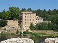
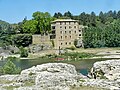
Situated on the left bank (Rive Gauche) down the Gardon River.
Media in category "Moulin du Pont du Gard"
The following 25 files are in this category, out of 25 total.
-
 Castillon du Gard-20160725.jpg 5,472 × 3,648; 3.97 MB
-
 Gardon R01.jpg 2,556 × 1,824; 4.16 MB
-
 Gardon R02.jpg 2,592 × 1,944; 4.77 MB
-
 GardPontduGard.jpg 751 × 514; 191 KB
-
 Le Gardon depuis le Pont du Gard (2).jpg 4,928 × 3,264; 10.05 MB
-
 Le vieux moulin-DSC 0038w.jpg 3,869 × 2,098; 3.8 MB
-
 Moulin du Pont du Gard 01.jpg 4,443 × 2,877; 2.05 MB
-
 Moulin du Pont du Gard 02.jpg 5,275 × 3,452; 2.1 MB
-
 Moulin du Pont du Gard-5849.jpg 6,487 × 3,649; 20.9 MB
-
 Pont du Gard - Moulin.jpg 4,000 × 3,000; 3.88 MB
-
 Pont du Gard - panoramio (13).jpg 4,912 × 1,080; 2.54 MB
-
 Pont du Gard - panoramio (14).jpg 2,592 × 3,456; 3.2 MB
-
 Pont du Gard - panoramio (5).jpg 2,592 × 3,872; 4.55 MB
-
 Pont Du Gard - panoramio.jpg 1,024 × 768; 295 KB
-
 Pont du Gard 2013 15.jpg 4,928 × 3,264; 11.16 MB
-
 Pont Du Gard 3808 (28845417841).jpg 5,310 × 3,540; 21.86 MB
-
 Pont Du Gard 3814 (28636300290).jpg 5,472 × 3,648; 30.13 MB
-
 Pont Du Gard 3815 (28636376710).jpg 5,472 × 3,648; 29.44 MB
-
 Pont du Gard T.D. - panoramio (2).jpg 3,264 × 2,448; 2.38 MB
-
 Pont du Gard, 2017 01.jpg 1,920 × 1,280; 1.12 MB
-
 Pont du Gard, Nîmes 33.jpg 4,272 × 2,848; 6.28 MB
-
 Pont du Gard, Nîmes 45.jpg 4,272 × 2,848; 6.65 MB
-
 Pont du Gard, Nîmes 46.jpg 4,272 × 2,848; 6.4 MB
-
 Pont du Gard-Vue aval du Gardon-20160725.jpg 5,472 × 3,648; 3.53 MB
-
 Remoulins Hôtel-restaurant au Pied du Pont.JPG 3,456 × 2,592; 2.1 MB


.jpg)


.jpg)
.jpg)


.jpg)
.jpg)
.jpg)
.jpg)


.jpg)