Category:Morriston
Jump to navigation
Jump to search
town and community in the City and County of Swansea, Wales  Pont yr hen gamlas | |||||
| Upload media | |||||
| Pronunciation audio | |||||
|---|---|---|---|---|---|
| Instance of | |||||
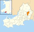
| Location | Swansea, Wales | ||||
| Population |
| ||||
| Area |
| ||||
 | |||||
Cymraeg: Tref ger Abertawe yn Sir Abertawe yw Treforys, cartref i ganolfan y DVLA ac un o ysbytai mwyaf Cymru.
English: Morriston ( Welsh: Treforys) is a community in the City and County of Swansea, Wales and falls within the Morriston ward. Morriston is sometimes referred to as a distinct town (e.g. the local football club is named Morriston Town A.F.C.), however Morriston never had a town charter, and is now part of the continuous urban area around Swansea, the centre of which lies three miles to the south-west. Morriston is the most populous of Swansea's electoral divisions. Morriston's Orpheus Choir has been described as one of the leading Welsh choirs.
Subcategories
This category has the following 5 subcategories, out of 5 total.
C
M
- Morris Castle (6 F)
- Morriston Cemetery (3 F)
Media in category "Morriston"
The following 200 files are in this category, out of 230 total.
(previous page) (next page)-
 2010 Wales Swansea Community Morriston map.svg 512 × 472; 632 KB
-
 2024 Wales Swansea Community Morriston map.svg 512 × 472; 651 KB
-
 42710 at Birds Manoravon Scrapyard (8164737235).jpg 803 × 533; 274 KB
-
 4637 Birds Manoravon Scrapyard(8145181460).jpg 811 × 586; 227 KB
-
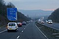
 Approaching junction 45 M4 - geograph.org.uk - 3125398.jpg 640 × 459; 72 KB
-
 Ascent into Morriston, Swansea - geograph.org.uk - 5973450.jpg 1,003 × 1,024; 167 KB
-

-
 Banwell Street, Morriston, Swansea - geograph.org.uk - 5942839.jpg 1,024 × 970; 150 KB
-
 Bassetts Nissan Swansea - geograph.org.uk - 5997965.jpg 1,024 × 768; 141 KB
-
 Bend in Heol Maes Eglwys, Morriston, Swansea - geograph.org.uk - 5943428.jpg 1,024 × 863; 196 KB
-
 Birds Manoravon Scrapyard, Morriston (8164927059).jpg 801 × 560; 206 KB
-

-

-

-
 Brays Powerhouse Gym - Banwell Street - geograph.org.uk - 4413689.jpg 1,600 × 1,064; 486 KB
-
-
-
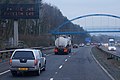
 Bridge over the M4 - geograph.org.uk - 3688678.jpg 640 × 430; 45 KB
-
 Bus shelter and service road, Clasemont Road, Morriston - geograph.org.uk - 5825505.jpg 1,600 × 1,200; 859 KB
-
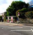
 Bus shelter, Pentrepoeth Road, Morriston - geograph.org.uk - 5825500.jpg 1,600 × 1,066; 810 KB
-
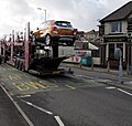 Cars in transit, Neath Road, Swansea - geograph.org.uk - 5973549.jpg 1,024 × 969; 214 KB
-
 Centrepoint in Morriston, Swansea - geograph.org.uk - 5969684.jpg 988 × 1,024; 211 KB
-
 Clos George Morgan, Morriston, Swansea - geograph.org.uk - 5993227.jpg 1,024 × 804; 216 KB
-
 Clydach Road, Swansea - geograph.org.uk - 2506196.jpg 640 × 480; 82 KB
-
 Clydach School - geograph.org.uk - 3751704.jpg 640 × 480; 57 KB
-
 Clyndu Street, Morriston, Swansea - geograph.org.uk - 5973484.jpg 1,024 × 705; 163 KB
-

-
-
 Crown St, Morriston - geograph.org.uk - 1540482.jpg 640 × 480; 71 KB
-
 Cwmrhydyceirw - geograph.org.uk - 5295392.jpg 640 × 480; 62 KB
-
 Dan Danino Way - geograph.org.uk - 2794256.jpg 640 × 480; 50 KB
-
 Dan Danino Way, Morriston, Swansea - geograph.org.uk - 5943405.jpg 1,024 × 893; 309 KB
-
 Derelict house, Morfydd St, Morriston - geograph.org.uk - 1540500.jpg 480 × 640; 105 KB
-
 Derelict house, Morriston - geograph.org.uk - 1540502.jpg 640 × 480; 98 KB
-
 Detached houses, Neath Road, Swansea - geograph.org.uk - 5973572.jpg 1,024 × 712; 224 KB
-
 Dinas Street houses, Plasmarl, Swansea - geograph.org.uk - 5988949.jpg 1,024 × 695; 179 KB
-

-

-
-
-
 Donato Pompei, Morriston, Swansea - geograph.org.uk - 5944203.jpg 1,024 × 853; 203 KB
-
 Dukes Arms name sign, Morriston, Swansea - geograph.org.uk - 5973528.jpg 847 × 1,024; 272 KB
-
 Dukes Arms, Morriston, Swansea - geograph.org.uk - 5973521.jpg 1,024 × 703; 155 KB
-
 East along Crown Street, Morriston, Swansea - geograph.org.uk - 6194320.jpg 1,600 × 1,278; 320 KB
-
 East along the M4 motorway, Morriston, Swansea - geograph.org.uk - 5943437.jpg 1,024 × 784; 165 KB
-

-
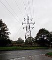
 Electricity pylon near Morriston Hospital, Swansea - geograph.org.uk - 5993226.jpg 1,936 × 3,603; 1.14 MB
-
-

-

-
 EuroBlinds, 30 Martin Street, Swansea - geograph.org.uk - 5973438.jpg 1,024 × 852; 184 KB
-
 Footbridge over M4 - geograph.org.uk - 3264460.jpg 640 × 481; 68 KB
-
 Footbridge over M4 at Morriston - geograph.org.uk - 985377.jpg 640 × 480; 90 KB
-

-
 Footbridge over the M4 - geograph.org.uk - 3688679.jpg 640 × 398; 47 KB
-

-

-
-
 Former Crown pub on a Morriston corner, Swansea - geograph.org.uk - 5943012.jpg 1,024 × 949; 188 KB
-
 Former Helibeds shop in Morriston, Swansea - geograph.org.uk - 5943344.jpg 1,024 × 768; 151 KB
-
-
-
 FRF Motors, Neath Road, Morriston, Swansea - geograph.org.uk - 5997987.jpg 1,024 × 685; 122 KB
-
 Friendly in Woodfield Street, Morriston, Swansea - geograph.org.uk - 5943349.jpg 866 × 1,024; 198 KB
-
 GWR Collett 7235 (8155476727).jpg 724 × 525; 271 KB
-
 GWR Collett 7243 (8155506918).jpg 748 × 586; 220 KB
-
 GWR Hawkesworth 1661 (8145290880).jpg 608 × 471; 172 KB
-
 H is for Hospital, Heol Maes Eglwys, Swansea - geograph.org.uk - 5993223.jpg 813 × 1,024; 210 KB
-

-
 Harris Street, Morriston, Swansea - geograph.org.uk - 5942835.jpg 979 × 1,024; 269 KB
-
 Haryana in Morriston, Swansea - geograph.org.uk - 5943339.jpg 1,024 × 894; 179 KB
-
 Helicopter warning sign near Morriston Hospital, Swansea (geograph 5945232).jpg 693 × 1,024; 128 KB
-
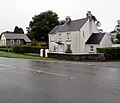
 Heol Maes Eglwys semis, Pantlasau, Swansea - geograph.org.uk - 5943388.jpg 1,024 × 613; 136 KB
-

-

-

-
 Housing at Heol Fran - geograph.org.uk - 6178289.jpg 3,264 × 2,448; 2.38 MB
-
 Internet disaster^ advert facing Neath Road, Swansea - geograph.org.uk - 5973606.jpg 1,024 × 1,010; 221 KB
-
 JCDecaux advertising site, Neath Road, Swansea - geograph.org.uk - 5997923.jpg 1,024 × 730; 213 KB
-
 Junction in Pantlasau, Swansea - geograph.org.uk - 5943361.jpg 1,024 × 768; 265 KB
-
-

-
 Junction of Neath Road and Parc Terrace, Swansea - geograph.org.uk - 5997899.jpg 1,024 × 837; 168 KB
-
 Just Jenny's in Morriston, Swansea - geograph.org.uk - 5942943.jpg 1,024 × 807; 201 KB
-
 Llwybr Craig Trewyddfa - Craig Trewyddfa Path - geograph.org.uk - 6362947.jpg 1,024 × 801; 342 KB
-
 Long name sign in Pantlasau, Swansea - geograph.org.uk - 5945439.jpg 1,010 × 1,024; 364 KB
-

-
 M4 bridge over the River Tawe - geograph.org.uk - 6178250.jpg 3,264 × 2,448; 2.99 MB
-
 M4 eastbound at junction 45 - geograph.org.uk - 4346902.jpg 1,600 × 1,062; 366 KB
-
 M4 eastbound at junction 45 - geograph.org.uk - 4346908.jpg 1,600 × 1,062; 408 KB
-
 M4 eastbound towards junction 45 - geograph.org.uk - 4346895.jpg 1,600 × 1,062; 468 KB
-
 M4 eastbound towards junction 45 - geograph.org.uk - 4346899.jpg 1,600 × 1,062; 457 KB
-
 M4 westbound after Junction 45 - geograph.org.uk - 2935438.jpg 640 × 480; 43 KB
-

-
 M4, Junction 45 - geograph.org.uk - 3688677.jpg 640 × 406; 37 KB
-
 Main entrance to Morriston Hospital, Swansea - geograph.org.uk - 5944692.jpg 1,024 × 944; 203 KB
-

-

-

-
 Metro bus outside Morriston Hospital, Swansea (geograph 5945227).jpg 1,024 × 935; 194 KB
-
 Metro bus stop and shelter, Neath Road, Swansea - geograph.org.uk - 5998005.jpg 984 × 1,024; 285 KB
-

-
-
 Morriston Hospital - geograph.org.uk - 6178278.jpg 3,018 × 2,264; 1.56 MB
-

-

-
 Neath Road houses SW of Parc Terrace, Swansea - geograph.org.uk - 5997928.jpg 1,024 × 667; 149 KB
-
 Neath Road houses, Plasmarl, Swansea - geograph.org.uk - 5988955.jpg 1,024 × 877; 169 KB
-
 Neath Road pelican crossing, Morriston, Swansea - geograph.org.uk - 5997985.jpg 1,009 × 1,024; 237 KB
-

-

-
 North along Market Street, Morriston, Swansea - geograph.org.uk - 5969749.jpg 1,024 × 908; 210 KB
-
 North side of Banwell Street, Morriston, Swansea - geograph.org.uk - 5969878.jpg 1,024 × 960; 173 KB
-
 Northwest corner of Morriston Hospital, Swansea - geograph.org.uk - 5945410.jpg 1,024 × 680; 109 KB
-

-

-
 One mile to junction 45 M4 - geograph.org.uk - 3125386.jpg 640 × 399; 55 KB
-
 One-way Banwell Street, Morriston, Swansea - geograph.org.uk - 5942950.jpg 1,024 × 921; 200 KB
-
 One-way Glantawe Street, Morriston, Swansea - geograph.org.uk - 5944189.jpg 1,024 × 864; 183 KB
-
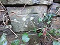
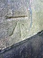
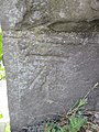
 Ordnance Survey Cut Mark - geograph.org.uk - 3792324.jpg 480 × 640; 107 KB
-
 Ordnance Survey Cut Mark - geograph.org.uk - 3792326.jpg 640 × 480; 110 KB
-
 Ordnance Survey Cut Mark - geograph.org.uk - 3829845.jpg 480 × 640; 104 KB
-
 Ordnance Survey Cut Mark - geograph.org.uk - 3829846.jpg 480 × 640; 95 KB
-
 Ordnance Survey Cut Mark - geograph.org.uk - 3829847.jpg 480 × 640; 119 KB
-
 Ordnance Survey Cut Mark - geograph.org.uk - 3829848.jpg 480 × 640; 104 KB
-
 Ordnance Survey Cut Mark - geograph.org.uk - 3829849.jpg 480 × 640; 85 KB
-
 Ordnance Survey Cut Mark - geograph.org.uk - 3829850.jpg 480 × 640; 100 KB
-
 Ordnance Survey Cut Mark - geograph.org.uk - 3838750.jpg 480 × 640; 95 KB
-
 Ordnance Survey Cut Mark - geograph.org.uk - 3838754.jpg 480 × 640; 114 KB
-
 Ordnance Survey Cut Mark - geograph.org.uk - 3838758.jpg 480 × 640; 107 KB
-
 Ordnance Survey Cut Mark - geograph.org.uk - 3838764.jpg 480 × 640; 85 KB
-
 Ordnance Survey Cut Mark - geograph.org.uk - 3838767.jpg 480 × 640; 104 KB
-
 Ordnance Survey Cut Mark - geograph.org.uk - 3838772.jpg 480 × 640; 108 KB
-
 Ordnance Survey Cut Mark - geograph.org.uk - 3838781.jpg 480 × 640; 106 KB
-
 Ordnance Survey Cut Mark - geograph.org.uk - 3838787.jpg 480 × 640; 91 KB
-
 Ordnance Survey Cut Mark - geograph.org.uk - 3838789.jpg 480 × 640; 90 KB
-
 Ordnance Survey Cut Mark - geograph.org.uk - 3838790.jpg 480 × 640; 111 KB
-
 Ordnance Survey Cut Mark - geograph.org.uk - 3838792.jpg 480 × 640; 76 KB
-
 Ordnance Survey Cut Mark - geograph.org.uk - 4074830.jpg 480 × 640; 93 KB
-
 Ordnance Survey Cut Mark - geograph.org.uk - 4074837.jpg 480 × 640; 95 KB
-
 Ordnance Survey Cut Mark - geograph.org.uk - 4506963.jpg 480 × 640; 96 KB
-
 Ordnance Survey Cut Mark - geograph.org.uk - 4506966.jpg 480 × 640; 121 KB
-
 Ordnance Survey Cut Mark - geograph.org.uk - 4506975.jpg 480 × 640; 95 KB
-
 Ordnance Survey Cut Mark - geograph.org.uk - 4506985.jpg 480 × 640; 124 KB
-
 Ordnance Survey Cut Mark - geograph.org.uk - 4506989.jpg 480 × 640; 119 KB
-
 Ordnance Survey Cut Mark - geograph.org.uk - 4506993.jpg 480 × 640; 110 KB
-
 Ordnance Survey Cut Mark - geograph.org.uk - 4506998.jpg 480 × 640; 112 KB
-
 Ordnance Survey Cut Mark - geograph.org.uk - 4507001.jpg 480 × 640; 87 KB
-
 Ordnance Survey Cut Mark - geograph.org.uk - 4507008.jpg 480 × 640; 107 KB
-
 Ordnance Survey Cut Mark - geograph.org.uk - 4507014.jpg 480 × 640; 94 KB
-
 Ordnance Survey Cut Mark - geograph.org.uk - 4507020.jpg 480 × 640; 112 KB
-
 Ordnance Survey Cut Mark - geograph.org.uk - 5099538.jpg 640 × 596; 42 KB
-
 Ordnance Survey Cut Mark - geograph.org.uk - 5125345.jpg 615 × 640; 119 KB
-
 Ordnance Survey Cut Mark - geograph.org.uk - 6119236.jpg 1,024 × 780; 184 KB
-
 Overgrown Danbert House in Morriston, Swansea - geograph.org.uk - 5944186.jpg 1,024 × 1,006; 315 KB
-
 P T's Late Shop in Morriston, Swansea - geograph.org.uk - 5943333.jpg 1,024 × 966; 210 KB
-
 Pant Lasau - geograph.org.uk - 6178285.jpg 3,264 × 2,448; 2.03 MB
-
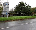
 Pant Lasau boundary sign, Swansea - geograph.org.uk - 5943396.jpg 1,024 × 986; 402 KB
-
 Parc Avenue, Swansea - geograph.org.uk - 5997992.jpg 739 × 1,024; 192 KB
-
 Passing Morriston rugby club 29th July 2006.jpg 800 × 600; 105 KB
-
 Path ascending from Neath Road, Swansea - geograph.org.uk - 5997940.jpg 769 × 1,024; 173 KB
-
 Path diverging from Heol Maes Eglwys, Pantlasau - geograph.org.uk - 5943401.jpg 1,024 × 813; 334 KB
-
 Path towards Cyril Evans Way, Morriston, Swansea - geograph.org.uk - 5945478.jpg 1,024 × 756; 273 KB
-
 Pedestrian refuge, Neath Road, Swansea - geograph.org.uk - 5997920.jpg 1,024 × 771; 154 KB
-
 Plas Bach Cottage, Swansea - geograph.org.uk - 2814094.jpg 640 × 386; 83 KB
-

-

-
 Plasmarl Community Centre, Swansea - geograph.org.uk - 5988927.jpg 1,024 × 870; 263 KB
-

-

-
-
 Queen Elizabeth II postbox, Pantlasau, Swansea - geograph.org.uk - 5943363.jpg 966 × 1,024; 490 KB
-
 Rane Bengal, Morriston, Swansea - geograph.org.uk - 5943301.jpg 919 × 1,024; 205 KB
-
 Refurbishing the Cross Inn, Morriston - geograph.org.uk - 5824587.jpg 1,600 × 1,200; 853 KB
-
 Rhodfa Fadog - geograph.org.uk - 6178291.jpg 2,950 × 2,212; 1.64 MB
-
 Rosebery Villa, Morfydd Street, Morriston, Swansea - geograph.org.uk - 5942904.jpg 1,024 × 1,015; 182 KB
-

-
 Row of stone houses, Neath Road, Swansea - geograph.org.uk - 5973555.jpg 1,024 × 805; 177 KB
-

-
 Rusting Royal Mail drop box, Neath Road, Swansea - geograph.org.uk - 5997936.jpg 1,024 × 1,021; 292 KB
-
 Salvation Army - geograph.org.uk - 4419659.jpg 1,600 × 1,064; 357 KB
-

-
 Sherwoods, Morriston, Swansea - geograph.org.uk - 5944199.jpg 1,024 × 735; 164 KB
-
 Shops in Woodfield Street - geograph.org.uk - 4419674.jpg 1,024 × 681; 153 KB
-
 Sky Step takeaway in Morriston, Swansea - geograph.org.uk - 5973478.jpg 3,058 × 2,127; 1.26 MB
-
 Spar, Morriston, Swansea - geograph.org.uk - 5943302.jpg 1,024 × 813; 219 KB
-
-
 St Martin's Lodge, Morriston, Swansea - geograph.org.uk - 5973446.jpg 1,024 × 786; 183 KB
-

-
-
 Stone houses above Neath Road, Swansea - geograph.org.uk - 5973611.jpg 1,023 × 1,024; 245 KB
-
 Street at Clun Ddu - geograph.org.uk - 5869184.jpg 3,264 × 2,448; 2.15 MB
-
 Sun Lounge Beauty Centre in Morriston, Swansea - geograph.org.uk - 5943345.jpg 1,020 × 1,024; 234 KB
-

-
 Swan Inn, Morriston, Swansea (geograph 5973462).jpg 1,024 × 799; 169 KB
-
 Swansea , M4 Motorway - geograph.org.uk - 3926779.jpg 4,288 × 2,848; 4.07 MB
-
 Swansea , M4 Motorway - geograph.org.uk - 3926780.jpg 4,288 × 2,848; 4.2 MB
-
 Swansea , M4 Motorway - geograph.org.uk - 3927287.jpg 4,288 × 2,848; 6.47 MB
-
 Swansea , M4 Motorway - geograph.org.uk - 3927288.jpg 2,848 × 4,288; 4.44 MB
-
 Swansea Canal (Ynystawe Works) - geograph.org.uk - 4588076.jpg 1,200 × 1,600; 378 KB


.jpg)
.jpg)


.jpg)


.jpg)
.jpg)
.jpg)


.jpg)


.jpg)


.jpg)


_-_geograph.org.uk_-_4588076.jpg)