Category:Mormon Flat Dam
Jump to navigation
Jump to search
dam on the Salt River in Arizona  | |||||
| Upload media | |||||
| Instance of | |||||
|---|---|---|---|---|---|
| Location |
| ||||
| Located in or next to body of water | |||||
| Service entry |
| ||||
| Inception |
| ||||
| Nominal power capacity |
| ||||
| Length |
| ||||
| Elevation above sea level |
| ||||
| Drainage basin |
| ||||
 | |||||
|
This is a category about a place or building that is listed on the National Register of Historic Places in the United States of America. Its reference number is 100001410. |
Subcategories
This category has the following 2 subcategories, out of 2 total.
C
M
- Mormon Flat Dam (HAER images) (61 F)
Media in category "Mormon Flat Dam"
The following 5 files are in this category, out of 5 total.
-
 ARIZONA-A-0038 Mormon Flat Dam.jpg 1,607 × 1,030; 345 KB
-
 AZ Maricopa County Salt River ProjectMPS Mormon Flat Dam 0001 (37194448284).jpg 4,368 × 2,912; 1.22 MB
-
 AZ Maricopa County Salt River ProjectMPS Mormon Flat Dam 0004 (24052065088).jpg 3,648 × 2,736; 1.43 MB
-
 AZ Maricopa County Salt River ProjectMPS Mormon Flat Dam Historic0008 (37646687220).jpg 1,968 × 2,796; 505 KB
-
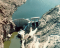 Mormon Flat Dam.gif 261 × 206; 49 KB
.jpg)
.jpg)
.jpg)

Categories:
- Dams in Arizona
- Salt River Project
- Buildings in Maricopa County, Arizona
- United States Bureau of Reclamation dams
- Built in Arizona in 1926
- Hydroelectric power plants in Arizona
- National Register of Historic Places in Maricopa County, Arizona
- Dams on the National Register of Historic Places
- Canyon Lake (Arizona)