Category:Mont Fallère
Jump to navigation
Jump to search
|
Mont Fallère has an entry on OpenStreetMap (show). |
Français : Le mont Fallère est un sommet des Alpes italiennes, culminant à 3 061 m d'altitude dans le massif du Grand Combin, entre le Valdigne et la vallée du Grand-Saint-Bernard en Vallée d'Aoste.
mountain in Italy  | |||||
| Upload media | |||||
| Instance of | |||||
|---|---|---|---|---|---|
| Location | Aosta Valley, Italy | ||||
| Mountain range | |||||
| Topographic prominence |
| ||||
| Topographic isolation |
| ||||
| Elevation above sea level |
| ||||
 | |||||
Subcategories
This category has the following 3 subcategories, out of 3 total.
L
- Lago Fallère (36 F)
R
- Refuge du Mont-Fallère (9 F)
Media in category "Mont Fallère"
The following 12 files are in this category, out of 12 total.
-
 Mont Fallère (depuis la combe de Vetan).jpg 2,000 × 3,008; 1.51 MB
-
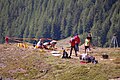 Mont Fallère (fouilles archéologiques).jpg 3,008 × 2,000; 1.63 MB
-
 Mont Fallère (vu depuis Vetan).jpg 2,000 × 3,008; 1.41 MB
-
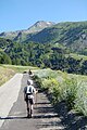 Mont Fallère - Au départ de Vetan.jpg 2,000 × 3,008; 1.47 MB
-
 Mont Fallère - Balisage.jpg 3,008 × 2,000; 1.52 MB
-
 Mont Fallère - Cabane Margherita.jpg 3,008 × 2,000; 1.52 MB
-
 Mont Fallère - Versant nord.jpg 2,000 × 3,008; 1.51 MB
-
 Mont Fallère - Versant ouest.jpg 3,008 × 2,000; 1.45 MB
-
 Mont Fallère.jpg 1,998 × 1,126; 616 KB
-
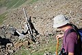
 Scavi Mont Fallere FP.jpg 1,339 × 1,050; 616 KB
-
 Tour du Mont Fallère - Balisage 2.jpg 2,000 × 3,008; 2.52 MB
-
 Valle d'aosta mont fallère.JPG 4,000 × 3,000; 4.75 MB
.jpg)
.jpg)
.jpg)


