Category:Monkstown, County Cork
Jump to navigation
Jump to search
town in Munster, Ireland  | |||||
| Upload media | |||||
| Instance of | |||||
|---|---|---|---|---|---|
| Location | County Cork, Munster, Ireland | ||||
| Elevation above sea level |
| ||||
 | |||||
English: Monkstown (Baile an Mhanaigh in Irish) is a village in County Cork, Ireland, situated southeast of Cork city. The village is on the estuary of the River Lee, facing Great Island and looking onto Monkstown Bay.
Media in category "Monkstown, County Cork"
The following 27 files are in this category, out of 27 total.
-
 Carlisle Place, Monkstown - geograph.org.uk - 5046259.jpg 1,024 × 768; 156 KB
-
 Castle Road, Monkstown - geograph.org.uk - 5008701.jpg 1,024 × 768; 185 KB
-
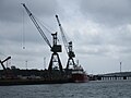
 Cork Harbour Marina - geograph.org.uk - 5046263.jpg 1,024 × 768; 123 KB
-

-
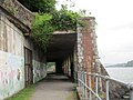 Cut and cover tunnel - geograph.org.uk - 5046162.jpg 1,024 × 768; 189 KB
-
 Entrance to Cork Harbour Marina, Monkstown - geograph.org.uk - 5008691.jpg 1,024 × 768; 145 KB
-
 Former Vicarage, Monkstown - geograph.org.uk - 5046236.jpg 1,024 × 768; 208 KB
-
 Glen Road - geograph.org.uk - 1427245.jpg 640 × 360; 70 KB
-
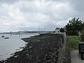 Harbour wall, Monkstown - geograph.org.uk - 5008695.jpg 1,024 × 768; 134 KB
-
 Houses on Castle Terrace - geograph.org.uk - 5046225.jpg 1,024 × 768; 127 KB
-
 Launch of the MV Connacht, from Verlohme Dockyards (^1978) - geograph.org.uk - 3784755.jpg 6,327 × 4,238; 2.46 MB
-
 Monkstown from Rushbrook - geograph.org.uk - 5836977.jpg 1,600 × 1,065; 595 KB
-
 Monkstown from Whitepoint - geograph.org.uk - 5836880.jpg 1,600 × 1,065; 570 KB
-
 Monkstown, Co Cork - geograph.org.uk - 1427309.jpg 640 × 360; 64 KB
-
 Moorings, Cork Harbour Marina - geograph.org.uk - 5046261.jpg 1,024 × 768; 129 KB
-
 MS Forth Fisher on the River Lee - geograph.org.uk - 5046129.jpg 1,024 × 768; 126 KB
-
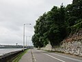
 On the R610 - geograph.org.uk - 4166664.jpg 4,000 × 2,664; 2.32 MB
-
 Road Junction above Monkstown - geograph.org.uk - 1427298.jpg 640 × 360; 49 KB
-
 Slipways at Rushbrooke - geograph.org.uk - 5046195.jpg 1,024 × 768; 133 KB
-
 Strand Road - geograph.org.uk - 5008706.jpg 1,024 × 768; 149 KB
-
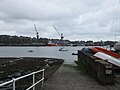 The busy River Lee - geograph.org.uk - 5046220.jpg 1,024 × 768; 122 KB
-
 The R610 - geograph.org.uk - 4166653.jpg 4,000 × 2,664; 2.16 MB
-
 This is not Youghal, yall! (6919996103).jpg 1,899 × 1,354; 1,014 KB
-
 Underneath the arches - geograph.org.uk - 5121216.jpg 3,216 × 2,144; 3.68 MB
-
 Upper section of Glen Road - geograph.org.uk - 1427268.jpg 640 × 360; 66 KB
-
 Verlohme Dockyards (1970's) - geograph.org.uk - 3784719.jpg 5,830 × 4,005; 5.03 MB
-
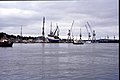
 Wharf at Rushbrooke - geograph.org.uk - 5046202.jpg 1,024 × 768; 105 KB


_-_geograph.org.uk_-_3784755.jpg)


.jpg)


_-_geograph.org.uk_-_3784719.jpg)
