Category:Monksilver
Jump to navigation
Jump to search
English: Monksilver is a village west of the Williton in Somerset, England, on the eastern flank of the Brendon Hills and the border of the Exmoor National Park. It is on the Coleridge Way footpath.
village in Somerset, England, UK  | |||||
| Upload media | |||||
| Instance of | |||||
|---|---|---|---|---|---|
| Location | Somerset West and Taunton, Somerset, South West England, England | ||||
| Said to be the same as | Monksilver (Wikimedia duplicated page, civil parish) | ||||
 | |||||
Subcategories
This category has only the following subcategory.
A
Media in category "Monksilver"
The following 42 files are in this category, out of 42 total.
-
 All Saints Church, Monksilver, Somerset - geograph.org.uk - 5674788.jpg 2,048 × 1,536; 1.56 MB
-
 All Saints' Church, Monksilver - geograph.org.uk - 2717328.jpg 640 × 480; 71 KB
-
 Beech hedge in the woods. - geograph.org.uk - 104507.jpg 480 × 640; 163 KB
-
 Beech Tree Cross - geograph.org.uk - 3457639.jpg 1,024 × 768; 246 KB
-
 Bench Mark, All Saints' Church - geograph.org.uk - 2717331.jpg 480 × 640; 86 KB
-
 Birchanger Farm - geograph.org.uk - 3335911.jpg 1,024 × 768; 191 KB
-
 Birchanger Lane - geograph.org.uk - 3336024.jpg 1,024 × 768; 238 KB
-
 Bridleway from Colton Cross - geograph.org.uk - 104492.jpg 640 × 480; 167 KB
-
 Bridleway north of Monksilver - geograph.org.uk - 67579.jpg 640 × 425; 141 KB
-
 Coleridge Way - geograph.org.uk - 1946800.jpg 640 × 443; 89 KB
-
 Colton Cross - geograph.org.uk - 687932.jpg 640 × 426; 178 KB
-
 Cottages, Monksilver - geograph.org.uk - 3336004.jpg 1,024 × 768; 167 KB
-
 Crossroads, Monksilver - geograph.org.uk - 1819203.jpg 1,024 × 768; 167 KB
-
 Cyclist entering Monksilver - geograph.org.uk - 3936873.jpg 640 × 480; 207 KB
-

-
 Driveway to Rowdon Farm - geograph.org.uk - 3457672.jpg 1,024 × 768; 151 KB
-
 Ferret Racing, Monksilver Country Fair, Somerset 1992 - geograph.org.uk - 6249381.jpg 2,501 × 1,592; 1.24 MB
-
 Ferret Racing, Monksilver Country Fair, Somerset 1992 - geograph.org.uk - 6249384.jpg 5,184 × 3,456; 3.94 MB
-
 Field above Monksilver - geograph.org.uk - 1947027.jpg 640 × 480; 124 KB
-
 Front Street, Monksilver - geograph.org.uk - 3336043.jpg 1,024 × 768; 188 KB
-
 Front Street, Monksilver - geograph.org.uk - 3414611.jpg 1,600 × 1,172; 468 KB
-
 Gate and Monksilver - geograph.org.uk - 1946843.jpg 640 × 480; 119 KB
-
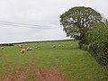 Grazing sheep , near Combecross Lane - geograph.org.uk - 3457907.jpg 1,024 × 768; 171 KB
-
 Inside the Miscanthus. - geograph.org.uk - 74246.jpg 425 × 640; 120 KB
-
 Lane to Monksilver - geograph.org.uk - 1654636.jpg 640 × 430; 110 KB
-

-
 Monksilver - geograph.org.uk - 1946857.jpg 640 × 493; 118 KB
-
 Monksilver Country Fair, Somerset 1992 - geograph.org.uk - 5836712.jpg 2,507 × 1,599; 600 KB
-
 Monksilver, east towards the village - geograph.org.uk - 152306.jpg 640 × 427; 145 KB
-
 NotleyArmsInn Monksilver Somerset.PNG 3,648 × 2,736; 10.56 MB
-

-
 Old Village Signpost by the B3183, Monksilver (geograph 6094675).jpg 577 × 800; 242 KB
-
 Ordnance Survey Cut Mark - geograph.org.uk - 4869420.jpg 480 × 640; 117 KB
-
 Road down to Monksilver - geograph.org.uk - 3457955.jpg 1,024 × 801; 319 KB
-
 Steep lane above Monksilver - geograph.org.uk - 3336082.jpg 1,024 × 768; 231 KB
-
 Stile and footpath to Monksilver - geograph.org.uk - 3891505.jpg 1,024 × 768; 277 KB
-
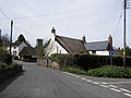
 The Notley Arms, Monksilver - geograph.org.uk - 1819071.jpg 1,024 × 768; 149 KB
-
 Tin Tabernacle at Monksilver - geograph.org.uk - 1946878.jpg 640 × 495; 129 KB
-
 View from Combecross Hill - geograph.org.uk - 1947071.jpg 640 × 480; 90 KB
-
 View towards Merry Farm - geograph.org.uk - 3457667.jpg 1,024 × 768; 169 KB
-
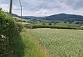
 Wheatfield above Monksilver - geograph.org.uk - 1946781.jpg 640 × 480; 100 KB
-
 White house at Birchanger. - geograph.org.uk - 109027.jpg 640 × 449; 100 KB


.jpg)
.jpg)


