Category:Millennium Bridge, York
Jump to navigation
Jump to search
| Object location | | View all coordinates using: OpenStreetMap |
|---|

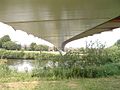
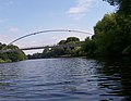
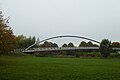
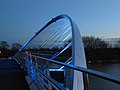
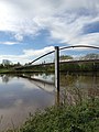
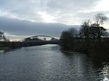
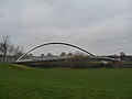
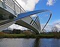
English: The Millennium Bridge spans the River Ouse to the south of York, linking Hospital Fields Road and Maple Grove in Fulford with Butcher Terrace on the South Bank
bridge in York, North Yorkshire, England, UK  | |||||
| Upload media | |||||
| Instance of | |||||
|---|---|---|---|---|---|
| Location | York, City of York, North Yorkshire, Yorkshire and the Humber, England | ||||
| Crosses | |||||
 | |||||
Subcategories
This category has only the following subcategory.
V
Media in category "Millennium Bridge, York"
The following 75 files are in this category, out of 75 total.
-
 009-SFEC-YORK-20070827.JPG 3,888 × 2,592; 4.2 MB
-
 012-SFEC-YORK-20070827.JPG 2,592 × 3,888; 2.43 MB
-
 Cyclists on York Millennium Bridge - geograph.org.uk - 6343326.jpg 640 × 480; 64 KB
-
 Illuminated Millennium bridge - geograph.org.uk - 2327678.jpg 640 × 480; 94 KB
-
 Illuminated santas Kayaking - geograph.org.uk - 2737236.jpg 640 × 480; 57 KB
-
 Millenium Bridge Bottom.jpg 640 × 480; 124 KB
-
 Millenium Bridge York from West side of Ouse.jpg 3,264 × 1,836; 2.44 MB
-
 Millennium Bridge (5506183700).jpg 4,176 × 2,784; 5.55 MB
-
 Millennium Bridge - geograph.org.uk - 1053045.jpg 640 × 480; 83 KB
-
 Millennium Bridge - geograph.org.uk - 1053047.jpg 640 × 480; 79 KB
-
 Millennium Bridge - geograph.org.uk - 1772862.jpg 800 × 623; 140 KB
-
 Millennium Bridge - geograph.org.uk - 267329.jpg 640 × 374; 58 KB
-
 Millennium Bridge - geograph.org.uk - 2774154.jpg 640 × 480; 93 KB
-
 Millennium Bridge - geograph.org.uk - 3118993.jpg 2,048 × 1,536; 554 KB
-
 Millennium Bridge - geograph.org.uk - 3121859.jpg 480 × 640; 85 KB
-
 Millennium Bridge - geograph.org.uk - 3851325.jpg 640 × 480; 71 KB
-
 Millennium Bridge - geograph.org.uk - 5036676.jpg 640 × 427; 109 KB
-
 Millennium Bridge - geograph.org.uk - 5532721.jpg 2,560 × 1,920; 685 KB
-
 Millennium Bridge - geograph.org.uk - 5949865.jpg 1,024 × 683; 428 KB
-
 Millennium Bridge - geograph.org.uk - 6251925.jpg 1,024 × 768; 147 KB
-
 Millennium Bridge across the Ouse - geograph.org.uk - 3891967.jpg 640 × 482; 75 KB
-
 Millennium bridge and river depth marker - geograph.org.uk - 482230.jpg 640 × 478; 119 KB
-
 Millennium Bridge and River Ouse - geograph.org.uk - 2448790.jpg 3,264 × 2,448; 1.48 MB
-
 Millennium Bridge and South Bank - geograph.org.uk - 1295441.jpg 640 × 478; 159 KB
-

-
 Millennium Bridge from Fulford.jpg 640 × 480; 127 KB
-
 Millennium bridge illuminated - geograph.org.uk - 2327671.jpg 640 × 480; 74 KB
-
 Millennium bridge in flood - geograph.org.uk - 292624.jpg 640 × 479; 51 KB
-
 Millennium Bridge over River Ouse - geograph.org.uk - 5067872.jpg 3,072 × 1,728; 1.49 MB
-
 Millennium Bridge over the River Ouse - geograph.org.uk - 4106671.jpg 1,600 × 1,064; 559 KB
-
 Millennium Bridge over the River Ouse - geograph.org.uk - 4106677.jpg 1,600 × 1,064; 536 KB
-
 Millennium Bridge over the River Ouse - geograph.org.uk - 4106685.jpg 1,600 × 1,064; 477 KB
-
 Millennium Bridge York - geograph.org.uk - 3937933.jpg 800 × 600; 126 KB
-
 Millennium Bridge York - geograph.org.uk - 3938121.jpg 1,024 × 768; 126 KB
-
 Millennium Bridge York.jpg 2,048 × 1,536; 790 KB
-

-
 Millennium bridge, Fulford - geograph.org.uk - 257808.jpg 640 × 457; 74 KB
-
 Millennium Bridge, River Ouse, York - geograph.org.uk - 2933025.jpg 480 × 640; 64 KB
-
 Millennium Bridge, York (15217411202).jpg 2,048 × 1,365; 2.27 MB
-
 Millennium Bridge, York (19902014741).jpg 3,000 × 3,000; 7.8 MB
-
 Millennium Bridge, York (25159709862).jpg 1,280 × 783; 602 KB
-
 Millennium Bridge, York (3352241036).jpg 2,523 × 1,920; 3.62 MB
-
 Millennium Bridge, York (5500655410).jpg 3,657 × 2,275; 5.46 MB
-
 Millennium Bridge, York (5534945677).jpg 3,962 × 2,432; 4.17 MB
-
 Millennium Bridge, York - geograph.org.uk - 4057798.jpg 640 × 480; 273 KB
-
 Millennium Bridge, York - geograph.org.uk - 4700456.jpg 640 × 543; 413 KB
-
 Millennium Bridge, York - geograph.org.uk - 5497972.jpg 1,600 × 1,065; 610 KB
-
 Millennium bridge, York - geograph.org.uk - 5602385.jpg 640 × 427; 59 KB
-
 Path to Millennium Bridge - geograph.org.uk - 5949857.jpg 1,024 × 683; 539 KB
-

-
 River Ouse and the Millennium Bridge - geograph.org.uk - 1220407.jpg 640 × 427; 407 KB
-
 River Ouse, south of Millennium Bridge - geograph.org.uk - 5149396.jpg 1,024 × 768; 116 KB
-
 Rowing down the river - geograph.org.uk - 1154853.jpg 640 × 361; 52 KB
-
 Runners near Millennium Bridge - geograph.org.uk - 6333559.jpg 768 × 1,024; 588 KB
-
 The Millennium Bridge - geograph.org.uk - 1178365.jpg 640 × 480; 55 KB
-
 The Millennium Bridge across the River Ouse - geograph.org.uk - 2496024.jpg 4,594 × 3,014; 4.99 MB
-
 The Millennium Bridge Fulford - geograph.org.uk - 2312694.jpg 2,498 × 1,836; 992 KB
-
-

-
 The Millennium Bridge over the River Ouse York - geograph.org.uk - 1906412.jpg 2,048 × 1,536; 530 KB
-
 The Millennium Bridge, River Ouse, York - geograph.org.uk - 1219712.jpg 640 × 427; 386 KB
-
 The Millennium Bridge, York - geograph.org.uk - 1220575.jpg 640 × 427; 342 KB
-
 The Millennium footbridge - geograph.org.uk - 1465108.jpg 640 × 465; 69 KB
-
 The River Ouse at York - geograph.org.uk - 2496030.jpg 3,802 × 2,535; 3.12 MB
-

-
 Trans Pennine Trail and Millennium Bridge - geograph.org.uk - 6027719.jpg 4,243 × 2,171; 1.6 MB
-
 Underneath the Millennium bridge - geograph.org.uk - 1220412.jpg 640 × 427; 329 KB
-
 York - panoramio (34).jpg 2,288 × 1,712; 1.65 MB
-
 York Millennium Bridge - geograph.org.uk - 2424284.jpg 480 × 640; 79 KB
-
 York Millennium Bridge - geograph.org.uk - 4057627.jpg 640 × 483; 254 KB
-
 York Millennium Bridge - geograph.org.uk - 5077320.jpg 800 × 600; 143 KB
-
 York Millennium Bridge - geograph.org.uk - 574496.jpg 477 × 640; 69 KB
-
 York Millennium Bridge - geograph.org.uk - 6343324.jpg 640 × 480; 74 KB
-
 York millennium bridge.jpg 800 × 540; 96 KB
-
 York Millennium Bridge.jpg 2,437 × 1,907; 4.03 MB


.jpg)


.jpg)
.jpg)
.jpg)
.jpg)
.jpg)
.jpg)


.jpg)


