Category:Military maps of the United States
Jump to navigation
Jump to search
Subcategories
This category has the following 4 subcategories, out of 4 total.
Media in category "Military maps of the United States"
The following 178 files are in this category, out of 178 total.
-

-
 BattleOfFortWashingtonMapBySauthier.jpg 2,528 × 4,595; 4.79 MB
-
 Forts Washington Tryon Cockhill.jpg 1,356 × 1,798; 1.13 MB
-
 Map of Texas and Part of New Mexico 1857 (1887) UTA.jpg 4,188 × 2,630; 1.54 MB
-
 Map showing the location of battle fields of Virginia (10089635013).jpg 800 × 678; 173 KB
-
 1904 map of the coast of Washington.jpg 1,250 × 1,238; 911 KB
-

-

-

-
 Air Force Facilities.jpg 2,400 × 1,500; 2.63 MB
-
 Amami-Gunto - DPLA - fae10dd15e97eac989faa9001bc068f7.jpg 11,392 × 9,519; 10.23 MB
-
 American bases worldwide.svg 512 × 263; 1.11 MB
-
 Army rotc brigade map.jpg 580 × 521; 71 KB
-
 Battle of Cooch's Bridge.jpg 601 × 871; 335 KB
-
 BorregoValleyManueverArea.jpg 1,279 × 830; 223 KB
-
 Bravo Fallout.jpg 813 × 639; 116 KB
-
 CampHydleWW2.jpg 622 × 885; 168 KB
-
 Crossroads Able Target Ship Map.png 500 × 500; 18 KB
-
 Crossroads Baker Target Ship Map.png 500 × 500; 17 KB
-
 Deployment of USAF combat forces CONUS as of July 1, 1960.png 830 × 595; 259 KB
-
 Descriptive Map of Army Posts - NARA - 77452232.jpg 12,772 × 8,180; 17.07 MB
-
-
 DoD Western Test Ranges.jpg 2,529 × 1,686; 467 KB
-
 EMP mechanism.png 618 × 729; 48 KB
-
 Figure 1- Examples of Anti-Access and Area Denial Capabilities (15223188706).jpg 2,273 × 1,421; 138 KB
-

-
 GERMAN OPERATIONS AND PLANS.png 2,940 × 2,317; 845 KB
-

-
-
 Jurisdictions with United States Armed Forces bases.svg 2,048 × 1,097; 202 KB
-
 Launch complexes at Cape Canaveral Air Force Station.jpg 638 × 1,019; 440 KB
-
 Major United States Air Force Facilities around the gloabe.jpg 2,632 × 1,936; 1.26 MB
-
 Manhattan1781.jpg 864 × 1,680; 893 KB
-
 Manhattanville forts showing Blockhouse 1.jpg 2,798 × 1,801; 1.5 MB
-
 Manhattanville forts.jpg 2,798 × 5,144; 3.36 MB
-
 Map of Activities of the Air Service - DPLA - 7a1843ab8b2681471f65b1c6a4791891.jpg 14,454 × 10,200; 13.61 MB
-

-
 Map of Army Corps Areas - DPLA - 7181635a105eb1e1605704653399749b.jpg 5,692 × 3,887; 809 KB
-

-
 Map of St. Clair's Encampment.jpg 3,880 × 2,168; 4.13 MB
-
 Map of the american military power 2015.svg 912 × 572; 2.92 MB
-
 Map of the american military power.png 2,200 × 1,400; 147 KB
-

-

-
 Map of WW2 Shipyards building DD.jpg 853 × 630; 94 KB
-

-

-

-
-

-

-
 Map Showing Stations Occupied by the United States Army - DPLA - 26e0f3dd5101f931f09ca68922c25332.jpg 12,709 × 10,348; 23.61 MB
-
 Map Showing Stations Occupied by the United States Army - DPLA - 344ab3b38113e5bf29379bc03d816623.jpg 12,765 × 10,516; 24.58 MB
-

-

-
-

-

-

-
 Military maps of the United States. LOC 2009581117-1.jpg 5,872 × 8,880; 3.5 MB
-
 Military maps of the United States. LOC 2009581117-1.tif 5,872 × 8,880; 149.18 MB
-
 Military maps of the United States. LOC 2009581117-10.jpg 9,496 × 8,438; 14.82 MB
-
 Military maps of the United States. LOC 2009581117-10.tif 9,496 × 8,438; 229.25 MB
-
 Military maps of the United States. LOC 2009581117-11.jpg 5,035 × 3,393; 2.41 MB
-
 Military maps of the United States. LOC 2009581117-11.tif 5,035 × 3,393; 48.88 MB
-
 Military maps of the United States. LOC 2009581117-12.jpg 5,134 × 4,290; 3.06 MB
-
 Military maps of the United States. LOC 2009581117-12.tif 5,134 × 4,290; 63.01 MB
-
 Military maps of the United States. LOC 2009581117-13.jpg 7,883 × 5,832; 5.38 MB
-
 Military maps of the United States. LOC 2009581117-13.tif 7,883 × 5,832; 131.53 MB
-
 Military maps of the United States. LOC 2009581117-14.jpg 5,277 × 3,705; 1.67 MB
-
 Military maps of the United States. LOC 2009581117-14.tif 5,277 × 3,705; 55.94 MB
-
 Military maps of the United States. LOC 2009581117-15.jpg 3,632 × 5,021; 1.95 MB
-
 Military maps of the United States. LOC 2009581117-15.tif 3,632 × 5,021; 52.17 MB
-
 Military maps of the United States. LOC 2009581117-16.jpg 6,810 × 10,200; 8.15 MB
-
 Military maps of the United States. LOC 2009581117-16.tif 6,810 × 10,200; 198.73 MB
-
 Military maps of the United States. LOC 2009581117-17.jpg 9,013 × 9,368; 16.31 MB
-
 Military maps of the United States. LOC 2009581117-17.tif 9,013 × 9,368; 241.57 MB
-
 Military maps of the United States. LOC 2009581117-18.jpg 8,951 × 10,586; 15.43 MB
-
 Military maps of the United States. LOC 2009581117-18.tif 8,951 × 10,586; 271.1 MB
-
 Military maps of the United States. LOC 2009581117-19.jpg 8,889 × 10,757; 16.08 MB
-
 Military maps of the United States. LOC 2009581117-2.jpg 11,989 × 8,480; 16.88 MB
-
 Military maps of the United States. LOC 2009581117-20.jpg 8,798 × 10,460; 16.21 MB
-
 Military maps of the United States. LOC 2009581117-20.tif 8,798 × 10,460; 263.29 MB
-
 Military maps of the United States. LOC 2009581117-21.jpg 5,803 × 8,880; 8.33 MB
-
 Military maps of the United States. LOC 2009581117-21.tif 5,803 × 8,880; 147.43 MB
-
 Military maps of the United States. LOC 2009581117-22.jpg 8,497 × 13,385; 15.21 MB
-
 Military maps of the United States. LOC 2009581117-22.tif 8,497 × 13,385; 325.39 MB
-
 Military maps of the United States. LOC 2009581117-23.jpg 8,128 × 7,174; 12.02 MB
-
 Military maps of the United States. LOC 2009581117-23.tif 8,128 × 7,174; 166.83 MB
-
 Military maps of the United States. LOC 2009581117-24.jpg 8,710 × 7,152; 12.11 MB
-
 Military maps of the United States. LOC 2009581117-24.tif 8,710 × 7,152; 178.22 MB
-
 Military maps of the United States. LOC 2009581117-25.jpg 7,201 × 10,230; 13.31 MB
-
 Military maps of the United States. LOC 2009581117-25.tif 7,201 × 10,230; 210.76 MB
-
 Military maps of the United States. LOC 2009581117-26.jpg 7,997 × 7,212; 12.18 MB
-
 Military maps of the United States. LOC 2009581117-26.tif 7,997 × 7,212; 165.01 MB
-
 Military maps of the United States. LOC 2009581117-27.jpg 6,300 × 9,901; 13.3 MB
-
 Military maps of the United States. LOC 2009581117-27.tif 6,300 × 9,901; 178.46 MB
-
 Military maps of the United States. LOC 2009581117-28.jpg 9,911 × 6,471; 14.07 MB
-
 Military maps of the United States. LOC 2009581117-28.tif 9,911 × 6,471; 183.49 MB
-
 Military maps of the United States. LOC 2009581117-29.jpg 5,964 × 5,111; 5.85 MB
-
 Military maps of the United States. LOC 2009581117-29.tif 5,964 × 5,111; 87.21 MB
-
 Military maps of the United States. LOC 2009581117-3 (cropped).jpg 9,286 × 8,154; 11.71 MB
-
 Military maps of the United States. LOC 2009581117-3.jpg 11,711 × 8,800; 13.83 MB
-
 Military maps of the United States. LOC 2009581117-3.tif 11,711 × 8,800; 294.85 MB
-
 Military maps of the United States. LOC 2009581117-30.jpg 10,581 × 6,720; 16.15 MB
-
 Military maps of the United States. LOC 2009581117-30.tif 10,581 × 6,720; 203.43 MB
-
 Military maps of the United States. LOC 2009581117-31.jpg 10,371 × 6,790; 14.83 MB
-
 Military maps of the United States. LOC 2009581117-31.tif 10,371 × 6,790; 201.47 MB
-
 Military maps of the United States. LOC 2009581117-32.jpg 9,192 × 6,400; 13.69 MB
-
 Military maps of the United States. LOC 2009581117-32.tif 9,192 × 6,400; 168.31 MB
-
 Military maps of the United States. LOC 2009581117-33.jpg 10,358 × 6,981; 18.98 MB
-
 Military maps of the United States. LOC 2009581117-34.jpg 10,501 × 6,911; 15.33 MB
-
 Military maps of the United States. LOC 2009581117-35.jpg 10,651 × 6,420; 15.7 MB
-
 Military maps of the United States. LOC 2009581117-36.jpg 9,485 × 7,038; 16.91 MB
-
 Military maps of the United States. LOC 2009581117-36.tif 9,485 × 7,038; 190.99 MB
-
 Military maps of the United States. LOC 2009581117-37.jpg 7,044 × 9,691; 12.74 MB
-
 Military maps of the United States. LOC 2009581117-37.tif 7,044 × 9,691; 195.3 MB
-
 Military maps of the United States. LOC 2009581117-4.jpg 8,775 × 9,617; 14.22 MB
-
 Military maps of the United States. LOC 2009581117-4.tif 8,775 × 9,617; 241.44 MB
-
 Military maps of the United States. LOC 2009581117-5.jpg 9,976 × 9,106; 19.14 MB
-
 Military maps of the United States. LOC 2009581117-5.tif 9,976 × 9,106; 259.9 MB
-
 Military maps of the United States. LOC 2009581117-6.jpg 6,748 × 11,219; 16.59 MB
-
 Military maps of the United States. LOC 2009581117-6.tif 6,748 × 11,219; 216.6 MB
-
 Military maps of the United States. LOC 2009581117-7.jpg 8,288 × 9,521; 17.48 MB
-
 Military maps of the United States. LOC 2009581117-7.tif 8,288 × 9,521; 225.76 MB
-
 Military maps of the United States. LOC 2009581117-8.jpg 10,198 × 7,639; 16.7 MB
-
 Military maps of the United States. LOC 2009581117-9.jpg 9,347 × 8,663; 15.01 MB
-
 Military maps of the United States. LOC 2009581117-9.tif 9,347 × 8,663; 231.67 MB
-
 Modified Phase II Safeguard defense (FY 71 recomendation).png 972 × 742; 588 KB
-
 Modified Phase II Safeguard Defense (FY 71 Recommendation).png 1,106 × 707; 115 KB
-
 National Guard space operations by US state.svg 959 × 593; 33 KB
-
 Naval Petroleum and Oil Shale Reserves.gif 905 × 573; 37 KB
-
 Navy Reserve Force Map 2022.png 10,000 × 7,500; 20.15 MB
-
 Nuclear missile sites in US.png 1,385 × 857; 205 KB
-
 OCDETF Strike Forces Locations.png 1,160 × 676; 38 KB
-
 Operation Infinite Reach map.png 1,086 × 762; 1.43 MB
-

-
 Outline Military Map of the United States - DPLA - d28f5db4137602e82f1c05ddc1f4a19d.jpg 12,868 × 9,560; 9.54 MB
-
 PACOM AOR.jpg 450 × 278; 32 KB
-
 PAPUA MAP 1.png 1,458 × 1,042; 1.22 MB
-
 PAPUA MAP 2.png 1,661 × 963; 1 MB
-
 Pathway 16-1 Before and After Pacific Pathways.jpg 1,501 × 577; 182 KB
-

-
 Prsf Presidio map.jpg 3,508 × 2,479; 2.72 MB
-
 Railway Artillery Routing Map - DPLA - ed2ed69541d93df543a649ee3ad8fa62 (page 5).jpg 9,908 × 6,675; 4.05 MB
-
 Railway Artillery Routing Map - DPLA - ed2ed69541d93df543a649ee3ad8fa62 (page 6).jpg 10,068 × 6,611; 4.07 MB
-

-
-
 San Diego Bay, Plan Showing Anchorages and Moorings - NARA - 295436.jpg 2,692 × 3,000; 4.93 MB
-
 SavannahCapture1778.jpg 1,774 × 1,443; 204 KB
-
 Sentinel proposed deployment EN.svg 1,273 × 777; 143 KB
-
 ShaysRebellionMapByEzraStiles.jpg 3,216 × 2,662; 1.8 MB
-
-

-
-
-

-

-
-
 Soviet Gross Capabilities for Attacks on the US with Tupolev Tu-4 across Greenland, 1954.jpg 1,201 × 1,625; 1.16 MB
-
 Soviet Gross Capabilities for Attacks on the US with Tupolev Tu-4 across Greenland.jpg 1,218 × 1,647; 1.18 MB
-
 Soviet Gross Capabilities for Attacks on the US with Tupolev Tu-95 across Canada.jpg 1,215 × 1,648; 1.13 MB
-

-
 The Cuba review and bulletin (1906) (14764296614).jpg 3,465 × 2,249; 1.92 MB
-

-
 The relative ranges of the IL-28, SS-4, and SS-5, stationed on Cuba.png 843 × 730; 182 KB
-
 Tx-counties-aaf.jpg 250 × 237; 13 KB
-
 U.S. Military Installations Map.jpg 16,500 × 13,800; 52.36 MB
-
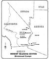 US Army DesertTrainingCentermap.jpg 544 × 654; 40 KB
-
 US Civil Defense Regional Boundaries and Field Installations.png 1,024 × 808; 515 KB
-
 US military bases in the world 2007.PNG 1,425 × 625; 19 KB
-
 US military bases in the world 2007.svg 940 × 415; 1.5 MB
-
 USACMH European Map.png 3,676 × 2,351; 836 KB
-
 USAFUKbases.PNG 600 × 800; 31 KB
-
 USChemicalWeaponsStockpiles082808.jpg 960 × 720; 100 KB
-
 War Theaters - DPLA - c1d13e203f87e1a406dfe617de1a97bc.jpg 15,003 × 9,000; 9.97 MB
-
 WarmSprings CA 33Airway.jpg 432 × 379; 33 KB
-
 Livermore Military Map of the Rio Grande Frontier 1883 (1926) UTA.jpg 9,477 × 5,448; 13 MB


_UTA.jpg)
.jpg)


.png)


.jpg)


_-_DPLA_-_15f3f93b23114a34ef930f004f565b07_(page_1).jpg)
_-_DPLA_-_57028b92141212db17eb003db9c686a4.jpg)
_-_DPLA_-_d050945813878fa4a3a61e3966ece955.jpg)
_-_DPLA_-_89d8fa06a03cbe28d1dc686a5aacce2e.jpg)
_-_DPLA_-_6ed510c23fd6563552455bf2937da9c9_(page_1).jpg)
_-_DPLA_-_6ed510c23fd6563552455bf2937da9c9_(page_2).jpg)


.jpg)
.jpg)
.jpg)
.jpg)
.jpg)


.jpg)


.png)
.png)


.jpg)


.jpg)
.jpg)


_(14764296614).jpg)
_(14595218770).jpg)


_UTA.jpg)