Category:Milestones on the Holyhead Road (Shropshire)
Jump to navigation
Jump to search
Media in category "Milestones on the Holyhead Road (Shropshire)"
The following 60 files are in this category, out of 60 total.
-
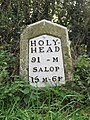
 102 miles to Holyhead - geograph.org.uk - 138549.jpg 480 × 640; 186 KB
-
 Milepost on the Holyhead road (A5) - geograph.org.uk - 664302.jpg 640 × 480; 75 KB
-
 Milestone at NGR SJ 2955 3707.jpg 917 × 1,375; 354 KB
-
 Milestone at NGR SJ 29977 35737.jpg 768 × 1,024; 355 KB
-
 Milestone near Bicton (2).jpg 768 × 1,024; 311 KB
-
 Milestone near Ensdon House.jpg 768 × 1,024; 321 KB
-
 Milestone near Felton Butler.jpg 768 × 1,024; 343 KB
-
 Milestone near Kinton.jpg 768 × 1,024; 287 KB
-
 Milestone near Long Oak.jpg 480 × 640; 163 KB
-
 Milestone near Montford Bridge.jpg 768 × 1,024; 314 KB
-
 Milestone near Nesscliffe.jpg 683 × 1,024; 280 KB
-
 Milestone near Queen's Head.jpg 768 × 1,024; 299 KB
-
 Milestone near Stone House.jpg 768 × 1,024; 365 KB
-
 Milestone on A5 road.jpg 778 × 1,024; 340 KB
-
 Milestone on the route of the old A5 - geograph.org.uk - 189281.jpg 640 × 480; 123 KB
-
 Milestone south of Gobowen.jpg 683 × 1,024; 281 KB
-
 Milestone south of West Felton.jpg 768 × 1,024; 277 KB
-
 Milestone, The Mount, Shrewsbury.jpg 768 × 1,024; 283 KB
-
 Modern Milestone by St Andrew's church, Great Ness (geograph 6037333).jpg 1,000 × 1,500; 263 KB
-
 Old Milepost (geograph 4930488).jpg 683 × 1,024; 254 KB
-
 Old Milepost (geograph 6098273).jpg 1,328 × 1,704; 464 KB
-
 Old Milepost by the B5061 (former A5), in Wellington (geograph 6099110).jpg 1,310 × 1,704; 448 KB
-

-

-
 Old Milestone (geograph 6097699).jpg 834 × 1,200; 246 KB
-
 Old Milestone (geograph 6097700).jpg 800 × 1,200; 332 KB
-
 Old Milestone (geograph 6097717).jpg 1,012 × 1,350; 399 KB
-
 Old Milestone (geograph 6099046).jpg 900 × 1,200; 378 KB
-
-

-
 Old Milestone by the A458, The Mount, Shrewsbury (geograph 6056626).jpg 800 × 1,200; 203 KB
-
 Old Milestone by the A5, east of Burlington, Sheriffhales Parish (geograph 6038758).jpg 1,414 × 1,704; 497 KB
-
 Old Milestone by the A5, Holyhead Road, (geograph 6068736).jpg 799 × 1,200; 255 KB
-

-
 Old Milestone by the A5, Moreton Bridge, Lion Quays (geograph 6037097).jpg 867 × 1,300; 366 KB
-
 Old Milestone by the A5, Redhill, Shifnal (geograph 6045473).jpg 975 × 1,300; 396 KB
-
 Old Milestone by the B4380, Holyhead Road, Bicton parish (geograph 6056617).jpg 800 × 1,200; 282 KB
-

-
 Old Milestone by the B4380, north of Oxon Hall (geograph 6038634).jpg 834 × 1,200; 309 KB
-

-

-
 Old Milestone by the former A5, Nesscliffe (geograph 6045165).jpg 800 × 1,200; 255 KB
-
 Old milestone on former main road, Great Ness (geograph 6326400).jpg 2,920 × 5,184; 4.9 MB
-
 Old Milestone, Blists Hill Open Air Museum (geograph 5790470).jpg 428 × 557; 85 KB
-
 Oops! That's not improved it one little bit (geograph 5337648).jpg 1,102 × 1,469; 964 KB
-
 Redhill Milestone with Benchmark (geograph 6965559).jpg 1,024 × 768; 257 KB
-
 Salop 10 And 6 Furlongs (geograph 4950866).jpg 1,024 × 768; 224 KB
-
 Salop 11 And 6 Furlongs (geograph 4930497).jpg 1,024 × 683; 267 KB
-
 Salop 9 And 6 Furlongs (geograph 4713767).jpg 1,024 × 683; 262 KB
-
 The Bicton milestone - detail - geograph.org.uk - 1720267.jpg 538 × 717; 200 KB
-
 The Bicton milestone in its setting - geograph.org.uk - 1720268.jpg 819 × 614; 205 KB
-
 The Cluddley milepost - detail - geograph.org.uk - 1720331.jpg 538 × 717; 164 KB
-
 The Cluddley milepost in its setting - geograph.org.uk - 1720335.jpg 819 × 614; 169 KB
-
 The Ensdon milestone - detail - geograph.org.uk - 1720282.jpg 522 × 696; 192 KB
-
 The Ensdon milestone in its setting - geograph.org.uk - 1720285.jpg 799 × 599; 198 KB
-

-
 The Haybridge milestone - detail - geograph.org.uk - 1352426.jpg 480 × 640; 124 KB
-
 The Haybridge milestone in its setting - geograph.org.uk - 1352430.jpg 640 × 480; 135 KB
-
 The Udlington milestone - detail - geograph.org.uk - 1720265.jpg 480 × 640; 211 KB
-
 The Udlington milestone in its setting - geograph.org.uk - 1720266.jpg 717 × 538; 199 KB

_-_geograph.org.uk_-_664302.jpg)


.jpg)


.jpg)
.jpg)
.jpg)
,_in_Wellington_(geograph_6099110).jpg)
.jpg)
,_Wellington_(geograph_6157008).jpg)
.jpg)
.jpg)
.jpg)
.jpg)
.jpg)
.jpg)
.jpg)
.jpg)
.jpg)
.jpg)
.jpg)
.jpg)
.jpg)
.jpg)
.jpg)
.jpg)
.jpg)
.jpg)
.jpg)
.jpg)
.jpg)
.jpg)
.jpg)
.jpg)
.jpg)


