Category:Mildenhall, Suffolk
Jump to navigation
Jump to search
town in Suffolk, England  | |||||
| Upload media | |||||
| Instance of | |||||
|---|---|---|---|---|---|
| Location | West Suffolk, Suffolk, East of England, England | ||||
| Different from | |||||
| official website | |||||
 | |||||
Deutsch: Mildenhall ist eine Gemeinde ( Civil Parish) in der englischen Grafschaft Suffolk mit ca. 11.500 Einwohnern. Die namensgebende Kleinstadt Mildenhall ist Verwaltungssitz des Distrikts Forest Heath und liegt nahe der Fernverkehrsstraße A11 London-Norwich am Fluss Lark. Die nächstgelegenen größeren Orte sind Lakenheath, Newmarket und Bury St Edmunds.
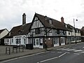
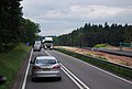
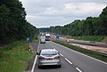
English: Mildenhall is a small market town and civil parish in Suffolk, England. It is run by Forest Heath District Council and has a population of 9,906 people. The town is near the A11 and is located north-west of county town, Ipswich. The large Royal Air Force base, RAF Mildenhall, is located immediately north of the town. The base is used by the United States Air Force, as the headquarters of its 100th Air Refueling Wing and 352nd Special Operations Group.
Polski: Mildenhall - miasto w hrabstwie Suffolk, Anglia. Na północ od miasta wielka baza RAF-u i US Air Force.
Subcategories
This category has the following 15 subcategories, out of 15 total.
B
- The Bell Hotel, Mildenhall (3 F)
C
- Cavenham Hall (1 F)
H
- The Half Moon, Mildenhall (2 F)
- Hanmer Almshouses (2 F)
M
- St Mary's Church, Mildenhall (120 F)
- Mildenhall railway station (3 F)
Q
- Queens Arms, Mildenhall (2 F)
R
S
T
- Mildenhall Town Sign (4 F)
- Mildenhall Treasure (16 F)
W
- The White Hart, Mildenhall (2 F)
Media in category "Mildenhall, Suffolk"
The following 200 files are in this category, out of 253 total.
(previous page) (next page)-
 17 and 19 High Street, Mildenhall (geograph 7179751).jpg 1,024 × 768; 144 KB
-
 1887 VG&R timetable.jpg 4,032 × 3,024; 3.87 MB
-
 2016, a year on Geograph (Day 300) - geograph.org.uk - 5169114.jpg 640 × 480; 50 KB
-
 22-26 High Street, Mildenhall (geograph 7179775).jpg 1,024 × 768; 159 KB
-
 7-9 Market Place, Mildenhall (geograph 7179789).jpg 1,024 × 768; 156 KB
-
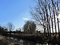
 A Leat of The Lark - geograph.org.uk - 1275110.jpg 640 × 480; 108 KB
-
 A11 - geograph.org.uk - 3348496.jpg 640 × 498; 80 KB
-
 A11 - geograph.org.uk - 3774694.jpg 640 × 430; 64 KB
-
 A11 - geograph.org.uk - 3774699.jpg 640 × 510; 56 KB
-
 A11 - geograph.org.uk - 3814116.jpg 640 × 430; 61 KB
-
 A11 at Barton Mills - geograph.org.uk - 2170083.jpg 3,504 × 2,336; 1.93 MB
-
 A11 in Mildenhall Wood - geograph.org.uk - 2590499.jpg 640 × 452; 101 KB
-
 A11 in Mildenhall Woods - geograph.org.uk - 5979468.jpg 1,600 × 1,200; 896 KB
-
 A11 road improvements - geograph.org.uk - 3774696.jpg 640 × 430; 58 KB
-
 A11 road improvements - geograph.org.uk - 3774698.jpg 640 × 430; 60 KB
-
 A11 through Mildenhall Woods - geograph.org.uk - 1939229.jpg 856 × 1,280; 264 KB
-
 A11, Mildenhall Wood - geograph.org.uk - 3814111.jpg 640 × 430; 61 KB
-
 A11, northbound - geograph.org.uk - 3348497.jpg 640 × 478; 82 KB
-
 A11, southbound - geograph.org.uk - 3814118.jpg 640 × 430; 64 KB
-
 Are you looking at me^ Oh deer. - geograph.org.uk - 1309713.jpg 640 × 510; 93 KB
-
 Bagsham - geograph.org.uk - 1639469.jpg 640 × 480; 134 KB
-
 Bank of River Lark - geograph.org.uk - 295581.jpg 640 × 427; 47 KB
-
 Bargate Road, West Row - geograph.org.uk - 1639232.jpg 640 × 480; 90 KB
-
 Barmans Ltd, Hampstead Avenue - geograph.org.uk - 5301659.jpg 1,600 × 1,200; 481 KB
-
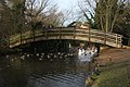
 Geese on the River Lark, Mildenhall - geograph.org.uk - 1309818.jpg 512 × 640; 128 KB
-
 Bavarian Motor Cars - geograph.org.uk - 3169882.jpg 1,600 × 1,200; 573 KB
-
 Beet field by Wamil Road - geograph.org.uk - 2092282.jpg 1,600 × 1,200; 835 KB
-
 Behind the sightscreen - geograph.org.uk - 922545.jpg 640 × 427; 76 KB
-
 Brandon Rd (A1065) - geograph.org.uk - 3826957.jpg 640 × 395; 54 KB
-
 Brandon Road - geograph.org.uk - 5221443.jpg 1,024 × 768; 292 KB
-
 Brandon Road, Mildenhall - geograph.org.uk - 2289405.jpg 640 × 480; 94 KB
-
 Brandon Road, Mildenhall - geograph.org.uk - 2939019.jpg 640 × 480; 119 KB
-
 Breckland heath and wood near Mildenhall RAF base - geograph.org.uk - 3498611.jpg 4,320 × 3,240; 3.43 MB
-
 Brick Kiln Road Mildenhall - geograph.org.uk - 2289395.jpg 640 × 480; 85 KB
-
 Bridge at Wamil Hall - geograph.org.uk - 923516.jpg 640 × 427; 125 KB
-
 Bridge over Cut-off Channel - geograph.org.uk - 5600645.jpg 1,600 × 1,200; 281 KB
-
 Bridleway - geograph.org.uk - 5221447.jpg 1,024 × 768; 334 KB
-
 Bridleway from Field Lane - geograph.org.uk - 3169904.jpg 1,600 × 1,200; 620 KB
-
 Bridleway past Wamil Hall - geograph.org.uk - 2006953.jpg 1,600 × 1,200; 728 KB
-
 Bridleway to Wamil Hall - geograph.org.uk - 1639186.jpg 640 × 480; 138 KB
-
 Bridleway to Wamil Hall - geograph.org.uk - 2092272.jpg 1,600 × 1,200; 833 KB
-

-
 Bus station - geograph.org.uk - 818113.jpg 640 × 480; 63 KB
-
 Business units on James Carter Road - geograph.org.uk - 5301797.jpg 1,600 × 1,200; 590 KB
-
 Chapel Road - geograph.org.uk - 1671432.jpg 640 × 480; 167 KB
-
 Church Walk - geograph.org.uk - 5176057.jpg 640 × 480; 87 KB
-
 Church Walk at Twilight - geograph.org.uk - 5175366.jpg 640 × 480; 46 KB
-
 Church Walk, Mildenhall - geograph.org.uk - 3106934.jpg 1,280 × 856; 246 KB
-
 College Heath Road - geograph.org.uk - 3169720.jpg 1,600 × 1,200; 875 KB
-
 College Heath Road - geograph.org.uk - 3688236.jpg 1,024 × 768; 221 KB
-
 College Heath Road, Mildenhall - geograph.org.uk - 2938903.jpg 640 × 480; 74 KB
-
 Conifer belt by the A11 - geograph.org.uk - 3814113.jpg 640 × 430; 107 KB
-
 Conifers by the A11 - geograph.org.uk - 3774700.jpg 640 × 430; 75 KB
-
 Conifers, Mildenhall Wood - geograph.org.uk - 2716307.jpg 640 × 359; 93 KB
-
 Conifers, Mildenhall Wood - geograph.org.uk - 3814120.jpg 640 × 430; 106 KB
-
 Conifers, Mildenhall Woods - geograph.org.uk - 2590502.jpg 640 × 349; 85 KB
-
 Converted mill - geograph.org.uk - 821878.jpg 640 × 480; 93 KB
-
 Converted mill - geograph.org.uk - 821899.jpg 480 × 640; 101 KB
-
 Corralled Cattle - geograph.org.uk - 3689731.jpg 1,024 × 768; 299 KB
-
 Council offices, Mildenhall - geograph.org.uk - 3169711.jpg 1,600 × 1,200; 550 KB
-
 Cut Off Channel - geograph.org.uk - 2721754.jpg 1,024 × 768; 193 KB
-
 Cut off Channel - geograph.org.uk - 3348464.jpg 640 × 430; 67 KB
-
 Cut-off channel - geograph.org.uk - 3774690.jpg 640 × 430; 58 KB
-
 Cut-off Channel - geograph.org.uk - 5600647.jpg 1,600 × 1,200; 287 KB
-
 Cut-off Channel - geograph.org.uk - 5600650.jpg 1,600 × 1,200; 308 KB
-

-
 Deer Lawn, Mildenhall Woods - geograph.org.uk - 5600704.jpg 1,600 × 1,200; 345 KB
-
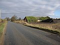
 Derelict fenland farm shed - geograph.org.uk - 1516730.jpg 640 × 414; 111 KB
-
 End of Southgate Avenue - geograph.org.uk - 5301698.jpg 1,600 × 1,200; 704 KB
-
 Entrance to Wamil Hall - geograph.org.uk - 923612.jpg 640 × 427; 128 KB
-
 Entrance To Warren Lodge - geograph.org.uk - 5386122.jpg 1,024 × 768; 298 KB
-
 Entry to Mildenhall Lock - geograph.org.uk - 923622.jpg 640 × 427; 126 KB
-
 Entry to Turf Lock, River Lark - geograph.org.uk - 922560.jpg 640 × 427; 113 KB
-
 EuroUSA Safepac - geograph.org.uk - 5301803.jpg 1,600 × 1,200; 596 KB
-
 Factory for sale, Mildenhall - geograph.org.uk - 5301646.jpg 1,600 × 1,200; 578 KB
-
 Fallen tree nearly blocks the river Lark - geograph.org.uk - 1309798.jpg 640 × 480; 111 KB
-
 Farm building off West Row Road - geograph.org.uk - 2938864.jpg 640 × 480; 50 KB
-
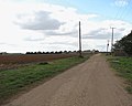
 Farm track off West Row Road - geograph.org.uk - 2938879.jpg 640 × 480; 71 KB
-
 Farmland, Mildenhall - geograph.org.uk - 2938883.jpg 640 × 480; 75 KB
-
 Field Lane leaving Mildenhall - geograph.org.uk - 3169892.jpg 1,600 × 1,200; 766 KB
-
 Finchley Road, Mildenhall - geograph.org.uk - 5301640.jpg 1,600 × 1,200; 561 KB
-
 Fishing tackle shop - geograph.org.uk - 821975.jpg 640 × 480; 83 KB
-
 Folly Road - geograph.org.uk - 5111853.jpg 1,600 × 1,327; 663 KB
-
 Folly Road - geograph.org.uk - 5386113.jpg 1,024 × 768; 157 KB
-
 Footbridge over River Lark - geograph.org.uk - 641315.jpg 640 × 427; 104 KB
-

-
 Footpath - geograph.org.uk - 3689713.jpg 1,024 × 768; 307 KB
-
 Footpath To Eriswell - geograph.org.uk - 3689722.jpg 768 × 1,024; 283 KB
-
 Forest edge near Mildenhall - geograph.org.uk - 1198346.jpg 640 × 427; 104 KB
-
 Formers Warreners Lodge - geograph.org.uk - 5221481.jpg 1,024 × 769; 207 KB
-
 Grand house, King Street, Mildenhall - geograph.org.uk - 2938897.jpg 640 × 480; 82 KB
-
 Greyhound racing at Mildenhall Stadium c.1980.png 1,077 × 670; 1.44 MB
-
 Hampstead Avenue, Mildenhall Industrial Park - geograph.org.uk - 5301732.jpg 1,600 × 1,200; 662 KB
-
 Heath Road, Mildenhall - geograph.org.uk - 2939017.jpg 640 × 480; 102 KB
-
 Horner Bros, Southgate Avenue - geograph.org.uk - 5301686.jpg 1,600 × 1,200; 641 KB
-
 Horse paddocks - geograph.org.uk - 1670336.jpg 640 × 480; 134 KB
-
 Impress Signs ^ Graphics - geograph.org.uk - 5301796.jpg 1,600 × 1,200; 618 KB
-
 Industrial Units - geograph.org.uk - 5386117.jpg 1,024 × 768; 150 KB
-
 Invading crayfish, Lark in the Park - geograph.org.uk - 2580771.jpg 2,352 × 1,848; 1.56 MB
-

-

-

-
 Irrigation reservoir on Harris Farms - geograph.org.uk - 1517187.jpg 640 × 488; 96 KB
-
 J.K.H. Drainage Units Ltd - geograph.org.uk - 5301707.jpg 1,600 × 1,200; 524 KB
-
 Jubilee Fields car park, Mildenhall - geograph.org.uk - 641326.jpg 640 × 427; 70 KB
-

-
 Kalsec UK - geograph.org.uk - 5301806.jpg 1,600 × 1,200; 634 KB
-
 King's Church Mildenhall - geograph.org.uk - 4443897.jpg 6,000 × 4,000; 7.72 MB
-
 Kings Staunch Cottage - geograph.org.uk - 3132473.jpg 1,024 × 768; 308 KB
-
 Kings Staunch Cottage - geograph.org.uk - 4443052.jpg 6,000 × 4,000; 5.04 MB
-
 Kingsway (A1101), Mildenhall - geograph.org.uk - 2938900.jpg 640 × 480; 88 KB
-
 Lark in the Park, Mildenhall - geograph.org.uk - 2580761.jpg 2,848 × 2,136; 1.47 MB
-
 Lark in the Park, Mildenhall - geograph.org.uk - 2580801.jpg 2,848 × 2,136; 1.56 MB
-
 Lark Road Mildenhall looking east - geograph.org.uk - 2002852.jpg 2,848 × 2,136; 1.66 MB
-
 Lark Road Mildenhall, around 1975 - geograph.org.uk - 997886.jpg 640 × 468; 106 KB
-
 Lark Road seen across disused meadow - geograph.org.uk - 1309879.jpg 640 × 480; 120 KB
-
 Lark Road, Mildenhall - geograph.org.uk - 2002847.jpg 2,848 × 2,136; 1.61 MB
-
 Lark Road, Mildenhall - geograph.org.uk - 2289556.jpg 640 × 480; 51 KB
-
 Lark Road, Mildenhall, about 1975 - geograph.org.uk - 997923.jpg 640 × 407; 58 KB
-
 Lifebelt at irrigation reservoir - geograph.org.uk - 1517196.jpg 640 × 449; 119 KB
-
 Lloyds bank - geograph.org.uk - 821982.jpg 480 × 640; 80 KB
-
 Looking north from Harris Farm - geograph.org.uk - 1516706.jpg 640 × 426; 120 KB
-
 Market Cross, Mildenhall - geograph.org.uk - 3583021.jpg 1,600 × 1,200; 406 KB
-
 Market Place, Mildenhall - geograph.org.uk - 4443869.jpg 6,000 × 4,000; 6.26 MB
-
 Market Place, Mildenhall - geograph.org.uk - 5301665.jpg 1,600 × 1,200; 507 KB
-
 Melvyn Taylor, speedway rider.jpg 288 × 358; 89 KB
-
 Mildenhall - geograph.org.uk - 3106794.jpg 1,280 × 856; 360 KB
-
 Mildenhall - geograph.org.uk - 3108709.jpg 1,280 × 856; 350 KB
-
 Mildenhall Cricket Club - geograph.org.uk - 4443257.jpg 6,000 × 4,000; 4.69 MB
-
 Mildenhall Cricket Club - geograph.org.uk - 922548.jpg 640 × 427; 87 KB
-
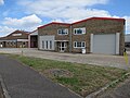
 Mildenhall fire station - geograph.org.uk - 1968464.jpg 640 × 427; 193 KB
-
 Mildenhall High Street, Barclays Bank and Aphrodite - geograph.org.uk - 5848859.jpg 7,360 × 4,912; 5.84 MB
-
 Mildenhall library - geograph.org.uk - 3169702.jpg 1,600 × 1,200; 697 KB
-
 Mildenhall Tyre ^ Autocentre - geograph.org.uk - 5301654.jpg 1,600 × 1,200; 521 KB
-
 Mildenhall Wood - geograph.org.uk - 3774702.jpg 640 × 430; 49 KB
-
 Mildenhall Woods - geograph.org.uk - 1939762.jpg 1,280 × 856; 374 KB
-
 Mildenhall Woods - geograph.org.uk - 2590494.jpg 640 × 543; 122 KB
-
 Mildenhall woods - geograph.org.uk - 2717028.jpg 1,024 × 768; 385 KB
-
 Mildenhall Woods - geograph.org.uk - 2717043.jpg 1,024 × 768; 352 KB
-
 Mildenhall Woods - geograph.org.uk - 5600664.jpg 1,200 × 1,600; 524 KB
-
 Mildenhall Woods, Barton Mills - geograph.org.uk - 2170079.jpg 3,504 × 2,336; 1.94 MB
-
 Mildenhall, Lloyds Bank - geograph.org.uk - 5847653.jpg 6,301 × 4,206; 3.92 MB
-
 Mildenhall, Post box at the side of Zack FM - geograph.org.uk - 5847647.jpg 4,412 × 6,610; 7.12 MB
-

-
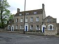
 Mildenhall, The Prior's Lodge - geograph.org.uk - 5848852.jpg 6,263 × 4,180; 3.19 MB
-
 Mildenhall, Zack FM - geograph.org.uk - 5847641.jpg 5,196 × 3,468; 2.67 MB
-
 Mill leat at Mildenhall - geograph.org.uk - 922564.jpg 640 × 427; 118 KB
-
 Narrowboat on River Lark near Isleham - geograph.org.uk - 1426140.jpg 427 × 640; 125 KB
-
 New housing on Evergreen Way, Mildenhall - geograph.org.uk - 3169728.jpg 1,600 × 1,200; 703 KB
-
 No stopping on the way to Mildenhall - geograph.org.uk - 1634682.jpg 640 × 428; 99 KB
-
 Old converted mill - geograph.org.uk - 821930.jpg 480 × 640; 78 KB
-
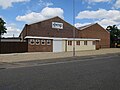
 Old Methodist Church in Mildenhall, Suffolk..jpg 2,000 × 1,292; 3.28 MB
-
 Onion field and irrigation system - geograph.org.uk - 1438630.jpg 640 × 427; 98 KB
-
 Open Space - geograph.org.uk - 2717033.jpg 1,024 × 768; 196 KB
-
 Ordnance Survey Flush Bracket S0154 - geograph.org.uk - 4273915.jpg 4,000 × 3,000; 3.13 MB
-
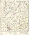
 Ordnance Survey One-Inch Sheet 135 Cambridge & Ely, Published 1946.jpg 10,887 × 12,781; 13.51 MB
-
 Ordnance Survey One-Inch Sheet 135 Cambridge & Ely, Published 1954.jpg 8,213 × 9,963; 8.63 MB
-
 Ordnance Survey One-Inch Sheet 135 Cambridge & Ely, Published 1967.jpg 8,285 × 9,971; 9.71 MB
-
 Ordnance Survey One-Inch Sheet 135 Cambridge & Ely, Published 1969.jpg 8,281 × 9,866; 28.33 MB
-
 OS Flush Bracket S 0154 - geograph.org.uk - 1852267.jpg 1,024 × 819; 180 KB
-
 Paddock over the river - geograph.org.uk - 922551.jpg 640 × 427; 105 KB
-
 Perimeter Fence, Mildenhall Stadium - geograph.org.uk - 1295435.jpg 640 × 480; 46 KB
-
 Petrol station, Mildenhall - geograph.org.uk - 3169886.jpg 1,600 × 1,200; 565 KB
-
 Pig Farm at Mildenhall Fen - geograph.org.uk - 368834.jpg 640 × 427; 78 KB
-
 Pigs at Chestnut Farm - geograph.org.uk - 368856.jpg 640 × 427; 60 KB
-
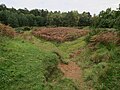 Pit off Warreners' Walk - geograph.org.uk - 5600680.jpg 1,600 × 1,200; 438 KB
-
 Pit Stop Auto Factors, Mildenhall - geograph.org.uk - 3169678.jpg 1,600 × 1,200; 526 KB
-
 Plantation Farm - geograph.org.uk - 1639220.jpg 640 × 480; 189 KB
-
 Planted fields north of Worlington - geograph.org.uk - 4443189.jpg 6,000 × 4,000; 5.49 MB
-

-
 Postbox and stamp machines - geograph.org.uk - 821865.jpg 640 × 480; 112 KB
-
 Pott Hall Road - geograph.org.uk - 1639226.jpg 640 × 480; 97 KB
-
 Pott Hall Road - geograph.org.uk - 1671437.jpg 640 × 480; 103 KB
-
 Private road past Harris Farms - geograph.org.uk - 1517170.jpg 640 × 511; 73 KB
-
 Project Blue Book report - 1954-04-6781310-MILDENHALL-ENGLAND.pdf 3,320 × 4,150, 8 pages; 1.22 MB
-
 Project Blue Book report - 1954-04-7276101-Mildenhall-England-2982-.pdf 4,025 × 5,964, 3 pages; 489 KB
-

-
 Queensway, Mildenhall - geograph.org.uk - 2938892.jpg 640 × 480; 70 KB
-
 RD Castings Ltd - geograph.org.uk - 5301723.jpg 1,600 × 1,200; 668 KB
-
 Recway, home of Mildenhall Town FC - geograph.org.uk - 4443933.jpg 6,000 × 4,000; 5.13 MB
-
 Rex Graham nature reserve, 1977 - geograph.org.uk - 2881766.jpg 640 × 428; 176 KB
-
 Ridgeon distribution centre - geograph.org.uk - 5301737.jpg 1,600 × 1,200; 567 KB
-
 Ripe barley field - geograph.org.uk - 5301808.jpg 1,600 × 1,200; 681 KB
-
 River Lark and old mill buildings, Mildenhall - geograph.org.uk - 3498566.jpg 4,320 × 3,240; 2.93 MB
-
 River Lark at Judes Ferry - geograph.org.uk - 295579.jpg 640 × 427; 68 KB
-
 River Lark at Mildenhall - geograph.org.uk - 641317.jpg 640 × 427; 94 KB
-
 River Lark at Mildenhall - geograph.org.uk - 641322.jpg 640 × 427; 74 KB
-
 River Lark by the A11 - geograph.org.uk - 2590490.jpg 640 × 430; 82 KB
-
 River Lark near Barton Mills - geograph.org.uk - 641323.jpg 640 × 427; 107 KB
-
 River Lark near West Row - geograph.org.uk - 295575.jpg 640 × 427; 86 KB
-
 River Lark near West Row - geograph.org.uk - 295583.jpg 640 × 427; 86 KB
-
 River Lark, near Worlington - geograph.org.uk - 2825022.jpg 1,024 × 768; 166 KB
-
 Roadside Cafe - geograph.org.uk - 5632831.jpg 640 × 425; 91 KB
-
 Sarll Metal Products - geograph.org.uk - 5301631.jpg 1,600 × 1,200; 598 KB
-
 Sat-Comm, Chiswick Avenue - geograph.org.uk - 5301643.jpg 1,600 × 1,200; 451 KB
-
 Signs - geograph.org.uk - 821914.jpg 480 × 640; 81 KB
-
 Silver Birch - geograph.org.uk - 2717049.jpg 1,024 × 768; 391 KB
-
 Spigot Mortar emplacement in Mildenhall town centre - geograph.org.uk - 5447641.jpg 3,456 × 2,592; 3.96 MB
-
 Street name sign - geograph.org.uk - 822200.jpg 640 × 480; 120 KB
-
 Supermarket trolleys - geograph.org.uk - 818090.jpg 640 × 480; 107 KB
.jpg)

_-_geograph.org.uk_-_5169114.jpg)
.jpg)
.jpg)


_-_geograph.org.uk_-_3826957.jpg)


.jpg)


_-_geograph.org.uk_-_1516715.jpg)
_-_geograph.org.uk_-_1516716.jpg)
_-_geograph.org.uk_-_1516722.jpg)


,_Mildenhall_-_geograph.org.uk_-_2938900.jpg)


