Category:Mijnsheerenland
Jump to navigation
Jump to search
Nederlands: Afbeeldingen van Mijnsheerenland behorende tot de gemeente Hoeksche Waard in de provincie Zuid-Holland in het westen van Nederland. Nabij de gemeenten Nissewaard, Dordrecht en Rotterdam
English: Pictures of Mijnsheerenland belongs to the municipality Hoeksche Waard in the province South Holland in the West of the Netherlands. Near the municipalities Nissewaard, Dordrecht and Rotterdam
farm village in the Netherlands    | |||||
| Upload media | |||||
| Instance of | |||||
|---|---|---|---|---|---|
| Location |
| ||||
| Located in or next to body of water | |||||
| Population |
| ||||
 | |||||
Subcategories
This category has the following 8 subcategories, out of 8 total.
- Maps of Mijnsheerenland (10 F)
B
D
R
S
- Shops in Mijnsheerenland (5 F)
W
- Wintersweg 1, Mijnsheerenland (10 F)
Media in category "Mijnsheerenland"
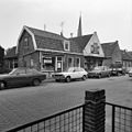
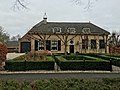
The following 71 files are in this category, out of 71 total.
-
 Flag of Mijnsheerenland.png 125 × 83; 571 bytes
-
 Flag of Mijnsheerenland.svg 512 × 341; 10 KB
-
 5boeken.mijnsheerenland.jpg 2,086 × 1,436; 767 KB
-
 Aanzicht - Mijnsheerenland - 20159315 - RCE.jpg 1,200 × 794; 183 KB
-
 Achter - Mijnsheerenland - 20159314 - RCE.jpg 1,200 × 799; 232 KB
-
 Achterbouw - Mijnsheerenland - 20159322 - RCE.jpg 1,200 × 1,197; 355 KB
-
 Achtergevel - Mijnsheerenland - 20159298 - RCE.jpg 1,200 × 805; 224 KB
-
 Exterieur - Mijnsheerenland - 20159299 - RCE.jpg 1,193 × 1,200; 250 KB
-
 Gevel - Mijnsheerenland - 20159313 - RCE.jpg 1,200 × 805; 197 KB
-
 Gevels - Mijnsheerenland - 20159343 - RCE.jpg 1,200 × 805; 247 KB
-
 Gevels - Mijnsheerenland - 20159353 - RCE.jpg 1,200 × 805; 207 KB
-
 Hoek Julianastraat overzicht - Mijnsheerenland - 20159335 - RCE.jpg 1,197 × 1,200; 224 KB
-
 Landheerlaan, Mijnsheerenland.jpg 1,536 × 2,048; 413 KB
-
 Mijnsheerenland - Bakker Nolen - Wilhelminastraat 34.png 1,401 × 1,032; 1.62 MB
-
 Mijnsheerenland - Everocken 19 - 1979.png 1,372 × 1,047; 1.22 MB
-
 Mijnsheerenland - Everocken 19 - 2015 - 1.JPG 4,000 × 3,000; 3 MB
-
 Mijnsheerenland - Everocken 19 - 2015 - 2.JPG 4,000 × 3,000; 2.36 MB
-
 Mijnsheerenland - Gemeentehuis.png 1,401 × 1,032; 1.35 MB
-
 Mijnsheerenland - Raadhuislaan.png 1,401 × 1,032; 1.34 MB
-
 Mijnsheerenland - Rabobank.png 1,370 × 1,018; 1.3 MB
-
 Mijnsheerenland - Rietgors 13-15.JPG 4,000 × 3,000; 2.56 MB
-
 Mijnsheerenland - Rietgors 13.JPG 4,000 × 3,000; 2.18 MB
-
 Mijnsheerenland - Van der Sluys.png 1,382 × 1,039; 1.31 MB
-
 Mijnsheerenland 002.jpg 2,592 × 1,944; 2.27 MB
-
 Mijnsheerenland Ambachtsherenlaan juni 2016.jpg 5,312 × 2,988; 4.53 MB
-
 Mijnsheerenland Coat of Arms.png 223 × 264; 6 KB
-
 Mijnsheerenland huizen jaren '70.png 1,388 × 1,032; 1.52 MB
-
 Mijnsheerenland pad.jpg 4,032 × 1,816; 3.32 MB
-
 Mijnsheerenland wapen.svg 363 × 411; 118 KB
-
 Mijnsheerenland Wilhelminastraat.png 1,388 × 944; 1.43 MB
-
 Mijnsheerenland, August 2015 01.jpg 2,988 × 5,312; 5.64 MB
-
 Mijnsheerenland, August 2015 02.jpg 5,312 × 2,988; 6.51 MB
-
 N489 Mijnsheerenland.jpg 669 × 416; 140 KB
-
 Nightmare Outdoor 2006.jpg 1,280 × 960; 236 KB
-
 Overzicht - Mijnsheerenland - 20159310 - RCE.jpg 1,190 × 1,200; 277 KB
-
 Overzicht - Mijnsheerenland - 20159319 - RCE.jpg 1,200 × 1,193; 314 KB
-
 Overzicht - Mijnsheerenland - 20159329 - RCE.jpg 1,171 × 1,200; 309 KB
-
 Overzicht - Mijnsheerenland - 20159330 - RCE.jpg 1,190 × 1,200; 305 KB
-
 Overzicht - Mijnsheerenland - 20159333 - RCE.jpg 1,197 × 1,200; 253 KB
-
 Overzicht - Mijnsheerenland - 20159339 - RCE.jpg 1,192 × 1,200; 257 KB
-
 Overzicht - Mijnsheerenland - 20159340 - RCE.jpg 1,200 × 1,200; 255 KB
-
 Overzicht - Mijnsheerenland - 20159349 - RCE.jpg 1,188 × 1,200; 252 KB
-
 Overzicht dorp - Mijnsheerenland - 20159223 - RCE.jpg 1,200 × 804; 262 KB
-

-
 Overzicht Van der Waalstraat - Mijnsheerenland - 20159336 - RCE.jpg 1,193 × 1,200; 255 KB
-
 Rechter zij- en achtergevel - Mijnsheerenland - 20159321 - RCE.jpg 1,198 × 1,200; 313 KB
-
 RET tramhaltepaal oud.jpg 1,735 × 1,523; 1.26 MB
-
 Rietgors 13 voorzijde.JPG 4,000 × 3,000; 2.41 MB
-

-
 Schuur - Mijnsheerenland - 20159332 - RCE.jpg 1,198 × 1,200; 293 KB
-
 Versie 2.jpg 4,032 × 3,024; 3.79 MB
-
 Vijfschelpen.mijnsheerenland.jpg 2,051 × 2,051; 1.16 MB
-
 Voor- en linker zijgevel - Mijnsheerenland - 20159312 - RCE.jpg 1,200 × 1,183; 281 KB
-
 Voor- en linker zijgevel - Mijnsheerenland - 20159320 - RCE.jpg 1,200 × 1,197; 400 KB
-
 Voor- en linker zijgevel - Mijnsheerenland - 20159331 - RCE.jpg 1,188 × 1,200; 337 KB
-
 Voor- en linker zijgevel - Mijnsheerenland - 20159352 - RCE.jpg 1,200 × 1,197; 281 KB
-
 Voor- en rechter zijgevel - Mijnsheerenland - 20159350 - RCE.jpg 1,200 × 1,190; 257 KB
-
 Voor- en zijgevel - Mijnsheerenland - 20159311 - RCE.jpg 1,200 × 1,200; 278 KB
-
 Vooraanzicht - Mijnsheerenland - 20159351 - RCE.jpg 1,200 × 808; 196 KB
-
 Voorgevel - Mijnsheerenland - 20159297 - RCE.jpg 1,200 × 805; 291 KB
-
 Voorgevel - Mijnsheerenland - 20159342 - RCE.jpg 1,200 × 1,180; 328 KB
-
 Voorgevel - Mijnsheerenland - 20159344 - RCE.jpg 1,200 × 1,200; 302 KB
-
 Voorgevel - Mijnsheerenland - 20159345 - RCE.jpg 1,197 × 1,200; 244 KB
-
 Voorgevel - Mijnsheerenland - 20159346 - RCE.jpg 1,200 × 1,200; 314 KB
-
 Voorgevel - Mijnsheerenland - 20159354 - RCE.jpg 1,200 × 1,195; 265 KB
-
 Voorgevels - Mijnsheerenland - 20159317 - RCE.jpg 1,200 × 1,200; 320 KB
-
 Voorgevels - Mijnsheerenland - 20159334 - RCE.jpg 1,200 × 1,188; 298 KB
-
 Voorgevels - Mijnsheerenland - 20159341 - RCE.jpg 1,200 × 1,197; 247 KB
-

-

-
 Zijgevel Ontvangen via R.C. Hekker - Mijnsheerenland - 20442644 - RCE.jpg 1,200 × 900; 194 KB


