Category:Mient 33, Alkmaar
Jump to navigation
Jump to search
| Object location | | View all coordinates using: OpenStreetMap |
|---|
 | |||||
| Upload media | |||||
| Instance of |
| ||||
|---|---|---|---|---|---|
| Location | Alkmaar, North Holland, Netherlands | ||||
| Street address |
| ||||
| Located on street | |||||
| Owned by |
| ||||
| Heritage designation |
| ||||
| Inception |
| ||||
 | |||||
|
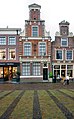
This is a category about rijksmonument number 7321
|
| Address |
|
Media in category "Mient 33, Alkmaar"
The following 14 files are in this category, out of 14 total.
-

-
 Alkmaar - Mient - View ESE - Renaissance architecture.jpg 5,984 × 3,988; 15.67 MB
-
 Alkmaar Ansichten 8.jpg 4,608 × 1,992; 2.73 MB
-
 Alkmaar-Mient 31.jpg 1,842 × 2,972; 1.01 MB
-
 Alkmaar-Mient 33.jpg 1,512 × 2,436; 672 KB
-
 C.voorgevel - Alkmaar - 20006564 - RCE.jpg 958 × 1,200; 199 KB
-
 L. - Alkmaar - 20006563 - RCE.jpg 871 × 1,200; 218 KB
-

-

-
 Mient ca1894 (2).jpg 2,014 × 2,504; 1.27 MB
-
 Nederland Alkmaar 01.jpg 3,840 × 2,160; 2.73 MB
-
 Overzicht voorgevel woonhuis - Alkmaar - 20318930 - RCE.jpg 884 × 1,200; 205 KB
-
 Overzicht voorgevels - Alkmaar - 20006553 - RCE.jpg 894 × 1,200; 201 KB
-
 Voorgevels - Alkmaar - 20006554 - RCE.jpg 1,012 × 1,200; 283 KB


.jpg)


