Category:Michaëlkerk (Eanjum)
Jump to navigation
Jump to search
| Object location | | View all coordinates using: OpenStreetMap |
|---|
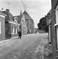
church building in Anjum, Netherlands  | |||||
| Upload media | |||||
| Instance of | |||||
|---|---|---|---|---|---|
| Dedicated to | |||||
| Location | Eanjum, Noardeast-Fryslân, Friesland, Netherlands | ||||
| Street address |
| ||||
| Located on street |
| ||||
| Heritage designation |
| ||||
| Inception |
| ||||
| Significant event |
| ||||
| official website | |||||
 | |||||
|
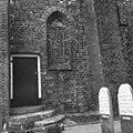
This is a category about rijksmonument number 31557
|
| Address |
|
Subcategories
This category has only the following subcategory.
I
- Interior of Michaëlkerk (Eanjum) (35 F)
Media in category "Michaëlkerk (Eanjum)"
The following 85 files are in this category, out of 85 total.
-
 20080801 Church Anjum NL.jpg 4,000 × 3,200; 4.97 MB
-
 6e travee afgekapte pilaster en gewelf aanzet - Anjum - 20022535 - RCE.jpg 1,200 × 780; 227 KB
-
 7e travee - Anjum - 20022440 - RCE.jpg 1,200 × 788; 245 KB
-
 9e travee en toegang grafkelder - Anjum - 20022442 - RCE.jpg 795 × 1,200; 165 KB
-
 Aanzicht van afgekapte tufmuur - Anjum - 20022533 - RCE.jpg 1,200 × 800; 177 KB
-
 B 390, aanzicht - Anjum - 20022562 - RCE.jpg 1,200 × 806; 234 KB
-
 Beschildering oostzijde toren boven doorgang - Anjum - 20022528 - RCE.jpg 1,200 × 1,197; 367 KB
-
 Dorpsoverzichten - Anjum - 20022587 - RCE.jpg 1,188 × 1,200; 363 KB
-
 Dorpsoverzichten - Anjum - 20022589 - RCE.jpg 1,190 × 1,200; 486 KB
-
 Dorpsoverzichten - Anjum - 20022594 - RCE.jpg 1,190 × 1,200; 346 KB
-
 Dorpsoverzichten - Anjum - 20022595 - RCE.jpg 1,185 × 1,200; 318 KB
-
 Dorpsoverzichten - Anjum - 20022596 - RCE.jpg 1,188 × 1,200; 392 KB
-
 Dorpsoverzichten - Anjum - 20022601 - RCE.jpg 1,178 × 1,200; 318 KB
-
 Dorpsoverzichten - Anjum - 20022604 - RCE.jpg 1,188 × 1,200; 400 KB
-
 Exterieur - Anjum - 20022481 - RCE.jpg 970 × 1,200; 219 KB
-
 Exterieur - Anjum - 20022516 - RCE.jpg 1,200 × 1,200; 455 KB
-
 Exterieur - Anjum - 20022517 - RCE.jpg 1,200 × 1,200; 535 KB
-
 Exterieur - Anjum - 20022518 - RCE.jpg 1,200 × 1,200; 518 KB
-
 Exterieur - Anjum - 20022519 - RCE.jpg 1,200 × 1,200; 456 KB
-
 Exterieur - Anjum - 20022520 - RCE.jpg 1,200 × 1,200; 429 KB
-
 Exterieur - Anjum - 20022521 - RCE.jpg 1,200 × 1,200; 434 KB
-
 Exterieur - Anjum - 20022522 - RCE.jpg 1,200 × 1,200; 426 KB
-
 Exterieur - Anjum - 20022523 - RCE.jpg 1,200 × 1,200; 424 KB
-
 Exterieur - Anjum - 20022524 - RCE.jpg 1,200 × 1,200; 418 KB
-
 Exterieur - Anjum - 20022525 - RCE.jpg 1,200 × 1,200; 432 KB
-
 Exterieur - Anjum - 20022526 - RCE.jpg 1,200 × 1,200; 477 KB
-
 Exterieur - Anjum - 20022527 - RCE.jpg 1,200 × 1,200; 467 KB
-
 Exterieur koor - Anjum - 20022501 - RCE.jpg 956 × 1,200; 244 KB
-
 Exterieur naar het oosten - Anjum - 20022484 - RCE.jpg 851 × 1,200; 194 KB
-
 Exterieur noord-west zijde - Anjum - 20022502 - RCE.jpg 944 × 1,200; 202 KB
-
 Exterieur noord-west zijde - Anjum - 20022504 - RCE.jpg 960 × 1,200; 188 KB
-
 Exterieur noordzijde - Anjum - 20022500 - RCE.jpg 1,200 × 957; 260 KB
-
 Exterieur toren westzijde - Anjum - 20022503 - RCE.jpg 956 × 1,200; 340 KB
-

-

-
 Exterieur zuidzijde - Anjum - 20022498 - RCE.jpg 1,200 × 953; 313 KB
-
 Exterieur zuidzijde - Anjum - 20022499 - RCE.jpg 1,200 × 955; 266 KB
-
 Fundering 8e travee - Anjum - 20022530 - RCE.jpg 1,200 × 841; 232 KB
-

-

-
 Gewelfaanzetten 8e travee - Anjum - 20022446 - RCE.jpg 797 × 1,200; 235 KB
-
 Kerk - Anjum - 20022479 - RCE.jpg 1,200 × 956; 211 KB
-
 Koorsluiting - Anjum - 20022443 - RCE.jpg 1,200 × 800; 195 KB
-
 Koorsluiting - Anjum - 20022444 - RCE.jpg 1,200 × 802; 199 KB
-
 Laag venster 9e travee - Anjum - 20022445 - RCE.jpg 1,200 × 794; 252 KB
-
 Lichtspleet 8e travee - Anjum - 20022534 - RCE.jpg 1,200 × 796; 237 KB
-
 Noord-oost gevel - Anjum - 20022467 - RCE.jpg 1,200 × 948; 276 KB
-
 Noord-west gevel - Anjum - 20022465 - RCE.jpg 960 × 1,200; 216 KB
-
 Noord-zijde koor - Anjum - 20022447 - RCE.jpg 1,200 × 782; 210 KB
-
 Noordgevel kerk met kerktoren - Anjum - 20022486 - RCE.jpg 881 × 1,200; 231 KB
-
 Oost-noordzijde - Anjum - 20022470 - RCE.jpg 1,200 × 961; 261 KB
-
 Oostzijde exterieur - Anjum - 20022495 - RCE.jpg 1,200 × 1,191; 382 KB
-
 Oostzijde exterieur - Anjum - 20022497 - RCE.jpg 1,200 × 1,190; 494 KB
-
 Opening 9e travee - Anjum - 20022441 - RCE.jpg 1,200 × 796; 221 KB
-
 Overzicht - Anjum - 20022464 - RCE.jpg 1,200 × 962; 276 KB
-

-

-

-

-

-
 Ronde opening achter 6e steunbeer - Anjum - 20022448 - RCE.jpg 1,200 × 780; 188 KB
-
 Scheurvorming bij toren - Anjum - 20022469 - RCE.jpg 1,192 × 1,200; 313 KB
-
 Scheurvorming in de kerk - Anjum - 20022468 - RCE.jpg 1,190 × 1,200; 190 KB
-
 Schildering oostzijde toren boven doorgang - Anjum - 20022529 - RCE.jpg 1,192 × 1,200; 390 KB
-
 Tekening van toren, plattegrond en doorsnede - Anjum - 20022477 - RCE.jpg 868 × 1,200; 183 KB
-

-
 Toren na restauratie - Anjum - 20022513 - RCE.jpg 960 × 1,200; 202 KB
-
 Toren noord-west zijde - Anjum - 20022505 - RCE.jpg 967 × 1,200; 221 KB
-
 Toren noord-west zijde na restauratie - Anjum - 20022514 - RCE.jpg 1,011 × 1,200; 171 KB
-
 Toren zuid-oost zijde - Anjum - 20022506 - RCE.jpg 968 × 1,200; 219 KB
-
 Toren zuid-oost zijde na restauratie - Anjum - 20022515 - RCE.jpg 1,004 × 1,200; 240 KB
-
 Twee mannen die pauzeren - Anjum - 20411662 - RCE.jpg 1,200 × 799; 183 KB
-
 Vanuit het zuiden exterieur - Anjum - 20022480 - RCE.jpg 1,200 × 829; 204 KB
-
 Voet van doopvont 4e travee - Anjum - 20022532 - RCE.jpg 1,200 × 801; 171 KB
-

-

-
 Zicht op hervormde kerk vanuit het zuidwesten - Anjum - 20319389 - RCE.jpg 1,200 × 1,001; 177 KB
-

-
 Zicht vanuit het noordoosten - Anjum - 20322415 - RCE.jpg 927 × 1,200; 251 KB
-
 Zuid-oost zijde exterieur - Anjum - 20022494 - RCE.jpg 1,200 × 1,200; 407 KB
-
 Zuid-oost zijde exterieur - Anjum - 20022496 - RCE.jpg 1,200 × 1,200; 473 KB
-
 Zuidgevel - Anjum - 20022466 - RCE.jpg 1,200 × 950; 302 KB
-
 Zuidgevel - Anjum - 20022471 - RCE.jpg 1,200 × 955; 260 KB
-
 Zuidgevel - Anjum - 20322414 - RCE.jpg 1,200 × 783; 153 KB
-
 Zuidmuur naar het oosten - Anjum - 20022531 - RCE.jpg 1,200 × 802; 228 KB


