Category:Messtischblatt by early prussian reference
Jump to navigation
Jump to search
English: Messtischblatt maps that use a sequential id of the first prussian land survey done between 1830 and 1865. For the second land survey new numbers were used. On some sheets these ids were used on published maps well after 1870 - these are put in both categories if first and second land survey ids are known.
Please use Template:Messtischblatt on media files to categorize them into this category.
Media in category "Messtischblatt by early prussian reference"
The following 11 files are in this category, out of 11 total.
-
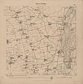
 Zahna Messtischblatt df dk 0010001 4042 1874.jpg 8,346 × 8,598; 8.71 MB
-
 Meuchen Messtischblatt df dk 0010001 4739 1873.jpg 8,383 × 8,514; 9.01 MB
-
 Zwenkau Messtischblatt df dk 0000151 4739 1879.jpg 7,708 × 7,746; 8.76 MB
-
 Zwenkau Messtischblatt df dk 0010001 4739 1894.jpg 8,218 × 8,106; 9.38 MB
-
 Urmesstischblatt 3445 (Spandau) um 1835 (auf Stresow).jpg 1,056 × 900; 669 KB
-
 Urmesstischblatt 3445 (Spandau) um 1835.jpg 5,200 × 5,196; 15.83 MB
-
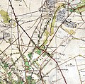
 Urmesstischblatt 3446 (Berlin Nord) um 1840 (Bernauer Tor nach Weißensee).jpg 1,663 × 1,248; 1.05 MB
-
 Urmesstischblatt 3446 (Berlin Nord) um 1840 (Panke Luisenbrunnen).jpg 1,348 × 1,337; 991 KB
-
 Urmesstischblatt 3446 (Berlin Nord) um 1840 (Panke).jpg 2,167 × 1,571; 1.79 MB
-
 Urmesstischblatt 3446 (Berlin Nord) um 1840.jpg 4,429 × 4,399; 6.79 MB
-
 Urmesstischblatt 3446 (Berlin Nord) um 1840; Berlin-Reinickendorf (cropped).jpg 1,269 × 1,117; 739 KB


_um_1835_(auf_Stresow).jpg)
_um_1835.jpg)
_um_1840_(Bernauer_Tor_nach_Wei%C3%9Fensee).jpg)
_um_1840_(Panke_Luisenbrunnen).jpg)
_um_1840_(Panke).jpg)
_um_1840.jpg)
_um_1840;_Berlin-Reinickendorf_(cropped).jpg)