Category:Merton, Oxfordshire
Jump to navigation
Jump to search
village and civil parish in Cherwell district, Oxfordshire, England  | |||||
| Upload media | |||||
| Instance of | |||||
|---|---|---|---|---|---|
| Location | Cherwell, Oxfordshire, South East England, England | ||||
| Population |
| ||||
| Area |
| ||||
| Said to be the same as | Merton (Wikimedia duplicated page, civil parish) | ||||
| official website | |||||
 | |||||
English: Merton is a village and civil parish near the River Ray, about south of Bicester in Oxfordshire.
Subcategories
This category has only the following subcategory.
C
Media in category "Merton, Oxfordshire"
The following 84 files are in this category, out of 84 total.
-
 Along the perimeter - geograph.org.uk - 464264.jpg 640 × 480; 138 KB
-
 Approach to Merton - geograph.org.uk - 1767629.jpg 640 × 480; 103 KB
-
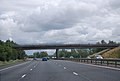 Bridge over the M40 near Merton - geograph.org.uk - 2687454.jpg 640 × 430; 44 KB
-
 Field by Merton Road - geograph.org.uk - 4871885.jpg 2,048 × 1,536; 1.48 MB
-
 Field by Merton Road - geograph.org.uk - 4872666.jpg 2,048 × 1,536; 1.48 MB
-
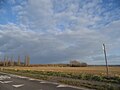
 Fields looking north - geograph.org.uk - 66779.jpg 640 × 480; 142 KB
-
 Footpath by Merton Grounds - geograph.org.uk - 2769832.jpg 640 × 480; 76 KB
-
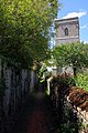 Footpath by the church - geograph.org.uk - 2492837.jpg 1,000 × 1,500; 289 KB
-
 Footpath crossing River Ray - geograph.org.uk - 2769817.jpg 640 × 480; 110 KB
-
 Footpath heading to Merton Grounds - geograph.org.uk - 2769828.jpg 640 × 480; 84 KB
-
 Houses on Merton Road - geograph.org.uk - 4872620.jpg 2,048 × 1,536; 1.53 MB
-
 Houses on Merton Road - geograph.org.uk - 4872624.jpg 2,016 × 1,492; 796 KB
-
 Langford Lane - geograph.org.uk - 2769837.jpg 640 × 480; 71 KB
-
 Langford Lane to Bicester - geograph.org.uk - 3506219.jpg 1,500 × 1,000; 152 KB
-
 Leaving Merton on Merton Road - geograph.org.uk - 4871881.jpg 2,048 × 1,536; 1.11 MB
-
 M40 at Merton Barrow Pit - geograph.org.uk - 4464366.jpg 4,196 × 2,033; 3.59 MB
-
 M40 motorway - Merton Road bridge - geograph.org.uk - 3021554.jpg 640 × 480; 54 KB
-

-
 M40 motorway crosses the River Ray - geograph.org.uk - 3021570.jpg 640 × 480; 62 KB
-
 M40 motorway west of Merton - geograph.org.uk - 3021562.jpg 640 × 480; 56 KB
-
 M40 near Merton - geograph.org.uk - 3181900.jpg 2,989 × 1,951; 3.71 MB
-
 M40 north of Merton Barrow Pit - geograph.org.uk - 3451123.jpg 3,463 × 2,656; 1.01 MB
-
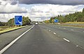
 M40 northbound near Merton - geograph.org.uk - 2900514.jpg 640 × 463; 53 KB
-
 M40 west of Merton - geograph.org.uk - 2830834.jpg 640 × 481; 32 KB
-
 M40, Minor Road Bridge near Merton - geograph.org.uk - 3610550.jpg 640 × 480; 232 KB
-
 M40, southbound - geograph.org.uk - 5648503.jpg 640 × 345; 37 KB
-
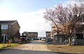 Manor Farm Close, Merton - geograph.org.uk - 4871869.jpg 2,014 × 1,314; 947 KB
-
 Merton Grounds farmhouse - geograph.org.uk - 387241.jpg 640 × 480; 74 KB
-
 Merton Road before Ambrosden - geograph.org.uk - 4872659.jpg 2,048 × 1,536; 807 KB
-
 Merton Road before Ambrosden - geograph.org.uk - 4872673.jpg 2,048 × 1,536; 1.49 MB
-
 Merton Road leaving Merton - geograph.org.uk - 4872640.jpg 2,048 × 1,536; 1.48 MB
-
 Merton Road, Merton - geograph.org.uk - 4872785.jpg 2,048 × 1,536; 1.51 MB
-
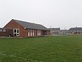 Merton village hall - geograph.org.uk - 387457.jpg 640 × 480; 62 KB
-
 Northbound M40 near Merton - geograph.org.uk - 3610556.jpg 640 × 480; 219 KB
-
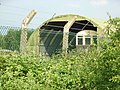 Railway shed - geograph.org.uk - 464214.jpg 640 × 480; 163 KB
-
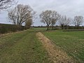
 Road to Home Farm - geograph.org.uk - 66782.jpg 640 × 480; 137 KB
-
 Sheep and Lambs - geograph.org.uk - 351940.jpg 640 × 479; 198 KB
-
 Sheep at Merton Grounds farm - geograph.org.uk - 379398.jpg 640 × 480; 175 KB
-
 The entrance to Manor House Nursing Home, Merton - geograph.org.uk - 4872753.jpg 2,038 × 1,522; 800 KB
-
 The gate into Merton Wood - geograph.org.uk - 4365682.jpg 1,500 × 999; 216 KB
-
 The M40 heading southbound - geograph.org.uk - 4977188.jpg 1,500 × 1,125; 111 KB
-
 The M40 heading southbound - geograph.org.uk - 4977192.jpg 1,500 × 1,125; 105 KB
-
 The Plough, Merton - geograph.org.uk - 387290.jpg 640 × 480; 69 KB
-
 The road to Ambrosden - geograph.org.uk - 4365680.jpg 1,500 × 999; 157 KB
-
 The road to Charlton-on-Otmoor - geograph.org.uk - 4365689.jpg 1,500 × 999; 94 KB
-
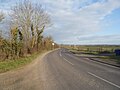
 The road to Merton - geograph.org.uk - 3506221.jpg 1,500 × 1,000; 187 KB
-
 The road to Merton - geograph.org.uk - 4365678.jpg 1,500 × 999; 162 KB
-
 Total reconstruction in Merton - geograph.org.uk - 4871870.jpg 2,048 × 1,536; 1.44 MB
-
 Trees and sheep by Merton Road - geograph.org.uk - 4872641.jpg 1,934 × 1,370; 799 KB
-
 Barn and level crossing - geograph.org.uk - 352768.jpg 640 × 480; 210 KB
-
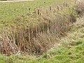 Bullrushes by Field Road - geograph.org.uk - 386700.jpg 640 × 479; 160 KB
-
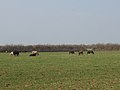 Cattle at Murcott - geograph.org.uk - 386667.jpg 640 × 479; 62 KB
-
 Corner Farm, Fencott - geograph.org.uk - 180768.jpg 640 × 479; 86 KB
-
 Cottage in Fencott - geograph.org.uk - 180765.jpg 640 × 480; 102 KB
-
 Drainage ditch by Langford Lane - geograph.org.uk - 379390.jpg 640 × 480; 184 KB
-
 Drainage stream - geograph.org.uk - 387461.jpg 480 × 640; 246 KB
-
 Field of broad beans, Murcott - geograph.org.uk - 384523.jpg 640 × 480; 226 KB
-
 Field Road bridge over the M40 - geograph.org.uk - 386669.jpg 640 × 480; 212 KB
-
 Field, hedge and footbridge - geograph.org.uk - 379368.jpg 640 × 480; 232 KB
-
 Footpath maintained through new crops. - geograph.org.uk - 352775.jpg 640 × 480; 202 KB
-
 Footpath through field of rape, Murcott - geograph.org.uk - 179261.jpg 640 × 480; 113 KB
-
 Footpath with post to show route - geograph.org.uk - 387458.jpg 480 × 640; 200 KB
-
 Gas pipeline marker - geograph.org.uk - 387249.jpg 480 × 640; 327 KB
-
-
-
 Grass edge to wheat field, Murcott - geograph.org.uk - 180787.jpg 640 × 480; 108 KB
-
 Growing wheat near Fencott - geograph.org.uk - 179246.jpg 480 × 640; 92 KB
-
 House in Merton - geograph.org.uk - 387270.jpg 640 × 480; 88 KB
-
 Ivy Farm, Fencott - geograph.org.uk - 179235.jpg 640 × 481; 78 KB
-
 Lake by Merton Grounds - geograph.org.uk - 387236.jpg 640 × 480; 140 KB
-
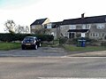
 Modern houses in Merton - geograph.org.uk - 387456.jpg 640 × 480; 76 KB
-
 Nursing home, Merton - geograph.org.uk - 387264.jpg 640 × 479; 152 KB
-
 Pasture by Field Road, Murcott - geograph.org.uk - 384516.jpg 640 × 480; 192 KB
-
 Pasture near Murcott - geograph.org.uk - 386688.jpg 640 × 480; 188 KB
-
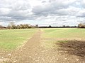
 Road looking east - geograph.org.uk - 66780.jpg 640 × 480; 138 KB
-
 Road looking north-east - geograph.org.uk - 66781.jpg 640 × 480; 105 KB
-
 Standing water in wheat field - geograph.org.uk - 352763.jpg 640 × 480; 180 KB
-
 Stile in hedge with oak tree - geograph.org.uk - 387459.jpg 640 × 480; 90 KB
-
 Thatched cottage in Murcott - geograph.org.uk - 180794.jpg 640 × 480; 98 KB
-

-
 View west towards Upper Arncott Hill - geograph.org.uk - 66784.jpg 640 × 480; 126 KB
-
 Wet pasture - geograph.org.uk - 352746.jpg 640 × 480; 191 KB
-
 Wheat field - geograph.org.uk - 352758.jpg 640 × 480; 167 KB
-
 Wheat field and track, Murcott - geograph.org.uk - 386685.jpg 640 × 480; 195 KB


