Category:Melbury Abbas
Jump to navigation
Jump to search
English: Melbury Abbas is a village in north Dorset, England, situated between Shaftesbury and Blandford Forum on Cranborne Chase. The village has a population of 301 (2001), 34.4% are retired. 6.1% of dwellings are second homes.
village in the United Kingdom  | |||||
| Upload media | |||||
| Instance of | |||||
|---|---|---|---|---|---|
| Location | North Dorset, Dorset, South West England, England | ||||
| Said to be the same as | Melbury Abbas (Wikimedia duplicated page, civil parish) | ||||
 | |||||
Subcategories
This category has only the following subcategory.
T
Media in category "Melbury Abbas"
The following 113 files are in this category, out of 113 total.
-

-

-

-

-
 Across Spread Eagle Hill to Compton Down - geograph.org.uk - 5433061.jpg 1,728 × 1,152; 1.24 MB
-

-
 Approaching Possessions Corner near Compton Abbas Airfield - geograph.org.uk - 5433076.jpg 1,728 × 1,152; 1.14 MB
-
 Ashmore Down - geograph.org.uk - 3314427.jpg 1,200 × 794; 698 KB
-

-
 Carpet of leaves in Melbury Wood - geograph.org.uk - 620423.jpg 430 × 640; 233 KB
-

-

-

-
 Cottage at West Melbury - geograph.org.uk - 420563.jpg 640 × 480; 168 KB
-
 Countrymans Day, Melbury Abbas - geograph.org.uk - 1407932.jpg 640 × 480; 133 KB
-
 Countryside near Redhills Farm - geograph.org.uk - 1297704.jpg 640 × 480; 71 KB
-
 Countryside near Whitings farm - geograph.org.uk - 1297702.jpg 640 × 456; 78 KB
-
 Cross Dyke on Melbury Hill - geograph.org.uk - 4480613.jpg 640 × 480; 56 KB
-
 Dead Morris Minor Van, Melbury Abbas - geograph.org.uk - 2689269.jpg 640 × 480; 123 KB
-
 Dukum Hollow from Melbury Hill - geograph.org.uk - 5433082.jpg 640 × 427; 96 KB
-
 East Melbury, postbox No. SP7 57 - geograph.org.uk - 1508544.jpg 640 × 480; 98 KB
-
 Farmland near Compton Abbas - geograph.org.uk - 1919376.jpg 640 × 441; 95 KB
-
 Footpath, Cann - geograph.org.uk - 1968356.jpg 640 × 481; 156 KB
-

-
 Gravestones, St Thomas's Churchyard - geograph.org.uk - 2689242.jpg 640 × 480; 72 KB
-
 Just a touch of colour in Melbury Wood - geograph.org.uk - 620418.jpg 430 × 640; 227 KB
-
 Looking down on Melbury Abbas - geograph.org.uk - 517758.jpg 640 × 418; 59 KB
-
 Melbury Abbas - geograph.org.uk - 2362987.jpg 640 × 433; 61 KB
-
 Melbury Abbas from a hill to the east - geograph.org.uk - 5433065.jpg 1,728 × 1,152; 1.32 MB
-
 Melbury Abbas from Melbury Hill - geograph.org.uk - 5433087.jpg 640 × 427; 77 KB
-

-

-

-
 Melbury Abbas, chevron on Zig-Zag Hill - geograph.org.uk - 2127035.jpg 480 × 640; 181 KB
-

-

-

-

-

-

-

-
-
 Melbury Abbas, postbox No. SP7 39 - geograph.org.uk - 1509667.jpg 480 × 640; 108 KB
-
 Melbury Abbas, sheep grazing - geograph.org.uk - 3388782.jpg 1,600 × 1,200; 318 KB
-

-

-
 Melbury Abbas, three deer at Incombe - geograph.org.uk - 1153215.jpg 640 × 480; 77 KB
-

-
 Melbury Hill - geograph.org.uk - 5433083.jpg 640 × 427; 81 KB
-
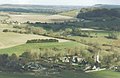
 Melbury Hill, aerial 2017 - geograph.org.uk - 5439129.jpg 800 × 490; 78 KB
-
 Melbury Wood and chalky down-land - geograph.org.uk - 5433070.jpg 1,728 × 1,152; 1.3 MB
-
 Moto Cross Track near Guy's Marsh - geograph.org.uk - 1297701.jpg 640 × 480; 99 KB
-

-
 Orchid on down above Melbury Wood - geograph.org.uk - 5433072.jpg 1,152 × 1,728; 1.32 MB
-
 Overgrown ox drove track - geograph.org.uk - 4565945.jpg 640 × 427; 86 KB
-
 Ox Drove leading to the B3081 at the top of Zig Zag Hill - geograph.org.uk - 5433078.jpg 1,728 × 1,152; 1.21 MB
-
 Path approaching corner of woodland - geograph.org.uk - 4565475.jpg 640 × 427; 97 KB
-
 Pock-marked tree in Melbury Wood - geograph.org.uk - 620189.jpg 430 × 640; 233 KB
-
 Red carpet of Melbury Wood - geograph.org.uk - 619979.jpg 640 × 430; 162 KB
-
 Red carpeted slopes of Melbury Wood - geograph.org.uk - 620402.jpg 640 × 430; 170 KB
-

-
 Road through Melbury Abbas - geograph.org.uk - 5432928.jpg 640 × 427; 55 KB
-
 Rush hour in Melbury Abbas - geograph.org.uk - 4583587.jpg 640 × 480; 137 KB
-
 Shaftesbury covered in snow - geograph.org.uk - 517759.jpg 640 × 429; 109 KB
-
 Sheep in a valley at Melbury Abbas - geograph.org.uk - 5433069.jpg 640 × 427; 64 KB
-
 Snow at Melbury Abbas - geograph.org.uk - 450637.jpg 640 × 425; 123 KB
-
 Stile, Cann - geograph.org.uk - 1968347.jpg 640 × 480; 206 KB
-
 The road through Cann Common - geograph.org.uk - 3056675.jpg 640 × 480; 83 KB
-

-
 Track in Melbury Wood - geograph.org.uk - 5433074.jpg 1,728 × 1,152; 1.15 MB
-
 Unnamed wood on Ox Drove - geograph.org.uk - 5433079.jpg 640 × 427; 81 KB
-
 View from ox drove track - geograph.org.uk - 4565477.jpg 640 × 427; 91 KB
-
 View on Charlton Down - geograph.org.uk - 4565946.jpg 640 × 427; 72 KB
-
 View over B3081 on Charlton Down - geograph.org.uk - 4565948.jpg 640 × 427; 86 KB
-

-

-

-

-

-

-
 Yew tree, St Thomas's Churchyard - geograph.org.uk - 2689205.jpg 480 × 640; 90 KB
-
 Bales and field near Matts Barn - geograph.org.uk - 311676.jpg 640 × 480; 65 KB
-

-
 Bull Pit Coppice - geograph.org.uk - 301259.jpg 480 × 640; 146 KB
-

-

-
-
 Corner of Ashmore Down - geograph.org.uk - 311719.jpg 640 × 480; 89 KB
-
 Descending Spreadeagle Hill - geograph.org.uk - 516561.jpg 640 × 480; 70 KB
-
 Hatts Barn - geograph.org.uk - 311316.jpg 640 × 480; 80 KB
-
 Hilltop Barns - geograph.org.uk - 301557.jpg 640 × 480; 134 KB
-
 Zig Zag Hill - geograph.org.uk - 893195.jpg 640 × 480; 128 KB
-
 Zigzagging valley - geograph.org.uk - 517749.jpg 640 × 419; 41 KB
-
 Melbury Abbas from Compton Down - geograph.org.uk - 358525.jpg 640 × 480; 126 KB
-
 Melbury Hill - geograph.org.uk - 558540.jpg 424 × 640; 87 KB
-
 Melbury Hill - viewed from the border - geograph.org.uk - 517756.jpg 640 × 418; 33 KB
-
 Melbury Hill from Zig Zag Hill - geograph.org.uk - 589504.jpg 640 × 430; 233 KB
-
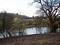 Mill Pond - geograph.org.uk - 369758.jpg 640 × 480; 133 KB
-
 Possessions Corner - geograph.org.uk - 311331.jpg 480 × 640; 77 KB
-
 Preston Wood - geograph.org.uk - 301257.jpg 640 × 480; 82 KB
-
 Road from Possessions Corner - geograph.org.uk - 311723.jpg 480 × 640; 94 KB
-
 Road past Hatts Barn - geograph.org.uk - 311693.jpg 480 × 640; 55 KB
-
 Signpost on Trail by Boyne's Lane - geograph.org.uk - 301247.jpg 480 × 640; 152 KB
-
 Stile by Boyne's Lane - geograph.org.uk - 301240.jpg 480 × 640; 109 KB
-
 The entrance to Bull Pit - geograph.org.uk - 301238.jpg 640 × 480; 187 KB
-

-
 The Pit in Bull Pit Coppice - geograph.org.uk - 301235.jpg 640 × 480; 160 KB
-
 Track by Bull Pit Coppice - geograph.org.uk - 301255.jpg 480 × 640; 109 KB
-

-
 View from Possessions Corner - geograph.org.uk - 311711.jpg 640 × 480; 85 KB
-
 View of Heth and Boyne's Coppice - geograph.org.uk - 301245.jpg 640 × 480; 60 KB
-
 View towards Common Bushes - geograph.org.uk - 301549.jpg 640 × 480; 97 KB
-
 View towards Great Peaky Coppice - geograph.org.uk - 301541.jpg 640 × 480; 89 KB


,_Woodfry%27s_Farm_-_geograph.org.uk_-_1408002.jpg)
_-_geograph.org.uk_-_5728559.jpg)
_-_geograph.org.uk_-_5728565.jpg)
_-_geograph.org.uk_-_5728575.jpg)
_-_geograph.org.uk_-_5728551.jpg)


_-_geograph.org.uk_-_455031.jpg)
_-_geograph.org.uk_-_455038.jpg)
_-_geograph.org.uk_-_527570.jpg)


