Category:Measham
Jump to navigation
Jump to search
English: Measham is a village in Leicestershire, near to the borders with Derbyshire, Staffordshire and Warwickshire (although historically within Derbyshire, until being surrendered to Leicestershire in 1897), located just off the A42 just south of Ashby-de-la-Zouch. It was originally a Saxon village but was granted a market in the 13th century and grew to be a local industrial hub during the Industrial Revolution. Its name means the homestead on the River Mease.
village in Leicestershire, England, United Kingdom  | |||||
| Upload media | |||||
| Instance of | |||||
|---|---|---|---|---|---|
| Location | North West Leicestershire, Leicestershire, East Midlands, England | ||||
| Said to be the same as | Measham (Wikimedia duplicated page, civil parish) | ||||
| official website | |||||
 | |||||
Subcategories
This category has the following 2 subcategories, out of 2 total.
M
- Measham railway station (2 F)
Media in category "Measham"
The following 186 files are in this category, out of 186 total.
-
 A place to watch the traffic - geograph.org.uk - 1753823.jpg 1,280 × 852; 313 KB
-
 A variety of pots - geograph.org.uk - 1755804.jpg 1,280 × 959; 277 KB
-
 A42 - footbridge north of Measham - geograph.org.uk - 2333950.jpg 640 × 480; 57 KB
-

-
 A42 bridge over Measham Road - geograph.org.uk - 6200957.jpg 800 × 600; 136 KB
-

-

-
 A42 north of Measham - geograph.org.uk - 2333955.jpg 640 × 480; 54 KB
-
 Adcocks Yard - geograph.org.uk - 1753853.jpg 959 × 1,280; 264 KB
-
 Along Tamworth Road towards Measham - geograph.org.uk - 928978.jpg 640 × 447; 69 KB
-
 Ashby Canal alignment - geograph.org.uk - 1753874.jpg 1,280 × 959; 292 KB
-
 Ashby Canal Mine Seam Marker - geograph.org.uk - 1753873.jpg 959 × 1,280; 512 KB
-
 Ashby Canal Mine Seam Marker - geograph.org.uk - 2308486.jpg 1,024 × 768; 189 KB
-
 Ashby Canal reclamation works - geograph.org.uk - 1753880.jpg 1,280 × 959; 360 KB
-
 Ashby Road - geograph.org.uk - 1753863.jpg 1,280 × 930; 239 KB
-
 Ashby Road near Measham - geograph.org.uk - 3032278.jpg 1,024 × 720; 102 KB
-
 Atherstone Road, Measham - geograph.org.uk - 6200966.jpg 800 × 526; 95 KB
-
 Autumn sun on the dismantled railway - geograph.org.uk - 286018.jpg 640 × 480; 146 KB
-
 Bend in Gallows Lane (B4416) - geograph.org.uk - 6200990.jpg 800 × 531; 128 KB
-
 Bird In Hand - geograph.org.uk - 1753849.jpg 1,280 × 959; 243 KB
-
 Bosworth Road - geograph.org.uk - 1753846.jpg 1,280 × 959; 188 KB
-

-
 Bosworth Road crossing Gallows Lane - geograph.org.uk - 6083979.jpg 3,776 × 2,520; 4.06 MB
-
 Bosworth Road entering Measham - geograph.org.uk - 2308525.jpg 1,024 × 768; 143 KB
-
 Bosworth Road entering Measham - geograph.org.uk - 6083809.jpg 3,776 × 2,520; 3.25 MB
-

-
 Bridge over the Gilwiskaw Brook - geograph.org.uk - 1753877.jpg 1,280 × 959; 423 KB
-
 Burton Road, Measham - geograph.org.uk - 6200959.jpg 800 × 600; 119 KB
-
 Celtic Sanctuary - geograph.org.uk - 1753875.jpg 1,280 × 959; 355 KB
-
 Cemetery lodge, Bosworth Road, Measham - geograph.org.uk - 6083807.jpg 3,776 × 2,520; 4.16 MB
-
 Chimney pots - geograph.org.uk - 1755806.jpg 1,280 × 959; 277 KB
-
 Covered reservoir with trig point - geograph.org.uk - 2713803.jpg 1,500 × 1,015; 1.64 MB
-
 Crossroads near Measham - geograph.org.uk - 2308492.jpg 1,024 × 768; 142 KB
-
 Cycle Route 63 and the Ivanhoe Way beneath Meer Bridge - geograph.org.uk - 6083388.jpg 3,776 × 2,520; 3.21 MB
-
 Disused industrial site - geograph.org.uk - 3482436.jpg 1,600 × 1,069; 482 KB
-
 Drive to Measham Fields Farm - geograph.org.uk - 3482437.jpg 1,600 × 1,068; 669 KB
-
 Earthworks near Measham - geograph.org.uk - 1753876.jpg 1,280 × 959; 311 KB
-
 Elizabeth II postbox on Atherstone Road, Measham - geograph.org.uk - 6205762.jpg 2,535 × 4,293; 3.4 MB
-
 Entrance to Champney's - geograph.org.uk - 3482442.jpg 1,600 × 1,068; 328 KB
-
 Entrance to Green Lane - geograph.org.uk - 1753826.jpg 1,280 × 959; 386 KB
-
 Farm building in an arable field - geograph.org.uk - 3482792.jpg 1,600 × 1,069; 562 KB
-
 Farmland off Gallows Lane (B4416) - geograph.org.uk - 6200988.jpg 800 × 600; 138 KB
-
 Field boundary north of Measham Hall - geograph.org.uk - 3499245.jpg 2,525 × 1,966; 1.55 MB
-

-
 Field near Measham - geograph.org.uk - 1753866.jpg 1,280 × 959; 245 KB
-
 Fields of Swepstone Road (B4116) - geograph.org.uk - 6201001.jpg 800 × 538; 137 KB
-
 Fireplace showrooms - geograph.org.uk - 1753839.jpg 1,280 × 959; 227 KB
-
 Fishtastic at Pot Kiln - geograph.org.uk - 2275340.jpg 4,388 × 2,871; 6.42 MB
-
 Footbridge over A42 near Oakthorpe - geograph.org.uk - 3195580.jpg 1,024 × 768; 547 KB
-
 Footbridge over the A42 near Junction 12 - geograph.org.uk - 4342517.jpg 1,600 × 1,200; 1.01 MB
-
 Footpath from Packington - geograph.org.uk - 1753835.jpg 1,280 × 959; 435 KB
-
 Footpath into Measham - geograph.org.uk - 3810336.jpg 1,200 × 1,600; 572 KB
-
 Footpath to Normanton - geograph.org.uk - 1753821.jpg 1,280 × 959; 341 KB
-
 Footpath towards Measham - geograph.org.uk - 3811243.jpg 1,200 × 1,600; 579 KB
-
 Footpath up to the old railway bridge - geograph.org.uk - 3810360.jpg 1,600 × 1,068; 619 KB
-
 Former railway alignment - geograph.org.uk - 1755789.jpg 1,280 × 959; 299 KB
-
 Former shops on Bosworth Road - geograph.org.uk - 1753848.jpg 1,280 × 959; 194 KB
-
 Gallows Lane (B4416) - geograph.org.uk - 6200996.jpg 800 × 600; 94 KB
-
 Gallows Lane - geograph.org.uk - 1753822.jpg 1,280 × 959; 413 KB
-
 Gallows Lane junction - geograph.org.uk - 1753869.jpg 1,280 × 959; 274 KB
-
 Gallows Lane near Measham - geograph.org.uk - 931340.jpg 640 × 376; 64 KB
-
 Gardens by the Measham Museum with Goods Sheds beyond - geograph.org.uk - 3810529.jpg 1,600 × 1,069; 398 KB
-

-
 Gateway to Green Lane - geograph.org.uk - 1753864.jpg 1,280 × 959; 255 KB
-
 Gilwiskaw Brook - geograph.org.uk - 1753878.jpg 1,280 × 959; 425 KB
-
 Grazing lowland sheep - geograph.org.uk - 2308501.jpg 1,024 × 768; 187 KB
-
 Green Lane - geograph.org.uk - 1753867.jpg 1,280 × 959; 293 KB
-
 Green Lane, Measham - geograph.org.uk - 1753830.jpg 1,280 × 959; 465 KB
-
 High Street Measham - geograph.org.uk - 3810983.jpg 1,600 × 1,068; 351 KB
-
 High Street, Measham - geograph.org.uk - 1753843.jpg 1,280 × 959; 251 KB
-
 High Street, Measham - geograph.org.uk - 6083393.jpg 3,776 × 2,520; 4 MB
-
 High Street, Measham - geograph.org.uk - 6200963.jpg 800 × 600; 101 KB
-
 Highfield Cottages - geograph.org.uk - 1753861.jpg 1,280 × 959; 192 KB
-
 Houses on Atherstone Road, Measham - geograph.org.uk - 6200965.jpg 800 × 496; 70 KB
-
 Houses on Burton Road, Measham - geograph.org.uk - 6200958.jpg 800 × 520; 112 KB
-
 Houses on Leicester Road - geograph.org.uk - 1753833.jpg 1,280 × 959; 276 KB
-
 Houses on Measham Road - geograph.org.uk - 6200953.jpg 640 × 404; 77 KB
-
 It doesn't quite mean what it says - geograph.org.uk - 1753865.jpg 1,280 × 959; 352 KB
-
 Ivanhoe Way - geograph.org.uk - 297200.jpg 640 × 480; 126 KB
-
 Ivanhoe Way along the course of a dismantled Railway - geograph.org.uk - 3810367.jpg 1,200 × 1,600; 527 KB
-
 Ivanhoe Way squeezes past the brickworks - geograph.org.uk - 3810515.jpg 1,200 × 1,600; 681 KB
-
 Ivanhoe Way turns off Atherstone Road - geograph.org.uk - 3810518.jpg 1,600 × 1,068; 625 KB
-
 Junction on Swepstone Road - geograph.org.uk - 6201004.jpg 800 × 600; 122 KB
-
 Leicester Road - geograph.org.uk - 1753836.jpg 1,280 × 959; 182 KB
-
 Leicester Road - geograph.org.uk - 1753837.jpg 1,280 × 959; 214 KB
-
 Measham Bird In Hand - geograph.org.uk - 2978674.jpg 640 × 480; 173 KB
-
 Measham brickworks - geograph.org.uk - 1755795.jpg 1,280 × 940; 327 KB
-
 Measham brickworks - geograph.org.uk - 1755800.jpg 1,280 × 959; 220 KB
-
 Measham brickworks - geograph.org.uk - 1755810.jpg 1,280 × 959; 227 KB
-
 Measham brickworks - geograph.org.uk - 1755811.jpg 1,280 × 959; 285 KB
-
 Measham Brickyard Cottages.jpg 2,048 × 1,536; 413 KB
-
 Measham Cemetery, Bosworth Road, Measham - geograph.org.uk - 6083402.jpg 3,776 × 2,520; 4.14 MB
-
 Measham Church Hall - geograph.org.uk - 1753856.jpg 1,280 × 959; 259 KB
-
 Measham Fields Farm - geograph.org.uk - 2308519.jpg 1,024 × 768; 175 KB
-
 Measham Firs - geograph.org.uk - 1753832.jpg 1,280 × 959; 268 KB
-
 Measham Garden of Remembrance - geograph.org.uk - 6083399.jpg 3,776 × 2,520; 4.28 MB
-
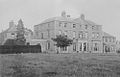 Measham Hall.jpg 500 × 320; 82 KB
-
 Measham High Street - geograph.org.uk - 929010.jpg 640 × 455; 66 KB
-
 Measham houses across the wasteland - geograph.org.uk - 3810374.jpg 1,600 × 1,067; 427 KB
-
 Measham Library - geograph.org.uk - 3810525.jpg 1,600 × 1,068; 487 KB
-
 Measham Lodge - geograph.org.uk - 6200992.jpg 800 × 548; 74 KB
-
 Measham Museum - geograph.org.uk - 2064586.jpg 640 × 360; 70 KB
-
 Measham Museum - geograph.org.uk - 3810526.jpg 1,600 × 1,068; 405 KB
-
 Measham Post Office - geograph.org.uk - 1753854.jpg 1,280 × 959; 239 KB
-
 Measham Post Office post box, Ref DE12 1150 - geograph.org.uk - 1753855.jpg 948 × 1,280; 229 KB
-
 Measham Road - geograph.org.uk - 1469823.jpg 640 × 480; 131 KB
-
 Measham station, remains 2002 - geograph.org.uk - 5365145.jpg 2,380 × 1,563; 2.27 MB
-
 Measham Sundial - Steve Field.jpg 789 × 1,184; 102 KB
-
 Measham town sign - geograph.org.uk - 1753825.jpg 1,280 × 959; 332 KB
-
 Measham traffic lights - geograph.org.uk - 3032274.jpg 1,024 × 768; 96 KB
-
 Measham, cattle grazing - geograph.org.uk - 3172028.jpg 1,024 × 768; 336 KB
-
 Measham, temperance hall - geograph.org.uk - 3172037.jpg 1,024 × 756; 150 KB
-
 Methodist Church, Bosworth Road - geograph.org.uk - 1753847.jpg 1,280 × 959; 171 KB
-
 Minorca open cast mine, Leicestershire.JPG 2,816 × 2,112; 2.85 MB
-
 New drainage along the field edge - geograph.org.uk - 3482687.jpg 1,600 × 1,068; 539 KB
-
 New Street - geograph.org.uk - 1753862.jpg 938 × 1,280; 191 KB
-
 New Street in Measham - geograph.org.uk - 797763.jpg 640 × 474; 80 KB
-
 New Street towards Measham - geograph.org.uk - 797743.jpg 640 × 428; 57 KB
-
 North West Leicestershire , The A42 - geograph.org.uk - 5951604.jpg 6,000 × 4,000; 7.56 MB
-
 North West Leicestershire , The A42 - geograph.org.uk - 5951606.jpg 6,000 × 4,000; 7.17 MB
-
 North West Leicestershire , The A42 - geograph.org.uk - 5951607.jpg 6,000 × 4,000; 7.58 MB
-
 Nos.101-105 High Street - geograph.org.uk - 1753858.jpg 800 × 800; 223 KB
-
 Old railway alignment - geograph.org.uk - 1755815.jpg 1,280 × 959; 329 KB
-
 Old Railway Trackbed - geograph.org.uk - 342244.jpg 640 × 480; 47 KB
-
 Old Railway Trackbed nr Measham - geograph.org.uk - 342248.jpg 640 × 480; 40 KB
-
 Path through the spinney - geograph.org.uk - 3482461.jpg 1,600 × 1,068; 536 KB
-
 Path to Measham - geograph.org.uk - 1753868.jpg 1,280 × 959; 384 KB
-
 Pickering's Junction - geograph.org.uk - 1753860.jpg 1,280 × 959; 229 KB
-
 Pines by the Packington Path - geograph.org.uk - 3482698.jpg 1,200 × 1,600; 521 KB
-
 Posts by the path - geograph.org.uk - 3810345.jpg 1,600 × 1,068; 629 KB
-
 Queen's Street - geograph.org.uk - 1753841.jpg 1,280 × 969; 173 KB
-
 Red ploughed field - geograph.org.uk - 2308512.jpg 1,024 × 768; 146 KB
-
 Red ploughed field - geograph.org.uk - 2308522.jpg 1,024 × 768; 186 KB
-
 River Mease a bit fuller than usual - geograph.org.uk - 3810326.jpg 1,600 × 1,068; 641 KB
-
 Road bridge crossing the A42 near Measham - geograph.org.uk - 3032270.jpg 1,024 × 768; 87 KB
-
 Rosebank Garden - geograph.org.uk - 1753859.jpg 1,280 × 959; 421 KB
-
 Shops on High Street - geograph.org.uk - 1753838.jpg 1,280 × 959; 202 KB
-
 Shops on High Street - geograph.org.uk - 1753845.jpg 1,280 × 959; 304 KB
-
 Site of aqueduct - geograph.org.uk - 1753870.jpg 1,280 × 959; 402 KB
-
 Site of Ilott Wharf - geograph.org.uk - 1753872.jpg 1,280 × 959; 368 KB
-
-
 Stanhope House on Swepstone Road - geograph.org.uk - 3499236.jpg 2,864 × 2,071; 2.03 MB
-
 Stream by Gallows Lane - geograph.org.uk - 3811277.jpg 1,600 × 1,067; 651 KB
-
 Stream crosses Gallows Lane - geograph.org.uk - 3811269.jpg 1,600 × 1,068; 358 KB
-
 Supermarket on High Street - geograph.org.uk - 1753851.jpg 1,280 × 959; 197 KB
-
 The A42 south - geograph.org.uk - 810919.jpg 640 × 367; 54 KB
-
 The bridge to DFS - geograph.org.uk - 3810339.jpg 1,200 × 1,600; 710 KB
-
 The Dairy Farm - geograph.org.uk - 1753840.jpg 1,280 × 959; 232 KB
-
 The old fire bell - geograph.org.uk - 1753844.jpg 1,280 × 959; 441 KB
-
 The old Temperance Hall - geograph.org.uk - 1753852.jpg 1,280 × 959; 233 KB
-
 The White Hart - geograph.org.uk - 1753850.jpg 1,280 × 959; 212 KB
-
 The White Swan and Nos.101-105 High Street - geograph.org.uk - 1753857.jpg 1,280 × 959; 185 KB
-
 Tractor and fields north of Measham Hall - geograph.org.uk - 3499290.jpg 3,300 × 2,315; 2.23 MB
-
 View from the old canal - geograph.org.uk - 1753871.jpg 1,280 × 959; 243 KB
-
 Willesley Reservoir - geograph.org.uk - 1500825.jpg 640 × 480; 132 KB
-
 Wooded slope - geograph.org.uk - 3482424.jpg 1,600 × 1,070; 595 KB
-

-
 Young arable field by Meashem House Farm - geograph.org.uk - 3482427.jpg 1,600 × 1,067; 611 KB
-
 A42 at Willesley Wood - geograph.org.uk - 1500816.jpg 640 × 480; 98 KB
-
 Arable land and pond near Lowlands Farm - geograph.org.uk - 1500665.jpg 640 × 480; 135 KB
-
 Bosworth Road - geograph.org.uk - 342236.jpg 640 × 480; 39 KB
-
 Bosworth Road junction - geograph.org.uk - 342234.jpg 640 × 480; 40 KB
-
 Bridge over the A42 - geograph.org.uk - 1500837.jpg 640 × 480; 135 KB
-
 Built to last - geograph.org.uk - 421066.jpg 640 × 480; 173 KB
-
 Do the splits - geograph.org.uk - 421143.jpg 640 × 480; 139 KB
-
 Zebra crossing on the High Street - geograph.org.uk - 929019.jpg 640 × 480; 69 KB
-
 Farm machinery next to the A42 - geograph.org.uk - 745178.jpg 640 × 363; 50 KB
-
 Flyover in the Trees - geograph.org.uk - 186807.jpg 640 × 480; 84 KB
-
 Foggy - geograph.org.uk - 296592.jpg 640 × 480; 50 KB
-
 Footpath and road side by side - geograph.org.uk - 387808.jpg 640 × 480; 82 KB
-
 Get fit^ - geograph.org.uk - 386444.jpg 640 × 480; 95 KB
-
 Gone but not forgotten - geograph.org.uk - 421090.jpg 640 × 480; 131 KB
-
 High Street, Measham - geograph.org.uk - 184386.jpg 640 × 480; 64 KB
-
 Long Drive - geograph.org.uk - 286023.jpg 640 × 480; 104 KB
-
 Obviously - geograph.org.uk - 421152.jpg 640 × 480; 136 KB
-
 Off track - geograph.org.uk - 386462.jpg 640 × 480; 152 KB
-
 Open all hours - geograph.org.uk - 421075.jpg 640 × 480; 159 KB
-
 Standing to attention - geograph.org.uk - 296740.jpg 640 × 480; 98 KB
-
 Towards Snarestone - geograph.org.uk - 342240.jpg 640 × 480; 47 KB
-
 Tractor work - geograph.org.uk - 387804.jpg 640 × 480; 84 KB
-
 Trig Point in a Reservoir - geograph.org.uk - 186819.jpg 640 × 480; 98 KB
-
 Trunk Call - geograph.org.uk - 296745.jpg 640 × 480; 148 KB
-
 Underneath the arches - geograph.org.uk - 421111.jpg 640 × 480; 115 KB
-
 Up on high - geograph.org.uk - 421100.jpg 640 × 480; 103 KB
-
 What's the point^ - geograph.org.uk - 421117.jpg 640 × 480; 122 KB
-
 You've been framed - geograph.org.uk - 421163.jpg 640 × 480; 154 KB


_-_geograph.org.uk_-_6200990.jpg)


_-_geograph.org.uk_-_6200988.jpg)

_-_geograph.org.uk_-_6200987.jpg)

_-_geograph.org.uk_-_6201001.jpg)


_-_geograph.org.uk_-_6200996.jpg)


_-_geograph.org.uk_-_6200999.jpg)


