Category:May 2017 in York
Jump to navigation
Jump to search
Deutsch: Bilder, die im Mai 2017 in York aufgenommen worden sind. Bitte beachten Sie, dass dies weder das Datum des Uploads noch das Datum des Scannens eines Fotos ist.
English: Images/pictures taken in York during May 2017. Note this is not the date of the upload, nor the date a photo was scanned.
Español: Fotografías o imágenes tomadas en York durante mayo 2017. No es la fecha de subida ni escaneo, sino la fecha en que las fotografías o imágenes se crearon.
Esperanto: Bildoj faritaj en York en majo 2017. Tio ne estas la dato, kiam la bildoj estis alŝutitaj aŭ skanitaj.
Français : Photographies ou images prises en York durant mai 2017. Ce n'est pas la date du téléchargement ou du scan.
Galego: Fotografías ou imaxes tomadas en York durante maio 2017. Non é a data de subida nin escaneamento, senón a data na que se crearon as fotografías ou imaxes.
Italiano: Fotografie o immagini scattate a York nel maggio 2017. Nota bene: la data non si riferisce né a quella di upload né a quella in cui la foto è stata digitalizzata.
Norsk bokmål: Bilder tatt i York i løpet av mai 2017. Merk at dette ikke er datoen for opplasting, eller når et bilde har blitt skannet.
Norsk nynorsk: Bilete teke i York i løpet av mai 2017. Merk at dette ikkje er datoen for opplasting, eller når eit bilete har vorte skanna.
Русский: Изображения, сделанные в York в течение май 2017 (не дата загрузки изображения).
Українська: Зображення, зроблені в York протягом травень 2017. Зауважте, що це не дата завантаження чи дата сканування фотографії.
| May 2016 | ← | May 2017 | → | May 2018 | |||||||
| Jan | Feb | Mar | Apr | May | Jun | Jul | Aug | Sep | Oct | Nov | Dec |
| 97 | 67 | 183 | 158 | 99 | 93 | 242 | 156 | 52 | 200 | 65 | 151 |
|---|---|---|---|---|---|---|---|---|---|---|---|
Media in category "May 2017 in York"
The following 99 files are in this category, out of 99 total.
-
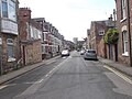
 Abbot Street - Penley's Grove Street - geograph.org.uk - 5402287.jpg 640 × 480; 77 KB
-
 Agar Street - Monkgate - geograph.org.uk - 5402214.jpg 640 × 480; 77 KB
-
 Allotments - Sixth Avenue - geograph.org.uk - 5402755.jpg 640 × 480; 86 KB
-

-
 Association of Voluntary Guides to the City Of York (34473220060).jpg 2,448 × 2,448; 2.31 MB
-
 Balloons over the clock tower - geograph.org.uk - 5464773.jpg 675 × 1,200; 424 KB
-
 Barconventdome.jpg 3,425 × 2,283; 4.84 MB
-
 Bowes Avenue - Fifth Avenue - geograph.org.uk - 5402971.jpg 640 × 480; 73 KB
-
 Bowling Green - Glen Gardens - East Parade (geograph 5402720).jpg 640 × 480; 75 KB
-
 Bowling Green Lane - Lowther Lane - geograph.org.uk - 5402348.jpg 640 × 465; 64 KB
-
 Bowling Pavilion - Glen Gardens - East Parade (geograph 5402721).jpg 640 × 480; 81 KB
-
 Bracken Road - Middlethorpe Grove - geograph.org.uk - 5411268.jpg 640 × 480; 93 KB
-
 Brownlow Street - Park Grove - geograph.org.uk - 5402304.jpg 640 × 480; 70 KB
-
 Bull Lane - East Parade - geograph.org.uk - 5402718.jpg 640 × 480; 83 KB
-
 Carter Avenue - Fifth Avenue - geograph.org.uk - 5402963.jpg 640 × 480; 76 KB
-
 Carter Avenue - Fourth Avenue - geograph.org.uk - 5402764.jpg 640 × 480; 70 KB
-
 Chemistry Hub is gone - geograph.org.uk - 5413550.jpg 640 × 427; 275 KB
-
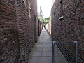
 Cloisters Walk - Jewbury - geograph.org.uk - 5402205.jpg 640 × 480; 99 KB
-
 Cosmo Avenue - Starkey Crescent - geograph.org.uk - 5402807.jpg 640 × 480; 81 KB
-
 Dalguise Grove - Heworth Green - geograph.org.uk - 5402362.jpg 640 × 480; 96 KB
-
 Dringthorpe Road - Lycett Road - geograph.org.uk - 5411260.jpg 640 × 480; 67 KB
-
 Dringthorpe Road - Lycett Road - geograph.org.uk - 5411263.jpg 640 × 488; 65 KB
-
 Dudley Street - Brownlow Street - geograph.org.uk - 5402301.jpg 640 × 480; 71 KB
-
 Eastern Terrace - East Parade - geograph.org.uk - 5402719.jpg 640 × 480; 75 KB
-
 Eboracum Way - Heworth Green - geograph.org.uk - 5402359.jpg 640 × 480; 62 KB
-
 Eighth Avenue - Fifth Avenue - geograph.org.uk - 5402826.jpg 640 × 480; 111 KB
-
 Eldon Street - Neville Street - geograph.org.uk - 5402307.jpg 640 × 480; 77 KB
-
 Eldon Terrace - Warwick Street - geograph.org.uk - 5402340.jpg 640 × 480; 82 KB
-
 Electricity Substation - Bull Lane - geograph.org.uk - 5402746.jpg 640 × 480; 98 KB
-

-
 Emerald Street - Park Grove - geograph.org.uk - 5402342.jpg 640 × 458; 62 KB
-
 Faber Street - Hallfield Road - geograph.org.uk - 5402982.jpg 640 × 480; 84 KB
-
 Fern Street - Garden Street - geograph.org.uk - 5402225.jpg 640 × 480; 87 KB
-
 Fifth Avenue - Melrosegate - geograph.org.uk - 5402821.jpg 640 × 484; 69 KB
-
 Fifth Avenue -Melrosegate - geograph.org.uk - 5402822.jpg 640 × 480; 71 KB
-
 Flying Scotsman passing the National Railway Museum, York - geograph.org.uk - 5609115.jpg 5,184 × 2,920; 5.03 MB
-
 Footpath - Fifth Avenue - geograph.org.uk - 5402968.jpg 640 × 480; 111 KB
-
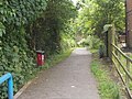 Footpath - Heworth Green - geograph.org.uk - 5402713.jpg 640 × 480; 114 KB
-
 Fourth Avenue - viewed from Sixth Avenue - geograph.org.uk - 5402759.jpg 640 × 480; 109 KB
-

-
 Garden Street - Groves Lane - geograph.org.uk - 5402223.jpg 640 × 458; 72 KB
-
 Grove Terrace Lane - Park Grove - geograph.org.uk - 5402343.jpg 640 × 480; 92 KB
-
 Groves Lane - Penley's Grove Street - geograph.org.uk - 5402219.jpg 640 × 480; 84 KB
-

-

-
 Hyrst Grove - Heworth Green - geograph.org.uk - 5402712.jpg 640 × 480; 89 KB
-
 Jackson Street - Lowther Street - geograph.org.uk - 5402297.jpg 640 × 480; 74 KB
-
 Jorvik Fishermen tableau 05 May 2017.jpg 2,800 × 1,537; 1.78 MB
-
 Jorvik frying pan 05 May 2017.jpg 2,448 × 3,264; 2.52 MB
-
 Jorvik underfloor 05 May 2107.jpg 3,264 × 1,840; 1.93 MB
-
 Jorvik Wilkom 05 May 2017.jpg 3,264 × 2,448; 3.27 MB
-
 Little Hallfield Road - Fifth Avenue - geograph.org.uk - 5402972.jpg 640 × 480; 66 KB
-

-
 Lock keeper's cottage, Elvington Lock - geograph.org.uk - 5411913.jpg 640 × 624; 458 KB
-
 Lockwood Street - Groves Lane - geograph.org.uk - 5402222.jpg 640 × 480; 88 KB
-
 Lowther Court - Lowther Lane - geograph.org.uk - 5402346.jpg 640 × 480; 58 KB
-

-

-
 Main Avenue - Bull Lane - geograph.org.uk - 5402749.jpg 640 × 447; 61 KB
-
 March Street - Penley's Grove Street - geograph.org.uk - 5402289.jpg 640 × 480; 91 KB
-
 Melrose Close - Fourth Avenue - geograph.org.uk - 5402802.jpg 640 × 461; 70 KB
-

-

-
 Milestone - Tadcaster Road (geograph 5411201).jpg 640 × 480; 117 KB
-
 Mill Lane - Heworth Green - geograph.org.uk - 5402714.jpg 640 × 480; 75 KB
-

-
 Monkbar Hotel - St Maurice Road - geograph.org.uk - 5402210.jpg 640 × 480; 83 KB
-

-

-
 Neville Street - Haxby Road - geograph.org.uk - 5402318.jpg 640 × 474; 75 KB
-
 New Travelodge at Layerthorpe, York - geograph.org.uk - 5609119.jpg 5,184 × 2,920; 4.72 MB
-
 Park and Ride buses at Grimston Bar car park - geograph.org.uk - 5412550.jpg 2,304 × 1,728; 1.14 MB
-
 Park Crescent - Bowling Green Lane - geograph.org.uk - 5402352.jpg 640 × 480; 77 KB
-
 Park Crescent - Huntington Road - geograph.org.uk - 5402354.jpg 640 × 480; 71 KB
-
 Park Grove - Huntington Road - geograph.org.uk - 5402363.jpg 640 × 480; 76 KB
-
 Penley's Grove Street - Monkgate - geograph.org.uk - 5402217.jpg 640 × 480; 77 KB
-
 Richmond Street - Hallfield Road - geograph.org.uk - 5402979.jpg 640 × 480; 58 KB
-
 River Foss - Heworth Green - geograph.org.uk - 5402356.jpg 640 × 480; 96 KB
-
 Seventh Avenue - Fifth Avenue - geograph.org.uk - 5402960.jpg 640 × 480; 73 KB
-
 Shell filling station by A12 northbound - geograph.org.uk - 5436102.jpg 1,600 × 1,200; 812 KB
-
 Sixth Avenue - Fifth Avenue - geograph.org.uk - 5402966.jpg 640 × 480; 74 KB
-

-
 St John Street - Garden Street - geograph.org.uk - 5402228.jpg 640 × 480; 88 KB
-
 St John's Walk - Heworth Green - geograph.org.uk - 5402711.jpg 640 × 480; 87 KB
-
 Stanley Street - Haxby Road - geograph.org.uk - 5402319.jpg 640 × 480; 70 KB
-

-
 Starkey Crescent - Fourth Avenue - geograph.org.uk - 5402805.jpg 640 × 480; 54 KB
-
 Starkey Crescent - Melrosegate - geograph.org.uk - 5402811.jpg 640 × 474; 59 KB
-
 Sutton Bridge, Elvington - geograph.org.uk - 5411886.jpg 640 × 508; 478 KB
-
 Teachers Close - Principal Rise - geograph.org.uk - 5411223.jpg 640 × 480; 70 KB
-

-
 Third Avenue - Bull Lane - geograph.org.uk - 5402752.jpg 640 × 480; 109 KB
-
 Walpole Street - Haxby Road - geograph.org.uk - 5402321.jpg 640 × 473; 66 KB
-
 Warwick Street - Walpole Street - geograph.org.uk - 5402310.jpg 640 × 480; 66 KB
-
 Whin Close - Whin Road - geograph.org.uk - 5411273.jpg 640 × 480; 80 KB
-
 Whin Garth - Whin Road - geograph.org.uk - 5411853.jpg 640 × 472; 61 KB
-
 Whin Road - Middlethorpe Grove - geograph.org.uk - 5411270.jpg 640 × 480; 66 KB
-
 Whin Road - Middlethorpe Grove - geograph.org.uk - 5411271.jpg 640 × 480; 59 KB
-
 York Art Gallery Grade 2 listed - geograph.org.uk - 5412483.jpg 2,304 × 1,728; 1.11 MB


.jpg)


.jpg)

.jpg)


.jpg)


