Category:May 2011 in Utah
Jump to navigation
Jump to search
English: Images/pictures taken in Utah during May 2011. Note this is not the date of the upload, nor the date a photo was scanned.
States of the United States: Alabama · Alaska · Arizona · Arkansas · California · Colorado · Connecticut · Delaware · Florida · Georgia · Hawaii · Idaho · Illinois · Indiana · Iowa · Kansas · Kentucky · Louisiana · Maine · Maryland · Massachusetts · Michigan · Minnesota · Mississippi · Missouri · Montana · Nebraska · Nevada · New Hampshire · New Jersey · New Mexico · New York · North Carolina · Ohio · Oregon · Pennsylvania · Rhode Island · South Carolina · South Dakota · Tennessee · Texas · Utah · Vermont · Virginia · Washington · West Virginia · Wisconsin · Wyoming – Washington, D.C.
Puerto Rico
Puerto Rico
| May 2010 | ← | May 2011 | → | May 2012 | |||||||||
| Jan | Feb | Mar | Apr | May | Jun | Jul | Aug | Sep | Oct | Nov | Dec | ||
| ← | 42 | 38 | 60 | 95 | 92 | 89 | 91 | 140 | 160 | 489 | 106 | 26 | → |
|---|---|---|---|---|---|---|---|---|---|---|---|---|---|
Media in category "May 2011 in Utah"
The following 91 files are in this category, out of 91 total.
-
 A Fremont Granary High in the Cliffs dyeclan.com - panoramio.jpg 3,088 × 2,056; 5.04 MB
-
 Air force SW8.jpg 3,000 × 1,875; 2.19 MB
-
 Boulder Mountain Overlook dyeclan.com - panoramio (1).jpg 3,088 × 2,056; 3.46 MB
-
 Boulder Mountain Overlook dyeclan.com - panoramio.jpg 3,088 × 2,056; 3.08 MB
-
 Bromus carinatus (B. marginatus) (6230608463).jpg 4,320 × 3,240; 2.87 MB
-
 Bromus carinatus (B. marginatus) (6230613243).jpg 3,240 × 4,320; 2.66 MB
-
 Bromus carinatus (B. marginatus) (6231128696).jpg 3,240 × 4,320; 2.71 MB
-
 Bromus carinatus (B. marginatus) (6244111914).jpg 4,320 × 3,240; 2.61 MB
-
 Bromus carinatus (B. marginatus) (6244112420).jpg 3,240 × 4,320; 2.6 MB
-
 Bromus tectorum (6230597815).jpg 4,320 × 3,240; 2.68 MB
-
 Bryce Canyon (5951686955).jpg 3,840 × 2,391; 4.68 MB
-
 Bryce Canyon (5952240736).jpg 3,840 × 2,391; 4.36 MB
-
 Bryce Canyon (5952242362).jpg 3,840 × 2,390; 4.96 MB
-
 Bryce Canyon (5952244438).jpg 3,840 × 2,391; 5 MB
-
 Bryce Canyon (5952245222).jpg 3,840 × 2,439; 4.44 MB
-
 Canyonlands The Maze Aerial.jpg 819 × 577; 557 KB
-
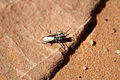 Cicindela albissima 2.jpg 4,272 × 2,848; 4.15 MB
-
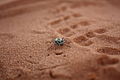 Cicindela albissima 3.jpg 4,272 × 2,848; 3.92 MB
-
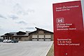 Corps completes first Gold-rated facility at Hill Air Force Base (5740333627).jpg 4,288 × 2,848; 4.54 MB
-
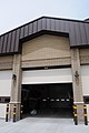 Corps completes first Gold-rated facility at Hill Air Force Base (5740885212).jpg 2,848 × 4,288; 4.6 MB
-
 Corps completes first Gold-rated facility at Hill Air Force Base (5740886054).jpg 4,288 × 2,848; 4.5 MB
-
 DancehallRock1.jpg 640 × 427; 73 KB
-
 Denver and Rio Grande Lime Kiln.jpeg 2,560 × 1,920; 1.1 MB
-
 Desert (5951682187).jpg 941 × 1,440; 1.14 MB
-
 Desert (5951682463).jpg 3,840 × 2,391; 4.34 MB
-
 Desert (5951683083).jpg 3,840 × 2,391; 4.1 MB
-
 Desert (5951683465).jpg 3,840 × 2,391; 4.2 MB
-
 Desert (5951683773).jpg 3,840 × 2,391; 4.35 MB
-
 Desert (5952236932).jpg 3,840 × 2,391; 3.58 MB
-
 Desert flora of the Moab, Utah area (15438142254).jpg 3,128 × 2,085; 3.25 MB
-
 Desert flora of the Moab, Utah area (15438352204).jpg 4,861 × 3,241; 7.84 MB
-
 Desert flora of the Moab, Utah area (15440798693).jpg 5,163 × 3,442; 16.47 MB
-
 Desert flora of the Moab, Utah area (15872966498).jpg 2,265 × 1,510; 2.17 MB
-
 Desert flora of the Moab, Utah area (15873164650).jpg 4,836 × 3,224; 8.91 MB
-
 Desert flora of the Moab, Utah area (15874338949).jpg 5,411 × 3,604; 7.56 MB
-
 Desert flora of the Moab, Utah area (15874678477).jpg 1,656 × 1,104; 1.5 MB
-
 Desert flora of the Moab, Utah area (16034877196).jpg 1,669 × 1,113; 1.13 MB
-
 Desert flora of the Moab, Utah area (16058467761).jpg 5,285 × 3,744; 11.02 MB
-
 Desert flora of the Moab, Utah area (16058499461).jpg 3,183 × 4,774; 8.87 MB
-
 Desert flora of the Moab, Utah area (16060416825).jpg 5,379 × 3,586; 9.3 MB
-
 Desert flora of the Moab, Utah area (16060426225).jpg 4,113 × 2,742; 5.12 MB
-
 Desert flora of the Moab, Utah area (16060449295).jpg 2,017 × 1,345; 1.58 MB
-
 Desert scenes driving W through Utah (15438162044).jpg 5,091 × 3,394; 19.78 MB
-
 Final Run 110506-F-EI321-161.jpg 3,000 × 1,651; 2.67 MB
-
 Final Run 110506-F-EI321-164.jpg 3,000 × 1,961; 2.95 MB
-
 Fisher Towers, near Moab (15440782373).jpg 5,278 × 3,519; 14.85 MB
-
 Foot Petroglyphs in Fremont Indian State Park dyeclan.com - panoramio.jpg 3,264 × 2,448; 7.5 MB
-
 Free College Pathology Student Sleeping Creative Commons (6961676525).jpg 5,616 × 3,744; 12.12 MB
-
 GooseneckMeandersUtahAerial1.jpg 3,757 × 2,803; 5.99 MB
-
 Handprints in 100 Hands Cave dyeclan.com - panoramio.jpg 3,264 × 2,448; 10.02 MB
-
 HITRRDancehall1.jpg 3,456 × 2,304; 1.32 MB
-
 Hunting Maps dyeclan.com - panoramio.jpg 2,056 × 3,088; 6.06 MB
-
 Landscape View, at Circleville, UT.jpg 5,184 × 3,456; 11.2 MB
-
 LDS stake center in West Valley City, Utah.jpg 2,272 × 1,704; 1.82 MB
-
 Lower Calf Creek Falls dyeclan.com - panoramio (1).jpg 2,552 × 2,108; 5.43 MB
-
 Lower Calf Creek Falls dyeclan.com - panoramio (10).jpg 3,264 × 2,448; 5.18 MB
-
 Lower Calf Creek Falls dyeclan.com - panoramio (2).jpg 2,448 × 3,264; 5.32 MB
-
 Lower Calf Creek Falls dyeclan.com - panoramio (3).jpg 3,088 × 2,056; 4.04 MB
-
 Lower Calf Creek Falls dyeclan.com - panoramio (8).jpg 2,056 × 3,088; 5.17 MB
-
 Lower Calf Creek Falls dyeclan.com - panoramio (9).jpg 2,056 × 3,088; 5.34 MB
-
 Lower Calf Creek Falls dyeclan.com - panoramio.jpg 2,448 × 3,264; 6.44 MB
-
 Lower Calf Creek Falls through the trees dyeclan.com - panoramio.jpg 2,448 × 3,264; 5.31 MB
-
 Manti Utah Temple from the street.jpg 3,648 × 2,736; 1.87 MB
-
 MMPpan.png 3,641 × 1,424; 7.43 MB
-
 Modern Petroglyphs dyeclan.com - panoramio (1).jpg 3,088 × 2,056; 5.3 MB
-
 Modern Petroglyphs dyeclan.com - panoramio.jpg 3,264 × 2,448; 7.5 MB
-
 Monument Valley road.jpg 3,840 × 2,391; 4.84 MB
-
 Mother's Day Park 4 (5701582042).jpg 3,744 × 5,616; 15.03 MB
-
 Nbrut1.jpg 640 × 427; 45 KB
-
 Needas - Flickr - brewbooks.jpg 1,718 × 925; 688 KB
-
 Newspaper Rock in Fremont Indian State Park dyeclan.com - panoramio (1).jpg 3,264 × 2,448; 7.99 MB
-
 Newspaper Rock in Fremont Indian State Park dyeclan.com - panoramio.jpg 3,264 × 2,448; 8.1 MB
-
 Off Road Jeep - Flickr - brewbooks.jpg 3,264 × 1,228; 1.8 MB
-
 Off Road Jeep window stickers - Flickr - brewbooks.jpg 2,973 × 2,095; 2.62 MB
-
 On US 128 near Moab, Utah (15874358579).jpg 5,616 × 3,744; 23.63 MB
-
 On US 128 near Moab, Utah (15874657607).jpg 3,792 × 2,528; 7.28 MB
-
 On US 128 near Moab, Utah (16060432615).jpg 4,782 × 3,188; 11.92 MB
-
 Orange Cliffs on the Way Back From Lower Calf Creek Falls dyeclan.com - panoramio.jpg 3,088 × 2,056; 3.93 MB
-
 Petroglyphs in Fremont Indian State Park dyeclan.com - panoramio.jpg 3,264 × 2,448; 8.87 MB
-
 Pictograph of Three Men dyeclan.com - panoramio.jpg 3,088 × 2,056; 5.56 MB
-
 Poa fendleriana (6243631985).jpg 4,320 × 3,240; 2.98 MB
-
 Shear Cliffs dyeclan.com - panoramio.jpg 3,088 × 1,712; 3.48 MB
-
 Sheep Petroglyph on Newspaper Rock dyeclan.com - panoramio.jpg 3,264 × 2,448; 9.27 MB
-
 SW8 cab interior.jpg 3,000 × 1,871; 2.88 MB
-
 The Beginnings of a Natural Bridge dyeclan.com - panoramio.jpg 3,088 × 2,056; 5.23 MB
-
 Tiger Beetle Trio (7783679746).jpg 4,272 × 2,848; 4.58 MB
-
 Tipi at Fremont Indian State Park dyeclan.com - panoramio.jpg 2,056 × 3,088; 4.9 MB
-
 Tithing Granary Huntington Utah.jpeg 2,560 × 1,920; 1.09 MB
-
 Trail Leading to the Falls dyeclan.com - panoramio.jpg 2,016 × 2,960; 5.91 MB
-
 Under Stormy Skies (10747790204).jpg 4,272 × 2,848; 2.94 MB
-
 UP833 (5705739286).jpg 1,296 × 976; 216 KB


.jpg)

_(6230608463).jpg)
_(6230613243).jpg)
_(6231128696).jpg)
_(6244111914).jpg)
_(6244112420).jpg)
.jpg)
.jpg)
.jpg)
.jpg)
.jpg)
.jpg)


.jpg)
.jpg)
.jpg)


.jpg)
.jpg)
.jpg)
.jpg)
.jpg)
.jpg)
.jpg)
.jpg)
.jpg)
.jpg)
.jpg)
.jpg)
.jpg)
.jpg)
.jpg)
.jpg)
.jpg)
.jpg)
.jpg)
.jpg)


.jpg)

.jpg)


.jpg)
.jpg)
.jpg)
.jpg)
.jpg)
.jpg)


.jpg)


.jpg)


.jpg)


.jpg)
.jpg)
.jpg)


.jpg)


.jpg)


.jpg)
.jpg)