Category:May 2009 in West Sussex
Jump to navigation
Jump to search
Deutsch: Bilder, die im Mai 2009 in West Sussex aufgenommen worden sind. Bitte beachten Sie, dass dies weder das Datum des Uploads noch das Datum des Scannens eines Fotos ist.
English: Images/pictures taken in West Sussex during May 2009. Note this is not the date of the upload, nor the date a photo was scanned.
Español: Fotografías o imágenes tomadas en West Sussex durante mayo 2009. No es la fecha de subida ni escaneo, sino la fecha en que las fotografías o imágenes se crearon.
Esperanto: Bildoj faritaj en West Sussex en majo 2009. Tio ne estas la dato, kiam la bildoj estis alŝutitaj aŭ skanitaj.
Français : Photographies ou images prises en West Sussex durant mai 2009. Ce n'est pas la date du téléchargement ou du scan.
Galego: Fotografías ou imaxes tomadas en West Sussex durante maio 2009. Non é a data de subida nin escaneamento, senón a data na que se crearon as fotografías ou imaxes.
Italiano: Fotografie o immagini scattate a West Sussex nel maggio 2009. Nota bene: la data non si riferisce né a quella di upload né a quella in cui la foto è stata digitalizzata.
Norsk bokmål: Bilder tatt i West Sussex i løpet av mai 2009. Merk at dette ikke er datoen for opplasting, eller når et bilde har blitt skannet.
Norsk nynorsk: Bilete teke i West Sussex i løpet av mai 2009. Merk at dette ikkje er datoen for opplasting, eller når eit bilete har vorte skanna.
Русский: Изображения, сделанные в West Sussex в течение май 2009 (не дата загрузки изображения).
Українська: Зображення, зроблені в West Sussex протягом травень 2009. Зауважте, що це не дата завантаження чи дата сканування фотографії.
| May 2008 | ← | May 2009 | → | May 2010 | |||||||
| Jan | Feb | Mar | Apr | May | Jun | Jul | Aug | Sep | Oct | Nov | Dec |
| 47 | 44 | 71 | 105 | 61 | 43 | 67 | 50 | 21 | 40 | 16 | 132 |
|---|---|---|---|---|---|---|---|---|---|---|---|
Subcategories
This category has only the following subcategory.
G
- Goodwood Breakfast Club May 2009 (18 F)
Media in category "May 2009 in West Sussex"
The following 60 files are in this category, out of 60 total.
-
 VirginTheBase01.jpg 2,816 × 2,112; 1.14 MB
-
 Cuckfield Baptist Chapel.jpg 2,048 × 1,100; 919 KB
-
 Former Providence Chapel, Cuckfield.jpg 1,500 × 1,750; 1,017 KB
-
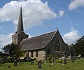 Holy Trinity Church, Cuckfield (IoE Code 302923).jpg 1,800 × 1,500; 998 KB
-
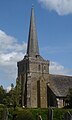 Holy Trinity Church, Cuckfield - Tower and Steeple.JPG 1,200 × 2,000; 249 KB
-
 Holy Trinity Church, Cuckfield - View across Churchyard.jpg 2,000 × 1,400; 1.04 MB
-
 All Saints Church Buncton - geograph.org.uk - 1322118.jpg 640 × 480; 137 KB
-
 All Saints Church Buncton - geograph.org.uk - 1322284.jpg 640 × 480; 134 KB
-
 All Saints Church Buncton - geograph.org.uk - 1322311.jpg 640 × 480; 79 KB
-
 Baker's Arms Hill, Arundel - geograph.org.uk - 1303594.jpg 640 × 480; 73 KB
-
 Christ's Hospital Station - geograph.org.uk - 1296406.jpg 640 × 365; 51 KB
-

-
 Cottage by Old Holbrook - geograph.org.uk - 1290359.jpg 640 × 430; 80 KB
-

-

-

-
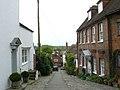
 Cottages in Water Lane - geograph.org.uk - 1322109.jpg 640 × 480; 80 KB
-
 Cottages, Southwater St - geograph.org.uk - 1292247.jpg 640 × 430; 107 KB
-

-
 Fastway577.jpg 1,596 × 1,197; 420 KB
-
 Faygate Station - geograph.org.uk - 1289499.jpg 640 × 430; 105 KB
-

-
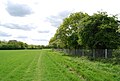
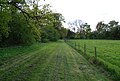
 Field view to South Downs - geograph.org.uk - 1319680.jpg 640 × 480; 68 KB
-

-
-

-
 Footpath by the Arun Valley Line - geograph.org.uk - 1293362.jpg 640 × 430; 78 KB
-

-

-
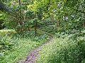
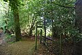
 Footpath in Capite Wood - geograph.org.uk - 1318335.jpg 640 × 480; 142 KB
-
 Footpath near Lickfold - geograph.org.uk - 1341979.jpg 640 × 480; 226 KB
-
 Footpath near Nursted - geograph.org.uk - 1336700.jpg 480 × 640; 206 KB
-
 Footpath near Nursted - geograph.org.uk - 1336704.jpg 640 × 481; 170 KB
-
 Footpath near Swift Farm - geograph.org.uk - 1294802.jpg 640 × 430; 86 KB
-
 Footpath signposted off Springfield Lane - geograph.org.uk - 1289386.jpg 640 × 430; 134 KB
-
 Footpath through Barnsnap Wood - geograph.org.uk - 1288836.jpg 640 × 430; 146 KB
-
 Footpath through the brassicas - geograph.org.uk - 1289577.jpg 640 × 430; 81 KB
-
 Footpath to Hightiten Barn - geograph.org.uk - 1333914.jpg 480 × 640; 89 KB
-
 Footpath to Layby - geograph.org.uk - 1298694.jpg 480 × 640; 108 KB
-
 Footpath to Pyecombe Hill - geograph.org.uk - 1297770.jpg 480 × 640; 127 KB
-
 Footpath, Rival Lodge - geograph.org.uk - 1336708.jpg 640 × 479; 235 KB
-

-
 Gatwick Airport railway station - geograph.org.uk - 1314666.jpg 640 × 480; 66 KB
-

-
 Horsham Station - geograph.org.uk - 1296439.jpg 640 × 399; 59 KB
-

-
 Level Crossing, Wimland Rd - geograph.org.uk - 1290170.jpg 640 × 430; 89 KB
-
 London Road, Arundel - geograph.org.uk - 1778734.jpg 640 × 480; 82 KB
-
 M23 Motorway - geograph.org.uk - 1324478.jpg 2,472 × 3,296; 1.03 MB
-

-
 River Arun From Arundel Bridge - geograph.org.uk - 1302545.jpg 640 × 360; 54 KB
-
 River Arun, Arundel - geograph.org.uk - 1295982.jpg 640 × 424; 68 KB
-
 Shrub, Topiary Garden.jpg 2,816 × 2,112; 1.94 MB
-
 Southwater Village sign, Southwater St - geograph.org.uk - 1292219.jpg 640 × 430; 117 KB
-
 The Three Crowns - geograph.org.uk - 1330538.jpg 640 × 480; 60 KB
-
 Third Avenue - geograph.org.uk - 1326808.jpg 640 × 425; 200 KB
-
 Trains waiting at Horsham Station - geograph.org.uk - 1287758.jpg 640 × 430; 80 KB
-

-
 Village sign, Rogate - geograph.org.uk - 1336889.jpg 480 × 640; 144 KB
-
 Village sign, Storrington - geograph.org.uk - 1332512.jpg 480 × 640; 93 KB


.jpg)


