Category:May 2009 in Northern Ireland
Jump to navigation
Jump to search
English: Images taken in Northern Ireland in this month of 2009 (not the date of the upload).
| Jan | Feb | Mar | Apr | May | Jun | Jul | Aug | Sep | Oct | Nov | Dec | ||
| ← | 8 | 10 | 208 | 141 | 365 | 342 | 581 | 691 | 444 | 685 | 324 | 537 | → |
|---|
Subcategories
This category has the following 8 subcategories, out of 8 total.
Media in category "May 2009 in Northern Ireland"
The following 200 files are in this category, out of 357 total.
(previous page) (next page)-
 'Victoria' at Belfast - geograph.org.uk - 1302634.jpg 640 × 523; 432 KB
-

-
 A big fish, Belfast - geograph.org.uk - 1304285.jpg 640 × 479; 63 KB
-
 A muddy lane, Errigle - geograph.org.uk - 1298131.jpg 640 × 436; 97 KB
-

-
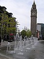 Albert Clock and Fountains, Belfast - geograph.org.uk - 1305028.jpg 479 × 640; 89 KB
-
 Albert Clock, Belfast - geograph.org.uk - 1305216.jpg 479 × 640; 84 KB
-
 Alexander Place or "The Front Row" - geograph.org.uk - 1320092.jpg 640 × 427; 83 KB
-

-
 An arch on Clady Bridge - geograph.org.uk - 1320241.jpg 427 × 640; 75 KB
-
 An old plough - geograph.org.uk - 852513.jpg 640 × 360; 73 KB
-
 Approaching the port of Larne - geograph.org.uk - 1322673.jpg 640 × 427; 50 KB
-
 Ardclinis Church of Ireland Carnlough.JPG 3,264 × 2,448; 1.52 MB
-
 Ardglass (3), May 2009.JPG 2,304 × 3,072; 2.96 MB
-
 Ardglass (4), May 2009.JPG 3,072 × 2,304; 2.96 MB
-
 Ardglass (5), May 2009.JPG 2,304 × 3,072; 3.19 MB
-
 Ardglass (6), May 2009.JPG 2,304 × 3,072; 2.65 MB
-
 Ardglass (7), May 2009.JPG 3,072 × 2,304; 2.44 MB
-
 Argento, Belfast - geograph.org.uk - 1305246.jpg 640 × 479; 80 KB
-
 Avoiding the jets, Belfast - geograph.org.uk - 1305031.jpg 640 × 479; 54 KB
-
 B536 Spout Road, Dergalt - geograph.org.uk - 1313742.jpg 640 × 479; 53 KB
-
 B72 Liskey Road - geograph.org.uk - 1313761.jpg 640 × 479; 83 KB
-
 B72 Liskey Road - geograph.org.uk - 1313779.jpg 640 × 479; 59 KB
-
 Ballymaconnelly Orange Hall.JPG 3,264 × 2,448; 1.69 MB
-
 Ballynahatty Road - geograph.org.uk - 1457952.jpg 640 × 479; 81 KB
-
 Ballynahinch River - geograph.org.uk - 1288090.jpg 600 × 450; 187 KB
-
 BangorAcademyBuildingFront.png 290 × 193; 95 KB
-
 Bannon, Belfast - geograph.org.uk - 1305257.jpg 640 × 479; 79 KB
-
 Bessbrook Bowling Green - geograph.org.uk - 1347391.jpg 640 × 480; 67 KB
-
 Bessbrook Bowling Green - geograph.org.uk - 1347396.jpg 640 × 480; 83 KB
-
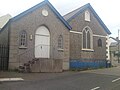
 Bessbrook Institute - geograph.org.uk - 1347207.jpg 640 × 480; 80 KB
-
 Bessbrook Institute - geograph.org.uk - 1347223.jpg 640 × 480; 72 KB
-
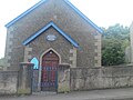
 Bessbrook Presbyterian Church - geograph.org.uk - 1345567.jpg 480 × 640; 126 KB
-
-
-
 Big Fish, Belfast - geograph.org.uk - 1304966.jpg 393 × 640; 95 KB
-
 Bluebells along the river, Omagh - geograph.org.uk - 1307894.jpg 640 × 479; 100 KB
-
 Bluebells on the Camowen, Omagh - geograph.org.uk - 1309140.jpg 640 × 479; 104 KB
-
 Boveva Orange Hall.JPG 3,264 × 2,448; 1.55 MB
-
 Bowling Green, Strabane - geograph.org.uk - 1315179.jpg 640 × 286; 29 KB
-
 Brackagh Moss - geograph.org.uk - 1327948.jpg 640 × 480; 152 KB
-

-

-
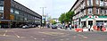 Bridge Street, Belfast - geograph.org.uk - 1305220.jpg 640 × 243; 35 KB
-
 Brown's Row, Belfast - geograph.org.uk - 1320128.jpg 640 × 461; 77 KB
-
 Buddha statues, Belfast - geograph.org.uk - 1297150.jpg 640 × 542; 69 KB
-
 Busking in Belfast - geograph.org.uk - 1305236.jpg 479 × 640; 93 KB
-

-
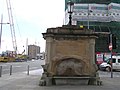 Calder Fountains, Belfast - geograph.org.uk - 1304998.jpg 640 × 479; 50 KB
-
 Camowen River - geograph.org.uk - 1318159.jpg 640 × 479; 78 KB
-
 Camowen River at Cranny - geograph.org.uk - 1307888.jpg 640 × 479; 118 KB
-
 Camowen River, Cranny, Omagh - geograph.org.uk - 1309162.jpg 640 × 479; 95 KB
-
 Camowen River, Omagh - geograph.org.uk - 1318370.jpg 640 × 271; 40 KB
-
 Capecastle Wood - geograph.org.uk - 1301113.jpg 640 × 480; 108 KB
-
 Carnlough Church Of Ireland Hall.JPG 3,264 × 2,448; 1.21 MB
-
 Carnlough Methodist Church.JPG 3,264 × 2,448; 1.49 MB
-
 Carrigullion Townland - geograph.org.uk - 1313776.jpg 640 × 479; 61 KB
-
 Carrigullion Townland - geograph.org.uk - 1313778.jpg 640 × 479; 54 KB
-
 Cart House, Dergalt - geograph.org.uk - 1304073.jpg 640 × 479; 77 KB
-
 Cart, Dergalt - geograph.org.uk - 1304076.jpg 640 × 479; 69 KB
-
 Castle Place, Belfast - geograph.org.uk - 1305229.jpg 640 × 479; 66 KB
-
 Castlecourt Shopping Centre - geograph.org.uk - 1305252.jpg 640 × 479; 92 KB
-
 Cathedral Quarter, Belfast - geograph.org.uk - 1305270.jpg 479 × 640; 116 KB
-
 Chatham Lodge - geograph.org.uk - 1300359.jpg 640 × 480; 73 KB
-
 Chatham Mill construction site - geograph.org.uk - 1300419.jpg 640 × 480; 91 KB
-
 Chatham Mill development - geograph.org.uk - 1300386.jpg 640 × 480; 114 KB
-
 Chichester Buildings, Belfast (2) - geograph.org.uk - 1284234.jpg 640 × 441; 85 KB
-
 Chichester Buildings, Belfast (3) - geograph.org.uk - 1284282.jpg 640 × 410; 79 KB
-
 Chichester Street, Belfast - geograph.org.uk - 1304204.jpg 640 × 479; 57 KB
-
 Church Street, Omagh - geograph.org.uk - 1294955.jpg 640 × 480; 75 KB
-
 Church Street, Strabane - geograph.org.uk - 1315168.jpg 640 × 479; 50 KB
-
 Church Street, Strabane - geograph.org.uk - 1315176.jpg 640 × 479; 67 KB
-
-
 Clare Orange Hall.jpg 640 × 480; 97 KB
-
 Cleared land, Belfast (1) - geograph.org.uk - 1320051.jpg 632 × 374; 98 KB
-
 Cleared land, Belfast (2) - geograph.org.uk - 1320078.jpg 640 × 389; 103 KB
-

-
 Coach, Belfast - geograph.org.uk - 1312925.jpg 640 × 425; 111 KB
-
 Coalisland.jpg 1,036 × 625; 249 KB
-
 College Square Bessbrook - geograph.org.uk - 1347363.jpg 640 × 480; 72 KB
-
 College Square North, Belfast - geograph.org.uk - 1304181.jpg 640 × 479; 63 KB
-

-

-
 Commemorative plaque - geograph.org.uk - 1302892.jpg 640 × 480; 85 KB
-
 Commemorative plaque - geograph.org.uk - 1302899.jpg 640 × 480; 98 KB
-
 Corinthian columns, Belfast - geograph.org.uk - 1321438.jpg 640 × 400; 55 KB
-
 Corner detail, Omagh Leisure Centre - geograph.org.uk - 1289529.jpg 480 × 640; 51 KB
-
 Cornmarket, Belfast - geograph.org.uk - 1305234.jpg 640 × 479; 58 KB
-
 Cranny Roundabout - geograph.org.uk - 1318194.jpg 640 × 479; 80 KB
-
 Crop under wraps, Victoria Bridge - geograph.org.uk - 1313797.jpg 640 × 479; 63 KB
-
 Crossing the Ardstraw Bridge - geograph.org.uk - 1322083.jpg 640 × 427; 64 KB
-
 D and R Pit Stop, Strabane - geograph.org.uk - 1315358.jpg 640 × 479; 61 KB
-
 Dandelion Clocks - geograph.org.uk - 1309171.jpg 640 × 479; 65 KB
-
 Dandelions, Cranny - geograph.org.uk - 1307276.jpg 640 × 479; 94 KB
-
 Dargan Road, Belfast - geograph.org.uk - 1313741.jpg 640 × 435; 263 KB
-
 Date plaque, Belfast - geograph.org.uk - 1297191.jpg 640 × 413; 34 KB
-
 Delaney's, Belfast - geograph.org.uk - 1320152.jpg 640 × 529; 85 KB
-
 Derelict flats, Strabane - geograph.org.uk - 1315164.jpg 479 × 640; 70 KB
-
 Derelict footbridge - geograph.org.uk - 1302665.jpg 640 × 480; 116 KB
-
 Dergalt Townland - geograph.org.uk - 1313744.jpg 640 × 479; 44 KB
-
 Dergalt Townland - geograph.org.uk - 1313747.jpg 640 × 479; 66 KB
-
 Dergalt Townland - geograph.org.uk - 1313749.jpg 640 × 479; 64 KB
-
 Dinnahorra Road near Loughgilly - geograph.org.uk - 1348870.jpg 640 × 480; 83 KB
-
 Dinnahorra Road near Loughgilly - geograph.org.uk - 1348883.jpg 640 × 480; 78 KB
-
 Distant View of Slemish.JPG 3,264 × 2,448; 1.5 MB
-
 Disused store in Northern Ireland.JPG 3,264 × 2,448; 1.29 MB
-
 Dock Street, Strabane - geograph.org.uk - 1315383.jpg 640 × 479; 56 KB
-
-
 Donaghanie Road - geograph.org.uk - 1318187.jpg 640 × 479; 78 KB
-
 Donegal Street, Belfast - geograph.org.uk - 1304968.jpg 479 × 640; 102 KB
-
 Donegall Avenue, Belfast (2) - geograph.org.uk - 1297259.jpg 640 × 423; 90 KB
-
 Donegall Avenue, Belfast - geograph.org.uk - 1284605.jpg 640 × 391; 84 KB
-
 Door and windows, Belfast - geograph.org.uk - 1330794.jpg 640 × 441; 101 KB
-
 Down Convent Hill Bessbrook - geograph.org.uk - 1347135.jpg 640 × 480; 97 KB
-
 Dunaghy Orange Hall.jpg 640 × 480; 57 KB
-
 Dungiven Church of Ireland.jpg 3,264 × 2,448; 1.53 MB
-
 Earthly remains - geograph.org.uk - 1303577.jpg 640 × 480; 140 KB
-

-
 Eden Centre, Church Street, Strabane - geograph.org.uk - 1315160.jpg 640 × 479; 48 KB
-
 Edenderry Road, Cloghfin - geograph.org.uk - 1318102.jpg 640 × 479; 86 KB
-
 Electric Candy, Strabane - geograph.org.uk - 1315183.jpg 479 × 640; 99 KB
-
 Entrance, Main Street, Omagh - geograph.org.uk - 1307067.jpg 640 × 480; 67 KB
-
 Entry, Belfast - geograph.org.uk - 1321514.jpg 628 × 471; 100 KB
-

-
 Erinvale bus, Belfast - geograph.org.uk - 1325234.jpg 640 × 357; 90 KB
-
 Erne River, Enniskillen - geograph.org.uk - 1305710.jpg 640 × 479; 46 KB
-
 Escape artist, Omagh - geograph.org.uk - 1294905.jpg 640 × 480; 59 KB
-
 European election posters, Omagh - geograph.org.uk - 1294896.jpg 472 × 640; 138 KB
-
 Fane Street, Belfast - geograph.org.uk - 1297294.jpg 640 × 387; 95 KB
-
 Farm building - geograph.org.uk - 1300729.jpg 640 × 480; 93 KB
-
 Farm buildings - geograph.org.uk - 1302675.jpg 640 × 480; 69 KB
-
 Farmhouse, Carrigullion - geograph.org.uk - 1313774.jpg 640 × 479; 79 KB
-
 Fish, Belfast - geograph.org.uk - 1304967.jpg 640 × 479; 82 KB
-
 Forestry road - geograph.org.uk - 1301163.jpg 640 × 480; 100 KB
-
 Fountain Street, Belfast - geograph.org.uk - 1304202.jpg 640 × 479; 75 KB
-
 Fountian Street Bessbrook - geograph.org.uk - 1347258.jpg 640 × 480; 72 KB
-
-
 Foyle Hospice Charity Shop, Strabane - geograph.org.uk - 1315157.jpg 640 × 479; 52 KB
-
-
 Gallows Hill, Omagh - geograph.org.uk - 1294944.jpg 640 × 285; 44 KB
-

-
 Glenlough Hall.JPG 3,264 × 2,448; 1.54 MB
-
 Grosvenor Road, Belfast - geograph.org.uk - 1305304.jpg 640 × 479; 49 KB
-

-
 Harleston Street, Belfast - geograph.org.uk - 1315938.jpg 640 × 367; 72 KB
-
 Harp and crown, Belfast - geograph.org.uk - 1332407.jpg 640 × 421; 79 KB
-
 Hartington Street, Belfast - geograph.org.uk - 1321815.jpg 640 × 414; 82 KB
-
 Heather and bog-land - geograph.org.uk - 1301116.jpg 640 × 480; 83 KB
-
 Hemlock, Cranny - geograph.org.uk - 1307307.jpg 640 × 479; 91 KB
-
 Hemlock, trees and water - geograph.org.uk - 1309177.jpg 640 × 479; 100 KB
-
 High Street, Belfast - geograph.org.uk - 1305224.jpg 640 × 479; 68 KB
-

-
 Highway to Health, Omagh - geograph.org.uk - 1309172.jpg 640 × 479; 95 KB
-
 Highway to Health, Omagh - geograph.org.uk - 1309174.jpg 640 × 479; 95 KB
-

-
 Horse, Cranny - geograph.org.uk - 1339638.jpg 640 × 479; 133 KB
-
 Hotel extension, Belfast - geograph.org.uk - 1329910.jpg 640 × 429; 66 KB
-
 House north of Newtownstewart - geograph.org.uk - 1315414.jpg 640 × 479; 52 KB
-
 Houses, Plumbridge - geograph.org.uk - 1313621.jpg 640 × 479; 48 KB
-
 In the shade, Cranny - geograph.org.uk - 1307291.jpg 640 × 479; 95 KB
-

-
 Information stone - geograph.org.uk - 1347194.jpg 640 × 480; 92 KB
-
 Irish Street, Downpatrick - geograph.org.uk - 1290332.jpg 640 × 355; 83 KB
-
 Islandtown Road at junction of Killygore Road.JPG 3,264 × 2,448; 1.44 MB
-
 Japanese Knotweed, Cranny - geograph.org.uk - 1307302.jpg 640 × 479; 106 KB
-

-
 John Wesley Street, Strabane - geograph.org.uk - 1315235.jpg 640 × 479; 58 KB
-
 John Wesley Street, Strabane - geograph.org.uk - 1315244.jpg 640 × 479; 61 KB
-
 Joy's Entry, Belfast - geograph.org.uk - 1305222.jpg 479 × 640; 82 KB
-
 Kilclief Beach (1), May 2009.JPG 3,072 × 2,304; 2.76 MB
-
 Kilclief Beach (2), May 2009.JPG 3,072 × 2,304; 2.97 MB
-
 Kilclief Beach (3), May 2009.JPG 2,304 × 3,072; 2.96 MB
-
 Killen Street, Belfast - geograph.org.uk - 1316373.jpg 640 × 362; 80 KB
-
 Killyclogher Burn, Omagh - geograph.org.uk - 1307861.jpg 640 × 479; 114 KB
-
 Kilrea Orange Hall.JPG 3,264 × 2,448; 1.53 MB
-
 Laganvale Street, Belfast - geograph.org.uk - 1315894.jpg 640 × 365; 78 KB
-
 Legavallon Road at junction of Belraugh Road.jpg 3,264 × 2,448; 1.76 MB
-
 Letterbrat Road, Letterbrat - geograph.org.uk - 1313647.jpg 640 × 479; 52 KB
-
 Letterbrat Townland - geograph.org.uk - 1304149.jpg 640 × 479; 65 KB
-
 Letterbrat Townland - geograph.org.uk - 1313636.jpg 640 × 479; 51 KB
-
 Letterbrat Townland - geograph.org.uk - 1313644.jpg 640 × 479; 61 KB
-
 Letterbrat Townland - geograph.org.uk - 1313653.jpg 640 × 479; 47 KB
-
 Letterbrat Townland - geograph.org.uk - 1313655.jpg 640 × 479; 47 KB
-
 Letterbrat Townland - geograph.org.uk - 1313657.jpg 640 × 479; 58 KB
-
 Letterbrat, Plumbridge - geograph.org.uk - 1304148.jpg 640 × 479; 72 KB
-
 Level crossing, Whitehead - geograph.org.uk - 1323420.jpg 640 × 414; 75 KB
-
 Lindsay Street, Belfast - geograph.org.uk - 1330575.jpg 640 × 336; 64 KB
-
 Linton and Robinson Group, Strabane - geograph.org.uk - 1315351.jpg 640 × 479; 47 KB
-

-
 Liskey Road - Old Strabane Road - geograph.org.uk - 1313782.jpg 640 × 479; 63 KB
-
 Liskey Road, Strabane - geograph.org.uk - 1313756.jpg 640 × 479; 69 KB
-
 Liskey Road, Strabane - geograph.org.uk - 1313770.jpg 640 × 479; 52 KB
-
 Little Charlotte Street, Belfast - geograph.org.uk - 1330482.jpg 640 × 415; 80 KB
-
 Longmore Crossroads with Tullymore Road.JPG 3,264 × 2,448; 1.6 MB
-
 Looking east from the Liskey Road - geograph.org.uk - 1313758.jpg 640 × 479; 72 KB
-
 Loughloughan Road at junction of Longmore Road.JPG 3,264 × 2,448; 1.61 MB
-
 Lucerne Parade, Belfast - geograph.org.uk - 1315969.jpg 640 × 358; 75 KB
-
 Mahon Hire, Strabane - geograph.org.uk - 1315362.jpg 640 × 479; 66 KB
-
 Main Armagh to Newry Road - geograph.org.uk - 1348806.jpg 640 × 480; 102 KB
-
 Main Armagh to Newry Road 1 - geograph.org.uk - 1348830.jpg 640 × 480; 77 KB


,_May_2009.JPG)
,_May_2009.JPG)
,_May_2009.JPG)
,_May_2009.JPG)
,_May_2009.JPG)


_-_geograph.org.uk_-_1284234.jpg)
_-_geograph.org.uk_-_1284282.jpg)


_-_geograph.org.uk_-_1297259.jpg)


,_May_2009.JPG)
,_May_2009.JPG)
,_May_2009.JPG)


_-_geograph.org.uk_-_1320051.jpg)
_-_geograph.org.uk_-_1320078.jpg)