Category:May 2005 Ireland photographs
Jump to navigation
Jump to search
Countries of Europe: Austria · Belarus · Belgium · Bulgaria · Croatia · Czech Republic · Denmark · Estonia · Finland · France‡ · Georgia‡ · Germany · Greece · Hungary · Iceland · Republic of Ireland · Italy · Latvia · Lithuania · Malta · Montenegro · Netherlands‡ · Norway · Poland · Portugal‡ · Romania · Russia‡ · Serbia · Slovakia · Slovenia · Spain‡ · Sweden · Switzerland · Turkey‡ · Ukraine · United Kingdom
Specific status: Isle of Man – Limited recognition: Kosovo
‡: partly located in Europe
Specific status: Isle of Man – Limited recognition: Kosovo
‡: partly located in Europe
English: Images taken in Ireland during this month of 2005 (not the date of the upload). With CatScan, this allows one to browse any Ireland-related category by year or month. Images should be placed directly in this category, not in subcategories. Note: Images from 2005 should be also added into the appropriate province, territory or city category of Category:2005 photographs of Ireland.
| Jan | Feb | Mar | Apr | May | Jun | Jul | Aug | Sep | Oct | Nov | Dec | ||
| ← | 0 | 1 | 0 | 0 | 150 | 0 | 2 | 0 | 200 | 0 | 0 | 0 | → |
|---|
Media in category "May 2005 Ireland photographs"
The following 150 files are in this category, out of 150 total.
-
 "Shard" Cliff Face - geograph.org.uk - 16692.jpg 640 × 480; 564 KB
-
 2005-05-01 - Ireland - Dublin - Spire of Dublin 4887211077.jpg 1,200 × 1,800; 1.25 MB
-
 2005-05-01 - Ireland - Dublin - Trinity College 4887812244.jpg 1,200 × 1,800; 631 KB
-
 2005-05-01 - Ireland - Dublin 8 4887817214.jpg 1,800 × 1,200; 2.13 MB
-
 Broom bridge plaque.jpg 1,536 × 1,024; 203 KB
-
 2005-05-01 - Ireland - Dublin - St Stephen's Green - Famine Memorial 4887806354.jpg 1,200 × 1,800; 3.11 MB
-
 2005-05-01 - Ireland - Dublin - St Stephen's Green - Garden for the Blind 1 4887207281.jpg 1,200 × 1,800; 3.47 MB
-
 2005-05-01 - Ireland - Dublin - St Stephen's Green - Garden for the Blind 2 4887207939.jpg 1,044 × 1,567; 2.01 MB
-
 2005-05-01 - Ireland - Dublin - St Stephen's Green - Garden for the Blind 3 4887811704.jpg 1,200 × 1,800; 2.78 MB
-
 2005-05-01 - Ireland - Dublin - St Stephen's Green - The Three Fates 4887801348.jpg 1,200 × 1,800; 1.55 MB
-
 2005-05-01 - Ireland - Dublin - St Stephen's Green 4887803106.jpg 1,800 × 1,200; 2.49 MB
-
 2005-05-01 - Ireland - Dublin - St Stephens Green - Garden for the Blind (4887808546).jpg 1,800 × 1,200; 2.99 MB
-
 2005-05-01 - Ireland - Dublin - St Stephens Green - Pink (4887204617).jpg 1,800 × 1,200; 3.44 MB
-
 IE- Dublin - 2005-05-01 (4887804894).jpg 1,800 × 1,200; 1.63 MB
-
 IE-L - Dublin - 2005-05-01 (4887201589).jpg 1,200 × 1,800; 2.38 MB
-
 IE-L - Dublin - 2005-05-01 (4887803714).jpg 1,800 × 1,200; 2.25 MB
-
 Sculpture Dublin Present 02.jpg 1,024 × 768; 69 KB
-
 Dublin Castle i06.jpg 2,048 × 1,365; 450 KB
-
 National Wax Museum, Dublin - geograph.org.uk - 12231.jpg 360 × 640; 60 KB
-
 266 Cashel.JPG 1,600 × 1,200; 388 KB
-
 267 Cashel.JPG 1,600 × 1,200; 428 KB
-
 3000 (miles-km) to New York - geograph.org.uk - 14551.jpg 640 × 480; 131 KB
-
 A Currach at Dooneen Pier - geograph.org.uk - 17763.jpg 640 × 480; 452 KB
-
 A Kilcrohane Playground - geograph.org.uk - 14863.jpg 640 × 480; 269 KB
-
 A northern view of Dooneen Pier - geograph.org.uk - 17774.jpg 640 × 480; 387 KB
-
 Ahakista Memorial of the Air India Crash - geograph.org.uk - 14877.jpg 640 × 480; 249 KB
-
 Air Finland Boeing 757-28A OH-AFI Dublin Airport.jpg 2,288 × 1,712; 1.1 MB
-
 An Ghraig Peak - geograph.org.uk - 16780.jpg 640 × 480; 499 KB
-
 An Irish Pub near Duncormick - geograph.org.uk - 14550.jpg 640 × 408; 140 KB
-
 Aranmore Island - Ferry from Burtonport - geograph.org.uk - 1166103.jpg 640 × 426; 243 KB
-
 Ardnamanagh Hill - geograph.org.uk - 16109.jpg 640 × 372; 221 KB
-
 Around Ahakista - geograph.org.uk - 14876.jpg 640 × 480; 378 KB
-
 Athlone (MGW) railway station.jpg 640 × 426; 126 KB
-
 Baile an Daighin 1.jpg 2,184 × 1,092; 823 KB
-
 Ballylickey Bay - geograph.org.uk - 16111.jpg 640 × 480; 190 KB
-
 Ballylickey Bay - geograph.org.uk - 16112.jpg 640 × 480; 247 KB
-
 Ballylickey Bay - geograph.org.uk - 16113.jpg 640 × 480; 190 KB
-
 Ballymacrinan Bay - geograph.org.uk - 13266.jpg 640 × 426; 79 KB
-
 Bantry Aerodrome in 2005.jpg 640 × 480; 252 KB
-
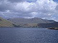
 Bantry Bay - geograph.org.uk - 15192.jpg 640 × 480; 311 KB
-
 Beach area near Ahakista - geograph.org.uk - 14880.jpg 640 × 480; 328 KB
-
 Beach at Dunmore Head - geograph.org.uk - 16735.jpg 640 × 480; 110 KB
-
 Beach at Saltmills - geograph.org.uk - 14582.jpg 640 × 480; 281 KB
-
 Beach near Coumskrihaun - geograph.org.uk - 15875.jpg 640 × 480; 288 KB
-
 Blarney Castle, Co. Cork - geograph.org.uk - 88444.jpg 640 × 480; 79 KB
-
 Bloody Foreland - geograph.org.uk - 87442.jpg 640 × 480; 75 KB
-
 Boarded up Church Window - geograph.org.uk - 14547.jpg 480 × 600; 244 KB
-
 Boats at West Pier Toraig - geograph.org.uk - 539040.jpg 640 × 480; 161 KB
-
 Bridge at Ballylickey - geograph.org.uk - 16118.jpg 640 × 480; 352 KB
-
 Bridge at Tintern Abbey - geograph.org.uk - 14587.jpg 640 × 480; 332 KB
-

-
 Bridge over the River at Duncormick - geograph.org.uk - 14537.jpg 640 × 480; 378 KB
-
 Bridge over the River Laune - geograph.org.uk - 16035.jpg 640 × 480; 241 KB
-
 Burrane National School - geograph.org.uk - 13274.jpg 640 × 426; 99 KB
-
 Burren (alphageek).jpg 2,048 × 1,536; 399 KB
-
 Carraig Na Sasanach - geograph.org.uk - 16718.jpg 640 × 480; 511 KB
-

-
 Church at Kilcrohane - geograph.org.uk - 14868.jpg 640 × 480; 218 KB
-
 Church at New Ross - geograph.org.uk - 17880.jpg 640 × 480; 335 KB
-
 Church near Baile na Ngall - geograph.org.uk - 17741.jpg 640 × 480; 294 KB
-
 Church Near Ventry - geograph.org.uk - 16611.jpg 640 × 480; 407 KB
-
 Church of Ireland - geograph.org.uk - 14553.jpg 640 × 480; 301 KB
-
 Cliff near the Aerodrome - geograph.org.uk - 15151.jpg 640 × 480; 244 KB
-
 Cliffs of Dooneen and the Pier - geograph.org.uk - 17770.jpg 640 × 480; 469 KB
-
 Clogher Beach - geograph.org.uk - 16917.jpg 640 × 480; 125 KB
-
 Clogher Beach from An Ghraig Viewpoint - geograph.org.uk - 16921.jpg 640 × 480; 541 KB
-
 Closeup of the Pier - geograph.org.uk - 16749.jpg 640 × 480; 554 KB
-
 Clár Clainne Mhuiris 1.jpg 2,173 × 1,379; 1.04 MB
-
 Country Road on the Dingle Peninsula - geograph.org.uk - 16586.jpg 640 × 480; 397 KB
-
 Cruising at Foynes - geograph.org.uk - 12686.jpg 640 × 426; 110 KB
-
 Derek Hill's hut on Toraig - geograph.org.uk - 673932.jpg 640 × 480; 97 KB
-
 Derrynane House - geograph.org.uk - 247229.jpg 640 × 425; 136 KB
-
 Donnybrook, Dublin.jpg 2,592 × 1,944; 1.03 MB
-
 Doonagurroge House - geograph.org.uk - 13261.jpg 640 × 426; 99 KB
-
 Dromcloc House Bantry Co. Cork - geograph.org.uk - 15153.jpg 640 × 480; 267 KB
-
 Dublin - Bank of Ireland.jpg 384 × 600; 121 KB
-
 Dunbeg Fort - geograph.org.uk - 16625.jpg 640 × 480; 394 KB
-
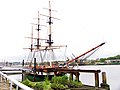 Dunbrody Famine Ship (Replica) - geograph.org.uk - 14535.jpg 640 × 480; 143 KB
-
 Dunfanaghy Bay, co Donegal - geograph.org.uk - 86844.jpg 640 × 480; 80 KB
-
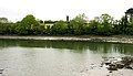
 Durras River - geograph.org.uk - 14901.jpg 640 × 480; 268 KB
-
 East Pier Toraig - geograph.org.uk - 357548.jpg 640 × 480; 86 KB
-
 Edge of the Pier - geograph.org.uk - 14835.jpg 640 × 480; 298 KB
-
 Estuary at Bannow Bay - geograph.org.uk - 14591.jpg 640 × 366; 127 KB
-
 Farm Building Near Rosslare and Tagoat - geograph.org.uk - 14592.jpg 640 × 366; 115 KB
-
 Farm near Ahakista - geograph.org.uk - 15188.jpg 640 × 480; 502 KB
-
 Farm near Durras - geograph.org.uk - 14883.jpg 640 × 480; 331 KB
-
 Farm near Saltmills and Bannow Bay - geograph.org.uk - 14577.jpg 640 × 480; 213 KB
-
 Farm School - geograph.org.uk - 17805.jpg 640 × 480; 453 KB
-
 Farmhouse near Minard East - geograph.org.uk - 17830.jpg 640 × 480; 425 KB
-
 Ferrybank church Waterford.jpg 640 × 612; 349 KB
-
 Fields south of the N86 near Anascaul - geograph.org.uk - 15574.jpg 640 × 480; 557 KB
-
 Gallarus Oratory - geograph.org.uk - 17678.jpg 640 × 480; 368 KB
-
 Inisheer - O'Briens.jpg 2,048 × 1,536; 329 KB
-
 Interesting Rock along the Ahakista Coast - geograph.org.uk - 14881.jpg 640 × 480; 288 KB
-
 Kennedy Country - geograph.org.uk - 14534.jpg 640 × 480; 174 KB
-
 Kilcrohane - geograph.org.uk - 24773.jpg 640 × 353; 65 KB
-
-
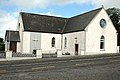 Killimer Church - geograph.org.uk - 13264.jpg 640 × 426; 88 KB
-
 Knock Village, Co. Clare. - geograph.org.uk - 19730.jpg 640 × 426; 146 KB
-
 Local Bantry Residence - geograph.org.uk - 14824.jpg 640 × 480; 215 KB
-
 Looking across Bannow Bay - geograph.org.uk - 14590.jpg 640 × 480; 208 KB
-
 Modern Dwelling near Rosslare - geograph.org.uk - 14543.jpg 640 × 480; 216 KB
-
 N72 to Lismore - geograph.org.uk - 17872.jpg 640 × 480; 499 KB
-
 Old bridge on Kerry Way - geograph.org.uk - 247233.jpg 640 × 425; 130 KB
-
 Old Cottage - geograph.org.uk - 14542.jpg 480 × 569; 192 KB
-
 Oscar Wilde - geograph.org.uk - 88443.jpg 640 × 480; 118 KB
-
 Parish Church at Ballybrack - geograph.org.uk - 172975.jpg 640 × 363; 90 KB
-
 Phasianus colchicus -Wicklow Mountains, Ireland-8.jpg 2,288 × 1,712; 1.43 MB
-
 Pier at Pointanskoh - geograph.org.uk - 16592.jpg 640 × 480; 390 KB
-
 Pier at Traigh an Fhiona - geograph.org.uk - 17005.jpg 640 × 480; 372 KB
-
 Pier near Dunquin - geograph.org.uk - 16747.jpg 640 × 480; 534 KB
-
 Ploughed Field and Farmland near New Ross - geograph.org.uk - 14567.jpg 640 × 480; 251 KB
-
 Quayside view of Dingle Harbour - geograph.org.uk - 16557.jpg 640 × 480; 329 KB
-

-

-
 River Liffey, Dublin - geograph.org.uk - 88441.jpg 640 × 480; 106 KB
-
 Rosie's Pub - geograph.org.uk - 14574.jpg 640 × 480; 233 KB
-
 Rosslare Ferry Port - geograph.org.uk - 17881.jpg 640 × 480; 344 KB
-
 Rosslare Terminal Building - geograph.org.uk - 17883.jpg 640 × 480; 332 KB
-
 Rusheen Point, Shannon Estuary - geograph.org.uk - 19728.jpg 640 × 426; 116 KB
-
 Seaside Village - geograph.org.uk - 16578.jpg 640 × 480; 394 KB
-
 Seaview in Dunmannus Bay - geograph.org.uk - 14858.jpg 640 × 480; 311 KB
-
 Sheep Pasture near Dun Urlann - geograph.org.uk - 16998.jpg 640 × 480; 463 KB
-
 Slane Castle coMeath.jpg 1,600 × 1,200; 739 KB
-
 Sneem River - geograph.org.uk - 241571.jpg 602 × 400; 105 KB
-
 South shoreline Toraig - geograph.org.uk - 673983.jpg 640 × 480; 81 KB
-
 Staigue Fort on the inside - geograph.org.uk - 247219.jpg 640 × 425; 144 KB
-
 Stone Circle near Ahakista - geograph.org.uk - 15462.jpg 640 × 480; 389 KB
-
 Stud Farm between Rosslare and New Ross - geograph.org.uk - 14540.jpg 640 × 480; 221 KB
-
 The Blackwater River - geograph.org.uk - 14611.jpg 640 × 256; 82 KB
-
 The Dunbrody Inn, New Ross - geograph.org.uk - 14536.jpg 640 × 480; 212 KB
-
 The estuary at Saltmills - geograph.org.uk - 14589.jpg 640 × 480; 188 KB
-
 The Harbour at Glengariff - geograph.org.uk - 16089.jpg 640 × 480; 271 KB
-
 The N71 into Bantry - geograph.org.uk - 14827.jpg 640 × 480; 262 KB
-
 The Quay at Kilcrohane - geograph.org.uk - 14871.jpg 640 × 480; 338 KB
-
 The Scenic Route from Bantry to Durras - geograph.org.uk - 14916.jpg 525 × 636; 370 KB
-
 The Stonehouse Restaurant - geograph.org.uk - 16652.jpg 640 × 480; 459 KB
-
 The Tin Pub - geograph.org.uk - 24816.jpg 640 × 427; 128 KB
-
 Tintern Abbey (Co, Wexford).jpg 640 × 480; 183 KB
-
 Tintern Abbey (Ireland) - geograph.org.uk - 14586.jpg 640 × 480; 181 KB
-
 Tower between Kilcrohane and Ahakista - geograph.org.uk - 14831.jpg 640 × 480; 338 KB
-
 Trawnahaha - geograph.org.uk - 16106.jpg 640 × 406; 224 KB
-
 Tree Tunnel - geograph.org.uk - 14600.jpg 640 × 480; 406 KB
-
 View from the Sheepshead Way - geograph.org.uk - 15156.jpg 640 × 480; 398 KB
-
 View of Coumeenoole Bay - geograph.org.uk - 16715.jpg 640 × 480; 448 KB
-
 View of hillock at Lower Toomore - geograph.org.uk - 1537371.jpg 640 × 480; 109 KB
-
 Waterfall near Ahakista - geograph.org.uk - 15186.jpg 640 × 480; 455 KB
-
 Waterville - geograph.org.uk - 247220.jpg 640 × 425; 120 KB
-
 West Pier Toraig - geograph.org.uk - 357555.jpg 640 × 480; 75 KB
-
 Wexford countryside in the rain - geograph.org.uk - 442913.jpg 640 × 480; 87 KB


.jpg)
.jpg)
.jpg)
.jpg)
.jpg)


_to_New_York_-_geograph.org.uk_-_14551.jpg)


_railway_station.jpg)


.jpg)


_-_geograph.org.uk_-_14535.jpg)


.jpg)
_-_geograph.org.uk_-_14586.jpg)


