Category:Mawr
Jump to navigation
Jump to search
community in Swansea, Wales  | |||||
| Upload media | |||||
| Instance of | |||||
|---|---|---|---|---|---|
| Location | Swansea, Wales | ||||
| Population |
| ||||
| Area |
| ||||
 | |||||
Subcategories
This category has the following 4 subcategories, out of 4 total.
Media in category "Mawr"
The following 200 files are in this category, out of 306 total.
(previous page) (next page)-
 2010 Wales Swansea Community Mawr map.svg 512 × 472; 632 KB
-
 2024 Wales Swansea Community Mawr map.svg 512 × 472; 651 KB
-
 A shining beacon - geograph.org.uk - 6002627.jpg 1,403 × 2,251; 694 KB
-
 Abandoned 4x4 - geograph.org.uk - 5227742.jpg 800 × 450; 155 KB
-
 Abandoned Minibus - geograph.org.uk - 5288198.jpg 800 × 533; 133 KB
-
 Afon Dulais - geograph.org.uk - 6002658.jpg 3,264 × 2,448; 4.73 MB
-
 Afon Llan - geograph.org.uk - 3840113.jpg 640 × 480; 126 KB
-
 Afon Llwchwr (Loughor River) - geograph.org.uk - 3810139.jpg 640 × 480; 63 KB
-
 Allt-y-fanog derelict farm house - geograph.org.uk - 1343702.jpg 640 × 480; 70 KB
-
 Animal shelter - geograph.org.uk - 5942413.jpg 3,264 × 2,448; 2.35 MB
-
 Arable land - geograph.org.uk - 1338613.jpg 640 × 480; 77 KB
-
 Banc Llyn Mawr - geograph.org.uk - 3808385.jpg 640 × 429; 93 KB
-
 Banc Maestir Mawr - geograph.org.uk - 3853789.jpg 640 × 480; 84 KB
-
 Beginnings of Nant Ddu - geograph.org.uk - 855540.jpg 480 × 640; 94 KB
-
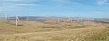 Betws Mountain Wind farm - geograph.org.uk - 3419487.jpg 1,280 × 480; 96 KB
-
 Bracken covered hillside - geograph.org.uk - 6003517.jpg 2,048 × 1,536; 1.4 MB
-
 Bridge over the Clydach - geograph.org.uk - 6258470.jpg 2,048 × 1,536; 1.29 MB
-
 Bridge over the Clydach - geograph.org.uk - 6269199.jpg 2,048 × 1,536; 1.15 MB
-
 Bridleway sign painted on road surface - geograph.org.uk - 3584345.jpg 1,280 × 960; 236 KB
-
 Building Platform - geograph.org.uk - 4215395.jpg 640 × 480; 77 KB
-
 Bwlch y Gwynt - geograph.org.uk - 6043907.jpg 2,048 × 1,536; 1.04 MB
-
 Cae Newydd Farm - geograph.org.uk - 5942199.jpg 3,264 × 2,448; 2.63 MB
-
 Cairn on Mynydd Garn-Fach - geograph.org.uk - 166974.jpg 640 × 480; 174 KB
-
 Capel Gerasim Chapel - geograph.org.uk - 2203744.jpg 690 × 518; 125 KB
-
 Cattle grid entrance to farm - geograph.org.uk - 1339365.jpg 640 × 480; 66 KB
-
 Cefn Drum - geograph.org.uk - 3804600.jpg 690 × 518; 151 KB
-
 Cefn Myddfai Nursery, Felindre - geograph.org.uk - 3441177.jpg 1,644 × 1,161; 916 KB
-
 Coed Cae Croes - geograph.org.uk - 5864189.jpg 3,264 × 2,448; 2.64 MB
-
 Commemorative mine dram in Craig Cefn Park - geograph.org.uk - 4488703.jpg 1,024 × 768; 197 KB
-
 Concrete Structure - geograph.org.uk - 3572406.jpg 480 × 640; 102 KB
-
 Covered reservoir near Rhyd-y-gwin - geograph.org.uk - 149463.jpg 640 × 480; 166 KB
-
 Craig yr Allt - geograph.org.uk - 3826577.jpg 640 × 426; 86 KB
-
 Cutting corners - geograph.org.uk - 6002605.jpg 3,264 × 2,448; 3.47 MB
-
 Cutting on Lliw Reservoir access road - geograph.org.uk - 855542.jpg 640 × 480; 88 KB
-
 Cwm Cile Farm - geograph.org.uk - 3824041.jpg 640 × 456; 78 KB
-
 Cwm Clydach - geograph.org.uk - 5447012.jpg 3,264 × 2,448; 3.4 MB
-
 Cwm Clydach - geograph.org.uk - 5751967.jpg 3,264 × 2,448; 1.93 MB
-
 Cwm Clydach Isaf - geograph.org.uk - 3821382.jpg 690 × 518; 159 KB
-
 Cwm Sgiach - geograph.org.uk - 3844638.jpg 640 × 480; 135 KB
-
 Cwmllwchwr Uchaf - geograph.org.uk - 3809403.jpg 690 × 518; 231 KB
-
 Cynghordy farm - geograph.org.uk - 5937416.jpg 3,264 × 2,448; 3.23 MB
-
 Dead branch - geograph.org.uk - 6002588.jpg 3,264 × 2,448; 3.93 MB
-
 Derelict near Mynydd Garn-Fach - geograph.org.uk - 166975.jpg 640 × 480; 195 KB
-
 Detail of blocked mine entrance under Tor Clawdd - geograph.org.uk - 2889667.jpg 1,024 × 768; 193 KB
-
 Detail of Bridge - geograph.org.uk - 5448521.jpg 2,448 × 3,264; 3.27 MB
-
 Disused Quarry - geograph.org.uk - 5751961.jpg 3,264 × 2,448; 2.9 MB
-
 Disused Ramp - geograph.org.uk - 3572413.jpg 480 × 640; 74 KB
-

-
 Dry stone wall in Cwm Clydach - geograph.org.uk - 846488.jpg 640 × 480; 94 KB
-
 Elim Baptist Chapel - geograph.org.uk - 5447001.jpg 2,378 × 3,171; 1.98 MB
-
 End of a country lane - geograph.org.uk - 1338624.jpg 640 × 480; 85 KB
-
 End of tramway - geograph.org.uk - 5937411.jpg 2,448 × 3,264; 3.67 MB
-
 Energy infrastructure - geograph.org.uk - 6003333.jpg 2,048 × 1,536; 637 KB
-
 Fallen tree - geograph.org.uk - 6178641.jpg 1,536 × 2,048; 1.5 MB
-
 Fallen trig point - geograph.org.uk - 6002611.jpg 3,264 × 2,448; 3.66 MB
-
 Farm track - geograph.org.uk - 6002565.jpg 2,925 × 1,859; 2.45 MB
-

-
 Felindre Road - geograph.org.uk - 5864177.jpg 2,448 × 3,264; 2.8 MB
-

-
 Ffarm Bryn Cyffon - Bryn Cyffon Farm - geograph.org.uk - 3809436.jpg 690 × 518; 231 KB
-
 Ffarm Cathelyd Ganol Farm - geograph.org.uk - 3826569.jpg 640 × 426; 68 KB
-
 Ffarm Llwyn y Domen Farm - geograph.org.uk - 3840088.jpg 640 × 480; 113 KB
-
 Ffarm y Bwllfa Isaf Farm - geograph.org.uk - 3854004.jpg 640 × 480; 89 KB
-
 Ffarm y Twyn Farm - geograph.org.uk - 3806274.jpg 640 × 456; 133 KB
-
 Field boundary - geograph.org.uk - 6002560.jpg 3,264 × 2,448; 1.39 MB
-
 Flood prevention work in Cwmdulais - geograph.org.uk - 4135821.jpg 1,024 × 768; 169 KB
-
 Footbridge over the Afon Lliw - geograph.org.uk - 3441198.jpg 1,856 × 1,302; 2.08 MB
-
 Footpath beside Lower Lliw reservoir - geograph.org.uk - 4165519.jpg 1,995 × 1,382; 2.08 MB
-
 Footpath to Bryncyffon - geograph.org.uk - 6003343.jpg 3,104 × 2,326; 2.59 MB
-
 Forests on south slope of Cwm Cathan - geograph.org.uk - 148942.jpg 640 × 480; 106 KB
-
 Galloping Track - geograph.org.uk - 1338605.jpg 640 × 480; 71 KB
-
 Ganol Farm - geograph.org.uk - 6002662.jpg 2,974 × 2,148; 2.4 MB
-
 Garnswllt Road - geograph.org.uk - 6003514.jpg 2,048 × 1,536; 1.25 MB
-
 Gelli-gwm Rock - geograph.org.uk - 3846879.jpg 640 × 480; 86 KB
-
 Gerazim Baptist Chapel Graveyard - geograph.org.uk - 3563845.jpg 640 × 480; 71 KB
-
 Graig Fawr - geograph.org.uk - 3283246.jpg 480 × 640; 70 KB
-
 Graig Fawr Ring Monument - geograph.org.uk - 4210310.jpg 640 × 480; 72 KB
-
 Grass track - geograph.org.uk - 5937414.jpg 480 × 640; 106 KB
-
 Grassy moorland - geograph.org.uk - 6045951.jpg 2,048 × 1,536; 1.32 MB
-
 Gât Fochyn Llety Morfil Kissing Gate - geograph.org.uk - 3875811.jpg 640 × 480; 104 KB
-
 Hedgerow-lined road - geograph.org.uk - 5864186.jpg 2,448 × 3,264; 3.01 MB
-
 Hen Glawd - geograph.org.uk - 6002557.jpg 3,166 × 2,372; 2.74 MB
-
 Hen heol Felindre old road - geograph.org.uk - 3836940.jpg 640 × 480; 81 KB
-
 Hen heol Felindre old road - geograph.org.uk - 3836959.jpg 640 × 480; 122 KB
-
 Hendrewen Farm - geograph.org.uk - 6003520.jpg 2,048 × 1,536; 1.2 MB
-
 Heol Cwm Cathan Isaf Road - geograph.org.uk - 3816051.jpg 690 × 518; 268 KB
-
 Heol Ffarm Abergelli Farm Road - geograph.org.uk - 3848548.jpg 640 × 420; 71 KB
-
 Heol Ffarm Cynghordy Fach Farm Road - geograph.org.uk - 3840107.jpg 640 × 480; 131 KB
-

-

-
 Heol y cron - Reservoir road - geograph.org.uk - 3837079.jpg 640 × 480; 109 KB
-
 House at Taironen - geograph.org.uk - 5942343.jpg 3,264 × 2,448; 2.18 MB
-
 Housing in Garnswllt - geograph.org.uk - 6003347.jpg 3,165 × 2,374; 2.44 MB
-
 Kissing gate - geograph.org.uk - 5942421.jpg 3,264 × 2,448; 3.67 MB
-
 Lliw Valley , Upper Lliw Reservoir - geograph.org.uk - 2897963.jpg 3,968 × 2,232; 1.97 MB
-
 Llwbr Gwenlais Uchaf Path - geograph.org.uk - 3856369.jpg 640 × 480; 143 KB
-
 Llwybr Allt Y Fanog - Allt y Fanog Path - geograph.org.uk - 6356509.jpg 1,024 × 768; 364 KB
-
 Llwybr Allt y Fanog - Allt y Fanog Path - geograph.org.uk - 6356513.jpg 1,024 × 768; 376 KB
-
 Llwybr Carreg Lwyd Path, Felindre - geograph.org.uk - 3803348.jpg 690 × 518; 152 KB
-
 Llwybr Ceffyl Cwm Clydach Bridleway - geograph.org.uk - 3854939.jpg 640 × 480; 72 KB
-
 Llwybr Ceffyl Cwmcerdinen Bridleway - geograph.org.uk - 3822896.jpg 640 × 480; 64 KB
-
 Llwybr Ceffyl Cwmdulais Bridleway - geograph.org.uk - 3846885.jpg 640 × 480; 71 KB
-
 Llwybr ceffyl Gelliwastad bridleway - geograph.org.uk - 3904521.jpg 640 × 480; 110 KB
-

-

-

-
 Llwybr Felindre Path - geograph.org.uk - 3837011.jpg 640 × 480; 142 KB
-

-
 Llwybr Gellionen Path - geograph.org.uk - 3817517.jpg 690 × 518; 159 KB
-
 Llwybr i Gwm Clydach - Path to Cwm Clydach - geograph.org.uk - 6356475.jpg 1,024 × 768; 357 KB
-
 Llwybr Rhydypandy Path - geograph.org.uk - 3840073.jpg 640 × 480; 114 KB
-
 Llwybr Salem - Salem Path - geograph.org.uk - 3840053.jpg 640 × 480; 144 KB
-

-
 Llwybr y Bugail Path - geograph.org.uk - 3837033.jpg 640 × 480; 115 KB
-
 Lower Lliw reservoir - geograph.org.uk - 3005156.jpg 1,620 × 1,159; 1.07 MB
-
 Luxury caravan^ - geograph.org.uk - 6002664.jpg 2,147 × 2,974; 3.54 MB
-
 Malthouse beside the river Llan - geograph.org.uk - 3532456.jpg 960 × 720; 203 KB
-
 Marker at Lower Lliw reservoir - geograph.org.uk - 3441190.jpg 1,685 × 1,161; 1.41 MB
-
 Mason's Arms - geograph.org.uk - 5942193.jpg 3,264 × 2,448; 2.09 MB
-
 Meadow and trees - geograph.org.uk - 6178642.jpg 2,048 × 1,536; 1 MB
-
 Miners Memorial - geograph.org.uk - 5446990.jpg 3,264 × 2,448; 3.64 MB
-

-
 Mountain path - geograph.org.uk - 1251361.jpg 640 × 480; 74 KB
-
 Mynydd Carn Llechart - geograph.org.uk - 3817466.jpg 690 × 518; 153 KB
-
 Mynydd Garn-fach Cairn - geograph.org.uk - 4351150.jpg 640 × 480; 81 KB
-
 Mynydd Gelliwastad - geograph.org.uk - 3904578.jpg 640 × 480; 75 KB
-
 Mynydd Pysgodlyn - geograph.org.uk - 3822906.jpg 690 × 518; 96 KB
-
 Mynydd y Betws - geograph.org.uk - 3310492.jpg 1,600 × 1,200; 935 KB
-
 Mynydd y Betws, moorland road - geograph.org.uk - 5043279.jpg 1,024 × 768; 153 KB
-
 Mynydd y Betws, path - geograph.org.uk - 5043268.jpg 1,024 × 768; 167 KB
-
 Mynydd y Betws, view - geograph.org.uk - 5043289.jpg 1,024 × 768; 145 KB
-
 Mynydd y Garn Fach - geograph.org.uk - 3806310.jpg 640 × 400; 68 KB
-
 Mynydd y Gwair - geograph.org.uk - 3816199.jpg 690 × 518; 125 KB
-
 Mynydd Y Gwair - geograph.org.uk - 3853124.jpg 640 × 480; 75 KB
-
 Mynydd y Gwair - geograph.org.uk - 6002653.jpg 3,264 × 2,448; 2.13 MB
-
 Mynydd y Gwair and Tor Clawdd - geograph.org.uk - 6217677.jpg 1,024 × 682; 143 KB
-
 Mynydd y Gwair, Bettws Mountain - geograph.org.uk - 1343685.jpg 640 × 480; 37 KB
-
 Mynydd y Gwair, dry gully - geograph.org.uk - 5043323.jpg 1,024 × 768; 210 KB
-
 Mynydd y Gwair, moorland road - geograph.org.uk - 5043309.jpg 1,024 × 768; 142 KB
-
 Mynydd y Gwair, sheep grazing - geograph.org.uk - 5043299.jpg 1,024 × 768; 173 KB
-
 Nant Yswidach - geograph.org.uk - 3844619.jpg 640 × 480; 152 KB
-
 New house, Pant-yr-elthin - geograph.org.uk - 2814091.jpg 640 × 480; 77 KB
-
 North end of Upper Lliw reservoir - geograph.org.uk - 95718.jpg 640 × 339; 49 KB
-

-
 Old mine tramway crosses road under Tor Clawdd - geograph.org.uk - 2889646.jpg 1,280 × 960; 232 KB
-
 Old pump house at Lliw Reservoir - geograph.org.uk - 3695992.jpg 1,600 × 1,200; 1.05 MB
-
 Old workings and standing stone - geograph.org.uk - 1343819.jpg 640 × 480; 41 KB
-
 Ordnance Survey Cut Mark - geograph.org.uk - 3563790.jpg 480 × 640; 110 KB
-
 Ordnance Survey Cut Mark - geograph.org.uk - 3563814.jpg 640 × 480; 135 KB
-
 Ordnance Survey Cut Mark - geograph.org.uk - 3563822.jpg 480 × 640; 136 KB
-
 Ordnance Survey Cut Mark - geograph.org.uk - 3563860.jpg 640 × 480; 109 KB
-
 Ordnance Survey Cut Mark - geograph.org.uk - 3563868.jpg 480 × 640; 83 KB
-
 Ordnance Survey Cut Mark - geograph.org.uk - 3572359.jpg 480 × 640; 115 KB
-
 Ordnance Survey Cut Mark - geograph.org.uk - 3572377.jpg 480 × 640; 112 KB
-
 Ordnance Survey Cut Mark - geograph.org.uk - 3572390.jpg 480 × 640; 119 KB
-
 Ordnance Survey Cut Mark - geograph.org.uk - 3572399.jpg 640 × 480; 153 KB
-
 Ordnance Survey Cut Mark - geograph.org.uk - 3625560.jpg 480 × 640; 115 KB
-
 Ordnance Survey Cut Mark - geograph.org.uk - 3884234.jpg 480 × 640; 112 KB
-
 Ordnance Survey Cut Mark - geograph.org.uk - 3884252.jpg 480 × 640; 84 KB
-
 Ordnance Survey Cut Mark - geograph.org.uk - 3884256.jpg 480 × 640; 129 KB
-
 Ordnance Survey Cut Mark - geograph.org.uk - 3884263.jpg 480 × 640; 106 KB
-
 Ordnance Survey Cut Mark - geograph.org.uk - 3884269.jpg 480 × 640; 108 KB
-
 Ordnance Survey Cut Mark - geograph.org.uk - 3884274.jpg 480 × 640; 89 KB
-
 Ordnance Survey Cut Mark - geograph.org.uk - 3884283.jpg 480 × 640; 117 KB
-
 Ordnance Survey Cut Mark - geograph.org.uk - 3884285.jpg 480 × 640; 84 KB
-
 Ordnance Survey Cut Mark - geograph.org.uk - 3884291.jpg 480 × 640; 95 KB
-
 Ordnance Survey Cut Mark - geograph.org.uk - 3884299.jpg 480 × 640; 90 KB
-
 Ordnance Survey Cut Mark - geograph.org.uk - 3892793.jpg 480 × 640; 116 KB
-
 Ordnance Survey Cut Mark - geograph.org.uk - 3994044.jpg 480 × 640; 127 KB
-
 Ordnance Survey Cut Mark - geograph.org.uk - 3994055.jpg 480 × 640; 129 KB
-
 Ordnance Survey Cut Mark - geograph.org.uk - 3994065.jpg 480 × 640; 142 KB
-
 Ordnance Survey Cut Mark - geograph.org.uk - 3994218.jpg 480 × 640; 140 KB
-
 Ordnance Survey Cut Mark - geograph.org.uk - 3994225.jpg 480 × 640; 143 KB
-
 Ordnance Survey Cut Mark - geograph.org.uk - 5122468.jpg 510 × 640; 127 KB
-
 Ordnance Survey Cut Mark - geograph.org.uk - 5122474.jpg 479 × 640; 116 KB
-
 Ordnance Survey Cut Mark - geograph.org.uk - 5122478.jpg 610 × 640; 162 KB
-
 Ordnance Survey Cut Mark - geograph.org.uk - 5122481.jpg 530 × 640; 112 KB
-
 Ordnance Survey Cut Mark - geograph.org.uk - 5977542.jpg 1,024 × 767; 254 KB
-
 Ordnance Survey Pivot (Remains) - geograph.org.uk - 3994257.jpg 480 × 640; 96 KB
-
 Ordnance Survey Pivot - geograph.org.uk - 3563806.jpg 640 × 480; 131 KB
-
 Ordnance Survey Pivot - geograph.org.uk - 3884312.jpg 640 × 480; 127 KB
-
 Ordnance Survey Pivot - geograph.org.uk - 3994014.jpg 480 × 640; 126 KB
-
 Ordnance Survey Rivet (Close-Up) - geograph.org.uk - 3884230.jpg 480 × 640; 137 KB
-
 Ordnance Survey Rivet - geograph.org.uk - 3520814.jpg 640 × 480; 151 KB
-
 Ordnance Survey Rivet - geograph.org.uk - 3520824.jpg 640 × 480; 121 KB
-
 Ordnance Survey Rivet - geograph.org.uk - 3563784.jpg 480 × 640; 104 KB
-
 Ordnance Survey Rivet - geograph.org.uk - 3884210.jpg 480 × 640; 137 KB
-
 Ordnance Survey Rivet - geograph.org.uk - 3884216.jpg 480 × 640; 109 KB
-
 Ordnance Survey Rivet - geograph.org.uk - 3884223.jpg 640 × 480; 114 KB
-
 Ordnance Survey Rivet - geograph.org.uk - 3884227.jpg 640 × 480; 115 KB
-
 Ordnance Survey Rivet - geograph.org.uk - 3884237.jpg 480 × 640; 118 KB
-
 Ordnance Survey Rivet - geograph.org.uk - 3884240.jpg 480 × 640; 121 KB
-
 Ordnance Survey Rivet - geograph.org.uk - 3884278.jpg 480 × 640; 118 KB
-
 Ordnance Survey Rivet - geograph.org.uk - 3884307.jpg 640 × 480; 100 KB
-
 Ordnance Survey Rivet - geograph.org.uk - 3994029.jpg 480 × 640; 121 KB
-
 Ordnance Survey Rivet - geograph.org.uk - 3994232.jpg 480 × 640; 119 KB
-
 Ordnance Survey Rivet - geograph.org.uk - 3994239.jpg 480 × 640; 137 KB
-
 Ordnance Survey Rivet - geograph.org.uk - 5122485.jpg 568 × 640; 178 KB
-

-
 Overgrown footpath - geograph.org.uk - 5942396.jpg 2,448 × 3,264; 2.46 MB


_-_geograph.org.uk_-_3810139.jpg)


_-_geograph.org.uk_-_3994257.jpg)


_-_geograph.org.uk_-_3884230.jpg)


_-_geograph.org.uk_-_3546872.jpg)
