Category:Maud, Aberdeenshire
Jump to navigation
Jump to search
town in the Buchan area of the Scottish county of Aberdeenshire  | |||||
| Upload media | |||||
| Instance of | |||||
|---|---|---|---|---|---|
| Location |
| ||||
| Population |
| ||||
 | |||||
English: Maud ( Gaelic: Am Mòd) is a small town in the Buchan area of the Scottish county of Aberdeenshire. Population 780 (2006 estimate). Located 13 miles west of Peterhead on the South Ugie Water, Maud rose to prosperity in the nineteenth century as a railway junction of the Formartine and Buchan Railway that ran through Maud to Fraserburgh and Peterhead, but has always been the meeting place of six roads. It has had a variety of names:
Simple English: Maud ( Gaelic: Am Mòd) is a small town in the Buchan area of the Scottish county of Aberdeenshire. Population 610 (2004). Located 13 miles west of Peterhead on the South Ugie Water, Maud rose to prosperity in the nineteenth century as a railway junction of the Formartine and Buchan Railway that ran through Maud to Fraserburgh and Peterhead, but has always been the meeting place of six roads. It has had a variety of names:

Subcategories
This category has the following 3 subcategories, out of 3 total.
B
- Brucklay railway station (5 F)
M
- Maud Hospital (1 F)
- Maud railway station (8 F)
Media in category "Maud, Aberdeenshire"
The following 88 files are in this category, out of 88 total.
-
 B9030 near Slampton - geograph.org.uk - 433065.jpg 640 × 480; 72 KB
-
 Brucklay Bridge - geograph.org.uk - 823922.jpg 640 × 480; 66 KB
-
 Brucklay Garage - geograph.org.uk - 833362.jpg 640 × 480; 58 KB
-
 Castle Road, Maud - geograph.org.uk - 833501.jpg 640 × 480; 50 KB
-
 Country road near Brownhill Farm - geograph.org.uk - 833569.jpg 640 × 480; 59 KB
-
 Formartine and Buchan Walkway - geograph.org.uk - 460107.jpg 640 × 480; 140 KB
-
 Formartine and Buchan Way - geograph.org.uk - 509884.jpg 640 × 480; 68 KB
-

-

-

-
 Formartine and Buchan Way, East of Maud. - geograph.org.uk - 164056.jpg 640 × 439; 138 KB
-
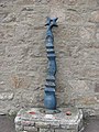 NCN Millennium Milepost MP770 Maud.jpeg 480 × 640; 119 KB
-
 Road to Aulton of Atherb - geograph.org.uk - 773433.jpg 640 × 480; 102 KB
-
 Rock Pile - geograph.org.uk - 443119.jpg 589 × 442; 73 KB
-
-
 Southbound ditch by Mains of Culsh - geograph.org.uk - 684730.jpg 426 × 640; 88 KB
-

-
 Stream at Craigmill - geograph.org.uk - 773460.jpg 640 × 480; 83 KB
-
 Tillypestle farm - geograph.org.uk - 773421.jpg 640 × 480; 98 KB
-
 Tree felling - geograph.org.uk - 773447.jpg 640 × 480; 127 KB
-
 A950 eastbound - geograph.org.uk - 773416.jpg 640 × 480; 75 KB
-
 A981 Looking south - geograph.org.uk - 434134.jpg 640 × 493; 60 KB
-
 B9029 - geograph.org.uk - 773457.jpg 640 × 480; 61 KB
-
 Backhill of Benwells - geograph.org.uk - 829014.jpg 640 × 480; 68 KB
-
 Backhill of Clackriach - geograph.org.uk - 460142.jpg 640 × 480; 90 KB
-
 Barns at Doghillock Farm - geograph.org.uk - 828986.jpg 640 × 480; 63 KB
-
 Brae of Biffie - geograph.org.uk - 443125.jpg 589 × 442; 58 KB
-
 Catcraig Farm - geograph.org.uk - 473627.jpg 640 × 480; 50 KB
-
 Cattle at North Denmore - geograph.org.uk - 774689.jpg 640 × 480; 128 KB
-
 Cattle grazing - geograph.org.uk - 433540.jpg 640 × 480; 75 KB
-
 Cemetery beside the Culsh Monument - geograph.org.uk - 684753.jpg 640 × 426; 63 KB
-
 Clockhill - geograph.org.uk - 459839.jpg 640 × 480; 62 KB
-
 Cloffrickford Farm - geograph.org.uk - 473633.jpg 640 × 480; 65 KB
-
 Conifer plantation - geograph.org.uk - 433508.jpg 640 × 480; 70 KB
-
 Cross roads near Ardieknowes - geograph.org.uk - 434138.jpg 640 × 480; 60 KB
-
 Crossroads at Barrack - geograph.org.uk - 433531.jpg 640 × 480; 63 KB
-
 Crossroads on A950 - geograph.org.uk - 773410.jpg 640 × 480; 52 KB
-
 Culsh Monument - geograph.org.uk - 684747.jpg 426 × 640; 136 KB
-
 Disused horse paddock at Kiddshill - geograph.org.uk - 460122.jpg 640 × 480; 76 KB
-
 Ditch by North Mains of Culsh - geograph.org.uk - 684723.jpg 640 × 426; 92 KB
-
 Drum Croft - geograph.org.uk - 459823.jpg 640 × 480; 66 KB
-
 Entrance to Culsh Monument - geograph.org.uk - 684771.jpg 426 × 640; 105 KB
-
 Farm at Loanhead of Fedderate - geograph.org.uk - 434149.jpg 640 × 480; 89 KB
-
 Farm at North Denmore - geograph.org.uk - 774685.jpg 640 × 480; 77 KB
-
 Farm buildings - geograph.org.uk - 433517.jpg 640 × 480; 62 KB
-
 Farmland at Milton of Auchorthie - geograph.org.uk - 495029.jpg 640 × 480; 109 KB
-
 Fedderate - geograph.org.uk - 434148.jpg 640 × 480; 66 KB
-
 Fedderate Castle Ruins - geograph.org.uk - 443148.jpg 589 × 442; 53 KB
-
 Field at South Greenbrae - geograph.org.uk - 460118.jpg 640 × 480; 87 KB
-
 Formartine and Buchan Way near Maud - geograph.org.uk - 509944.jpg 640 × 480; 65 KB
-
 Gate at Shantlerhill - geograph.org.uk - 459880.jpg 640 × 480; 147 KB
-
 Junction for Whinhill - geograph.org.uk - 684705.jpg 640 × 426; 53 KB
-
 Kirkhill Pendicle Farm - geograph.org.uk - 460134.jpg 640 × 480; 79 KB
-
 Lane to North Mains of Culsh - geograph.org.uk - 684733.jpg 640 × 426; 98 KB
-
 Little Tack - geograph.org.uk - 773345.jpg 640 × 480; 76 KB
-
 Lodge and cottage at Nethermuir - geograph.org.uk - 459859.jpg 640 × 480; 94 KB
-
 Loudon Wood Stone Circle - geograph.org.uk - 256267.jpg 640 × 480; 119 KB
-
 Mains of Drum - geograph.org.uk - 459795.jpg 640 × 480; 83 KB
-
 Marnabogs Farm - geograph.org.uk - 499432.jpg 640 × 480; 62 KB
-
 Maud Leisure Park - geograph.org.uk - 444584.jpg 589 × 442; 93 KB
-
 Meikle Kirkhill Farm - geograph.org.uk - 460132.jpg 640 × 480; 69 KB
-
 Milton of Auchorthie - geograph.org.uk - 495040.jpg 640 × 480; 103 KB
-
 Old Maud Farm - geograph.org.uk - 459751.jpg 640 × 480; 58 KB
-
 Pet Hotel sign, Clockhill - geograph.org.uk - 459845.jpg 640 × 480; 103 KB
-
 Radio mast at Fedderate - geograph.org.uk - 434151.jpg 640 × 480; 65 KB
-

-
 Ruined farmhouse at Hillside - geograph.org.uk - 495037.jpg 640 × 480; 97 KB
-
 Rumbling Pots Farm Road-end signpost - geograph.org.uk - 260344.jpg 640 × 480; 39 KB
-
 Shantlerhill Farm - geograph.org.uk - 459866.jpg 640 × 480; 70 KB
-
 Sheep Cheese Dairy at Shevado - geograph.org.uk - 443136.jpg 589 × 442; 61 KB
-
 Shelter Belt of Trees on A948 - geograph.org.uk - 460099.jpg 640 × 480; 67 KB
-
 Sign at West Drymuir - geograph.org.uk - 459779.jpg 640 × 480; 65 KB
-
 Sign for Shevado Sheep Cheese dairy - geograph.org.uk - 443141.jpg 589 × 442; 67 KB
-
 Silage cut at West Kiddshill - geograph.org.uk - 460114.jpg 640 × 480; 76 KB
-
 Skillmafilly Farm - geograph.org.uk - 473675.jpg 640 × 480; 57 KB
-
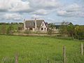
 The Bungalow - geograph.org.uk - 494993.jpg 640 × 480; 96 KB
-
 Towards Bulwark Moss - geograph.org.uk - 460136.jpg 640 × 480; 75 KB
-

-
 Track to Dens of Crichie - geograph.org.uk - 433024.jpg 640 × 480; 126 KB
-
 View east - geograph.org.uk - 433464.jpg 640 × 480; 72 KB
-
 View towards Parkhouse Hill - geograph.org.uk - 443129.jpg 589 × 442; 67 KB
-
 View towards Wind Hill - geograph.org.uk - 443131.jpg 589 × 442; 102 KB
-
 West Bruntbrae Farm - geograph.org.uk - 460125.jpg 640 × 480; 80 KB
-
 West Bruntbrae Farm - geograph.org.uk - 460129.jpg 640 × 480; 84 KB
-
 West Crichie Farmhouse - geograph.org.uk - 470218.jpg 640 × 480; 77 KB
-
 West Drymuir - geograph.org.uk - 459768.jpg 640 × 480; 67 KB
-
 West Gowkhill - geograph.org.uk - 459810.jpg 640 × 480; 79 KB
-
 Wright's Croft - geograph.org.uk - 460138.jpg 640 × 480; 79 KB


