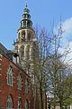
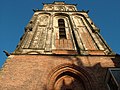
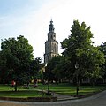
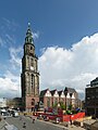
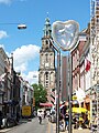
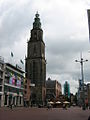
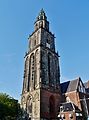
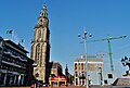
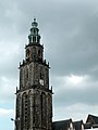
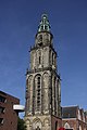
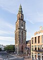
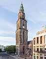
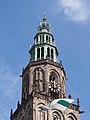
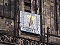
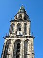
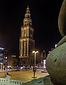
Category:Martinitoren
Jump to navigation
Jump to search
| Object location | | View all coordinates using: OpenStreetMap |
|---|
building it the city of Groningen    | |||||
| Upload media | |||||
| Audio | |||||
|---|---|---|---|---|---|
| Instance of | |||||
| Part of | |||||
| Location | Groningen, Netherlands | ||||
| Street address |
| ||||
| Architectural style | |||||
| Owned by | |||||
| Heritage designation |
| ||||
| Inception |
| ||||
| Height |
| ||||
| Angle from vertical |
| ||||
 | |||||
Nederlands: De Martinitoren in Groningen
|
This is a category about rijksmonument number 18553
|
| Address |
|
Subcategories
This category has the following 4 subcategories, out of 4 total.
H
- Martinitoren historical views (53 F)
I
- Martinitoren illustrations (14 F)
M
- Martinitoren in art (1 F)
S
Media in category "Martinitoren"
The following 115 files are in this category, out of 115 total.
-
 00 6814 Groningen Niederlande - Martinikerk.jpg 960 × 1,440; 1.03 MB
-
 2004 Martinitoren Groningen 01.JPG 2,848 × 2,136; 1.52 MB
-
 2004 Martinitoren Groningen 02.JPG 2,848 × 2,136; 1.47 MB
-
 2004 Martinitoren Groningen 03.JPG 2,848 × 2,136; 1.47 MB
-
 2004 Martinitoren Groningen 04.JPG 2,848 × 2,136; 1.52 MB
-
 2004 Martinitoren Groningen 05.JPG 2,848 × 2,136; 1.44 MB
-
 20090628 Martinikerkhof Groningen NL.jpg 2,346 × 2,346; 2.95 MB
-
 20100523 Grote Markt en Martinitoren Groningen NL.jpg 4,877 × 2,851; 8.72 MB
-
 20120424 Martinikerk Groningen NL.jpg 4,200 × 5,600; 5.44 MB
-
 20140401 Sociëteit Vindicat (Mutua Fides) Grote Markt Groningen NL.jpg 6,800 × 4,000; 7.45 MB
-
 20140419 Bouwput Groninger Forum Groningen NL (1).jpg 2,800 × 4,200; 3.03 MB
-
 20140621 Martinitoren en Mutua Fides (sociëteit Vindicat) Grote Markt Groningen NL.jpg 6,300 × 3,600; 5.12 MB
-
 20140621 Martinitoren Groningen NL.jpg 2,700 × 6,000; 3.22 MB
-
 20141018 Wijzerplaat klok Martinitoren Groningen NL.jpg 3,000 × 3,000; 4.86 MB
-
 20200906 08 Groningen - Martinikerkhof (50342064923).jpg 5,184 × 3,456; 9.05 MB
-
 4 Characteristic towers of the city Groningen - panoramio.jpg 4,101 × 2,500; 2.1 MB
-
 Carillonmartinitoren.jpg 3,648 × 2,736; 1.09 MB
-
 Cliché van koper.jpg 530 × 707; 168 KB
-
 De Martinitoren In Groningen.jpg 1,552 × 2,592; 804 KB
-
 Gardepoort Martinikerkhof Groningen.jpg 879 × 1,172; 109 KB
-
 Groningen (2770726390).jpg 3,845 × 2,527; 4.58 MB
-
 Groningen (stad), Martinitoren in Groningen. 13-06-2022. (actm.) 02.jpg 3,019 × 4,830; 7.99 MB
-
 Groningen (stad), Martinitoren in Groningen. 13-06-2022. (actm.) 03.jpg 2,530 × 4,048; 8.71 MB
-
 Groningen (stad), Martinitoren in Groningen. 13-06-2022. (actm.) 04.jpg 2,108 × 4,993; 10.2 MB
-
 Groningen (stad), Martinitoren in Groningen. 13-06-2022. (actm.) 05.jpg 2,057 × 3,511; 5.66 MB
-
 Groningen (stad), Martinitoren in Groningen. 13-06-2022. (actm.).jpg 2,798 × 5,137; 7.8 MB
-
 Groningen - Bernlef, Sint-Maarten en Agricola (1940) van Willem Valk - 01.jpg 2,128 × 2,832; 1.26 MB
-
 Groningen - Bernlef, Sint-Maarten en Agricola (1940) van Willem Valk - 02.jpg 2,832 × 2,128; 1.37 MB
-
 Groningen - Bernlef, Sint-Maarten en Agricola (1940) van Willem Valk - 03.jpg 2,021 × 1,667; 684 KB
-
 Groningen - Bus-stops (1996) van Loes Heebink en Shlomo Schwarzberg - 1.jpg 2,128 × 2,832; 1.15 MB
-
 Groningen - Bus-stops (1996) van Loes Heebink en Shlomo Schwarzberg - 2.jpg 2,128 × 2,832; 1.2 MB
-
 Groningen - Bus-stops (1996) van Loes Heebink en Shlomo Schwarzberg - 3.jpg 2,128 × 2,832; 1.19 MB
-
 Groningen grote markt Martinikerk IMG 7843.JPG 3,456 × 4,516; 5.77 MB
-
 Groningen grote markt Martinikerk IMG 7844.JPG 3,456 × 5,184; 6.52 MB
-
 Groningen Martini Tower.Martini Kulesi.jpg 768 × 1,024; 319 KB
-
 Groningen Martinikerk 1.jpg 3,238 × 4,442; 4.95 MB
-
 Groningen Martinikerk 2.jpg 3,350 × 4,520; 5.02 MB
-
 Groningen Martinikerk Turm 02.jpg 4,553 × 3,058; 4.28 MB
-
 Groningen Martinikerk Turm 03.jpg 2,566 × 2,739; 2.61 MB
-
 Groningen Martinikerk Turm 04.jpg 3,123 × 4,327; 4.26 MB
-
 Groningen Martinikerk Turm 06.jpg 3,330 × 4,504; 3.1 MB
-
 Groningen Martinikerk Turm 07.jpg 3,002 × 4,560; 4.14 MB
-
 Groningen Martinikerk Turm 08.jpg 2,707 × 4,444; 4.36 MB
-
 Groningen Martinikerk Turm 09.jpg 2,906 × 4,354; 4.58 MB
-
 Groningen Martinikerk Turm 10.jpg 3,362 × 4,530; 6.07 MB
-
 Groningen Martinikerk Turm 11.jpg 2,617 × 4,518; 3.5 MB
-
 Groningen Martinitoren 8-9-13.jpg 2,420 × 3,618; 2.29 MB
-
 Groningen Martinitoren v1.jpg 2,448 × 3,264; 2.52 MB
-
 Groningen Martinitoren v2.jpg 2,448 × 3,264; 2.09 MB
-
 Groningen Martinitoren v3.jpg 2,448 × 3,264; 2.54 MB
-
 Groningen Martinitoren.jpg 3,098 × 4,799; 2.09 MB
-
 Groningen martinitoren.tif 4,752 × 7,008; 76.43 MB
-
 Groningen, Martinitoren (2) RM-18553-WLM.jpg 2,736 × 3,648; 2.15 MB
-
 Groningen, Martinitoren (4) RM-18553-WLM.jpg 2,736 × 3,648; 2.61 MB
-
 Groningen, Martinitoren (5) RM-18553-WLM.jpg 2,736 × 3,648; 2.52 MB
-
 Groningen, Martinitoren RM-18553-WLM.jpg 2,736 × 3,648; 2.31 MB
-
 GroningenSkyline.jpg 500 × 333; 85 KB
-
 GroningenSundialMartini1.JPG 2,816 × 2,112; 2.94 MB
-
 GroningenSundialMartini2.JPG 2,112 × 2,816; 3.07 MB
-
 GroningenSundialMartini3.JPG 2,816 × 2,112; 3.1 MB
-
 Groninger Forum - bouwput.jpg 3,264 × 4,896; 7.06 MB
-
 Gronings Ontzet kermis1.jpg 2,736 × 3,648; 372 KB
-
 Gronings Ontzet kermis2.jpg 2,736 × 3,648; 281 KB
-
 Gronings Ontzet kermis3.jpg 2,272 × 3,368; 383 KB
-
 Gronings Ontzet kermis4.jpg 2,736 × 3,648; 347 KB
-
 Grote Markt, Groningen, Netherlands - panoramio (2).jpg 3,264 × 4,928; 3.3 MB
-
 Grote Markt, Groningen, Netherlands - panoramio (4).jpg 3,264 × 4,928; 5.82 MB
-
 Interieur toren - Groningen - 20327146 - RCE.jpg 878 × 1,200; 220 KB
-
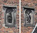 Jozef & Maria - Martinitoren.jpg 1,696 × 1,515; 1.22 MB
-
 Klokkenmartinitoren.jpg 3,648 × 2,736; 1.76 MB
-
 LG-Groningen- R18553 - 1.JPG 2,112 × 2,816; 1.45 MB
-
 LG-Groningen- R18553 - 3.JPG 2,112 × 2,816; 2.51 MB
-
 LG-Groningen- R18555.JPG 2,816 × 2,112; 1.8 MB
-
 Martini bij nacht.jpg 1,178 × 2,133; 647 KB
-
 Martini Toren.JPG 1,214 × 2,256; 738 KB
-
 Martini tower - panoramio.jpg 2,048 × 3,072; 3.2 MB
-
 Martini Tower, Groningen, the Netherlands.jpg 1,200 × 1,600; 1.03 MB
-
 Martini1.jpg 960 × 1,280; 171 KB
-
 Martini2.jpg 960 × 1,280; 166 KB
-
 Martini3.jpg 960 × 1,280; 173 KB
-
 Martinikerk en Martinitoren.jpg 3,888 × 2,592; 3.57 MB
-
 Martinikerk Groningen (29117921854).jpg 3,456 × 5,184; 6.26 MB
-
 Martinikerk Groningen (29120014123).jpg 3,456 × 5,184; 6.24 MB
-
 Martinikerk Groningen (29243152283).jpg 3,456 × 5,184; 5.29 MB
-
 Martinikerk Groningen.jpg 2,143 × 3,000; 4.19 MB
-
 Martinikerk in Groningen.jpg 2,318 × 3,000; 4.45 MB
-
 Martinitoren 1120.jpg 3,456 × 4,608; 3.21 MB
-
 Martinitoren 1123.jpg 4,608 × 3,456; 3.58 MB
-
 Martinitoren 1252.jpg 3,002 × 4,632; 6.03 MB
-
 Martinitoren 1253.jpg 3,016 × 4,304; 6.58 MB
-
 Martinitoren 1502.jpg 3,456 × 4,608; 3.19 MB
-
 Martinitoren from bus stop.jpg 2,736 × 3,648; 3.1 MB
-
 Martinitoren from Grote Markt.jpg 2,736 × 3,648; 3.36 MB
-
 Martinitoren Groningen - 1.jpg 3,167 × 4,223; 1.81 MB
-
 Martinitoren Groningen 1510-283.jpg 3,331 × 4,997; 1.3 MB
-
 Martinitoren Groningen 1510-310.jpg 2,841 × 4,847; 764 KB
-
 Martinitoren groningen.jpg 500 × 500; 35 KB
-
 Martinitoren Groningen.JPG 2,113 × 2,936; 1.43 MB
-
 Martinitoren vanaf bordes Stadshuis.jpg 3,715 × 4,808; 7.1 MB
-
 Martinitoren vanaf Nieuwe Kerk.jpg 2,889 × 2,889; 5.59 MB
-
 Martinitoren.jpeg 1,152 × 2,048; 584 KB
-
 Martinitoren.jpg 450 × 600; 44 KB
-
 Martinitoren6.jpg 565 × 768; 70 KB
-
 Martinkirche.Groningen.jpg 2,386 × 3,648; 5.26 MB
-
 Muziektrommelmartinitoren.jpg 3,648 × 2,736; 1.15 MB
-
 Queen's day 2004 crowd.jpg 768 × 1,024; 417 KB
-
 Spits Martinitoren.jpg 2,343 × 3,124; 350 KB
-
 SR09 Glazen Huis Groningen 20091219.jpg 2,592 × 3,888; 3.32 MB
-
 The 96,8 m high tower of the Martinichurch (1628) Groningen - panoramio.jpg 3,264 × 4,928; 6.49 MB
-
 Torengroningen.jpg 4,032 × 3,024; 3.09 MB
-
 Wageningen and Groningen (Netherlands, July-August 2020) - 62 (50553912416).jpg 5,472 × 3,648; 21.9 MB
-
 Wageningen and Groningen (Netherlands, July-August 2020) - 70 (50554044752).jpg 3,648 × 5,472; 19.68 MB
-
 Zicht op de Martinitoren vanaf een nabije gracht.jpg 3,072 × 1,728; 1.47 MB
-

-
 Zicht op de Martinitoren, vanaf de Grote Markt - Groningen - 20413512 - RCE.jpg 772 × 1,200; 236 KB


_Grote_Markt_Groningen_NL.jpg)
.jpg)
_Grote_Markt_Groningen_NL.jpg)


.jpg)


.jpg)
,_Martinitoren_in_Groningen._13-06-2022._(actm.)_02.jpg)
,_Martinitoren_in_Groningen._13-06-2022._(actm.)_03.jpg)
,_Martinitoren_in_Groningen._13-06-2022._(actm.)_04.jpg)
,_Martinitoren_in_Groningen._13-06-2022._(actm.)_05.jpg)
,_Martinitoren_in_Groningen._13-06-2022._(actm.).jpg)
_van_Willem_Valk_-_01.jpg)
_van_Willem_Valk_-_02.jpg)
_van_Willem_Valk_-_03.jpg)
_van_Loes_Heebink_en_Shlomo_Schwarzberg_-_1.jpg)
_van_Loes_Heebink_en_Shlomo_Schwarzberg_-_2.jpg)
_van_Loes_Heebink_en_Shlomo_Schwarzberg_-_3.jpg)


_RM-18553-WLM.jpg)
_RM-18553-WLM.jpg)
_RM-18553-WLM.jpg)


.jpg)
.jpg)


.jpg)
.jpg)
.jpg)


_Groningen_-_panoramio.jpg)

_-_62_(50553912416).jpg)
_-_70_(50554044752).jpg)


