Category:Markt 26, 's-Hertogenbosch
Jump to navigation
Jump to search
| Object location | | View all coordinates using: OpenStreetMap |
|---|
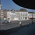
house in 's-Hertogenbosch, Netherlands  | |||||
| Upload media | |||||
| Instance of | |||||
|---|---|---|---|---|---|
| Location | 's-Hertogenbosch, North Brabant, Netherlands | ||||
| Street address |
| ||||
| Heritage designation |
| ||||
 | |||||
|
This is a category about rijksmonument number 21733
|
| Address |
|
Media in category "Markt 26, 's-Hertogenbosch"
The following 4 files are in this category, out of 4 total.
-
 's-Hertogenbosch Rijksmonument 21733 Markt 26.JPG 2,736 × 3,648; 3.45 MB
-
 Overzicht - 's-Hertogenbosch - 20110368 - RCE.jpg 1,200 × 818; 209 KB
-
 Overzicht van de voorgevels - 's-Hertogenbosch - 20381368 - RCE.jpg 1,200 × 1,198; 240 KB
-
 Overzicht van de voorgevels - 's-Hertogenbosch - 20381374 - RCE.jpg 1,200 × 1,191; 229 KB


