Category:Markt 17, 's-Hertogenbosch
Jump to navigation
Jump to search
| Object location | | View all coordinates using: OpenStreetMap |
|---|
building in 's-Hertogenbosch, Netherlands  | |||||
| Upload media | |||||
| Instance of | |||||
|---|---|---|---|---|---|
| Location | 's-Hertogenbosch, North Brabant, Netherlands | ||||
| Street address |
| ||||
| Heritage designation |
| ||||
 | |||||
|
This is a category about rijksmonument number 21724
|
| Address |
|
Media in category "Markt 17, 's-Hertogenbosch"
The following 23 files are in this category, out of 23 total.
-
 's-Hertogenbosch Rijksmonument 21724 Markt 17.JPG 3,648 × 2,736; 3.28 MB
-
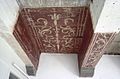
 Detail plafondschildering - 's-Hertogenbosch - 20110348 - RCE.jpg 1,200 × 788; 204 KB
-
 Detail plafondschildering - 's-Hertogenbosch - 20110349 - RCE.jpg 792 × 1,200; 246 KB
-
 Detail plafondschildering - 's-Hertogenbosch - 20110351 - RCE.jpg 1,200 × 791; 185 KB
-
 Detail plafondschildering - 's-Hertogenbosch - 20110352 - RCE.jpg 1,200 × 792; 180 KB
-
 Detail plafondschildering - 's-Hertogenbosch - 20357250 - RCE.jpg 1,200 × 773; 186 KB
-
 Interieur - 's-Hertogenbosch - 20110355 - RCE.jpg 1,190 × 1,200; 248 KB
-
 Interieur plafondschildering - 's-Hertogenbosch - 20110363 - RCE.jpg 1,200 × 788; 206 KB
-
 Interieur plafondschildering - 's-Hertogenbosch - 20110364 - RCE.jpg 1,200 × 788; 240 KB
-
 Interieur plafondschildering - 's-Hertogenbosch - 20110366 - RCE.jpg 1,200 × 788; 216 KB
-
 Interieur plafondschildering - 's-Hertogenbosch - 20363497 - RCE.jpg 1,200 × 781; 162 KB
-
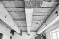
 INTERIEUR, PLAFOND, BESCHILDERDE BALKEN - 's-Hertogenbosch - 20263092 - RCE.jpg 1,200 × 785; 185 KB
-

-
 Overzicht van de voorgevels - 's-Hertogenbosch - 20381380 - RCE.jpg 1,200 × 1,191; 245 KB
-
 Plafondschildering - 's-Hertogenbosch - 20110347 - RCE.jpg 1,200 × 788; 202 KB
-
 Plafondschildering - 's-Hertogenbosch - 20110357 - RCE.jpg 788 × 1,200; 263 KB
-
 Plafondschildering detail - 's-Hertogenbosch - 20110358 - RCE.jpg 788 × 1,200; 220 KB
-
 Plafondschildering detail - 's-Hertogenbosch - 20110361 - RCE.jpg 1,200 × 788; 207 KB
-
 Plafondschildering detail - 's-Hertogenbosch - 20110362 - RCE.jpg 788 × 1,200; 152 KB
-
 Plafondschildering detail datum - 's-Hertogenbosch - 20110359 - RCE.jpg 1,200 × 788; 246 KB
-
 Voorgevel - 's-Hertogenbosch - 20110353 - RCE.jpg 830 × 1,200; 230 KB
-
 Voorgevel - 's-Hertogenbosch - 20110356 - RCE.jpg 1,184 × 1,200; 285 KB
-
 Zolder - 's-Hertogenbosch - 20110354 - RCE.jpg 1,178 × 1,200; 226 KB


