Category:March 2010 in Greater Manchester
Jump to navigation
Jump to search
Deutsch: Bilder, die im März 2010 in Greater Manchester aufgenommen worden sind. Bitte beachten Sie, dass dies weder das Datum des Uploads noch das Datum des Scannens eines Fotos ist.
English: Images/pictures taken in Greater Manchester during March 2010. Note this is not the date of the upload, nor the date a photo was scanned.
Español: Fotografías o imágenes tomadas en Greater Manchester durante marzo 2010. No es la fecha de subida ni escaneo, sino la fecha en que las fotografías o imágenes se crearon.
Esperanto: Bildoj faritaj en Greater Manchester en marto 2010. Tio ne estas la dato, kiam la bildoj estis alŝutitaj aŭ skanitaj.
Français : Photographies ou images prises en Greater Manchester durant mars 2010. Ce n'est pas la date du téléchargement ou du scan.
Galego: Fotografías ou imaxes tomadas en Greater Manchester durante marzo 2010. Non é a data de subida nin escaneamento, senón a data na que se crearon as fotografías ou imaxes.
Italiano: Fotografie o immagini scattate a Greater Manchester nel marzo 2010. Nota bene: la data non si riferisce né a quella di upload né a quella in cui la foto è stata digitalizzata.
Norsk bokmål: Bilder tatt i Greater Manchester i løpet av mars 2010. Merk at dette ikke er datoen for opplasting, eller når et bilde har blitt skannet.
Norsk nynorsk: Bilete teke i Greater Manchester i løpet av mars 2010. Merk at dette ikkje er datoen for opplasting, eller når eit bilete har vorte skanna.
Русский: Изображения, сделанные в Greater Manchester в течение март 2010 (не дата загрузки изображения).
Українська: Зображення, зроблені в Greater Manchester протягом березень 2010. Зауважте, що це не дата завантаження чи дата сканування фотографії.
| March 2009 | ← | March 2010 | → | March 2011 | |||||||
| Jan | Feb | Mar | Apr | May | Jun | Jul | Aug | Sep | Oct | Nov | Dec |
| 40 | 87 | 140 | 25 | 28 | 21 | 13 | 25 | 56 | 21 | 6 | 9 |
|---|---|---|---|---|---|---|---|---|---|---|---|
Subcategories
This category has the following 9 subcategories, out of 9 total.
Media in category "March 2010 in Greater Manchester"
The following 131 files are in this category, out of 131 total.
-
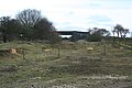
 A path off the Pennine Bridleway - geograph.org.uk - 1775517.jpg 3,872 × 2,592; 3.57 MB
-
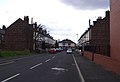
 A row of shops and houses on Reddish Lane - geograph.org.uk - 1736714.jpg 3,968 × 2,232; 3.42 MB
-
 All Saints' Church, Hamer - geograph.org.uk - 1756878.jpg 2,112 × 2,816; 834 KB
-
 Angouleme Way, Bury - geograph.org.uk - 1774311.jpg 1,632 × 1,224; 540 KB
-
 Angouleme Way, Bury - geograph.org.uk - 1774316.jpg 1,632 × 1,224; 941 KB
-
 Approaching Giant's Seat - geograph.org.uk - 1753566.jpg 2,816 × 2,112; 1.6 MB
-
 Ashworth Fold - geograph.org.uk - 1770931.jpg 2,317 × 1,738; 820 KB
-
 Ashworth Fold - geograph.org.uk - 1770934.jpg 2,816 × 2,112; 1.21 MB
-
 Ashworth Hall Farm - geograph.org.uk - 1770926.jpg 2,537 × 1,903; 1,010 KB
-
 Ashworth Moor - geograph.org.uk - 1770819.jpg 2,816 × 2,112; 1,016 KB
-
 Ashworth Moor - geograph.org.uk - 1770841.jpg 2,816 × 2,112; 1.01 MB
-
 Ashworth Road, Approaching Ashworth Fold - geograph.org.uk - 1770916.jpg 2,816 × 2,112; 1.33 MB
-
 Ashworth Valley - geograph.org.uk - 1770884.jpg 2,816 × 2,112; 1,020 KB
-
 Behind Clover Hall - geograph.org.uk - 1770657.jpg 2,816 × 2,112; 1.6 MB
-
 Belfield Mill Lane - geograph.org.uk - 1770586.jpg 2,816 × 2,112; 1.29 MB
-
 Belfield Mill Lane - geograph.org.uk - 1770703.jpg 2,816 × 2,112; 1.75 MB
-
 Bickershaw Junction - geograph.org.uk - 1739407.jpg 2,496 × 1,664; 2.03 MB
-
 Bickershaw Junction - geograph.org.uk - 1739412.jpg 2,496 × 1,664; 2.53 MB
-
 Bickershaw Junction - geograph.org.uk - 1739692.jpg 2,496 × 1,664; 2.22 MB
-
 Bickershaw Junction - geograph.org.uk - 1739737.jpg 2,496 × 1,664; 2.35 MB
-
 Bickershaw Junction - geograph.org.uk - 1739806.jpg 2,496 × 1,664; 2.39 MB
-
 The Black dog - geograph.org.uk - 1734441 (cropped).jpg 1,863 × 1,397; 320 KB
-
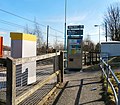
 Bowker Vale Station - geograph.org.uk - 1736026.jpg 640 × 480; 120 KB
-
 Bowker Vale Station - geograph.org.uk - 1736036.jpg 640 × 480; 115 KB
-
 Bowker Vale Station - geograph.org.uk - 1748281.jpg 2,816 × 2,112; 1.58 MB
-
 Bridge - geograph.org.uk - 1739709.jpg 2,496 × 1,664; 1.45 MB
-
 Bridgewater Canal - geograph.org.uk - 1749769.jpg 2,311 × 1,734; 522 KB
-
 Bridgewater Canal at Brooklands - geograph.org.uk - 1749763.jpg 2,816 × 2,112; 1.87 MB
-
 Brooklands Station - geograph.org.uk - 1749793.jpg 2,816 × 2,112; 1.11 MB
-
 Bulls Head bus terminus - geograph.org.uk - 1751952.jpg 640 × 348; 63 KB
-
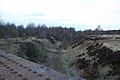
 Castle Hill Quarry - geograph.org.uk - 1756724.jpg 2,816 × 2,112; 1.6 MB
-
 Castlefield 4657.JPG 1,280 × 960; 457 KB
-
 Castlefield Grocers 4642.JPG 1,280 × 960; 459 KB
-
 Castlefield Rochdale 4695.JPG 1,280 × 960; 471 KB
-
 Church Lane, Birtle - geograph.org.uk - 1756821.jpg 2,515 × 1,834; 1.17 MB
-
 Church of All Saints, Hamer - geograph.org.uk - 1756875.jpg 2,128 × 1,596; 457 KB
-
 Copped Hill - geograph.org.uk - 1770834.jpg 2,816 × 2,112; 1.35 MB
-
 Cottages at Birtle - geograph.org.uk - 1756830.jpg 2,760 × 2,060; 1.27 MB
-
 Cranbrook Road - geograph.org.uk - 1751969.jpg 640 × 422; 75 KB
-

-
 Dane Road Station - geograph.org.uk - 1749877.jpg 2,816 × 2,112; 4.05 MB
-
 Dane Road Station - geograph.org.uk - 1749880.jpg 2,816 × 2,112; 1.33 MB
-
 Dane Road Station - geograph.org.uk - 1749891.jpg 2,816 × 2,112; 1.37 MB
-
 East from Bickershaw Junction - geograph.org.uk - 1739681.jpg 2,496 × 1,664; 1.75 MB
-
 East Lancashire Railway - geograph.org.uk - 1751259.jpg 2,816 × 2,112; 1.7 MB
-
 Entrance to Woodlands Road Station - geograph.org.uk - 1736000.jpg 640 × 559; 148 KB
-
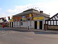
 Falconers Arms - geograph.org.uk - 1768517.jpg 640 × 599; 119 KB
-
 Falconers Arms Sign - geograph.org.uk - 1768522.jpg 640 × 474; 146 KB
-
 Fallow deer at Dunham Deer Park - geograph.org.uk - 1738335.jpg 640 × 427; 138 KB
-
 Firgrove Business Park and Belfield Mill - geograph.org.uk - 1770593.jpg 2,657 × 1,993; 837 KB
-
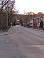
 Gibraltar Bridge - geograph.org.uk - 1741273.jpg 640 × 480; 172 KB
-
 Gibraltar Lane - geograph.org.uk - 1741320.jpg 640 × 558; 190 KB
-
 Gibraltar Lane - geograph.org.uk - 1741336.jpg 640 × 480; 181 KB
-
 Gibraltar Lane - geograph.org.uk - 1741414.jpg 640 × 595; 164 KB
-
 Gibraltar Weir - geograph.org.uk - 1741219.jpg 640 × 480; 168 KB
-
 GMEX Central Station Beetham Manchester 4624.JPG 960 × 1,280; 429 KB
-
 Godley Arches - geograph.org.uk - 1732767.jpg 640 × 480; 132 KB
-
 Greenside Farm - geograph.org.uk - 1753581.jpg 2,816 × 2,112; 1.36 MB
-
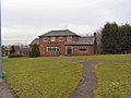
 Hazel Grove Civic Hall - geograph.org.uk - 1759662.jpg 640 × 451; 109 KB
-
 Heaps Cottage - geograph.org.uk - 1753573.jpg 2,816 × 2,112; 1.21 MB
-
 Heaton Park Station - geograph.org.uk - 1748130.jpg 2,816 × 2,112; 1.2 MB
-
 Heywood Old Road, Bowlee - geograph.org.uk - 1746792.jpg 2,816 × 2,112; 1.19 MB
-
 Highfield Range - geograph.org.uk - 1772651.jpg 640 × 438; 66 KB
-
 Hindley Field Junction. - geograph.org.uk - 1739725.jpg 2,496 × 1,664; 2.65 MB
-
 HMP Manchester at Empire Street.jpg 3,072 × 2,304; 1.62 MB
-
 Hollin Lane - geograph.org.uk - 1746637.jpg 2,816 × 2,112; 1.11 MB
-
 Homebase, Bredbury - geograph.org.uk - 1743396.jpg 640 × 486; 122 KB
-
 Junction Inn - geograph.org.uk - 1731037.jpg 2,654 × 1,991; 713 KB
-
 King's Ransom - geograph.org.uk - 1749861.jpg 2,816 × 2,112; 1.08 MB
-
 King's Ransom - geograph.org.uk - 1749866.jpg 2,816 × 2,112; 1.03 MB
-
 Landor Court - geograph.org.uk - 1751964.jpg 640 × 418; 75 KB
-
 LNWR route to Manchester - geograph.org.uk - 1739758.jpg 2,496 × 1,664; 2.34 MB
-
 LNWR route to Wigan - geograph.org.uk - 1739752.jpg 2,496 × 1,664; 2.24 MB
-
 Lord Raglan - geograph.org.uk - 1752091.jpg 2,816 × 2,112; 772 KB
-
 M62 Bridge, Oldham Road - geograph.org.uk - 1730982.jpg 2,158 × 1,619; 775 KB
-
 Manchester Airport station - geograph.org.uk - 1744410.jpg 1,600 × 1,200; 382 KB
-
 Marsland Bridge - geograph.org.uk - 1749819.jpg 1,937 × 1,453; 632 KB
-
 Milnrow Station 18 March 2010 - geograph.org.uk - 1764858.jpg 525 × 350; 221 KB
-
 Monarch G-MONJ MAN.jpg 640 × 480; 78 KB
-
 Mosley Street tram stop - geograph.org.uk - 1748751.jpg 2,816 × 2,112; 879 KB
-
 Myrtle Grove - geograph.org.uk - 1751959.jpg 640 × 346; 61 KB
-
 Navigation Road crossing - geograph.org.uk - 1749650.jpg 2,816 × 2,112; 1.4 MB
-
 Navigation Road Station - geograph.org.uk - 1749644.jpg 2,816 × 2,112; 1.29 MB
-
 Oldham Road-M62 - geograph.org.uk - 1730988.jpg 2,341 × 1,756; 861 KB
-
 Pack Horse Inn - geograph.org.uk - 1731090.jpg 2,816 × 2,112; 1.37 MB
-
 Parish Church of St Ann, Belfield - geograph.org.uk - 1754977.jpg 2,821 × 2,113; 1.02 MB
-
 Parish Church of St Ann, Belfield - geograph.org.uk - 1754988.jpg 2,069 × 1,552; 627 KB
-
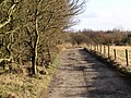
 Pennine Bridleway, Rooley Moor - geograph.org.uk - 1767419.jpg 2,816 × 2,112; 1.39 MB
-
 Piccadilly Gardens Tram Station - geograph.org.uk - 1748735.jpg 2,816 × 2,112; 1.12 MB
-
 Queen Anne - geograph.org.uk - 1742035.jpg 2,816 × 2,112; 1.19 MB
-
 Railway to Rochdale - geograph.org.uk - 1770734.jpg 2,816 × 2,112; 1.74 MB
-
 Road to Dobfield House - geograph.org.uk - 1770577.jpg 2,816 × 2,112; 2.05 MB
-
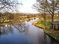 Rochdale Canal - geograph.org.uk - 1770631.jpg 2,816 × 2,112; 1.93 MB
-
 Rochdale Canal - geograph.org.uk - 1770638.jpg 2,816 × 2,112; 1.84 MB
-
 Sacred Heart Catholic Church and Parish Centre, Rochdale - geograph.org.uk - 1755015.jpg 2,024 × 1,518; 546 KB
-
 Rooley Moor, Top of Pike - geograph.org.uk - 1767412.jpg 1,600 × 1,200; 593 KB
-
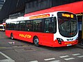 Rossendale Transport 213 Volvo B7RLE Wright Eclipse 2 PO59 MLN.jpg 1,600 × 1,200; 196 KB
-
 Row of shops on Victoria Avenue - geograph.org.uk - 1753018.jpg 3,699 × 2,461; 2.76 MB
-
 Rylands Library Manchester 4563.JPG 1,280 × 960; 480 KB
-
 Sacred Heart Church and Parish Centre - geograph.org.uk - 1755024.jpg 2,622 × 1,967; 770 KB
-
 Sale Station - geograph.org.uk - 1749829.jpg 2,816 × 2,112; 1.19 MB
-
 Sale Station - geograph.org.uk - 1749841.jpg 2,816 × 2,112; 1.25 MB
-
 Sale Station - geograph.org.uk - 1749849.jpg 2,693 × 2,020; 607 KB
-
 Sale Town Hall - geograph.org.uk - 1749852.jpg 2,816 × 2,112; 1.3 MB
-
 Salford Quays 009.JPG 3,648 × 2,736; 1.66 MB
-
 Sarn Avenue, Wythenshawe - panoramio.jpg 3,072 × 2,304; 1.83 MB
-
 Shudehill Interchange - geograph.org.uk - 1748425.jpg 2,816 × 2,112; 1.26 MB
-
 Shudehill Interchange - geograph.org.uk - 1748432.jpg 2,705 × 2,029; 1.05 MB
-
 St Thomas' Church, Bowlee - geograph.org.uk - 1747126.jpg 2,466 × 1,850; 896 KB
-
 St Thomas's Church, Bowlee - geograph.org.uk - 1773427.jpg 3,723 × 2,471; 4.26 MB
-
 Stepping Hill Hospital - geograph.org.uk - 1759670.jpg 640 × 583; 155 KB
-
 Stoneclough Road - geograph.org.uk - 1753736.jpg 2,112 × 2,816; 1.13 MB
-
 Strangeways East Junction - geograph.org.uk - 1739765.jpg 2,496 × 1,664; 1.64 MB
-
 Terraced houses on Huddersfield Road, Newhey - geograph.org.uk - 1773587.jpg 3,751 × 2,489; 3.66 MB
-
 The Black dog - geograph.org.uk - 1734441.jpg 2,816 × 2,112; 932 KB
-
 The Brook - geograph.org.uk - 1749787.jpg 2,816 × 2,112; 1.14 MB
-
 The eastern end of Simister Lane - geograph.org.uk - 1773420.jpg 3,872 × 2,592; 5.32 MB
-
 The Grapes Inn - geograph.org.uk - 1773047.jpg 2,685 × 1,760; 566 KB
-
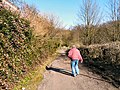
 Towards Glass House Fold - geograph.org.uk - 1741300.jpg 640 × 480; 200 KB
-
 Track to Clegg Hall - geograph.org.uk - 1770570.jpg 2,816 × 2,112; 2.31 MB
-
 Track to Giant's Seat - geograph.org.uk - 1753548.jpg 2,816 × 2,112; 1.82 MB
-
 Track to Giants Seat - geograph.org.uk - 1753499.jpg 2,816 × 2,112; 1.76 MB
-
 Track to Lower Heaps Farm - geograph.org.uk - 1753481.jpg 2,816 × 2,112; 1.23 MB
-
 Wainwright Avenue - geograph.org.uk - 1751958.jpg 640 × 435; 104 KB
-
 Westbourne Range - geograph.org.uk - 1772655.jpg 640 × 451; 92 KB
-
 Whelley Loop Line - De Trafford Junction - geograph.org.uk - 1739395.jpg 2,496 × 1,664; 2.05 MB
-
 Woodlands Road - geograph.org.uk - 1735715.jpg 640 × 480; 149 KB
-
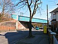 Woodlands Road Railway Bridge - geograph.org.uk - 1735892.jpg 640 × 480; 138 KB
-
 Woodlands Road Railway Bridge - geograph.org.uk - 1735899.jpg 640 × 549; 120 KB
-
 Woodlands Road Station - geograph.org.uk - 1735876.jpg 640 × 464; 139 KB
-
 Woodlands Road Station - geograph.org.uk - 1735880.jpg 640 × 495; 140 KB


.jpg)


