Category:March 2010 in Aberdeenshire
Jump to navigation
Jump to search
Council areas (municipalities) of Scotland: Aberdeen · Aberdeenshire · Argyll and Bute · Edinburgh · Glasgow · Highland · Perth and Kinross · Renfrewshire · Scottish Borders ·
Deutsch: Bilder, die im März 2010 in Aberdeenshire aufgenommen worden sind. Bitte beachten Sie, dass dies weder das Datum des Uploads noch das Datum des Scannens eines Fotos ist.
English: Images/pictures taken in Aberdeenshire during March 2010. Note this is not the date of the upload, nor the date a photo was scanned.
Español: Fotografías o imágenes tomadas en Aberdeenshire durante marzo 2010. No es la fecha de subida ni escaneo, sino la fecha en que las fotografías o imágenes se crearon.
Esperanto: Bildoj faritaj en Aberdeenshire en marto 2010. Tio ne estas la dato, kiam la bildoj estis alŝutitaj aŭ skanitaj.
Français : Photographies ou images prises en Aberdeenshire durant mars 2010. Ce n'est pas la date du téléchargement ou du scan.
Galego: Fotografías ou imaxes tomadas en Aberdeenshire durante marzo 2010. Non é a data de subida nin escaneamento, senón a data na que se crearon as fotografías ou imaxes.
Italiano: Fotografie o immagini scattate a Aberdeenshire nel marzo 2010. Nota bene: la data non si riferisce né a quella di upload né a quella in cui la foto è stata digitalizzata.
Norsk bokmål: Bilder tatt i Aberdeenshire i løpet av mars 2010. Merk at dette ikke er datoen for opplasting, eller når et bilde har blitt skannet.
Norsk nynorsk: Bilete teke i Aberdeenshire i løpet av mars 2010. Merk at dette ikkje er datoen for opplasting, eller når eit bilete har vorte skanna.
Русский: Изображения, сделанные в Aberdeenshire в течение март 2010 (не дата загрузки изображения).
Українська: Зображення, зроблені в Aberdeenshire протягом березень 2010. Зауважте, що це не дата завантаження чи дата сканування фотографії.
| March 2009 | ← | March 2010 | → | March 2011 | |||||||
| Jan | Feb | Mar | Apr | May | Jun | Jul | Aug | Sep | Oct | Nov | Dec |
| 0 | 0 | 34 | 0 | 0 | 0 | 16 | 0 | 4 | 0 | 0 | 0 |
|---|---|---|---|---|---|---|---|---|---|---|---|
Media in category "March 2010 in Aberdeenshire"
The following 34 files are in this category, out of 34 total.
-
 Aikey Brae - geograph.org.uk - 1774984.jpg 1,600 × 1,064; 657 KB
-
 Aikey Brae Stone Circle - geograph.org.uk - 1774962 (cropped).jpg 1,286 × 851; 430 KB
-
 Aikey Brae Stone Circle - geograph.org.uk - 1774962.jpg 1,600 × 1,064; 717 KB
-
-
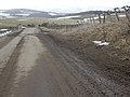
 Approach to Easter Migvie crossroads - geograph.org.uk - 1752702.jpg 640 × 480; 56 KB
-
 Banff Bridge - geograph.org.uk - 1762738.jpg 640 × 369; 200 KB
-
 Banff from the Wood of Montcoffer - geograph.org.uk - 1762623.jpg 640 × 427; 292 KB
-
 Banff Parish Kirk - geograph.org.uk - 1762792.jpg 640 × 363; 175 KB
-
 Bend in road from Migvie to Tarland - geograph.org.uk - 1752682.jpg 640 × 480; 70 KB
-
 Bridge of Alvah - geograph.org.uk - 1761831.jpg 427 × 640; 224 KB
-
 Bridge of Alvah - geograph.org.uk - 1761846.jpg 640 × 421; 293 KB
-
 Bridge of Alvah - geograph.org.uk - 1761851.jpg 427 × 640; 257 KB
-
 Bridge of Alvah - geograph.org.uk - 1761855.jpg 640 × 431; 271 KB
-
 Bridge over the Cowie Water - geograph.org.uk - 1743034.jpg 640 × 427; 266 KB
-
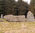
 Broomend Henge - geograph.org.uk - 1778576.jpg 3,456 × 2,304; 1.12 MB
-
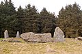
 Broomend of Crichie Stones - geograph.org.uk - 1778531.jpg 3,456 × 2,304; 1.07 MB
-
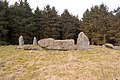
 Broomend Outlier - geograph.org.uk - 1778552.jpg 2,304 × 3,456; 1.19 MB
-
 CraigievarCastle.jpg 3,974 × 2,645; 9.64 MB
-
 Deer Abbey, creepers on the wall - geograph.org.uk - 1775686.jpg 1,600 × 1,064; 558 KB
-
 Deer Abbey, outline of the abbey church - geograph.org.uk - 1775248.jpg 1,600 × 1,064; 494 KB
-
 Deer Abbey, outline of the chancel - geograph.org.uk - 1775692.jpg 1,600 × 1,064; 613 KB
-
 Deer Abbey, outline of the cloister - geograph.org.uk - 1775682.jpg 1,600 × 1,064; 422 KB
-
 Deer Abbey, ruin of the refectory - geograph.org.uk - 1775198.jpg 1,600 × 1,064; 449 KB
-
 Deer Abbey, the great wall - geograph.org.uk - 1775240.jpg 1,600 × 1,064; 558 KB
-
 Deer Abbey, vista of the ruins - geograph.org.uk - 1775701.jpg 1,600 × 1,064; 391 KB
-
 Findlater Castle - geograph.org.uk - 1761408.jpg 640 × 427; 276 KB
-
 Findlater Castle - geograph.org.uk - 1761464.jpg 640 × 416; 245 KB
-
 Findlater Castle - geograph.org.uk - 1761500.jpg 640 × 425; 271 KB
-
 Findlater Castle Viewpoint - geograph.org.uk - 1761475.jpg 640 × 411; 257 KB
-
 Findlater Doocot - geograph.org.uk - 1761267.jpg 427 × 640; 250 KB
-
 Findlater Doocot - geograph.org.uk - 1761276.jpg 427 × 640; 217 KB
-
 Kirkton of Forbes - geograph.org.uk - 1742889.jpg 640 × 427; 256 KB
-
 Kirkton of Forbes - geograph.org.uk - 1742901.jpg 640 × 401; 202 KB
-
 Pitgaveny Lambs - geograph.org.uk - 1761021.jpg 3,456 × 2,304; 1.04 MB

.jpg)

.jpg)


