Category:Maps using Ferro prime meridian
Jump to navigation
Jump to search
17° 39′ 46″ W
English: Ferro meridian (El Hiero, Canary Islands) was used since Ancient (Ptolemy's Geographia). Early 17th century set to El pico 16° 45' W (Blaeu). Later redefined 17° 39′ 46″ W of Greenwich to be exactly 20° W of Paris (-17,66277083); 1890: 17° 39' 46.02" W (-17,66278); Austria 1920s used 17° 40' 00" W (-17,66667).
Subcategories
This category has the following 9 subcategories, out of 9 total.
Media in category "Maps using Ferro prime meridian"
The following 41 files are in this category, out of 41 total.
-

-
 Map of Europe by Herman Moll.jpg 22,977 × 14,035; 65.05 MB
-

-
 Herman Moll A New Map of Europe According to the Newest Observations 1721.JPG 1,500 × 1,061; 301 KB
-
 Map of Europe according to the newest and most exact observations ... NYPL1630431.tiff 6,369 × 3,963; 72.21 MB
-

-

-
 1744 Bowen Map of the World in Hemispheres - Geographicus - World-bowen-1744.jpg 3,697 × 2,174; 2.48 MB
-
 Map of Korea.jpg 800 × 600; 131 KB
-
-
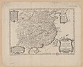
 AMH-7966-KB Map of China and Korea.jpg 2,400 × 2,241; 1.29 MB
-

-

-

-
-
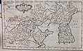
 KKR-20 La CHINE avec la Korée et les Parties de la Tartarie.jpg 3,148 × 2,584; 1.1 MB
-
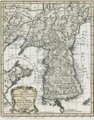
 Tatariae Sinensis mappa geographica 1749 24374665.jpg 13,080 × 7,036; 22.5 MB
-

-

-

-
 프랑스의 독도지도1 copy.gif 361 × 461; 164 KB
-
 1780 Raynal and Bonne Map of the World - Geographicus - Planisphere-bonne-1780.jpg 2,500 × 1,698; 1.32 MB
-
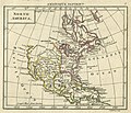
 1809 Reichard Vereinigte Staaten von Nord-America.jpg 8,485 × 6,990; 21.76 MB
-
-
 Carte de l'Afrique franc̨oise ou du Senegal.jpg 11,269 × 8,109; 26.34 MB
-

-
 Dury Atlas Map 3 Europe.jpg 3,026 × 2,698; 1.97 MB
-
 Dury Atlas Map 4 Asia.jpg 2,996 × 2,625; 1.84 MB
-
 Dury Atlas Map 6 Africa.jpg 2,980 × 2,550; 1.81 MB
-
 Dury Atlas Map 8 North America.jpg 3,047 × 2,612; 1.71 MB
-
 Dury Atlas Map 9 South America.jpg 3,020 × 2,608; 1.63 MB
-
 Dury Atlas Maps 1 and 2 The World.jpg 5,100 × 2,719; 3.13 MB
-
 EB1 Plate LXXXVII Fig. 2 World.png 2,768 × 1,550; 3.34 MB
-
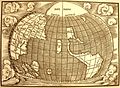
 Jan-of-Stobnica-Cosmographiam-of-Ptolemy.jpg 4,599 × 3,340; 9.42 MB
-
 Jean-Claude Dezauche - Map of Europe - Google Art Project.jpg 4,001 × 3,296; 5.31 MB
-
 Mapa Stobnica 1512a.jpg 3,013 × 2,197; 1.88 MB
-
 Nicolas Desliens Map (1566).jpg 2,496 × 1,504; 1.23 MB
-
 Nicolas Desliens1.JPG 12,340 × 7,358; 15.74 MB
-
 Orbis Terrarum J D Köhler.jpg 940 × 918; 383 KB
-
 Schöner globe 1520 western hemisphere.jpg 3,000 × 3,283; 3.25 MB
-
 The world, according to the latest discoveries (4071861291).jpg 2,000 × 1,440; 2.99 MB


.png)

.jpg)


.jpg)


_et_les_Isles_Canaries,_seconde_feuille_Depuis..._-_btv1b10678512f_(2_of_2).jpg)


.jpg)


.jpg)